
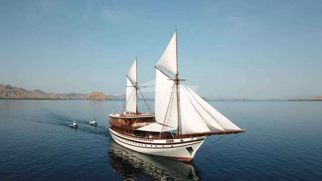
Stretching roughly 110 nautical miles along Spain’s south-eastern coastline, the province of Alicante—anchored by the rugged promontories of the Marina Alta in the north and the low-lying salt flats and island reserves of the south—presents one of the most hydrographically diverse cruising grounds in the western Mediterranean. Often overshadowed in commercial charter brochures by the neighbouring Balearic archipelago, this sector of the Iberian coast, known universally as the Costa Blanca, offers exceptional navigational value for discerning yacht owners and charter guests. The coastline functions as a crucial maritime crossroads: a self-contained cruising destination rich in deep-water anchorages, high-altitude cliffside lees, and world-class marina infrastructure, as well as the premier jumping-off point for open-sea passages to Formentera and Ibiza.
Executing a seamless voyage in these waters demands an understanding of local microclimates, thermal wind generation, seabed composition, and environmental restrictions. From the towering headlands of Cabo de la Nao and Cabo de San Antonio down to the granite-and-sand plateau of Isla de Tabarca, effective passage planning relies on matching the vessel's draft and stabilizer setup to the shifting dynamics of the sea state. Whether undertaking an extended coastal itinerary or preparing for a Balearic crossing, an Alicante Yacht Charter yacht charter provides access to a coastline where steep limestone mountains drop directly into blue water, creating deep natural shelters that have harboured mariners since antiquity.
Regional Wind Systems and Sea States
The meteorological profile of the Alicante coast is defined by its dramatic topography, specifically the continental mountain ranges that push down to the sea at Cabo de La Nao. This headland serves as a major geographical divide, splitting the region into two distinct wind zones. North of Cabo de la Nao, the coastal waters are heavily influenced by weather systems moving across the Gulf of Valencia. South of the cape, the coast curves southwestward, establishing a localized thermal regime that dominates the summer months.
The prevailing summer wind pattern across the region is the thermal sea breeze, locally termed the Garbí (or Llebeig when taking a more southerly vector). On a typical summer day between June and August, the morning begins with flat calm or a gentle land breeze off the Iberian interior. By 11:00 or 12:00 hours, as the interior landmass heats up, the sea breeze establishes itself from the southeast or south-southeast, building steadily to 12–16 knots by mid-afternoon before dying away rapidly at sunset. This thermal engine generates a short, light chop that vanishes by evening, leaving anchorages remarkably tranquil overnight.
Conversely, the Llevant (Easterly or East-Northeasterly wind) represents the primary hazard for coastal anchorages. Generated by low-pressure systems over the western Mediterranean or high-pressure blocks over Central Europe, the Llevant brings heavy, long-period swells that drive straight into east-facing coves. Even a moderate 15-knot Llevant can create an uncomfortable 1.5-metre swell that makes anchorages along the Marina Alta untenable, requiring captains to immediately run for the lee of a major headland or seek shelter inside a commercial marina.
- May: Transition month. Water temperature averages 18°C. Variable light breezes punctuated by late-spring Atlantic fronts bringing westerly winds (Ponent). Seas generally calm, but evening temperatures remain cool.
- June to August: The peak charter window. Water temperatures rise from 22°C to 27°C. Reliable thermal breezes (Garbí) of 10–16 knots. Flat seas close to the high cliffs, with minor afternoon chop further offshore. Low rainfall and predictable overnight conditions.
- September to October: Water remains warm (22°C–25°C). The thermal system weakens, replaced by lighter, variable winds. Late September brings the risk of the DANA (Depresión Aislada en Niveles Altos or Gota Fría), sudden convective storms capable of producing severe gusts, torrential rain, and rapid barometric drops.
The Ponent (Westerly wind) blows off the high Spanish plateau. In summer, it is extremely hot and dry, flattening the sea state along the coast while pushing warm surface waters offshore. While it creates glass-like conditions close under the lee of the cliffs, captains must exercise caution when venturing offshore, as wind speeds can accelerate down mountain valleys and catch un-reefed vessels off guard.
Coastline Character and Key Sea Areas
The Alicante coastline can be logically divided into three primary cruising sectors, each displaying vastly different geological characteristics, depth contours, and visual landscapes.
### The Northern Headlands (Dénia to Calpe) This northern sector, known as the Marina Alta, features the most dramatic topography on the eastern Spanish coast. Here, the pre-Baetic mountain range plunges directly into the Mediterranean. High limestone cliffs drop into clear water, featuring sea caves, fallen boulder fields, and deep-water drop-offs where depths exceed 30 metres within a cable of the shoreline. Cabo de San Antonio and Cabo de la Nao project prominently into the sea, acting as natural windbreaks but also creating local wind-shear zones where breezes can double in velocity as they squeeze around the limestone walls.
### The Central Bays (Calpe to Santa Pola) South of the towering monolith of the Peñón de Ifach at Calpe, the coastline softens into a series of wide, crescent-shaped bays separated by moderate headlands. The Bahía de Altea and the bay off Benidorm are backed by the dramatic ridge of the Serra Gelada, whose vertical sea cliffs drop over 300 metres into the ocean. This sector is home to world-class superyacht infrastructure, including Marina Greenwich (Campomanes)—situated precisely on the Greenwich Meridian (0°00'00")—and the historic port of Alicante itself. Depths here slope more gradually, offering vast areas of sandy bottom suitable for anchoring in 6 to 12 metres of water.
### The Southern Shelf and Tabarca Reserve (Santa Pola to Cabo de Palos) South of Alicante city, the high mountains retreat inland, giving way to low alluvial plains, salt lagoons (salinas), and long sand dunes. The maritime defining feature of this sector is the Reserva Marina de la Isla de Tabarca, located 11 nautical miles south-southeast of Alicante port and 3 nautical miles off the headland of Cabo de Santa Pola. The seabed here consists of a shallow, rock-and-sand plateau surrounded by extensive sea-grass beds, demanding precise navigation and strict adherence to local environmental regulations.
Essential Anchorages and Technical Shelter
Finding secure, comfortable anchorage along the Alicante coast depends entirely on identifying the prevailing swell direction. Because the coast faces east and southeast, anchorages must be selected with precise regard to whether wind and swell are coming from the northern or southern quadrants.
### Cala Sardinera and Cala del Portitxol (Jávea) Positioned on the northern side of Cabo de la Nao, these two adjacent coves provide exceptional shelter during south-westerly to southerly summer winds (Llebeig or Garbí). Cala Sardinera features a gently sloping seabed of fine sand and gravel with depths between 5 and 8 metres. It is entirely open to the northeast but perfectly flat in any southerly breeze.
Slightly further south, Cala del Portitxol is protected from the east by the rocky islet of Isla del Portitxol. Vessels drawing up to 3 metres can anchor between the island and the mainland in 6 to 10 metres over sand and rock. The holding is good, provided the anchor settles into sand rather than the flat rock shelves. This anchorage offers protection from North through West to South-South-West.
### El Portet de Moraira Located just north of the Cap d'Or watchtower, El Portet is widely regarded as one of the finest natural roadsteads on the Costa Blanca. This semicircular cove offers excellent protection from winds originating in the North, North-East, and East. The seabed is clean sand interspersed with small patches of Posidonia oceanica, with depths holding at a reliable 4 to 7 metres throughout the bay.
The holding ground is exceptional in thick sand. During the summer thermal cycle, when the wind turns south-easterly in the afternoon, a light roll can enter the bay; however, stabilizers make overnighting here exceedingly comfortable. The high cliffs of Cap d'Or block northern gusts completely.
### Ensenada de Calpe (South of Peñón de Ifach) The Peñón de Ifach—a 332-metre-high limestone rock rising sheer out of the ocean—creates a massive, reliable lee. The anchorage on the south side of the Peñón provides complete shelter from North, North-East, and North-West winds. Vessels can drop anchor in 6 to 10 metres of water over a mixture of sand and mud, which provides tenacious holding power.
This anchorage is an ideal overnight stop when strong northerlies or Llevant winds make the open coast uncomfortable. The high rock wall entirely flat-lines northern swells, although it can generate localized wind down-drafts during heavy squalls.
### Isla de Tabarca (North and South Roadsteads) Tabarca is a flat, granite-and-limestone island measuring just 1,800 metres in length. Because of its east-west orientation, it offers two distinct roadsteads:
- The Northern Anchorage: Situated off the main village and harbour, this roadstead is protected from South, South-West, and South-East breezes. Anchoring is conducted in 5 to 8 metres of water over clean sand patches clear of the protected marine park zones. It is fully exposed to the north.
- The Southern Anchorage: Positioned off the south coast of the island near the tower of San José, this anchorage provides outstanding protection during Northerly, North-Easterly, and North-Westerly winds. Depths range from 6 to 10 metres over sand.
Both anchorages require absolute vigilance regarding the underwater vegetation. Marine park rangers actively patrol Tabarca, and anchoring on Posidonia grass is strictly prohibited and subject to severe fines. Vessels should target the obvious white sand patches visible in the crystal-clear water.
Navigational Hazards and Local Regulations
While the Costa Blanca offers clear deep-water coastal navigation free from complex archipelagic mazes, several distinct hazards and stringent regulatory frameworks must be factored into every passage plan.
### Posidonia Oceanica Protection Regulations The Mediterranean seagrass Posidonia oceanica plays a vital ecological role in maintaining water clarity and preventing coastal erosion. Regional legislation across the Valencian Community strictly forbids vessels from dropping anchor on Posidonia beds.
Captains are required to use visual navigation, dedicated mapping applications (such as Posidonia MAPS), or local eco-buoy fields. In designated zones—including Cabo de San Antonio, parts of Jávea, and the Isla de Tabarca Marine Reserve—anchoring is permitted strictly on sand or in officially provided mooring buoys. The Guardia Civil Marítima and Regional Environmental Patrols conduct regular inspections via drone and patrol boat, issuing heavy fines for non-compliance.
### Commercial Aquaculture Infrastructure One of the most persistent operational hazards along the Alicante coastline is the presence of unlit or poorly marked offshore fish farms (piscifactorías). Large circular fish cages, often anchored in groups covering several square cables, are situated offshore at:
- Altea (1.5 nautical miles east of the harbour entrance)
- El Campello (2 nautical miles offshore)
- Guardamar del Segura / Santa Pola (1 to 3 nautical miles offshore)
These installations are marked on modern electronic charts, but their perimeter buoy lighting can easily be lost against the background glare of city lights at night. Captains must maintain a minimum offing of 0.5 nautical miles from these designated zones.
### Shallow Reefs and Shoals While the northern headlands drop steeply into deep water, several isolated underwater obstructions require careful monitoring:
- Escull de la Sella: A shallow rock reef located off the headland north of Jávea, covered by less than 2 metres of water. Vessels passing between Cabo de San Antonio and Jávea bay must give this headland a wide berth.
- La Laia and Els Illots (Tabarca): A chain of low-lying rocks and shallow reefs extending off the eastern tip of Isla de Tabarca for nearly 0.8 nautical miles. Charted depths drop to under 1.5 metres in places. Vessels rounding Tabarca to the east must pass well clear of the easternmost cardinal buoy marking the edge of the shelf.
- Bajo de la Campana (Cabo de Palos sector): Located further south toward the boundary of the Alicante cruising area, this infamous rock pinnacle rises out of deep water to within 3 metres of the surface and requires careful radar and GPS monitoring during coastal passages toward the Mar Menor.
### High-Speed Ferry Traffic The port of Dénia serves as the primary mainland terminal for fast ferries running to San Antonio and Ibiza Town. High-speed catamarans depart at regular intervals during peak summer hours, travelling at speeds in excess of 35 knots through the narrow passage off Cabo de San Antonio. Watchkeepers must maintain an active visual and AIS watch when transiting this sector.
Passage Distances and Day-Hop Metrics
Planning a charter along the Alicante coast involves manageable day-sail distances, allowing captains to easily balance time under way with extended periods at anchor or in port.
- Dénia (Marina de Dénia) to Jávea (Cala Blanca): 11 nautical miles
- Jávea to Cabo de la Nao: 5 nautical miles
- Cabo de la Nao to Moraira (El Portet): 7 nautical miles
- Moraira to Calpe (Peñón de Ifach): 8 nautical miles
- Calpe to Altea (Marina Greenwich / Campomanes): 6 nautical miles
- Altea to Benidorm (Isla de Benidorm): 10 nautical miles
- Benidorm to Alicante (Real Club Náutico): 22 nautical miles
- Alicante to Isla de Tabarca: 11 nautical miles
- Isla de Tabarca to Torrevieja: 13 nautical miles
- Cabo de la Nao to Formentera (Puerto de Espalmador): 58 nautical miles
The 58-nautical-mile passage from Cabo de la Nao across the Freus of Formentera represents the shortest distance between mainland Spain and the Balearic Islands. At a comfortable cruising speed of 12 to 15 knots, a yacht can make the passage in roughly four hours, making an Alicante Yacht Charter yacht charter an ideal launchpad for multi-region itineraries combining mainland coastal cruising with the Balearics.
How a Captain Plans a Seven-Day Charter
Executing a successful seven-day voyage along the Alicante coast requires a flexible strategy that accounts for the afternoon thermal wind cycle, guest preferences for fine dining versus secluded swimming, and required berthing arrangements. Below is how an experienced professional skipper structures a logical, weather-optimized week departing from either Dénia or Alicante.
### Day 1: Embarkation and Northern Headlands Guests embark at Marina de Dénia in the early afternoon. After safety briefings and vessel familiarisation, the yacht clears the harbour and rounds the dramatic cliff face of Cabo de San Antonio. The skipper anchors the vessel in Cala Sardinera for an afternoon swim in flat, clear water sheltered from the southerly thermal wind. As the breeze fades in the late evening, the yacht makes a short 5-nautical-mile run into the anchorage at El Portet de Moraira for an overnight stay under the stars, or takes a berth in the secure marina at Moraira.
### Day 2: The Limestone Coast and Greenwich Meridian After an early morning swim, the yacht leaves Moraira and heads south past the vertical rock faces of Morro de Toix. The captain plans the passage to clear the Peñón de Ifach before the thermal breeze picks up, dropping anchor on the south side of the Peñón for lunch. Guests take the tender to explore the sea caves along the coastline. In the afternoon, the yacht executes a brief 6-nautical-mile hop into Marina Greenwich (Campomanes). Situated on the zero meridian, this marina offers secure berthing, full bunkering facilities, and high-end waterfront dining options specialising in fresh Gamba Roja de Dénia (red prawns).
### Day 3: Coastal Passages and the Cliffs of Serra Gelada Leaving Marina Greenwich, the yacht crosses the Bahía de Altea, giving a wide berth to the offshore aquaculture farm. The route runs close along the base of the Serra Gelada cliffs—a stark wall of rock rising 300 metres above the sea—providing an exceptional perspective from the flybridge. The skipper anchors off the lee side of Isla de Benidorm, an uninhabited rock island lying 2 nautical miles off the mainland coast, offering deep-water snorkelling over clear rocky reefs. In the late afternoon, the yacht makes a smooth 22-nautical-mile run downwind to Alicante city, securing a berth at the Real Club Náutico de Alicante, situated beneath the historic Santa Bárbara Castle.
### Day 4: Marine Reserve Exploration – Isla de Tabarca The morning begins with fresh provisioning in Alicante’s Central Market before making the 11-nautical-mile passage south to the Reserva Marina de la Isla de Tabarca. The captain selects either the northern or southern anchorage based on the morning swell, carefully picking out an expansive patch of clean white sand in 7 metres of water to drop anchor. Guests spend the day exploring the clear waters of the marine reserve, rich with large groupers, sea bream, and octopus. The ship’s tender takes guests ashore to the island's car-free village to sample an authentic Caldero Tabarquino—a regional two-course rockfish stew cooked with local rice—paired with a glass of chilled, Monastrell-based Alicante wine.
### Day 5: The Southern Dunes and Coastal Run Leaving Tabarca, the yacht cruises southwest along the low-lying coast of Santa Pola and the salt dunes of Guardamar del Segura. This flat shoreline offers a completely different aesthetic from the northern headlands. The captain runs the yacht to the roadstead off Torrevieja or anchors off the long sandy beaches of Guardamar for water-sports operations in deep, unobstructed waters. If weather permits, the yacht stays anchored overnight in the southern roadstead of Tabarca to enjoy the isolation after the day-trip passenger ferries depart for the mainland.
### Day 6: The Return Leg and Hidden Coves The yacht turns north, utilizing the calm morning sea state to make a long, comfortable cruise back toward the Marina Alta. Running past the Serra Gelada and Altea, the skipper navigates to Cala del Portitxol, north of Cabo de la Nao. The yacht drops anchor between the mainland cliffs and Isla del Portitxol in 8 metres of water. Guests enjoy an afternoon of paddle-boarding and kayaking in the sheltered turquoise sound, surrounded by whitewashed coastal cottages and Mediterranean pine forests.
### Day 7: Final Anchorage and Disembarkation On the final morning, the yacht weighs anchor and makes a short 5-nautical-mile passage around Cabo de San Antonio, pausing for a final swim off the Cova Tallada—a massive sea cave carved into the cliff face at sea level. The captain then brings the vessel back into Marina de Dénia for disembarkation, completing a balanced 110-nautical-mile circuit of Spain's Costa Blanca.