
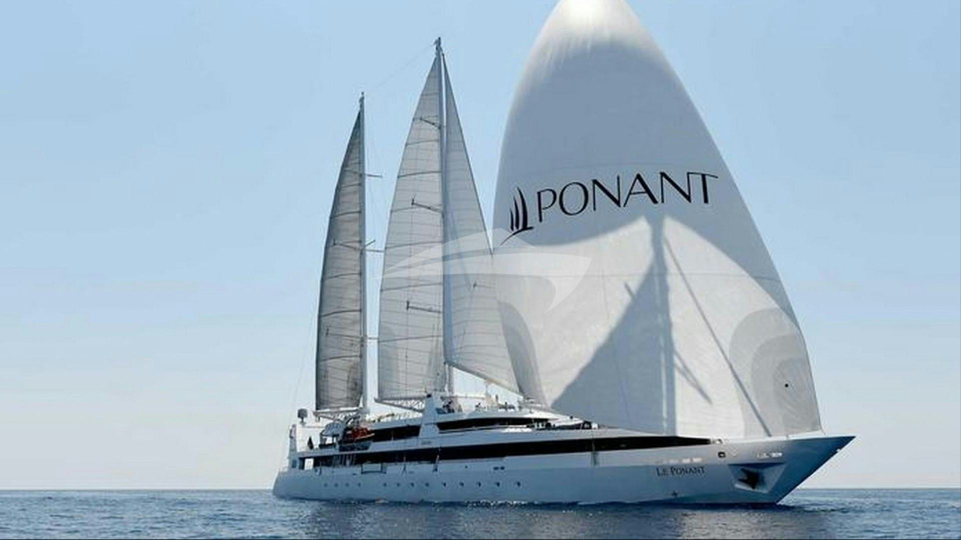
As the westernmost archipelagos of the Aegean command the attention of summer crowds, the Northern Sporades maintain a distinct maritime character defined by pine-forested coastlines, deep oceanic trenches, and strict conservation protocols. At the core of this cruising ground lies Alonissos. Flanked by an uninhabited cluster of satellite islets, this island represents one of the most rewarding navigation areas in the Mediterranean.
For the discerning skipper, an Alonissos Yacht Charter yacht charter provides access to the National Marine Park of Alonissos and Northern Sporades (NMPANS). Established in 1992, it is the largest protected marine area in Europe, encompassing over 2,200 square kilometres. Cruising here requires a higher degree of navigational awareness than simple day-sailing in the Saronic Gulf. Captains must calculate Meltemi funneling effects across deep channels, manage stern-line setups along steep limestone shores, and adhere to strict ecological zoning laws designed to protect the endangered Mediterranean monk seal (Monachus monachus).
This guide provides an editorially rigorous, seamanship-focused breakdown of the Alonissos cruising ground, covering local meteorology, tactical anchorage selection, pilotage hazards, and route architecture.
The Geography and Microclimates of the Alonissos Archipelago
The Alonissos landmass stretches roughly 14 nautical miles from southwest to northeast, characterized by a spine of rugged limestone heights that peak at Mount Kouvouli (475 metres). The island forms a natural barrier between the sheltered Sporades shelf to the west and the open, deep waters of the North Aegean to the east.
Cruising here is defined by three distinct marine sectors:
- The Southwest Coast and Peristera Channel: A relatively sheltered corridor running between Alonissos and the uninhabited island of Peristera. The water depth here ranges from 40 to 80 metres, creating ideal passage conditions with manageable seas even during Moderate Meltemi conditions.
- The Outer Islets (Zone A and B): Stretching northeast past the Pelagonisi Channel, this sector includes Kyra Panagia, Gioura, Skantzoura, and Piperi. Here, the seabed drops precipitously to depths exceeding 400 metres, exposing yachts to full oceanic swells and unmitigated wind tracks.
- The Wild Northwest Coast: Exposed to the full force of the prevailing weather, this coastline features vertical cliffs, sea caves, and very few safe entry points. It demands extreme respect and should only be negotiated in settled, light-wind conditions.
The entire region is governed by ecological zoning. Zone B includes Alonissos itself, Peristera, and the immediate surrounding waters, where anchoring, swimming, and leisure boating are generally permitted subject to standard park fees and restrictions on anchoring in Posidonia oceanica seagrass meadows. Zone A enforces tighter regulations: Piperi Island is a strictly off-limits marine reserve with a three-nautical-mile exclusion zone around its coastline to safeguard monk seal pupping sites. Gioura permits approach but prohibits landing without special permits. Kyra Panagia permits anchoring in designated bays such as Agios Petros and the natural hurricane hole of Planitis.
Wind Regimes and Sea States: May to October
Understanding the Aegean wind profile is critical for any captain executing an Alonissos yacht charter. While the southern Aegean suffers under relentless summer gales, the Northern Sporades experience a modified version of the Meltemi weather system.
The Meltemi Dynamics in the Sporades
The Meltemi in the Northern Sporades originates from a strong high-pressure system over the Balkans interacting with low pressure over Turkey. Unlike the straight southerly or south-easterly thermal breezes of early spring, the summer Meltemi blows predominantly from the north-northeast (NNE) to northeast (NE).
Because of the high topography of Skopelos and Alonissos, the wind does not blow uniformly. It funnels aggressively through the channels separating the islands. The passage between Skopelos and Alonissos (the Alonissos Strait) experiences an increase in velocity of 5 to 10 knots over the open-water gradient due to the high land masses squeezing the airflow. Similarly, katabatic winds drop off the steep northern ridges of Alonissos, striking anchorages on the lee side with sudden, powerful gusts even when the sea state outside appears calm.
Seasonal Breakdown
- May and June: A gentle, transitional period. Prevailing winds are variable, predominantly light north-westerlies or southerlies averaging Force 3 to 4 (7 to 15 knots). Sea surface temperatures sit around 19°C to 22°C. Sea states are smooth to slight. Cruising conditions are relaxed, making this an ideal window for low-stress exploration of the outer islets.
- July and August: The peak Meltemi window. The wind establishes a firm NNE vector, consistently blowing Force 5 to 6 (17 to 27 knots), frequently stepping up to Force 7 (30+ knots) during strong pulses that last three to four days continuously. The sea state in the open channels becomes rough, with steep, short-period waves building quickly. Anchorages on the south-western coast and deep natural inlets on the outer islets become essential retreats.
- September: Excellent cruising conditions. The Meltemi loses its relentless edge, settling into a predictable Force 3 to 5 pattern, predominantly from the NE or NW. Sea temperatures remain warm at 24°C, and the sea state calms significantly, allowing easier access to exposed north-coast anchorages.
- October: Early autumn brings unsettled frontal weather. Winds shift to south or south-westerlies, bringing occasional squalls and thunderstorms. While the sea remains warm, careful watching of synoptic charts is required, as southern exposure bays become untenable when long-fetch southerly swells roll into the archipelago.
Primary Anchorages and Haven Profiles
Selecting the correct haven on an Alonissos yacht charter requires matching your vessel's draft, anchor system, and line-out capabilities to the specific seabed geography.
### Patitiri Port The island’s primary commercial port is a small, high-walled inlet cut into the south-east coast. Vessels berth stern-to or bow-to the concrete quays using their own anchor.
- Shelter: Excellent protection from NW through N to NE winds. However, it is vulnerable to south-easterly swells, which can create a dangerous surge inside the basin.
- Holding and Mechanics: The seabed is a mix of coarse sand, mud, and scattered debris. Holding is generally good once the anchor is dug into the mud, but you must drop ample chain—at least 45 to 50 metres—to ensure a solid set against the violent wash generated by incoming high-speed ferries.
### Steni Vala and Kalamakia Located halfway up the east coast, facing Peristera, Steni Vala is a charming fishing village nestled inside a narrow channel.
- Shelter: Completely protected from Meltemi winds by the high ground of Alonissos to the north and Peristera Island acting as an outer breakwater to the east.
- Holding and Mechanics: The inner quay offers limited space for yacht berthing, requiring long stern lines to the opposite rocks or taking a berth along the stone pier if draft permits ( depths range from 2.2 to 3.5 metres near the quay). The bottom is sand and weed. Crosswinds can complicate Mediterranean-style stern-to mooring; using a bow thruster or taking a long line out via tender is standard procedure here. Kalamakia, just north, offers an alternative quay suitable for deeper-draft motor yachts, exposed only to southerly winds.
### Agios Dimitrios Situated on the north-east tip of Alonissos, this distinct white-pebble tongue extends out into the channel, creating two distinct bays.
- Shelter: Excellent protection on the southern side of the spit during a strong NNE Meltemi.
- Holding and Mechanics: The seabed drops off rapidly. You will be anchoring in 10 to 15 metres of water over coarse sand and gravel. Excellent holding power once the anchor sets. Ensure you drop sufficient chain (minimum 5:1 scope) because of the depth. It is customary to anchor off and enjoy the crystal-clear water, but it is not recommended as an overnight stay if the wind shifts south.
### Leftos Gialos and Tzortzi Kalos These twin indentations on the south-east coast are classic Mediterranean stopovers.
- Shelter: Tzortzi Kalos is a long, narrow bay lined with pine trees that provides exceptional shelter from the N, NW, and W. Leftos Gialos lies just south, offering safety from NW through N to NE winds.
- Holding and Mechanics: Tzortzi Kalos features a sandy seabed with patches of seagrass; target the bright turquoise sand patches for immediate anchor penetration in 4 to 8 metres of water. Longlines to the pine trunks on the northern shore are mandatory to prevent swinging in night-time katabatic shifts. Leftos Gialos offers good holding in sand and gravel in 6 to 10 metres.
### Peristera Island: Vasiliko Bay Located on the south-west side of Peristera, directly across from Alonissos, Vasiliko is a vast, fjord-like natural harbour.
- Shelter: Exceptional, all-round shelter. It is one of the safest natural hurricane holes in the Sporades. The surrounding hills break up even Force 8 Meltemi winds into manageable breezes.
- Holding and Mechanics: Thick mud and sand cover the seabed, providing supreme holding ground in 8 to 14 metres of water. Run long polypropylene floating lines to the rocks on the eastern shore. Be mindful of the ancient shipwreck site in the vicinity, which is clearly marked on modern navigational charts and protected by marine park laws.
### Kyra Panagia: Planitis Bay and Agios Petros Kyra Panagia is the largest uninhabited island of the outer group, owned by the Megisti Lavra Monastery of Mount Athos.
- Planitis Bay (North Coast): A landlocked natural lagoon entered via a narrow channel less than 50 metres wide with a shallow bar (minimum depth approx. 2.8 to 3.0 metres in the mid-channel line).
- Pilotage: Entry should not be attempted at night or during heavy northerly swells, which break across the outer entrance. Once inside, the bay expands into two large basins offering complete protection from all wind directions.
- Holding: Dense mud, depth 4 to 8 metres. Anchor holding is absolute.
- Agios Petros (South-West Coast): A deep, wide bay with turquoise waters surrounding a small islet.
- Shelter: Highly sheltered from the Meltemi (NNE to E). Unusable during strong southerlies.
- Holding: Sand and weed. Scope out plenty of chain in 8 to 12 metres and take shore lines to the reddish cliffs on the northern shore.
Navigational Hazards and Marine Park Compliance
While the Sporades offer deep water close to the shorelines, several micro-hazards demand precision from the helm during an Alonissos yacht charter.
### Shoals and Reefs Lefko and Prasso Rocks (Skantzoura):* The island of Skantzoura, lying south-east of Alonissos, is surrounded by low-lying islets and dangerous, unlit rocky reefs extending up to 0.8 nautical miles off its northern and western points. Keep a minimum offing of 1.5 nautical miles unless executing a day-time visual approach to the monastery cove. Planitis Entrance Bar:* As noted, the entrance to Planitis on Kyra Panagia requires strict adherence to the centerline. Deviation east or west of the channel leads to shallow rocky shelves that will ground deep-draft performance sailing yachts or large displacement motor yachts. Grammeza Islet (Kyra Panagia):* The pass between Grammeza and the west coast of Kyra Panagia looks inviting on small-scale charts, but contains uncharted rocky outcrops and unpredictable current shifts. Pass to the west of Grammeza unless using local visual pilotage.
### Environmental Regulations and Marine Ethics Operating inside a marine sanctuary requires absolute compliance with national park rules to protect fragile ecosystems and the local seal population:
[ZONE A: Piperi Island - 3 NM No-Entry Exclusion Zone]
[ZONE B: Alonissos, Peristera, Kyra Panagia - Open Cruising & Permitted Anchoring]
1. Anchoring Protocols: Always drop anchor in clear sand patches. Destroying Posidonia oceanica seagrass meadows with anchor drag carries heavy fines from the Hellenic Coast Guard. Use a trip line if anchoring near rocky boundaries to prevent chain entrapment. 2. Waste Management: Discharging grey or black water within the marine park boundaries is strictly prohibited. Holding tanks must be used, and zero plastic or organic waste may be disposed of at sea. 3. Speed Restrictions: Maintain a maximum speed of 10 knots within 500 metres of the coast inside Zone B, and reduce speed to 5 knots when approaching small harbours or narrow channels like Steni Vala to prevent bank erosion and protect small craft. 4. Ticketing: All commercial and private vessels entering the NMPANS must purchase an entrance permit (accessible via the official Natural Environment and Climate Change Agency digital portal). Have your registration papers and digital entry receipt ready for Coast Guard inspection.
Day-Hop Distances and Passage Mechanics
The compact layout of the Northern Sporades makes it easy to balance open-water sailing with relaxed bay-hopping. Below are the key passage distances calculated from Alonissos (Patitiri) to key points across the regional cruising ground:
- Patitiri to Skopelos Town (Skopelos): 10.5 NM
- Patitiri to Steni Vala (Alonissos): 5.8 NM
- Steni Vala to Vasiliko Bay (Peristera): 3.2 NM
- Patitiri to Skantzoura Island: 13.4 NM
- Agios Dimitrios (Alonissos) to Agios Petros (Kyra Panagia): 8.2 NM
- Agios Petros (Kyra Panagia) to Planitis Bay (Kyra Panagia): 5.5 NM
- Kyra Panagia (Planitis) to Gioura Island (Approach): 4.8 NM
- Patitiri to Skiathos Port (Skiathos): 23.5 NM
- Patitiri to Panormos Bay (Skopelos): 16.2 NM
Passage times are easily calculated. At an average cruising speed of 8 to 10 knots under power or a steady 7 knots under sail, most hops within the Alonissos sector take between 45 minutes and two hours. This allows charter guests to enjoy morning swims, relaxed coastal passages during the mid-day wind build, and comfortable arrivals at secure anchorages well before late-afternoon catabatic winds reach their peak.
How a Captain Plans a Seven-Day Alonissos Itinerary
A successful high-end luxury charter requires a balanced itinerary that accommodates guest preferences for dining, watersports, and secluded nature while keeping wind patterns in mind. Below is how an experienced captain structures a classic seven-day passage originating from Skiathos or Volos, centering heavily on the Alonissos Marine Park.
### Day 1: Embarkation at Skiathos – Cross to Skopelos (Panormos) After boarding at Skiathos Port and completing safety briefings, set sail east across the Skiathos Channel (15 NM) toward Skopelos. Anchor for the night in Panormos Bay, a deep, pine-encircled bay on the south coast of Skopelos that offers flawless shelter from the Meltemi. Deploy longlines to the shore and enjoy dinner aboard as the sun sets over the Aegean.
### Day 2: Skopelos Town to Alonissos (Tzortzi Kalos & Steni Vala) Weigh anchor at dawn and make the short passage around Cape Gourouni to Skopelos Town for morning coffee and provisions. By mid-morning, drop down across the Alonissos Strait (10 NM) to Alonissos. Stop for lunch and a swim in the turquoise waters of Tzortzi Kalos, where guests can use the yacht's paddleboards and sea bobs over clear, sandy bottoms. In the late afternoon, make the short 3-NM hop to Steni Vala. Secure a stern-to berth on the mole and dine ashore at one of the traditional fish tavernas famous for local spiny lobster pasta (astakomakaronada).
### Day 3: Crossing the Peristera Channel to Vasiliko Depart Steni Vala and cross the narrow channel to Peristera Island. Spend the morning over the ancient shipwreck site (where a 5th-century BC merchant vessel's cargo of thousands of amphorae rests on the seabed, accessible via guided diving tours or visual inspection). Move into Vasiliko Bay for the afternoon and night. This pristine, uninhabited fjord offers ideal conditions for deploying the yacht’s watersports setup. Anchor in 10 metres of mud with dual longlines to the shore.
### Day 4: Deep Marine Park Wilderness – Kyra Panagia Leave Peristera early to head north across the Pelagonisi Channel (11 NM) into the heart of Zone B. Your destination is Kyra Panagia. Make a mid-day stop at Agios Petros for swimming, snorkeling, and exploring small sea caves along the coast. In the late afternoon, weigh anchor and navigate around the eastern cape to enter Planitis Bay before the evening breeze picks up. Drop anchor in the landlocked lagoon for a night of complete solitude under extraordinary, light-pollution-free skies.
### Day 5: Skantzoura Remote Exploration to South Alonissos Exit Planitis at first light when the sea state is calm. Set a southerly course, running down the eastern flank of the archipelago toward Skantzoura (18 NM). Weather permitting, anchor off the low-lying coast to view the white-stone Monastery of Evangelistria rising from the scrubland. By mid-afternoon, turn back towards the south coast of Alonissos (13 NM), coming to rest in Leftos Gialos or Megalos Mourtias. Guests can take the tender ashore to meet private transport up to Chora, the cliffside old capital of Alonissos, for evening cocktails and sunset views over the Sporades ridge.
### Day 6: The Caves of North Alonissos to Patitiri Spend the morning exploring the wilder southwest coast of Alonissos, including the Blue Cave near Cape Nitza. Sail down to Patitiri Port to take on freshwater, top up fuel if necessary, and allow guests to explore the Marine Park Museum on the waterfront. Secure a comfortable berth on the outer wall or anchor in neighboring Votsi Bay, a dramatic limestone amphitheatre with emerald waters.
### Day 7: Return Passage via Skopelos to Skiathos Begin the return leg westward. Run along the southern coast of Skopelos, stopping at the famous St. John’s Chapel rock (made famous by cinema, but visually striking in its own right from the water) or the sheltered cove of Agnontas for a final swim stop. Cross the Skiathos Channel under full sail as the afternoon thermal breeze hits 18 knots, coming alongside in Skiathos Port by 17:00 for the final night of the charter.
### Day 8: Disembarkation Final breakfast on the aft deck in Skiathos Port, followed by guest disembarkation and transfer to Skiathos International Airport (JSI).
Final Technical Considerations for Charterers
When selecting a vessel for an Alonissos yacht charter, draft and ground tackle specification should be top priorities:
- Sailing Yachts vs. Motor Yachts: Performance sailing yachts and catamarans thrive in the consistent 15 to 22-knot summer breezes of the Sporades. Catamarans offer shallow drafts (typically under 1.5 metres), which allow entry into intimate coves like Tzortzi Kalos and easy maneuvering over the bar at Planitis. Motor yachts provide speed to bridge the gaps between outer islets effortlessly, but require careful anchoring setups in deeper bays like Agios Dimitrios.
- Ground Tackle: Ensure the yacht carries at least 80 to 100 metres of high-test chain on the primary anchor, along with two 50-metre floating longlines on reels mounted on the stern pushpit. Anchoring in deep, rock-lined coves requires running lines to shore to keep the vessel's bow pointed into catabatic gusts rolling off the islands.
- Stabilization: Dual-function zero-speed stabilizers are highly recommended for motor yachts lingering in outer island anchorages like Kyra Panagia, where gentle, long-period swells can roll around outer points even in light winds.
Cruising Alonissos and the Northern Sporades requires balanced seamanship, ecological respect, and precise navigation. In return, it offers one of the last true maritime sanctuaries in the Mediterranean—a realm of deep clear waters, ancient shipwrecks, and undisturbed sea life.