
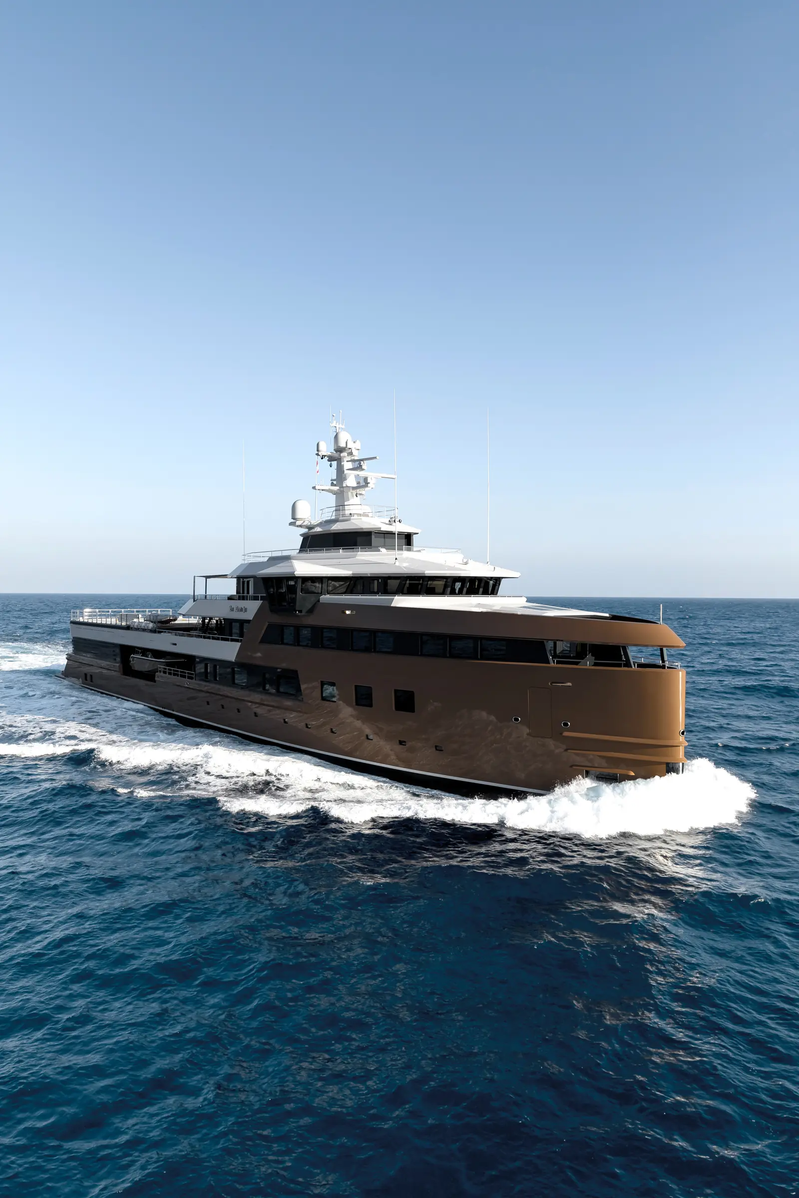
Carved into deep, pine-forested bays where the Aegean Sea meets the Mediterranean, southwestern Turkey offers one of the most sheltered and geographically varied cruising grounds in the world. Stretching from the Bodrum Peninsula eastwards to the sunken Lycian ruins of Kekova, this coastline—historically known as the Carian and Lycian Revieras—presents a rare confluence of deep-water anchorages, reliable summer wind patterns, and ancient maritime history.
For a luxury yacht charter, Turkey is defined by short, protected passages punctuated by dramatic headland crossings. Whether embarking from world-class marina hubs such as Yalıkavak Marina or D-Marin Göcek, executing a seamless itinerary requires an intimate understanding of local weather dynamics, seabed composition, line-handling techniques, and regional passage planning.
The Cruising Grounds: Geography and Sea Areas
The Turkish cruising coast is divided into four primary geographic sectors, each exhibiting distinct topography, meteorological conditions, and navigation profiles.
### The Gulf of Gökova Extending 50 nautical miles east from the Bodrum Peninsula to the shallow flats of Akyaka, the Gulf of Gökova is framed by steep mountain ranges. The northern shore is defined by dramatic gray limestone cliffs dropping into deep water, while the southern shore breaks into a intricate labyrinth of pine-shrouded coves, islets, and sheltered anchorages. The gulf is largely free of isolated off-lying shoals, allowing for stress-free deep-water navigation.
### The Datça Peninsula and Gulf of Hisarönü The Datça Peninsula acts as a narrow, 40-mile barrier dividing the Aegean from the Mediterranean. At its westernmost extremity lies Cape Crio and the ancient city-harbour of Knidos. South of the peninsula lies the Gulf of Hisarönü, an expansive basin bounded by the rugged Bozburun Peninsula. Hisarönü features starker, drier topography than Gökova, with volcanic islets, submerged reefs, and deep fjords such as Selimiye and Orhaniye that provide complete protection from open-sea swells.
### The Gulf of Fethiye and Göcek Bay Cruising east past the high promontory of Cape Kurtoğlu brings you into the Gulf of Fethiye. The northwestern corner of this gulf forms Göcek Bay, a landlocked basin dotted with islands including Tersane, Yassıca, and Göcek Island. This area is the undisputed heart of Turkish luxury yachting, characterized by calm, turquoise waters, short distance hops between coves, and dense Aleppo pines that grow directly down to the water’s edge.
### The Lycian Coast From Fethiye, the coastline shifts southeast toward Ölüdeniz, the towering cliffs of Yedi Burunlar (The Seven Capes), Kalkan, Kaş, and the semi-enclosed archipelago of Kekova. Unlike the sheltered gulfs to the west, the Lycian coast is an exposed ocean stretch where the Taurus Mountains meet the Mediterranean. Cruising here requires careful timing around open-sea swells, rewarding yachts with crystal-clear waters, steep drop-offs, and submerged Roman and Lycian antiquities.
Wind Systems, Microclimates, and Sea State
Understanding local wind mechanics is critical to comfortable passage planning along the Turkish coast. The weather from May through October is governed by the Meltemi (known locally as the Meltem), a dry northerly wind created by pressure differentials between the Balkan high-pressure system and the Asian thermal low.
       [ Aegean Sea / Meltemi Flow ]
                   |  (NW Winds)
                   v
   +-------------------------------+
   |   Cape Crio / Knidos Headland  |  <-- Severe Compression Zone
   +-------------------------------+      (Force 6-7 Gusts / Steep Seas)
                   |
         +---------+---------+
         |                   |
         v                   v
  [ Gulf of Gökova ]   [ Gulf of Hisarönü ]
  (Thermal Sea Breeze)  (Funneled Westerlies)
### Wind Behaviour and Regional Funneling In the open Aegean, the Meltemi blows from the north-northwest. However, as it encounters the Anatolian landmass, it is funneled and bent by the coastal mountain ranges.
At Cape Crio (Knidos), the Meltemi accelerates as it rounds the headland, frequently increasing by 10 to 15 knots over the ambient sea state. Inside the Gulf of Gökova and the Gulf of Hisarönü, the wind bends to follow the axis of the gulfs, blowing as a westerly or north-westerly thermal breeze.
In Göcek Bay, high surrounding peaks shield the inner island passages from the worst of the Aegean Meltemi. Here, a predictable sea breeze develops around midday, rising to 12–16 knots from the west-southwest, before dying away completely at sunset.
### Monthly Cruising Conditions May and June:* The transition period. Winds are predominantly light to moderate north-westerlies (10–15 knots). Sea states are smooth, though early-season fronts can occasionally bring brief southerly breezes. Air temperatures range from 24°C to 28°C; sea water temperatures sit around 20°C–22°C. July and August:* Peak Meltemi season. In exposed areas off Knidos or the Seven Capes, winds routinely reach Force 5 to 6 (18–25 knots) in the afternoon, creating a short, steep chop. Inside the protected gulfs, the wind provides welcome cooling without generating significant waves. Air temperatures frequently exceed 35°C; sea water warmness reaches 27°C. September and October:* Widely considered by experienced captains to be the prime cruising window. The Meltemi loses its strength, giving way to gentle thermal breezes (8–14 knots). High pressure yields clear skies, stable sea states, and sea water temperatures that remain at a warm 25°C throughout October.
Essential Natural Anchorages and Shelter
The Turkish coast offers some of the most secure natural harbors in the Mediterranean. Due to steep drop-offs, anchoring often involves dropping primary gear in 15 to 25 metres of water and running stern lines to shore.
### Kissebükü (Gulf of Gökova) Situated on the northern shore of the Datça Peninsula near the entrance to Gökova, Kissebükü consists of several small coves backed by pine forests and Byzantine ruins. Protection:* Exceptional shelter from the prevailing NW Meltemi. Exposed to the south and east. Seabed & Holding:* Thick weed over mud and sand. It requires setting the anchor firmly to ensure the fluke pierces the kelp layers. Tactics:* Drop anchor in 12–18 metres and run long polypropylene shorelines to the rocks on the cove’s western arm.
### English Harbour / Değirmen Bükü (Gulf of Gökova) Located in the south-eastern corner of Gökova, this deep inlet earned its name during World War II when British motor torpedo boats used its dense pine canopy for radar-defying shelter. Protection:* Total 360-degree protection from all winds and swells. Seabed & Holding:* Soft mud with outstanding holding ground in 8–12 metres. Tactics:* Ideal for anchoring overnight in heavy Meltemi conditions. Stern lines can be taken to shoreline bollards managed by local timber conservation authorities.
### Dirsek Bükü (Bozburun Peninsula) A horseshoe-shaped bay located at the south-western tip of the Bozburun Peninsula, positioned strategically for yachts preparing to cross the Gulf of Hisarönü. Protection:* Flawless shelter from NW, W, and SW winds. Open only to the north-east. Seabed & Holding:* Sand and fine gravel in 10–15 metres. Excellent holding. Tactics:* Anchor in the south-western corner of the bay. The water clarity is extraordinary, making visual verification of the anchor set effortless.
### Wall Bay and Cleopatra's Bath (Göcek Bay) Located on the southwestern rim of the Gulf of Fethiye, this famous inlet features submerged Roman bath structures built directly into the shoreline. Protection:* Protected from prevailing westerly sea breezes by high, pine-clad ridges. Seabed & Holding:* Mud and rock; depths drop quickly away from the shore from 5 metres to over 30 metres. Tactics:* Set anchor in 20–25 metres, paying out generous scope before stern-to mooring to shore-based rings. Watch for underwater masonry near the bath ruins when setting stern lines.
### Kekova Sound and Polemos Bay A landlocked marine park protected by Kekova Island, offering a dramatic historic backdrop of Lycian sarcophagi rising from the water and the Byzantine castle of Simena. Protection:* Complete protection from sea swell; minor surface wind chop during afternoon breezes. Seabed & Holding:* Mud and sand in 6–10 metres. Excellent holding throughout the sound. Tactics:* Avoid dropping anchor on or near designated archaeological underwater zones. Use the sandy mud flats in Polemos Bay for a tranquil, motionless overnight anchorage.
Navigational Hazards, Pilotage, and Seamanship
While cruising a Luxury Yacht Charter Turkey itinerary is generally stress-free, specific localized hazards require careful seamanship and proactive captaincy.
### Stern-To Shore Mooring Because the seabed drops off precipitously throughout the Carian and Lycian coasts—often exceeding 40 metres depth just 50 metres from the shoreline—traditional swinging anchorages are rare.
Captains must master stern-to shoreline mooring. The standard protocol involves dropping a heavy primary anchor with substantial chain scope (50 to 70 metres) in deep water, reversing toward the tree line, and sending the tender ashore with two floating polypropylene lines.
These lines must be secured around smooth shoreline boulders or dedicated stainless steel shore cleats. Captains should never tie lines directly around living pine trees unless using protective webbing straps, as heavy loads can strip the bark and kill the tree.
### Katabatic Winds (Fall Winds) High, sun-baked mountain slopes—most notably Mount Baba (Babadağ) behind Ölüdeniz and the high plateau above the Gulf of Gökova—generate nocturnal katabatic winds. As the land cools rapidly after sunset, cold heavy air cascades down mountain ravines and empties into the bays below. These gusts can strike a calm anchorage at 25 to 35 knots for 30–60 minutes during the early hours of the morning.
### Submerged Ancient Infrastructure Thousands of years of tectonic shifts have submerged classical infrastructure along this coast. Submerged quay walls, ancient breakwaters, and Roman slipways exist just beneath the surface in areas like Cleopatra’s Bath (Wall Bay), Aperlae, and Kekova. Captains and tender drivers must maintain diligent visual watches and cross-reference bathymetric soundings with electronic charts when operating close to shore.
### Cruising Chokepoints Two main headlands require sound passage planning: Cape Crio (Knidos):* The convergence of the Aegean and Mediterranean seas creates a standing wave pattern when a strong Meltemi meets the counter-current rounding the peninsula. Plan headland roundings for early morning hours when thermal amplification is at its minimum. Yedi Burunlar (The Seven Capes):* A 12-mile stretch of sheer cliffs with no intermediate shelter between Ölüdeniz and Kalkan. The high cliffs reflect waves, generating a confused, choppy sea state up to 3 miles offshore during afternoon winds.
Passage Distances and Leg Matrix
To assist with route planning, the following table details nautical mile distances between primary cruising ports and key anchorages along the Turkish coast.
- Bodrum Marina to Kissebükü: 18 NM
- Kissebükü to English Harbour (Gökova): 17 NM
- English Harbour to Knidos (Cape Crio): 32 NM
- Knidos to Datça Port: 22 NM
- Datça Port to Dirsek Bükü: 18 NM
- Dirsek Bükü to Selimiye (Hisarönü): 10 NM
- Selimiye to Bozburun: 8 NM
- Bozburun to Marmaris Port: 28 NM
- Marmaris to Ekincik (Dalyan River access): 22 NM
- Ekincik to D-Marin Göcek: 28 NM
- Göcek (Internal Bay Hopping): 3–8 NM
- Göcek to Ölüdeniz: 16 NM
- Ölüdeniz to Kalkan (via Seven Capes): 32 NM
- Kalkan to Kaş: 14 NM
- Kaş to Kekova Sound: 16 NM
How a Captain Plans a One-Week Itinerary
Executing a successful Luxury Yacht Charter Turkey yacht charter requires balancing guest desires for secluded anchorages, swimming, and shore side dining with the mechanical realities of sea state, fuel burn, and wind windows. Captains generally employ one of two strategic approaches depending on the departure port.
+-------------------------------------------------------------------+
|                   CAPTAIN'S DAILY ROUTINE MATRIX                  |
+-------------------------------------------------------------------+
| Time        | Operational Focus       | Tactical Rationale        |
+-------------+-------------------------+---------------------------+
| 07:30-10:30 | Main Passage / Open Water| Calm seas, zero Meltemi   |
| 11:30-15:00 | Swim Stop & Anchor-Out  | Thermal wind max / Shade  |
| 16:30-18:00 | Short Run to Night Bay  | Secure stern lines early  |
| 20:00-23:00 | Shoreline Dining / Stay | Quiet landlocked waters   |
+-------------------------------------------------------------------+
### Strategy A: The Northern Carian Loop (Bodrum to Gökova / Hisarönü) Designed for charterers embarking in Bodrum, this strategy prioritizes deep-water sailing, private pine coves, and classical antiquities, staying largely within sheltered gulf waters.
- Day 1: Embarkation in Bodrum. Clear the marina, execute a brief 12-mile run to the island of Karaada for an afternoon swim, then drop anchor stern-to in the secluded cove of Çökertme.
- Day 2: The Heart of Gökova. A morning passage of 17 nautical miles east to English Harbour. Spend the afternoon paddleboarding in the flat waters of Yedi Adalar (Seven Islands).
- Day 3: Western Bound to Knidos. Early morning departure (07:00) to cross the Gulf of Gökova before the Meltemi builds. Cover the 32 nautical miles to Cape Crio. Tie up stern-to at the ancient harbor mole of Knidos. Explore the Hellenistic amphitheatre and temple ruins as the sun sets over the Aegean.
- Day 4: Crossing into Hisarönü. A short 18-nautical-mile run along the high ridges of the Datça Peninsula into Dirsek Bükü. Secure lines to the shoreline in crystal-clear water.
- Day 5: The Selimiye Fjord. A gentle 10-nautical-mile morning cruise into the sheltered fjord of Selimiye. Go ashore in the evening to sample fresh local seafood, wild olive oil, and regional lamb dishes at a seafront lokanta.
- Day 6: Datça Town. Cruise 18 nautical miles back along the peninsula to Datça. Berth at the harbor quay for provisioning, boutique shopping, and exploring the stone architecture of Old Datça (Eski Datça).
- Day 7: The Return to Bodrum. A 28-nautical-mile passage rounding Cape Crio northwards. Take advantage of the afternoon Meltemi for a fast downwind sail across the Gulf of Gökova, arriving at Yalıkavak Marina or Bodrum Port by late afternoon.
### Strategy B: The Central Lycian Route (Göcek to Kekova) Designed for charters embarking at D-Marin Göcek or Marinturk, this itinerary blends the island passages of Göcek Bay with an open-water coastal run to the ancient sunken architecture of Kekova.
- Day 1: Göcek Islands. Embark at D-Marin Göcek. Execute a short 5-nautical-mile run to Wall Bay. Drop anchor in 20 metres, set stern lines to shore, and swim around the submerged walls of Cleopatra’s Bath.
- Day 2: Early Morning Run to Kalkan. Weigh anchor at 06:30 to negotiate Cape Kurtoğlu and the Seven Capes in smooth morning seas. Complete the 44-nautical-mile passage to Kalkan by midday, anchoring in the bay or securing a berth on the town quay.
- Day 3: Kalkan to Kaş. A relaxed 14-nautical-mile passage along the steep Lycian coast. Stop for a lunch anchor at Kaputaş Beach or the blue lagoon of Limanağzı before clearing into Setur Kaş Marina for an evening exploring the town's cobble-paved streets and Lycian sarcophagi.
- Day 4: The Kekova Archipelago. A 16-nautical-mile morning cruise to Kekova Sound. Spend the day slowly motoring past the sunken ruins of Simena. Anchor stern-to in Polemos Bay over fine mud holding ground.
- Day 5: Turning North to Karacaören. Depart Kekova early for the 35-nautical-mile return run past the Seven Capes. Drop anchor at Karacaören Island, a reef-protected bay south of Fethiye, using a mooring buoy set in 10 metres of clear water.
- Day 6: Göcek Bay Exploration. A brief 12-nautical-mile passage back into the sheltered waters of Göcek Bay. Spend the day moving between Bedri Rahmi Bay—named after the famous Turkish painter who left a fish mural on a shoreline rock in 1973—and Sarsala Bay.
- Day 7: Disembarkation Preparation. A leisurely 4-nautical-mile cruise across the inner bay to D-Marin Göcek, enjoying a final swim stop at Yassıca Islands before returning to the marina quay.
### Strategic Provisions and Onboard Logistics A skilled captain balances remote anchorages with marina stops to ensure seamless luxury service onboard. High-capacity watermakers are essential when staying extended days stern-to in pine bays where fresh shore water is unavailable.
In terms of culinary provisioning, while luxury yachts maintain world-class private chefs, integrating the local coastal culture is an integral part of the experience. Captains routinely coordinate with local shorefront lokantas in places like Selimiye, Dirsek Bükü, and Wall Bay. These family-run establishments maintain private wooden jetties equipped with mooring bollards, fresh water connections, and lazy lines, allowing yachts to berth stern-to directly steps away from tables serving fresh octopus, red mullet, and wild herbs harvested from the surrounding hills.
By pairing meticulous morning passage timing with an appreciation for local microclimates, a captain transforms a Luxury Yacht Charter Turkey voyage into an effortless, serene journey through one of antiquity’s most timeless maritime crossroads.