
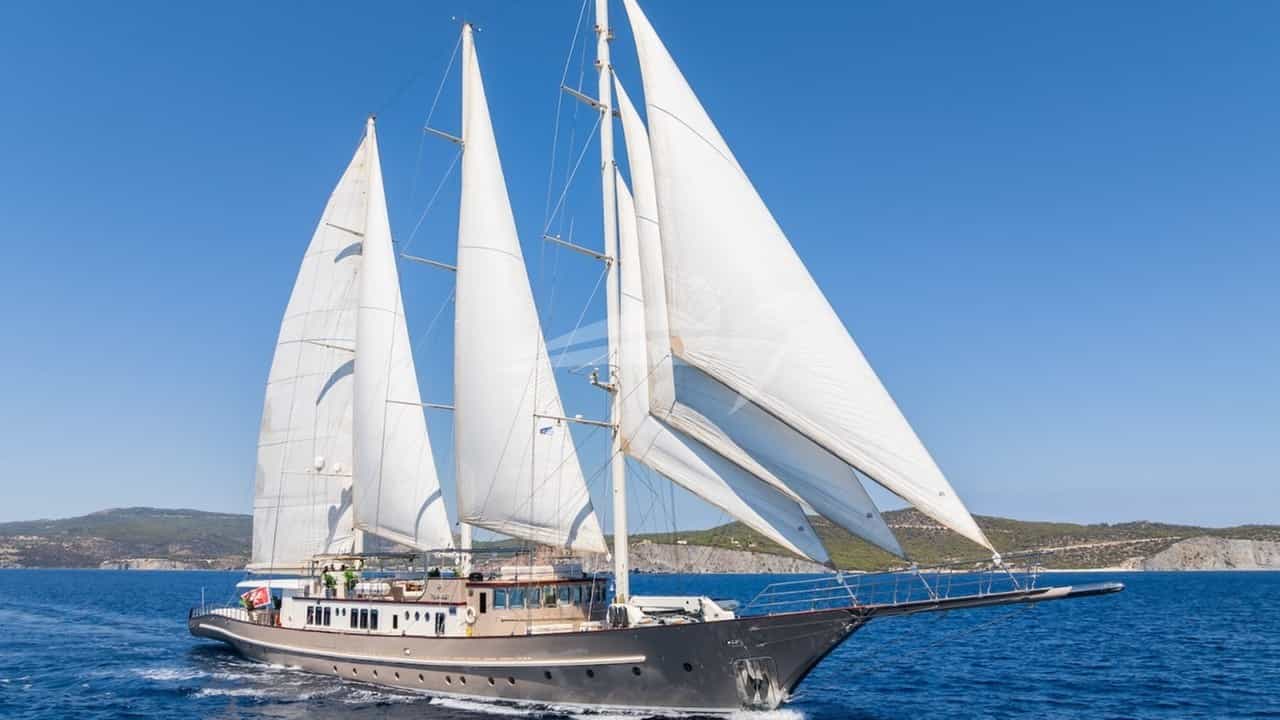
Positioned on the northern bank of the Western Solent at the edge of the New Forest, Lymington is widely regarded as the premier gateway for UK luxury yacht charters. Far more than a picturesque Hampshire market town, it serves as an operational epicenter for cruising the English Channel, the Isle of Wight, and the Jurassic Coast. The deep-water approaches of the Lymington River, combined with world-class marina infrastructure, allow large motor yachts and performance sailing yachts to base themselves directly at the threshold of some of Europe’s most dynamic waters.
Securing a Lymington Yacht Charter yacht charter provides immediate entry to Britain's most technical and rewardingly varied cruising grounds. Within a fifteen-mile radius lie protected saltwater inlets, steep-to chalk cliffs, historic naval anchorages, and demanding tidal passages. Navigating these waters requires an understanding of complex local hydrography, distinct wind-against-tide phenomena, and precise passage timing. This guide delivers the technical depth and local knowledge required to execute a seamless luxury charter in and around Lymington.
The Geography of Lymington and the Western Solent
The Western Solent is a semi-enclosed body of water running roughly southwest to northeast between the Hampshire mainland and the Isle of Wight. Lymington sits on the north shore, tucked inside the entrance of the Lymington River. The river mouth is guarded by extensive saltmarshes and mudflats—the Lymington Bank to the west and the Oxey Bank to the east—which are crisscrossed by shallow gutters and protected as nature reserves.
The fairway into Lymington is clearly marked by a well-buoyed dredged channel. The seaward entrance is marked by the distinctive 'Jack in the Basket' pile structure, from which the channel trends north-northwest toward the town. To the west of the river entrance lies Hurst Spit, a two-mile-long shingle bar extending from Milford-on-Sea toward the Isle of Wight. This natural barrier forms Hurst Narrows, a bottleneck barely three-quarters of a nautical mile wide that controls the volume of water entering and exiting the Solent from the west.
To the south, directly across the Western Solent from Lymington, lies the northwest coast of the Isle of Wight. This shoreline features Yarmouth Harbour, the pristine mouth of Newtown Creek, and the iconic chalk stacks of the Needles at the island's western tip. The combination of mainland protection and Isle of Wight shelter creates a vast natural basin, though one heavily influenced by strong tidal streams and shallow banks.
                    [HAMPSHIRE MAINLAND]
                        |
                  Lymington River
                        |
            [Jack in the Basket Light]
                        |
  WESTERN SOLENT <------+------> EASTERN SOLENT
                        |
    [Hurst Spit]        |        [Newtown Creek]
         \              |               /
   [Hurst Narrows]      |              /
         \              |             /
          +-------------+------------+
                        |
               [ISLE OF WIGHT]
Seasonal Prevailing Winds, Sea States, and Microclimates
Understanding the atmospheric conditions of the Western Solent is central to charter planning. The area experiences a maritime climate dominated by the passage of North Atlantic depressions, interspersed with stable high-pressure systems during the summer months.
### April to May Spring brings variable weather conditions. Prevailing winds oscillate between south-westerlies and north-easterlies. Air temperatures range from 10°C to 16°C, and sea surface temperatures hover around 9°C to 12°C. Sea states in the Western Solent are generally moderate, though crisp north-easterly breezes can create a harsh, short chop off Lymington Spit when the ebb tide runs west. Traffic is relatively light, making this an ideal window for technical sailing charters focused on passage making.
### June to August Summer delivers the most reliable charter conditions. The prevailing wind is south-westerly, averaging 12 to 20 knots. A key local phenomenon during these months is the Solent sea breeze. On clear, sunlit days, land heating over the Hampshire basin creates a strong thermal low. By mid-afternoon, a localized south-southwesterly sea breeze builds, funneling up the Western Solent between the high Downland of the Isle of Wight and the Hampshire coast. Winds frequently accelerate by 8 to 12 knots above the synoptic forecast, reaching Force 5 or 6 by late afternoon before dying away at sunset. Sea surface temperatures reach 17°C to 19°C.
### September to October Early autumn offers exceptional cruising conditions, with warm sea temperatures and stable early-season atmospheric conditions. Westerly and south-westerly winds dominate, typically between 15 and 22 knots. As Atlantic low-pressure systems become more active in late October, gales become more frequent. The sea state inside the Solent remains moderate due to land shelter, but heavy swell can roll into the Needles Channel and Alum Bay from the English Channel.
### Wind-Against-Tide Sea States The interaction between wind and tidal stream in the Western Solent requires careful monitoring. Because the tidal stream in Hurst Narrows and the Western Solent can reach speeds of 4 to 5.5 knots during spring tides, a strong westerly or south-westerly wind blowing against a falling ebb tide (running west) generates short, steep, breaking seas. This effect is particularly severe in three locations: Over The Shingles* sandbank west of Hurst Castle. Off Hurst Point* in the narrowest section of the gap. In the Bridge Channel* off the Needles.
Under these conditions, luxury motor yachts may experience considerable slamming, and charter captains will adjust their timing to transit these channels near slack water or with a conforming tide.
Tidal Dynamics and Navigational Hazards
The tidal regime of the Solent is one of the most complex in the world, governed by the hydraulic effects of the English Channel and the double entrance created by the Isle of Wight.
### The Double High Water Lymington and the Solent experience a 'Double High Water' on the flood tide. As the ocean tide flows east up the English Channel, water enters the Solent through both the Western entrance (Hurst Narrows) and the Eastern entrance (Spithead). The initial high water is followed by a slight dip, and then a second high water approximately two hours later, caused by water flowing back into the Solent from the eastern basin. This creates a extended period of high water—often lasting up to three hours—which provides an extended navigation window for deep-draft yachts entering shallow rivers like the Lymington or Beaulieu.
### The Solent Tidal Stream Cycle The Flood Tide (Eastbound):* Begins approximately 5.5 hours before High Water Portsmouth. Water surges east through Hurst Narrows, accelerating up to 4.5 knots off Hurst Castle, flowing past Lymington toward Cowes. The Ebb Tide (Westbound):* Begins roughly 1 hour after High Water Portsmouth. The stream turns west, flowing out through Hurst Narrows at speeds up to 5.5 knots on spring tides.
### Critical Navigational Hazards The Shingles Bank:* A constantly shifting shoal of coarse gravel and sand extending nearly three miles west-northwest from Hurst Spit. Depths can rise abruptly from 20 metres to less than 1 metre at Chart Datum. It must be given a wide berth, particularly in south-westerly swells. The Bridge Reef:* A rocky ledge extending southwest from the Needles Lighthouse. Transiting the Bridge Channel requires strict adherence to the leading lights or GPS tracks, as depths decrease rapidly. Lymington Fairway & Commercial Traffic:* The Lymington River channel is narrow and bounded by unyielding mudbanks. Large Wightlink car ferries operate continuously between Lymington Pier and Yarmouth. These vessels have restricted maneuverability within the dredged channel; charter yachts must maintain a vigilant watch, yield right of way, and refrain from overtaking inside the narrowest sections. The maximum speed limit in the river is 6 knots. Traps at Hurst Narrows:* Passing Hurst Point against a maximum spring ebb requires significant engine power or careful tactical sailing. Yachts unable to make more than 6 knots over the ground can find themselves stationary against the stream.
Essential Natural Anchorages and Shelter Profiles
While Lymington offers world-class marina berths, the Western Solent and adjacent Dorset coast feature outstanding natural anchorages providing total isolation and protection depending on wind direction.
### Newtown Creek (Isle of Wight) Located 6.5 nautical miles east-southeast of Lymington, Newtown Creek is a pristine, undeveloped natural harbour managed by the National Trust. It comprises a network of tidal rivers and saltmarshes. Shelter:* Excellent protection from all winds once inside. The entrance is exposed to northerlies and north-westerlies. Holding:* Heavy, soft mud; holding is exceptional once the anchor penetrates the upper layer. Approach & Draught:* The entrance bar has a depth of approximately 1.5 metres above Chart Datum. Deep-draft yachts (drawing over 2.2 metres) must enter during the upper half of the tide. Once inside, deep pools exist in Clamerkin Lake and Newtown River, though mooring buoys are available for craft up to 15 metres. Larger yachts anchor outside the bar in Newtown Bay in south-westerly winds.
### Alum Bay and Scratchell's Bay (Isle of Wight) Situated at the extreme western tip of the Isle of Wight, directly beneath the vertical chalk cliffs and the Needles. Shelter:* Alum Bay offers protection from south-easterlies, souths, and south-westerlies. Scratchell's Bay, located just south of the Needles stack, is protected from northerlies, easterlies, and south-easterlies. Both are untenable in any westerly or north-westerly swell. Holding:* Sand and chalk pockets. Good holding in Alum Bay clear of the weed beds. Operational Use:* Ideal daytime lunch anchorages. Not recommended for overnight stays due to potential swell shifts and intense tidal eddies close to the cliffs.
### Studland Bay (Dorset Coast) Located 18 nautical miles west-southwest of Lymington, just west of Old Harry Rocks at the start of the Jurassic Coast. Shelter:* Exceptional shelter from south-westerly, westerly, and north-westerly gales. Protected by the high chalk ridge of Ballard Down. Totally exposed to easterlies and south-easterlies. Holding:* Fine sand over chalk. Holding is excellent. Notes:* A vast, shallowing bay capable of anchoring dozens of yachts of all sizes. Luxury motor yachts can anchor in 4 to 6 metres of water, well clear of the eelgrass conservation zones marked near the beach.
### Beaulieu River Entrance and Osborne Bay Beaulieu River:* Located 10.5 nautical miles east of Lymington. While the river itself is private and features deep-water pontoon berths at Buckler's Hard, the approach anchorage off Warren Point provides shelter from northerly and westerly winds in soft mud. Osborne Bay:* Located 14 nautical miles east of Lymington, beneath Osborne House (Queen Victoria’s summer residence). Excellent shelter from south, south-west, and westerly winds. High quality mud and clay holding bottom.
Day-Hop Distances & Cruising Metrics
The following metrics represent accurate passage distances from Lymington (measured from the Jack in the Basket entrance beacon) to key regional ports and anchorages:
- Lymington Entrance to Yarmouth Harbour: 3.5 nautical miles
- Lymington Entrance to The Needles (via North Channel): 5.8 nautical miles
- Lymington Entrance to Newtown Creek Entrance: 6.5 nautical miles
- Lymington Entrance to Beaulieu River Entrance: 10.5 nautical miles
- Lymington Entrance to Cowes Roads: 11.5 nautical miles
- Lymington Entrance to Hamble River Entrance: 13.0 nautical miles
- Lymington Entrance to Studland Bay (via Hurst Narrows): 18.2 nautical miles
- Lymington Entrance to Swanage Bay: 20.5 nautical miles
- Lymington Entrance to St Vaast-la-Hougue (Normandy, France): 68.0 nautical miles
Berthing Facilities and Shore Infrastructure in Lymington
Lymington is uniquely equipped to handle luxury charter yachts, offering high-capacity shore support, deep-water berths, and discreet high-end service.
### Berthon Marina Located closest to the town centre, Berthon is a world-renowned shipyard and marina complex. Capacity:* 300 berths, accommodating yachts up to 45 metres LOA with a maximum draught of 3.5 metres. Facilities:* 100-tonne boat hoist, full engineering and shipyard infrastructure, fuel dock, private guest facilities, and 24-hour security.
### Lymington Yacht Haven Positioned closer to the river mouth on the western bank, offering immediate access to the Solent. Capacity:* 500 berths, handling vessels up to 45 metres LOA. Facilities:* Fully serviced berths with up to 100-amp three-phase electricity, high-capacity fuel pontoon (marine diesel and petrol), helipad options, and the Haven Bistro on site.
### Dan Bran Pontoon Operated by the Lymington Harbour Commissioners, this dedicated deep-water pontoon facility is specifically designed for visiting superyachts and larger charter craft up to 45 metres LOA. It offers undisturbed privacy, high-capacity shore power, and direct launch service to the Town Quay.
A Captain’s Seven-Day Master Itinerary
This seven-day itinerary is designed for a luxury motor or sailing yacht charter originating in Lymington. It balances technical passage making, anchorages, and high-end shore excursions, taking full advantage of local tidal gates.
DAY 1: Lymington River --> Yarmouth & Hurst Spit
DAY 2: Yarmouth --> Studland Bay & Swanage
DAY 3: Studland Bay --> Alum Bay & The Needles
DAY 4: The Needles --> Newtown Creek
DAY 5: Newtown Creek --> Cowes & Osborne Bay
DAY 6: Cowes --> Beaulieu River (Buckler's Hard)
DAY 7: Beaulieu River --> Lymington River
### Day 1: Embarkation, River Shake-down, and Yarmouth Board the yacht at Lymington Yacht Haven or the Dan Bran Pontoon at 12:00. After safety briefings and captain's introductions, drop lines and clear the Lymington River fairway, passing Jack in the Basket. Cross the Western Solent (3.5 nm) to Yarmouth, Isle of Wight. Berthing alongside the long pontoon or securing a berth inside Yarmouth Harbour allows the crew to finalize systems while guests enjoy aperitifs at the historic George Hotel, overlooking the Solent water boundary.
### Day 2: Yarmouth to Studland Bay and the Jurassic Coast Cast off to catch the early morning westbound ebb tide through Hurst Narrows. With up to 4 knots of tide beneath the hull, clear the Needles Channel within 45 minutes. Set a course west-southwest across Poole Bay (15 nm) toward Old Harry Rocks. Anchor in the calm, sheltered waters of Studland Bay under the chalk cliffs. Tender ashore to Studland Beach or launch water sports equipment in the sheltered bay. In the late afternoon, move 2 miles south into Swanage Bay for a secure night at anchor or take a deep-water berth in Poole Harbour.
### Day 3: Studland Bay to Alum Bay and Scratchell's Bay Weigh anchor at mid-morning. Cruise east past the chalk stacks of Old Harry Rocks, crossing the Christchurch Bay outer channel. Approach the Isle of Wight’s western tip from the seaward side, rounding the Needles Lighthouse at a safe distance clear of The Bridge reef. Drop anchor in Alum Bay for lunch, set against the famous multi-coloured sand cliffs. If conditions are calm, shift the vessel round to Scratchell’s Bay directly beneath the towering 120-metre white chalk face for swim stops inaccessible to land-based visitors. Re-enter the Solent via the North Channel and drop anchor inside Hurst Spit for the evening.
### Day 4: Hurst Spit to Newtown Creek A leisurely morning exploring the historic fortress of Hurst Castle via tender. At high water, weigh anchor and execute the short 6.5 nm passage east to Newtown Creek. Navigate the narrow, winding channel past the entrance spit into Clamerkin Lake. Secure the yacht to a heavy-duty mooring buoy or lay an anchor in deep mud. Spend the afternoon paddleboarding through the quiet channels of the National Nature Reserve, home to seals and migratory seabirds. Enjoy a private dinner prepared on board in complete seclusion.
### Day 5: Newtown Creek to Cowes and Osborne Bay Catch the eastbound flood tide at 10:00, cruising 6 nautical miles east along the Isle of Wight coastline past Gurnard Point into Cowes Roads. Berth at Trinity Landing or Cowes Yacht Haven, the global home of sea racing. Explore the high street’s nautical boutiques, private yacht clubs, and maritime heritage sites. In the late afternoon, slip berths and cruise 2 miles further east to Osborne Bay. Anchor in 5 metres of water directly off the private beach of Osborne House for sunset cocktails and an evening under the stars.
### Day 6: Osborne Bay to Beaulieu River (Buckler's Hard) Weigh anchor and head north-west across the Solent toward the Hampshire mainland. Enter the mouth of the Beaulieu River, navigating the shallow outer bar at mid-flood tide. Transit the winding, tree-lined channel six miles upstream to Buckler's Hard, the historic 18th-century shipyard where Nelson’s warships, including HMS Agamemnon, were constructed from New Forest oak. Secure an alongside berth on the Beaulieu River pontoon. Go ashore for dinner at the historic Master Builder's Hotel or take private guided walks through the private Beaulieu Estate.
### Day 7: Beaulieu River to Lymington River Enjoy a relaxed morning on the tranquil waters of the Beaulieu River. At top of high water, drop lines and clear the river entrance. Complete the final 10.5 nautical mile passage west down the Western Solent, timing the arrival to catch the young flood stand in the Lymington River. Cruise past the saltmarshes back to Lymington Yacht Haven or Dan Bran Pontoon for disembarkation at 14:00.
Practical Recommendations for Captains and Charterers
- Tidal Timing is Paramount: Always calculate passage times through Hurst Narrows using secondary port tidal differences. Attempting to transit west against a spring ebb tide consumes excessive fuel and risks severe sea states if the wind shifts south-westerly.
- Draft Awareness: Keep a constant check on soundings when approaching Newtown Creek, the Beaulieu River bar, and Keyhaven. While central Solent channels are deep, river entrances dry out significantly at Chart Datum.
- Ferry Safety: Wightlink car ferries operate strictly on schedule. Always maintain a active radar and AIS watch in the Lymington River fairway, and give way early in the narrow river stretches.
- Anchor Selection: Carry ground tackle suited to soft mud (for Solent rivers and Newtown Creek) and dense sand/chalk (for Studland and Alum Bay). Ensure adequate chain length (minimum 5:1 scope) when anchoring in areas subject to fast tidal reversing currents.