
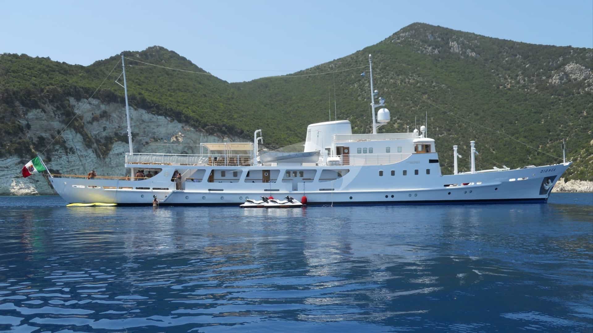
Portoferraio sits as a natural amphibious fortress, its deep horseshoe basin framed by sixteenth-century Medici ramparts—Forte Stella and Forte Falcone—that have guarded the sea lanes of the northern Tyrrhenian for centuries. For charterers embarking from this northern Tuscan hub, the town offers something rare in the Western Mediterranean: an immediate, storm-proof natural harbour positioned directly on the threshold of a varied island chain. Securing a Portoferraio Yacht Charter yacht charter provides immediate access to the seven islands of the Tuscan Archipelago National Park, placing captains within easy day-sailing distance of pristine marine sanctuaries, deep-water anchorages, and the high granite peaks of western Elba.
Understanding the mechanics of cruising these waters requires a clear view of local geography, seasonal weather shifts, and strict environmental regulations. The coastline surrounding Portoferraio ranges from sheer aplite cliffs and white pebble beaches on the northern shore to mineral-rich, iron-red coves in the east and deep, sand-bottomed gulfs along the south. Whether navigating a motor yacht seeking rapid transit between secluded coves or a large sailing yacht working the afternoon thermals across the Corsica Channel, success lies in matching the vessel's draught, itinerary, and ground tackle to the prevailing wind shifts that dictate daily anchorage selection.
Regional Geography and Coastal Morphology
The waters surrounding Portoferraio present a tactical division between the sheltered inland passage of the Canale di Piombino—ten nautical miles across to the Italian mainland—and the open, deep-water expanse of the Canale di Corsica to the west. Elba itself measures roughly 15 nautical miles from east to west and nine from north to south, yet its contorted coastline yields nearly 80 nautical miles of bays, coves, and dramatic promontories.
The northern coast of Elba, centred on Portoferraio, is defined by dramatic white limestone and aplite cliffs that drop off rapidly into 15 to 25 metres of crystal-clear water. This northern stretch is exposed to winds from the northwest around to the northeast, but offers excellent protection when southern winds push across the island's mountainous interior. Capo Bianco and the Scoglietto di Portoferraio mark the northern sea approaches, creating a distinct boundary between open-water transit lanes and protected coastal anchorages.
Moving westward around Capo Sant’Andrea, the coastal geology transforms into steep granite massifs anchored by Mount Capanne, which rises to 1,019 metres above sea level. This high topography acts as a major wind barrier and weather generator. It creates strong katabatic gusts during spring and autumn storms, but produces predictable thermal breezes during summer afternoons.
The southern coast features three deep, sweeping indentations: the Golfo di Marina di Campo, the Golfo di Lacona, and the Golfo Stella. These broad bays feature wide sand floors that provide superb holding ground, though they are completely open to the southern quadrant. The eastern peninsula, centred around Capoliveri and Porto Azzurro, is characterized by historic iron mining zones, dark mineral-rich sands, and deep, sheltered fjords like the Golfo di Mola that offer safe harbour from western gales.
Wind Patterns, Microclimates, and Sea State by Month
Cruising out of Portoferraio requires an understanding of the Mediterranean wind systems that funnels through the Corsica Channel and interacts with the high elevation of Elba and Corsica. The regional weather is driven by three main winds: the Maestrale (north-west), the Libeccio (south-west), and the Scirocco (south-east).
### May and June Early season cruising in May and June brings unstable atmospheric conditions with rapid transitions between light thermals and brisk northerly weather systems. The sea temperature rises from 18°C to 22°C, and overall sea states are generally calm, interrupted by short-lived Tramontana (north) or Grecal (north-east) breezes blowing off the Tuscan hills. Average wind speeds hover around 8 to 14 knots. Afternoon thermal breezes build reliably by mid-day, usually settling into a westerly direction along the north coast. High-pressure systems bring prolonged periods of glass-like seas, making early summer ideal for long offshore legs to Capraia or northern Corsica.
### July and August Mid-summer is dominated by stable high pressure, warm water (25°C to 27°C), and predictable thermal wind cycles. The Maestrale is the primary wind driver, filling in around 11:00 AM from the west-northwest, peaking at 12 to 18 knots between 2:00 PM and 5:00 PM, and dying completely shortly after sunset. This pattern provides magnificent afternoon sailing conditions in the Canale di Corsica and along Elba's northern shore.
However, mid-summer can occasionally be interrupted by a strong Scirocco. Pushing up from the south-east, the Scirocco brings humid air, reduced visibility, and a heavy, rolling swell that makes the southern gulfs of Lacona and Marina di Campo untenable. During a Scirocco, captains immediately shift operations to the northern anchorages around Portoferraio, where the island's mountainous spine creates a flat-water lee despite 20-knot winds aloft.
### September and October Late season brings cooler air, warmer sea temperatures, and a shift toward more dynamic Atlantic weather systems. September is widely considered by experienced yacht captains to be the prime cruising month in the Tuscan Archipelago. The summer thermal breezes moderate to 10-15 knots, commercial traffic declines sharply, and night-time anchorages become quiet.
By October, the incidence of the Libeccio increases significantly. Blowing from the south-west across the long fetch of the Western Mediterranean, a sustained Libeccio builds heavy, long-period seas along Elba’s western and southern coasts, creating spectacular surf against Capo Sant’Andrea and forcing all vessels to seek deep shelter in the Darsena Medicea of Portoferraio or inside the landlocked bay of Porto Azzurro.
Natural Anchorages and Tactical Shelter
Selecting the correct anchorage around Portoferraio depends on matching the daily wind direction against the island's coastal geography. The seabed around Elba varies widely, consisting of fine white sand, dense Posidonia oceanica seagrass beds, mud, and coarse granite gravel. Anchoring in Posidonia is increasingly restricted by Italian maritime law to protect benthic ecosystems; captains must target identified sandy holding patches.
Northern Sector Anchorages
Golfo della Biodola and Procchio: Located just four nautical miles west of Portoferraio entrance, this twin-bay complex features broad stretches of fine white sand and turquoise water over a gently sloping sandy bottom. It offers exceptional holding in three to eight metres of water. Shelter:* Superior protection from southerly winds (Scirocco, Mezzogiorno) and easterlies. Exposed to north-west through north-east winds. During strong Maestrale conditions, a heavy swell rolls directly into the beach, making it uncomfortable for overnight stays.
Ensenada di Viticcio: Situated on the eastern corner of the Procchio gulf, beneath the steep pine-covered cliffs of Capo Enfola. Vessels can drop anchor in six to ten metres over sand and rock patches. Shelter:* Excellent shelter from southerly and easterly winds, with moderate protection from the south-west due to the high ridge of Capo Enfola. It is vulnerable to northerlies.
Spiaggia delle Ghiaie and Capo Bianco: Positioned immediately west of the Portoferraio harbour mouth, famous for its smooth white aplite pebbles and bright turquoise water. Shelter:* Ideal for a day-stop in southerly winds. Anchoring must be executed with strict attention to local marine reserve boundaries (Zone A of the marine preserve around Scoglietto prohibits anchoring completely).
Southern Sector Anchorages
Golfo di Marina di Campo: A vast, horseshoe-shaped bay on the south coast with a broad sandy seabed that rises gradually toward a long beach. Shelter:* Outstanding shelter from northern winds (Tramontana, Maestrale, Grecal). The high peaks of Mount Capanne block all winds from the north-west. However, the bay is completely exposed to south and south-east winds. A persistent Scirocco makes this bay dangerous, generating heavy ground swell.
Golfo Stella and Golfo di Lacona: Two deep indentations separated by the narrow peninsula of Capo di Stella. Lacona features a clean sand bottom with excellent holding in four to nine metres. Shelter:* Highly effective protection against northerly weather systems. Capo di Stella allows captains to shift from one side of the peninsula to the other depending on whether the wind tilts east or west of south.
Eastern Sector Anchorages
Golfo di Mola / Porto Azzurro: A deep, sheltered inlet on the south-east coast. The inner bay provides mud and sand bottom holding in four to eight metres. Shelter:* One of the safest natural anchorages on Elba, offering total protection from north, west, and south-west winds (Libeccio). Only a heavy east-south-east wind sends significant swell into the outer roadstead.
Offshore Island Anchorages
Capraia - Cala Rossa: Located at the southern tip of Capraia Island, 24 nautical miles north-west of Portoferraio. Cala Rossa is a dramatic, breached volcanic crater with high walls of dark red volcanic tuff and black basalt contrasting with neon-blue water. Shelter:* Good protection from north-west to north-east winds. Exposed to the south and south-west. Depth drops off rapidly; vessels typically anchor in 10 to 18 metres on sand patches between rock ribs.
Capraia - Porto & Northern Coves: The east coast of Capraia features deep inlets like Cala Mortola and the harbour of Capraia itself. Shelter:* Excellent lee from prevailing summer western and south-westerly winds blowing across from Corsica.
Navigational Hazards, Passages, and Regulations
Navigating the waters surrounding Portoferraio requires attention to specific regional hazards, intense commercial ferry traffic, and strictly enforced marine protected area rules.
### Commercial Traffic Lanes The Canale di Piombino is one of the busiest maritime corridors in the Tyrrhenian Sea. High-speed hydrofoils and large commercial car ferries cross between Piombino and Portoferraio every 15 to 30 minutes during peak summer months. These vessels travel at speeds up to 28 knots and do not alter course easily within the narrow approaches to Portoferraio. Captains must maintain a active radar watch, monitor VHF Channel 16, and give wide berth to commercial craft entering or exiting the channel bounded by Capo Pero and Punta della Vita.
### Marine Protected Areas and Restricted Zones The Tuscan Archipelago National Park enforces clear zones around several islands:
- Montecristo: A strict Nature Reserve (Zone A). No navigation, anchoring, fishing, or diving is permitted within three nautical miles of the coastline without explicit permits issued by the Carabinieri Forestali.
- Pianosa: A former penal colony now strictly regulated. Navigation and anchoring are prohibited within two nautical miles of the island, except along a designated transit corridor and at designated mooring buoys managed by the park authority for authorised day-tour operators.
- Scoglietto di Portoferraio: The islet north of Portoferraio is surrounded by a biological protection zone. Anchoring is strictly prohibited on the shallow reef systems surrounding the rock, though diving vessels may use designated park moorings.
- Posidonia Protection: Throughout Elba, coastal authorities actively enforce regulations against anchoring in Posidonia oceanica beds. Captains should use clear-water optics or tender spotters to drop anchor exclusively in sandy patches (chiare).
### Submerged Hazards Scoglietto Reef:* Extends shallow rock ledges south-west toward Capo Bianco. Give the light structure on Scoglietto a clearance of at least 0.5 nautical miles. Pomonte Wreck (Elviscot):* Located off the south-western tip of Elba at Pomonte. The 62-metre freighter lies in just 12 metres of water on a sandy bottom, with parts of the superstructure coming within two metres of the surface. Marking buoys surround the wreck; vessels must drop anchor well clear of the dive zone in deeper water. Secca del Picco:* A submerged shoal off the northern coast near Marciana Marina, rising abruptly from 40 metres to less than eight metres. Large displacement motor yachts with deep draughts must clear this area when running close inshore.
Key Distances and Day-Hop Routes
Planning a regional charter route out of Portoferraio involves clear daily legs. The compact scale of the Tuscan Archipelago allows for flexible day-hopping without excessive engine hours.
- Portoferraio to Marciana Marina: 9 NM
- Marciana Marina to Capo Sant’Andrea: 4 NM
- Capo Sant’Andrea to Pomonte Wreck: 7 NM
- Pomonte Wreck to Marina di Campo: 8 NM
- Marina di Campo to Golfo Stella: 6 NM
- Golfo Stella to Porto Azzurro: 7 NM
- Porto Azzurro to Rio Marina: 6 NM
- Rio Marina to Portoferraio (via Capo Pero): 11 NM
- Portoferraio to Capraia Harbour: 24 NM
- Capraia Harbour to Macinaggio (Corsica): 18 NM
- Portoferraio to Bastia (Corsica): 42 NM
- Portoferraio to Giglio Harbour: 38 NM
The Captain’s Master Plan: Executing a Seven-Day Itinerary
Executing a successful week-long charter originating from Portoferraio requires adapting the route to shifting weather patterns. The following itinerary outlines how an experienced professional plans a counter-clockwise circumnavigation of Elba paired with an offshore leg to Capraia, working with prevailing thermal wind conditions.
### Day 1: Embarkation at Portoferraio and Local Shakedown Upon boarding at the Darsena Medicea, the captain reviews afternoon weather forecasts. With the typical summer Maestrale blowing at 12 knots, the vessel slips its lines and makes a short 4-nautical-mile run westward past Capo Bianco to drop anchor in the turquoise waters of Golfo della Biodola. Charter guests enjoy afternoon swimming and paddleboarding over fine white sand. As the thermal breeze drops at sunset, the yacht remains anchored in Biodola or shifts into the deep, quiet cove of Viticcio for a calm night under the lee of Capo Enfola.
### Day 2: The Northern Granite Coast to Marciana Marina Leaving Biodola, the yacht tracks west along the high, rugged north coast. The morning is spent exploring the clear inlets around Sant'Andrea, where granite platforms slide directly into deep blue water. Anchor in ten metres over sand for a long lunch stop. In the afternoon, as the north-westerly wind picks up, the yacht makes a short 4-nautical-mile hop into Marciana Marina. Guests can step ashore to explore the pine-shaded harbour front and the historic Cotone district, while the crew secures a berth along the main breakwater or sets a heavy bow anchor in the outer roadstead.
### Day 3: Offshore Transit to Capraia Island Taking advantage of light morning winds, the captain orders an early departure for the 24-nautical-mile western transit across the Corsica Channel to Capraia. This deep-water passage offers excellent opportunities for sighting striped dolphins and fin whales. By mid-morning, the yacht arrives at the wild, volcanic southern tip of Capraia, anchoring in the dramatic crater of Cala Rossa for lunch and diving along the sheer drop-offs. In the late afternoon, the vessel shifts round to the sheltered east coast, taking a reserved mooring buoy off Capraia Harbour or securing a stern-to berth along the village quay.
### Day 4: West Coast Elba and the Wreck of the Elviscot Leaving Capraia, the vessel runs south-east for 22 nautical miles, returning to Elba’s westernmost tip at Capo Sant’Andrea before rounding down to Pomonte. The captain drops anchor in 12 metres of water on the sand patch just off the Elviscot wreck. Guests snorkel over the sunken hull, visible just beneath the surface in crystal-clear conditions. Following a midday swim, the yacht turns east along Elba’s southern face, passing the granite cliffs of Cavoli before coming to rest in the wide, sheltered expanse of Golfo di Marina di Campo for an overnight stay at anchor under the stars.
### Day 5: Southern Gulfs and Capo di Stella With a light south-westerly swell forecast, the captain shifts the yacht east into the Golfo Stella. The morning is spent exploring the secluded coves around the Capo di Stella peninsula, dropping anchor in Cala della Madonna or Spiaggia dei Barabarca. These deep, pine-backed inlets feature steep rock faces and exceptional clarity for seabed exploration. In the late afternoon, the vessel makes a brief 5-nautical-mile passage around the mine-scarred headland of Punta Calamita into the landlocked fjord of Porto Azzurro.
### Day 6: Porto Azzurro and the Mining Coast The morning begins with a stroll through the narrow streets of Porto Azzurro, overlooked by the Spanish fortress of San Giacomo. Returning to the yacht, the itinerary turns north along Elba’s eastern mining coast. The vessel cruises past the rust-red cliffs of Rio Marina and drops anchor off Cala Seregola, where the dark, mineral-rich beach glitters with iron ore particles beneath the water. The afternoon is spent enjoying water sports in the lee of Cavo, before a final short leg round Capo Pero back into the calm, protected roadstead of Portoferraio.
### Day 7: Final Anchorage and Disembarkation On the final morning, the yacht executes a final 2-nautical-mile cruise across the Golfo di Portoferraio to drop anchor directly under the shadow of the Medici fortresses near Scoglietto. Guests take a final morning swim in the clear waters off Capo Bianco before the crew brings the vessel back to its berth in the Darsena Medicea for disembarkation.
Practical Provisions for Charter Management
Operating an extended itinerary out of Portoferraio requires efficient logistics. Fueling is available directly along the main quay at Portoferraio, though long queues build during peak afternoon hours on Fridays; captains should fuel during early morning hours or make use of secondary fuel berths at Marciana Marina or Porto Azzurro. Fresh water is readily available at all primary marinas, though conservation remains essential when cruising off-lying islands like Capraia, where local water supplies are strictly limited during mid-summer.
Provisions in Portoferraio are superior to surrounding island ports. High-grade regional supplies—including fresh Tuscan produce, seafood, and wines like Aleatico dell'Elba—are easily sourced directly to the berth. By combining thorough weather analysis, precise ground tackle selection, and respect for local environmental zones, a Portoferraio Yacht Charter yacht charter delivers one of the most flexible, reliable, and rewarding cruising experiences in the Western Mediterranean.