
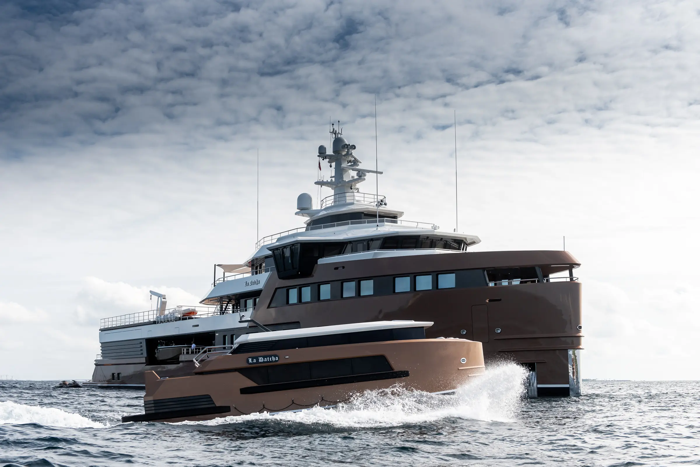
Executing a successful Positano Yacht Charter yacht charter requires recognizing a fundamental truth that escapes many first-time charterers: Positano is not a protected harbour, but a steep, exposed roadstead. The vertical topography that makes this stretch of the Italian coastline world-famous creates a demanding operational environment for superyacht captains. High limestone cliffs drop precipitously into deep water, offering dramatic vistas while severely limiting natural shelter from prevailing Tyrrhenian weather systems. For guests, a charter here delivers unparalleled dining, spectacular shore excursions, and exceptional Mediterranean water sports. For the crew, seamless execution hinges on understanding the bathymetry, navigating dynamic local microclimates, managing buoy field logistics, and anticipating the distinct wave patterns of the Gulf of Salerno.
Coastal Topography and Sea Areas
The cruising ground surrounding Positano is defined by the Lattari Mountains (Monti Lattari), a rugged limestone ridge that forms the spine of the Sorrento Peninsula before plunging into the Tyrrhenian Sea. The coastline faces predominantly south-southwest, fully exposed to open water from the southern quadrant. Understanding the regional division between the Gulf of Naples to the north-west and the Gulf of Salerno to the south-east is essential for effective navigation.
The immediate sea area off Positano features exceptionally steep bathymetry. The 30-metre depth contour lies within two to three cables of the shoreline along much of the coast between Punta Germano and Praiano. Beyond this, depths drop rapidly to 50 metres and deeper, making conventional anchoring inefficient or impossible for large displacement vessels requiring a 4:1 or 5:1 scope on their anchor chain. As a consequence, yachts operating in the Positano roadstead rely heavily on established seasonal mooring buoy fields or must anchor well offshore in 35 to 45 metres of water over a mixed seabed of sand, coarse shingle, and patches of Posidonia oceanica grass.
To the west, the coastline terminates at Punta Campanella, the extreme tip of the peninsula. Here, the narrow Bocca Piccola passage separates the mainland from the eastern tip of Capri (Punta del Capo) by just 2.7 nautical miles. This natural bottleneck fundamentally alters local hydrology and sea states. To the south-east of Positano lie the Li Galli islands—a small archipelago comprising Gallo Lungo, La Rotonda, and La Castelluccia—which provide a prominent visual landmark but very limited physical shelter from wind or wave action.
Prevailing Winds, Sea States, and Microclimates
The meteorological conditions off Positano vary significantly across the charter season, governed by the interaction between broad Mediterranean weather patterns and the steep terrestrial relief of the Lattari range.
### May and June Early season weather is dominated by light to moderate thermal cycles. The diurnal pattern typically brings a soft off-shore breeze from the north-east in the early morning, turning into a prevailing westerly or north-westerly (Maestrale) by midday as the landmass heats up. Wind speeds generally peak between 10 and 15 knots during mid-afternoon before dying away rapidly at sunset. Sea surface temperatures average 19°C to 22°C. Swell is usually minimal, making this an excellent period for peaceful positioning off Positano, although evening temperatures can drop sharply as cool air flows down the mountain ravines.
### July and August Mid-summer brings high thermal stability, clear skies, and light westerlies ranging from 8 to 12 knots. However, the dominant operational variable during these peak months is not wind strength, but surface temperature and localized swell generation. Sea surface temperatures reach 26°C to 28°C, creating ideal conditions for swimming but increasing atmospheric moisture.
Periodically, the region experiences persistent southerly breezes (the Scirocco from the south-east or the Libeccio from the south-west). Even at modest velocities of 12 to 16 knots, these winds blow across a vast open fetch in the Tyrrhenian Sea, generating a long, uncomfortable roll of 1.0 to 1.5 metres directly into the Positano anchorage. Because the shore drops off vertically, waves do not break offshore; instead, they reflect back off the rock faces, creating a confused, choppy sea state known locally as risacca. Under these conditions, remaining at anchor off Positano becomes unviable for guest comfort, regardless of stabilizer performance.
### September and October The late season sees the weakening of the steady diurnal thermal cycle and an increase in weather mobility. Frontal systems moving across the Western Mediterranean bring stronger, more persistent south-westerly winds. Sea temperatures remain warm (23°C to 25°C), but night-time temperature drops trigger powerful katabatic winds off the Lattari Mountains. Air chilled over the peaks cascades down steep valleys—such as the Valle dei Mulini directly above Positano—and blows out to sea through narrow gaps in the cliffs. These katabatic gusts can reach 20 to 25 knots within minutes, down-slope from a clear night sky, putting sudden strain on ground tackle and mooring lines.
Anchorage Analysis: Shelter, Holding Ground, and Alternatives
Navigating the anchorages around Positano requires constant evaluation of wind direction and swell direction, which frequently operate on different axes.
       [ Sorrento Peninsula / Gulf of Naples ]
                          |
                  (Punta Campanella)
                          |
 [Capri] <--- Bocca Piccola Strait ---> [Nerano / Cantone]
                                                |
                                        [Rada di Positano]
                                                |
                                        [Li Galli Islets]
                                                |
                                        [Conca / Amalfi]
### Rada di Positano The main anchorage off Positano sits directly in front of the cascading town, between Punta Sopramonte to the west and Punta Madonna to the east.
- Shelter: Protected from the north-west, north, and north-east by high terrain. Completely open to the south-west, south, and south-east.
- Holding Ground: Mixed. Sand and mud patches lie closer inshore at depths of 15 to 25 metres, but these are largely occupied by local seasonal buoy fields. Superyachts anchoring independently in 30 to 45 metres encounter a bed of thin sand over limestone rock, where holding can be unreliable in strong gusts.
- Operational Reality: The seasonal commercial buoy field, managed locally, offers heavy-duty moorings suitable for yachts up to 50 metres or more, subject to prior reservation. However, when a southerly swell builds above 0.8 metres, guests must be transferred ashore via specialized high-sided local wooden water taxis. Standard yacht tenders with low freeboards often take on water at the steep Positano commercial pier.
### Marina del Cantone (Nerano) Located six nautical miles west-north-west of Positano, Marina del Cantone sits within a deep indentation on the south side of the peninsula.
- Shelter: Excellent shelter from north-westerly, northerly, and north-easterly winds, offered by the high ridge of Monte San Costanzo. Exposed to the south and south-east.
- Holding Ground: Good holding in sticky sand and coarse gravel at depths between 10 and 20 metres.
- Operational Reality: Nerano provides a significantly calmer alternative to Positano when strong north-westerly thermals blow off the sea. The bay features an extensive seasonal buoy field and offers direct tender access to famous shore-side dining establishments. It serves as the primary secondary shelter on the southern face of the peninsula.
### Li Galli Archipelago (Zone B and C AMP Punta Campanella) The three small islets of Li Galli lie 3.5 nautical miles south-west of Positano.
- Shelter: Minimal. The islets provide modest windbreak from the immediate direction of the islands themselves, but offer zero protection from general sea swell.
- Holding Ground: Deep water, rocky seabed with steep drop-offs.
- Operational Reality: The archipelago falls within the Punta Campanella Marine Protected Area (Area Marina Protetta). Zone A is a strict reserve. In Zones B and C, anchoring is heavily restricted to protect Posidonia meadows. Vessels must use designated authorized mooring buoys or remain well outside the protected boundaries in depths exceeding 40 metres. Li Galli should be treated as a daytime lunch and swimming stop during calm conditions, never as an overnight anchorage.
### Conca dei Marini and Fiordo di Furore Located five nautical miles east of Positano, Conca dei Marini is a dramatic bay framed by sheer cliffs topped by an ancient watchtower.
- Shelter: Shielded from the north and north-west. Exposed to the south-east.
- Holding Ground: Deep, steep-sided bay. Holding is variable on sand and rock shelves in 20 to 35 metres.
- Operational Reality: Conca offers a seasonal buoy field and a somewhat quieter afternoon stop than Positano. The nearby Fiordo di Furore—a narrow gorge cut into the mountainside—is a striking visual landmark but is strictly off-limits to mechanical craft; tenders must remain outside the bridge aperture.
### Marina di Cassano and Piano di Sorrento (North Coast Backup) When a southern swell makes the entire southern face of the Amalfi Peninsula untenable, a captain’s primary tactical retreat lies on the northern side of the peninsula in the Gulf of Naples.
- Shelter: Outstanding protection from southerly, south-easterly, and south-westerly weather systems, which are completely blocked by the main mountain ridge. Exposed to the north and north-west.
- Holding Ground: Excellent holding in sand and dark mud off Piano di Sorrento and Marina di Cassano at depths of 10 to 18 metres.
- Operational Reality: Rounding Punta Campanella to anchor off Marina di Cassano or take a berth in Piano di Sorrento gives guests complete protection from southern seas while keeping them within a 20-minute road transfer of Sorrento or Positano.
Key Passages and Day-Hop Distances
Distances along the Amalfi Coast and across to the offshore islands are relatively short, allowing for highly flexible day-planning when weather conditions shift.
- Positano to Li Galli: 3.5 nautical miles. A short 15-minute run at cruising speed, ideal for a morning swim stop before midday traffic arrives.
- Positano to Marina del Cantone (Nerano): 6.2 nautical miles. A 20-minute passage heading west along the cliff face, past Crapolla cove.
- Positano to Capri (Marina Piccola): 11.5 nautical miles. A direct run west-south-west across the Bocca Piccola passage. Expect choppy conditions in the middle of the strait.
- Positano to Amalfi Harbour: 8.8 nautical miles. Heading east-north-east past Praiano, Furore, and Conca dei Marini.
- Amalfi to Cetara: 7.5 nautical miles. Continuing east towards the inner curve of the Gulf of Salerno, passing Minori and Maiori.
- Positano to Marina di Cassano (Sorrento Peninsula North): 13.8 nautical miles. Rounding Punta Campanella into the Gulf of Naples.
- Positano to Ischia (Sant'Angelo): 24.5 nautical miles. A longer open-water passage heading north-west across the Gulf of Naples, usually scheduled for early morning to avoid afternoon thermal chop.
Navigational Hazards and Traffic Density
Navigating the waters surrounding Positano demands sharp lookout protocols, particularly during peak summer months when vessel density reaches extreme levels.
### Commercial Ferry and Hydrofoil Traffic The primary hazard off Positano and Amalfi is high-speed commercial traffic. Large passenger catamarans and hydrofoils (aliscafi) run scheduled routes between Naples, Sorrento, Capri, Positano, and Salerno from 07:00 to 20:00 daily.
- These vessels approach the small embarkation jetties at Positano and Amalfi at speeds up to 30 knots, slowing down only at the last moment.
- Their displacement wakes create sudden, steep waves up to two metres in height that radiate across the anchorages.
- Yachts at anchor or on buoys must maintain a minimum distance from the commercial fairway, which is clearly demarcated by navigation buoys off Positano's main beach during summer.
### The Bocca Piccola Strait The 2.7-nautical-mile passage between Punta Campanella and Capri acts as a natural funnel for both wind and water currents.
- Current Compression: Tidal currents flowing between the Gulf of Naples and the Gulf of Salerno can reach velocities of 2.0 to 2.5 knots in the strait, particularly during spring tides.
- Wind-Against-Tide Chop: When a strong westerly wind hits an opposing easterly current in the Bocca Piccola, a short, steep, vertical chop develops rapidly. This causes significant pitching for smaller craft and uncomfortable rolling for tender operations.
### Marine Protected Area Regulations The Area Marina Protetta Punta Campanella encompasses the coastline from Raw Punta del Sorbo (near Massa Lubrense) on the north side, round Punta Campanella, to the border of Positano on the south side, including Li Galli.
- Zone A (No Entry): Strict nature reserve, fully prohibited to all private charter vessels.
- Zone B (High Protection): Speed limited to 5 knots. Mooring only permitted on authorized buoys. No anchoring on Posidonia beds.
- Zone C (Buffer Zone): Speed limited to 10 knots. Anchoring permitted only on sand or mud, clear of seagrass.
- Enforcement by the Guardia Costiera is active and rigorous. Fines for unauthorized anchoring in protected zones or exceeding speed limits close to shore are severe and billed directly to the vessel.
How a Captain Plans a Week Off Positano
A master managing a seamless itinerary on the Amalfi Coast knows that rigidity is the fastest path to a compromised charter. Because Positano offers no enclosed harbour, the itinerary must be designed dynamically around wind, swell, and tender logistics.
### Operational Strategy and APA Management A crucial duty of the captain during a Positano charter is protecting the guest experience while managing the Advance Provisioning Allowance (APA) efficiently:
- Mooring Fees versus Anchorage: A buoy off Positano or Nerano can range from €400 to over €1,200 per night for a 35-plus metre yacht during July and August. In contrast, docking inside Amalfi's small commercial port on private pontoons can exceed €2,500 per night, with limited availability. Captains balance these expenses against guest preferences for shore access.
- Tender Logistics and Local Water Taxis: Using the yacht’s main tender to land guests directly on Positano’s concrete pier carries a high risk of damage to the tender’s hull or tubes due to persistent ferry wake and surging swell. Seasoned captains frequently utilize local commercial tender services. These specialized wooden boats have high rubber fenders, local drivers who know the surge dynamics, and direct shore access, saving fuel, protecting the tender, and ensuring guest safety.
Typical Dynamic Seven-Day Master Plan
An experienced master structures a full-week itinerary with built-in weather contingencies, ensuring seamless adjustments if conditions change along the coast:
- Day 1: Embarkation in Sorrento or Naples. Guests board in the early afternoon. The vessel makes a gentle 12-nautical-mile evening run round Punta Campanella to anchor in the calm waters of Marina del Cantone (Nerano). Dinner is served on board or at a shore-side establishment accessible via short tender ride.
- Day 2: Nerano to Li Galli and Positano. Early morning passage to the Li Galli islets for a quiet swim stop in deep water before commercial day-boats arrive. At 11:30, weigh anchor and take a reserved buoy in the Rada di Positano. Guests go ashore via local water taxi for afternoon exploration and shopping along the town's vertical lanes. Overnight on the Positano buoy if the sea is flat; if a southerly roll develops, execute a short 6-nautical-mile relocation back to the shelter of Nerano.
- Day 3: Positano to Capri (Marina Piccola). Morning passage across the Bocca Piccola (11.5 NM) to Capri. Position the yacht off the Faraglioni rocks or pick up a buoy in Marina Piccola on Capri's south side. Guests spend the afternoon on shore via Marina Piccola’s tender tenders, returning for late-evening dining with views of the illuminated Faraglioni.
- Day 4: Capri Coastal Exploration to Conca dei Marini. Cruising around Capri’s outer coast to view the Blue Grotto and the lighthouse at Punta Carena. Midday passage east across to the Amalfi mainland (14 NM), anchoring off Conca dei Marini. Guests visit the Emerald Grotto (Grotta dello Smeraldo) by tender. Overnight on a buoy off Conca dei Marini.
- Day 5: Conca dei Marini to Amalfi and Ravello. A short 3-nautical-mile hop east into Amalfi. Secure a pontoon berth or anchor just outside the harbour mole. Guests go ashore for a short road transfer up to the hilltop town of Ravello to tour Villa Rufolo and Villa Cimbrone. Overnight in Amalfi Harbour or anchored off Praiano.
- Day 6: Eastern Gulf of Salerno or Pivot to the Gulf of Naples. Depending on the long-range weather forecast:
- Option A (Calm conditions): Cruise east past Minori and Maiori to the historic fishing village of Cetara (7.5 NM from Amalfi), famous for its traditional anchovy heritage. Anchor in sand in 12 metres off the watchtower for water sports.
- Option B (Southerly swell building): Pivot west early, round Punta Campanella, and enter the sheltered Gulf of Naples. Anchor off Marina di Cassano or take a berth in Marina di Stabia for easy access to Pompeii.
- Day 7: Final Return and Disembarkation. A leisurely morning cruise along the north face of the Sorrento Peninsula, stopping for lunch off Sorrento's high tuff cliffs. Return to the embarkation hub (Sorrento or Naples) by 17:00 for final evening dinner on board, followed by seamless morning disembarkation.
By understanding the unique balance between steep bathymetry, seasonal winds, dynamic swell patterns, and strict regional regulations, a captain executing a Positano Yacht Charter yacht charter delivers an extraordinary experience—combining the breathtaking scale of the Amalfi coastline with rigorous maritime safety and absolute guest comfort.