
Skyros occupies a singular position in the Aegean Sea. Although classified as the southernmost member of the Sporades archipelago, it sits isolated in the central Aegean, roughly 22 nautical miles east of Evia and 35 nautical miles southeast of Alonnisos. This spatial isolation endows the island with a double identity. Topographically, it is split into two strikingly different halves by a narrow, low-lying isthmus running between Pefkos Bay in the west and Achilli Bay in the east. The northern province, known locally as Meroi, features undulating hills covered in Aleppo pines, fertile valleys, and sheltered sandy coves. The southern sector, dominated by the arid mass of Mount Kochylas rising to 792 metres, is known as Vouno. This southern region consists of barren limestone cliffs, deep sea caves, and scrub-covered uplands where the rare Skyrian pony still wanders wild.
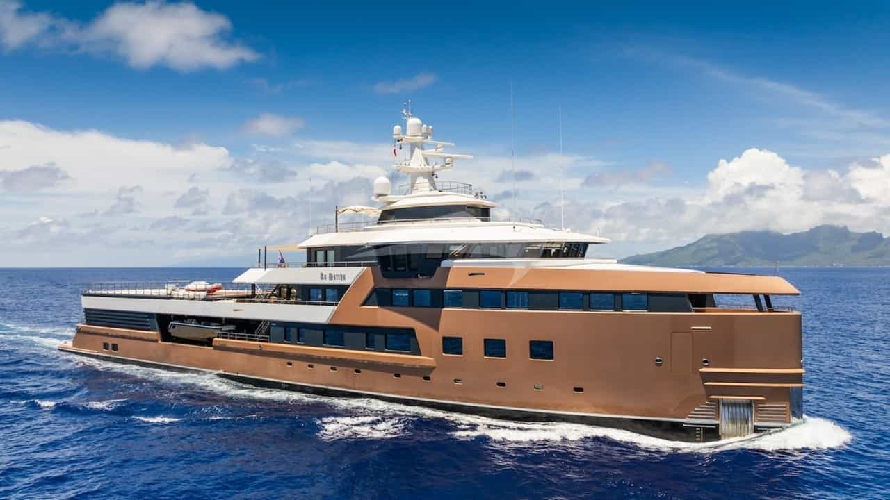
For the yacht captain and discerning charterer, Skyros represents a rewarding cruising destination that demands respect for Aegean weather dynamics. Unlike the tightly clustered Sporades islands to the northwest, where short hops of five to ten nautical miles offer constant lee, Skyros stands exposed to the open sea. Executing a successful itinerary around its 130 kilometres of coastline requires a clear understanding of its distinct microclimates, seabed holding conditions, and prevailing wind corridors. Commissioning a Skyros Yacht Charter yacht charter opens up an island of stark architectural beauty, pristine anchorages, rich Byzantine heritage, and outstanding maritime gastronomy far removed from overcrowded tourist routes.
Coastal Topography and Nautical Character
Approaching Skyros from the west or north, the island’s profile presents a dramatic contrast. The northern coastline is deeply indented with small bays where pine trees grow down to the water’s edge. The waters here are relatively shallow, with gentle gradients extending offshore, providing excellent sandy holding for vessels anchoring in depths between 5 and 10 metres.
As you navigate south past the central isthmus, the geological character shifts abruptly. The west coast south of Valaxa Island features sheer limestone cliffs plunging into deep water, where the 100-metre bathymetric line runs within a few cables of the shoreline. The southern extremity terminates at Cape Lithari, marked by its prominent lighthouse atop a towering cliff face. Here, the Aegean swell breaks heavily against vertical rock walls, creating impressive sea caves accessible only by tender in light conditions.
The eastern coast of Skyros is exposed to the full open fetch of the Aegean Sea. Aside from the man-made shelter of Achilli Marina and a few fair-weather roadsteads, the eastern shoreline offers minimal protection during periods of strong northerlies. The main settlement, Chora, clings to a precipitous granite outcrop crowned by a Venetian fortress and the Monastery of St George. Seen from seaward, Chora presents an imposing vista, but its open roadstead below Molos beach is purely a calm-weather stop.
Wind Mechanics and Monthly Meteorological Profile
The weather on Skyros is governed primarily by the Etesian winds, known locally as the Meltemi. Because Skyros lies in the open corridor between the Northern Sporades and the Cyclades, the Meltemi blows here with considerable consistency and force during the summer months. Understanding its monthly evolution is central to captaining a yacht in these waters.
### May and June Early season cruising brings mild, transitional weather. The Meltemi is not yet established. Winds are generally variable, predominantly from the northwest or southwest at Force 3 to 4 (10 to 16 knots). Sea temperatures average 19°C to 22°C, and rainfall is rare, though occasional spring fronts can bring brief showers. Anchorages on all coasts are generally accessible, and the lack of commercial maritime traffic makes June an ideal month for quiet exploration.
### July and August This is the peak of the summer Meltemi season. The wind establishes from the north-northeast, frequently blowing at Force 5 to 6 (17 to 27 knots) for three to five consecutive days before slacking off. During strong Meltemi cycles, winds can reach Force 7 or 8 (28 to 40 knots) in the open channels between Skyros and Evia or Alonnisos.
Cruising during these months requires strategic positioning. The northern and eastern coasts experience substantial fetch, generating short, steep seas. Conversely, the southwest coast and the deep bays of Kalamitsa, Pefkos, and Tris Boukes lie in the lee of the island's high topography, offering flat-water conditions. However, captains must account for severe katabatic winds—locally termed katabates—that drop off the vertical slopes of Mount Kochylas into the southern anchorages during intense northerly gales. Air temperatures during midsummer average 28°C to 33°C, tempered by the sea breeze, while water temperatures peak at 25°C.
### September and October Late season brings a marked softening of the wind regime. The Meltemi loses its density and duration, dropping to gentle breezes of Force 3 to 4. Days remain warm and sunny, with water temperatures holding at a pleasant 24°C through September. High-pressure systems dominate, creating ideal conditions for circumnavigating the island and anchoring in exposed spots like Sarakiniko Island or Agalipa Bay that are untenable during July. By mid-October, autumn depressions from the west begin to bring southwesterly winds and occasional convective activity.
Comprehensive Anchorage Guide: Protection and Holding
Skyros offers an exceptional mix of fully serviced harbour berths and remote, wild anchorages. Selecting the correct anchorage depends entirely on the prevailing wind direction and the vessel's draft.
### Linaria Harbour (West Coast) Linaria is the principal port of Skyros, situated inside a protected bay on the southwest coast, sheltered from the west by the adjacent island of Valaxa. Linaria Port Authority operates one of the most organized mariner facilities in the Aegean.
Yachts drop stern-to or alongside the quay or pontoon, where laid moorings, 220V electricity, and fresh water are available. Depth along the main quay ranges from 3.5 to 6 metres, accommodating sailing yachts and medium-sized superyachts with ease. Larger motor yachts can anchor in the outer harbor in 12 to 18 metres of water over good holding mud and sand. Linaria provides complete protection from the north and east, though strong southwesterly winds can drive a heavy surge into the bay. The port features excellent tavernas, seafood supply directly from local fishing boats, and reliable fuel delivery by mini-tanker.
### Pefkos Bay (West Coast) Located just two nautical miles north of Linaria, Pefkos Bay is an idyllic, green horseshoe bay enclosed by pine trees. The seabed consists of soft mud and thick weed, offering exceptional holding once the anchor digs past the upper weed layer.
Pefkos is completely sheltered from north, northeast, and easterly winds. A small wooden jetty exists at the head of the bay near a traditional taverna, but yachts generally drop anchor in 6 to 9 metres of water in the centre of the bay and swing freely. It is one of the safest natural hurricane holes on the island during a midsummer Meltemi.
### Atsitsa Bay (Northwest Coast) Atsitsa is a striking, historic bay on the northwest coast defined by pine-covered shorelines and concrete pillars extending out into the sea—remnants of early 20th-century iron ore mining operations. The bay contains several small islets at its entrance, creating a picturesque anchorage.
- Shelter: Excellent protection from south, southeast, and easterly winds. Exposed to northwest through northerly winds, which send in a heavy chop.
- Depth and Holding: Depths range between 4 and 8 metres over sand and rock. Cautious placement of the anchor is required to find clean sand patches between weed beds.
- Best Use: Day anchorage for swimming and lunch in light winds or south-westerlies; overnight stay only in settled weather or light southerlies.
### Tris Boukes Bay (South Coast) Tris Boukes ("Three Mouths") is a vast natural harbour located at the southern tip of Skyros, enclosed by the high mainland of Mount Kochylas and protected by two offshore islands, Platys and Sarakiniko. The bay gets its name from the three channels formed by these islands, though only the central and western channels are navigable for yachts.
This anchorage possesses a haunting, dramatic quality. In the olive groves at the head of the bay lies the grave of the English war poet Rupert Brooke, who died aboard a French hospital ship anchored here in 1915 during the Gallipoli campaign.
Tris Boukes offers deep-water anchoring in 10 to 22 metres over mud and sand. It provides complete protection from open sea swells regardless of direction. However, when the Meltemi blows at Force 6 or higher, heavy fall-winds blast down the slopes of Mount Kochylas. Yachts anchoring here during a northerly gale must deploy plenty of chain—at least five times the depth—and ensure the anchor is set firmly into the mud seabed.
### Sarakiniko Island & Glyfada Beach (South Coast) Located just off the southern coast, Sarakiniko Island features a deep cove on its southern side known as Glyfada Beach. The water here is extraordinarily clear, shifting in shade from bright turquoise to deep indigo over a white sand and shell bottom.
Glyfada is a superlative day-anchorage in light northerly or easterly winds. Anchoring in 5 to 10 metres on sand gives excellent holding. Tenders can explore the natural sea caves located along the islet's southern cliffs. However, because it is open to the south and west, Glyfada should be vacated before nightfall or if the wind shifts to the southern quadrant.
### Agalipa Bay (North Coast) For those seeking total isolation, Agalipa Bay on the northern point of Skyros offers a wild backdrop of pine forests, steep clay cliffs, and a small, abandoned wooden fishing boat resting on the beach.
The bay is split into two coves. The western cove offers the best protection from easterly winds, with anchoring in 6 to 8 metres on clean sand. Agalipa is completely exposed to northerlies and north-westerlies; it is strictly a fair-weather or southerly-wind anchorage.
Navigational Hazards, Shoals, and Passages
While cruising around Skyros is generally straight-forward due to deep water close off shore, several distinct hazards require careful chart work and navigational awareness.
- The Diavates Islets: This cluster of low-lying islets and rocks (including Exo Diavates and Petronisi) sits three nautical miles off the southwest coast of Skyros, directly in the approach path to Linaria from the south. The channels between the islets contain uncharted rocks and shallow reefs with soundings under 2 metres. Vessels should avoid passing between the Diavates islets and instead pass clear to the west, or use the main deep-water channel between Diavates and the main coast of Skyros, keeping a vigilant watch on radar and AIS.
- Melo Rock (Karavi): Located approximately 2.5 nautical miles northwest of Atsitsa, Melo Rock is a small, isolated hazard rising just above the waterline. It is unlit and presents a serious danger during night passages or periods of poor visibility during heavy rain.
- Valaxa Sound: The narrow channel between Valaxa Island and the mainland of Skyros, north of Linaria, is navigable by vessels drawing up to 2.5 metres, but narrows significantly at its shallowest point. Local knowledge or careful echo-sounder monitoring is mandatory. Superyachts and deep-draft vessels should always enter Linaria from the southwest, rounding the southern tip of Valaxa.
- Sarakiniko Eastern Channel: The eastern entrance to Tris Boukes Bay between Sarakiniko Island and Cape Marmara is narrow and bounded by shallow shelf projections from both sides. Drafts over 3 metres should stick strictly to the center line of the main western passage between Sarakiniko and Platys.
The Captain’s Strategy: Structuring a Skyros Itinerary
Planning a luxury charter itinerary involving Skyros requires flexibility based on the midsummer weather forecast. A professional captain typically views Skyros either as a dedicated central destination or as a high-value offshore leg connecting the Northern Sporades (Skiathos, Skopelos, Alonnisos) with the Cyclades or the North Aegean.
When clients book a custom Skyros Yacht Charter yacht charter, the captain structures the week to balance open-water sea passages with calm, sheltered island circumnavigation.
Sample 7-Day Cruise Flow: Sporades to Skyros
Day 1: Embarkation in Skiathos / Skopelos -> Cruise to Alonnisos (20 NM)
Day 2: Alonnisos Marine Park -> Passage to Northern Skyros / Pefkos Bay (36 NM)
Day 3: Pefkos Bay -> Atsitsa Bay & Agalipa Bay -> Linaria Harbour (18 NM)
Day 4: Linaria -> Valaxa Exploration -> Kalamitsa Bay (10 NM)
Day 5: Kalamitsa -> Sarakiniko Island -> Tris Boukes Bay (12 NM)
Day 6: Tris Boukes -> Cape Lithari -> Achilli Marina / Chora (22 NM)
Day 7: Skyros -> Return Passage to Skiathos or Onward to Evia/Kymi (25–45 NM)
Key Day-Hop Distances Matrix
- Alonnisos (Patitiri) to Skyros (Linaria): 38 nautical miles
- Skiathos Town to Skyros (Linaria): 56 nautical miles
- Kymi (Evia) to Linaria (Skyros): 24 nautical miles
- Linaria to Pefkos Bay: 2.5 nautical miles
- Linaria to Tris Boukes Bay: 11 nautical miles
- Circumnavigation of Skyros Main Coast: 48 nautical miles
Shoreline Culture, Gastronomy, and Logistics
A week afloat in Skyros is incomplete without engaging with the island's terrestrial highlights. From the harbour of Linaria, a fifteen-minute taxi ride brings guests up to Chora. The town is a maze of whitewashed, flat-roofed houses built in the traditional Skyrian style, where interiors are decorated with hand-carved wooden furniture, ornate ceramics, and copperware preserved across generations.
Gastronomically, Skyros is famed across Greece for two primary specialties: fresh spiny lobster (Astakos) and free-range mountain goat. The waters surrounding Valaxa and Skyropoula islets feature deep rocky reefs where local fishermen set traditional pots.
In Linaria and Chora, tavernas serve Astakomakaronada—a rich dish of spiny lobster braised with fresh tomatoes, garlic, white wine, and hand-rolled pasta. On the slopes of Mount Kochylas, the local livestock grazes on wild thyme and sea salt-sprayed scrub, giving the meat a distinct, sweet flavor. Sample slow-cooked goat with lemon and local oregano, accompanied by xinotyri (a tart, fresh goat cheese) and local Skyrian oil-pies (ladopita).
For provisioning, Linaria offers excellent artisanal bakeries, boutique wine merchants, and fresh produce. High-grade marine diesel and fresh water logistics are easily organized through the port authority.
When the sun sets over the Aegean and the Meltemi eases to a soft night breeze, anchoring in the shadow of Mount Kochylas in Tris Boukes or tied stern-to in the lively harbour of Linaria provides a yachting experience that remains authentic, unspoiled, and deeply rooted in maritime tradition.