
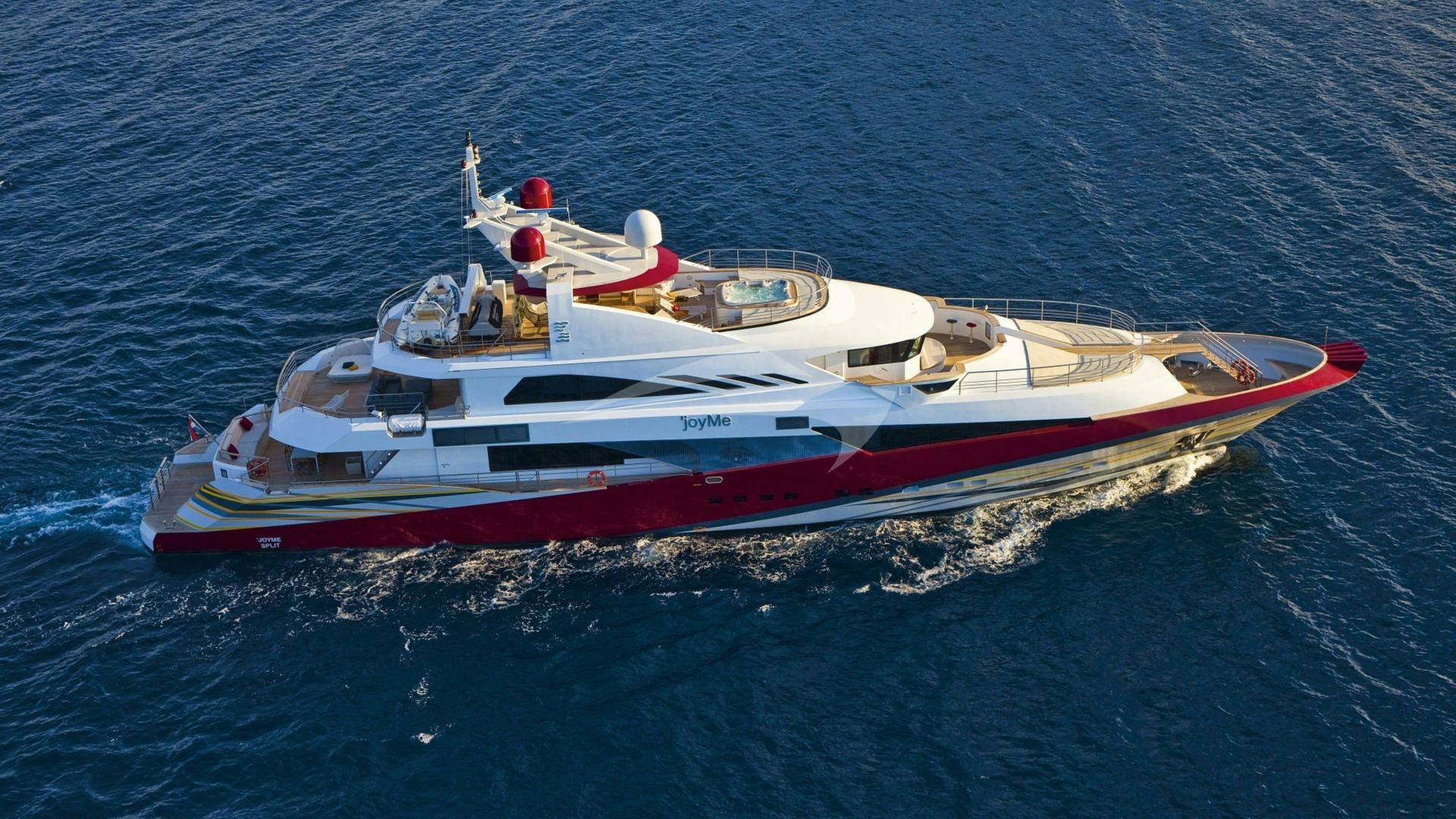
Rising sheer from the turquoise depths of the South-Eastern Aegean, just five nautical miles off the Turkish Datça Peninsula and 23 nautical miles north-west of Rhodes, Symi is one of the most striking cruising grounds in the Dodecanese. The island’s topography is defined by dramatic limestone cliffs, deep-water inlets, and an intricate, indented coastline that offers an extraordinary density of natural anchorages within a compact geographic area. For skipper and guest alike, executing a charter here requires an understanding of local wind patterns, deep-water anchoring techniques, and narrow passage navigation.
A successful voyage around Symi relies on combining technical seamanship with an appreciation for the island's unique rhythm. Whether dropping anchor beneath vertical rock walls or stern-mooring against the neoclassical quays of Gialos harbour, understanding the marine environment is the key to unlocking this exceptional Greek island.
Coastline and Marine Geography
Symi spans approximately 11.5 nautical miles from its northernmost point at Akra Kononas down to Akra Soni in the south, with a maximum width of roughly 8 nautical miles. The island is flanked by two notable satellites: Nimos Island to the north, separated by the shallow and hazardous Diapori Strait, and Sesklio Island to the south, an uninhabited sanctuary surrounded by crystalline shallows.
The eastern coastline of Symi is defined by steep, dramatic drop-offs where the seabed falls away rapidly from the shoreline. Here, vertical cliffs cut through with deep clefts create natural amphitheatres such as Agios Georgios Dysalonas and Nanou Bay. These eastern bays offer magnificent scenery and deep, clean water, though their depth demands specific anchoring protocols.
In contrast, the western coast is more exposed to prevailing Aegean swell, features lower topography, and is indented by wide, sweeping bays such as Faneromeni and Toli. The far south is dominated by the vast, natural landlocked harbour of Panormitis, an inland basin that provides near-total protection from all wind quadrants.
Navigating these waters means handling rapid depth changes. It is common to read 50 metres on the depth sounder less than a cable length from the cliff edge. Captains must be comfortable managing steep bottom contours, using long scopes of chain, and securing stern lines to shore rocks when swinging room is restricted.
Prevailing Winds and Sea State by Month
Cruising conditions around Symi are governed by the wind regimes of the Southern Dodecanese, dominated by the Aegean Meltemi during midsummer and softer thermal breezes in the shoulder months.
### May and June The early season delivers mild, settled cruising conditions. Prevailing winds blow predominantly from the north-west at 10 to 18 knots, typically building in the early afternoon and dying away by sunset. Sea state remains calm, with wave heights rarely exceeding 1 metre in open water. Air temperatures range between 22°C and 28°C, while sea temperatures hover around 20°C to 22°C. Anchorages are uncrowded, allowing easy selection of prime berths in Gialos and Pedi.
### July and August This is the peak Meltemi season. The Meltemi blows from the north-north-west, accelerating through the channel between Symi and the Datça Peninsula. In open water, wind speeds regularly reach Force 5 to 7 (18 to 30 knots), generating short, steep seas with wave heights between 1.5 and 2.5 metres.
The eastern lee side of Symi remains sheltered from wave action, offering flat sea conditions. However, the island's high interior plateau gives rise to intense katabatic winds—locally known as downdrafts or fall-winds. As the Meltemi tops the ridge, cool air plunges down the vertical cliffs into bays like Agios Georgios Dysalonas and Nanou, creating sudden gusts up to 15 knots stronger than the ambient wind. Vessels anchored in these bays must ensure their anchors are deeply embedded and stern lines are securely doubled.
### September and October September is widely regarded by professional captains as the finest month for a Symi Yacht Charter yacht charter. The Meltemi relaxes into gentle north-westerly thermal breezes averaging 10 to 15 knots. The sea remains warm at 25°C, and sea state is flat to slight. By October, south-westerly weather systems occasionally transit the region, bringing lighter, variable winds and brief rain showers, though clear, calm days still dominate the calendar.
A Guide to Anchorages and Harbours
Symi’s coastline provides a range of stopovers, from historic working quays to secluded, wilderness anchorages. Choosing the right spot depends on the prevailing wind direction, yacht draught, and whether guests prefer to dock or remain at anchor.
### Gialos Harbour Gialos is the main port and municipal heart of Symi, famous for its grand amphitheatrical layout of 19th-century neoclassical merchant houses. Entering the harbour demands careful attention due to heavy commercial ferry traffic and limited turning space.
- Berthing Dynamics: Yachts moor stern-to or bows-to the North Quay (Piazza area) or the South Quay (Paliomylos). Depths along the quay range from 2.5 to 4.5 metres. Anchors must be dropped in 12 to 18 metres of water in the centre of the harbour basin, laying out at least 50 to 60 metres of chain to ensure holding in the silt and mud seabed.
- Hazards: Crossing anchors is a frequent risk during peak season when dozens of yachts maneuver in tight quarters. High-speed ferries entering the outer channel generate significant wash; vessels berthed on the quays require stout spring lines and large, well-placed fenders.
- Protection: Excellent shelter from the Meltemi, though strong northerly winds can send a slight swell into the outer harbour basin.
### Pedi Bay Located just one nautical mile east-southeast of Gialos, Pedi Bay is a wide, fjord-like inlet running west-to-east. It serves as the primary deep-water alternative when Gialos is fully occupied.
- Anchoring & Berthing: The head of the bay features a small jetty with depths of 2 to 3 metres, suitable for tenders and shallow-draught yachts. Superyachts and larger motor yachts anchor in the middle of the bay in depths of 6 to 12 metres over sand, weed, and mud, offering good holding once the anchor penetrates the posidonia grass.
- Protection: Exceptional protection from north, west, and south winds. The bay is completely landlocked to the Meltemi, though minor gusts roll down the valley at the head of the bay.
### Agios Georgios Dysalonas (St George’s Bay) Recognisable by its sheer 300-metre vertical limestone cliff face, Agios Georgios Dysalonas is one of the most visually stunning day-anchorages in the Mediterranean.
- Anchoring Technique: The seabed drops rapidly off the white pebble beach. Yachts must approach to within 50 to 70 metres of the shore to find depths of 15 to 22 metres. Drop anchor on the narrow shelf of coarse sand and run long, heavy stern lines to the rock faces on the north or south shoulders of the cove using a crewed tender.
- Protection: Excellent protection from the prevailing north-west Meltemi wave action. However, it is strictly a day anchorage or fine-weather night stop. Katabatic gusts off the cliff face can be fierce, and the bay is entirely exposed to south-easterly wind and swell.
### Nanou Bay Further south along the east coast, Nanou Bay is a broad, curved bay lined with large white pebbles and dark green cypress trees.
- Anchoring Technique: Depths decrease gradually compared to Agios Georgios. Anchor in 10 to 16 metres over sand and gravel. Taking stern lines to the low rock formations on the northern shore is recommended to keep the bow pointed into the local downdrafts.
- Protection: Good shelter from north-westerly and westerly winds. A small local beach tavern operates here during the summer months, making it a favoured spot for extended swim stops and relaxed overnight stays.
### Panormitis Harbour Occupying the south-western corner of Symi, Panormitis is a vast, natural, landlocked lagoon accessed via a narrow channel approximately 100 metres wide with 5 metres of water depth.
- Berthing Mechanics: The focal point of the harbour is the historic 18th-century Monastery of the Archangel Michael, which sits directly on the water's edge. Yachts can drop anchor in the centre of the basin in 4 to 8 metres of water over a soft mud bottom, offering excellent holding. Alternatively, vessels can drop stern-to the monastery quay in 3 to 4 metres of depth.
- Protection: Panormitis provides total shelter from all wind directions, including the Meltemi. It is the safest overnight anchorage on the island during heavy summer storms, though strong south-westerly winds can drive a slight chop through the entrance inlet.
### Sesklio Island Lying two nautical miles south of Symi, Sesklio is a small, uninhabited island surrounded by translucent turquoise waters and shallow sandbanks.
- Anchoring: The northern coast of Sesklio offers an exceptional anchorage in depths of 4 to 8 metres over fine white sand.
- Protection: Ideal for daytime swimming and lunch anchorages in light to moderate north-westerly winds. It is exposed to open sea swell from the south and east, so it is rarely used for overnight stays unless conditions are exceptionally calm.
Navigational Hazards and Microclimates
While navigating around Symi is generally straightforward with modern Electronic Chart Display and Information Systems (ECDIS) and visual pilotage, captains must remain vigilant regarding specific localized hazards.
### The Diapori Strait The Diapori Strait separates northern Symi from Nimos Island. This passage is extremely narrow and obstructed by shallow reefs, submerged rocks, and shifting sandbars, with depths dropping below 1.5 metres in several places. Do not attempt to transit the Diapori Strait in yachts drawing more than 1.0 metre. All commercial charter vessels, motor yachts, and sailing yachts must circumnavigate Nimos Island to the north, keeping at least two cable lengths off Akra Kononas to clear offshore rock shelves.
### Katabatic Gust Dynamics As noted, the high central ridge of Symi (rising to over 600 metres at Mount Vigla) creates strong downdrafts on the lee side during heavy Meltemi conditions. When tracking down the eastern coast from Gialos to Panormitis, captains should expect sudden changes in apparent wind speed. A gentle 12-knot breeze in the open water can instantly transform into a 30-knot katabatic gust when standing under the cliffs of Agios Georgios or Nanou. Ensure deck furniture, tenders, and water toys are securely lashed when anchored close to high cliff faces.
### Harbour Traffic and Ferries Gialos channel experiences continuous, high-speed commercial vessel traffic between 09:00 and 17:00 daily. Large passenger hydrofoils and ferries enter the narrow entrance at speeds up to 15 knots before reversing engines hard near the quays. Stand well clear of the harbour entrance fairway when these vessels are maneuvering, and keep a dedicated watch on VHF Channel 12 or 16.
Day-Hop Distances and Regional Connections
Symi's position in the Southern Dodecanese makes it an ideal hub for island-hopping itineraries or cross-border passages to the Turkish Riviera. The following distances provide a clear metric for itinerary planning:
- Rhodes Marina (Rhodes) to Gialos (Symi): 23.5 nautical miles
- Gialos (Symi) to Pedi Bay: 3.2 nautical miles
- Pedi Bay to Agios Georgios Dysalonas: 2.8 nautical miles
- Agios Georgios Dysalonas to Nanou Bay: 3.6 nautical miles
- Nanou Bay to Panormitis Harbour: 8.4 nautical miles
- Panormitis (Symi) to Sesklio Island: 3.1 nautical miles
- Gialos (Symi) to Chalki Island (Nimborio): 24.2 nautical miles
- Gialos (Symi) to Tilos Island (Livadia): 21.5 nautical miles
- Gialos (Symi) to Datça (Turkey): 12.8 nautical miles
- Gialos (Symi) to Kos Town (Kos): 41.0 nautical miles
Planning a Seven-Day Symi and Dodecanese Itinerary
When a captain builds a seven-day charter plan centred on Symi, the objective is to balance high-energy harbour nights, secluded anchorage time, and comfortable sailing legs aligned with the prevailing winds.
### Day 1: Rhodes to Gialos, Symi Embarquing in Rhodes, the yacht clears the harbour and heads north-west across the Rhodes Channel (23.5 NM). Upon reaching Symi, the captain berths stern-to at the north quay of Gialos. Guests spend the evening dining along the waterfront, enjoying local specialities such as Simiako garidaki (crispy, pan-fried Symi shrimp eaten whole) and fresh octopus.
### Day 2: Gialos to Nimos Island & Pedi Bay Cast off early to make the short 4-nautical-mile run around the northern tip of Nimos Island. Anchor off the southern bay of Nimos for a morning swim in clear waters. In the afternoon, make the short 3-nautical-mile hop south into Pedi Bay. Drop anchor in 8 metres of water over sand and enjoy a peaceful evening at anchor with paddleboards deployed.
### Day 3: Pedi Bay to Agios Georgios & Nanou Bay Trace the steep eastern coastline south. Stop first at Agios Georgios Dysalonas (2.8 NM) for a mid-morning swim beneath the 300-metre sheer cliff face. Take stern lines to the rocks. After lunch on board, weigh anchor and shift 3.6 nautical miles south to Nanou Bay. Secure the vessel with a stern line for the night and dine on shore at the beachside tavern.
### Day 4: Nanou Bay to Sesklio Island & Panormitis Continue south along the coast to Sesklio Island (8.5 NM), dropping anchor in 5 metres of water on the turquoise sandbank for swimming and water sports. In the late afternoon, make the 3.1-nautical-mile passage into the sheltered lagoon of Panormitis. Moor stern-to the monastery quay, step ashore to tour the Monastery of Archangel Michael, and sample fresh pastries from the local bakery.
### Day 5: Panormitis to Chalki Island Depart Panormitis early for an open-water sail west-north-west to the quiet island of Chalki (24 NM). Anchor in the harbor of Nimborio, framed by restored captain's mansions, or lie at anchor in Potamos Bay for complete seclusion.
### Day 6: Chalki to Tilos or South-West Symi Depending on guest preferences and wind forecasts, either sail 16 nautical miles north-west to Livadia on Tilos Island, or return toward Symi to explore the quiet, wild inlets of the west coast, such as Faneromeni or Toli Bay. Anchor overnight in deep water with a stern line ashore.
### Day 7: Symi to Rhodes Enjoy a final morning swim stop in the clear waters of Sesklio or St George’s Bay before embarking on the final 24-nautical-mile passage back to Rhodes Marina for disembarkation.
Practical On-Board Essentials for Captains
Executing a seamless charter in Symi requires specific preparation and equipment checks prior to departure:
- Anchoring Gear: Ensure at least 80 to 100 metres of calibrated chain is available on the primary anchor, along with a functional chain counter and robust deck stoppers to handle high loads from katabatic gusts.
- Shore Lines: Carry at least two long 50-metre floating shore lines (polypropylene or specialized floating braid) on reels to allow easy deployment by tender when securing to rocks in deep bays.
- Water Management: While reverse-osmosis desalination plants now operate in Gialos and Pedi, quay side water connections can feature low pressure during peak hours. Captains should run the onboard watermaker when making passages in open water to maintain full tanks.
Symi remains one of the premier yachting destinations in the Eastern Mediterranean. By matching sound seamanship with a detailed understanding of its bays, winds, and geography, a charter here delivers an unrivaled on-the-water experience.