
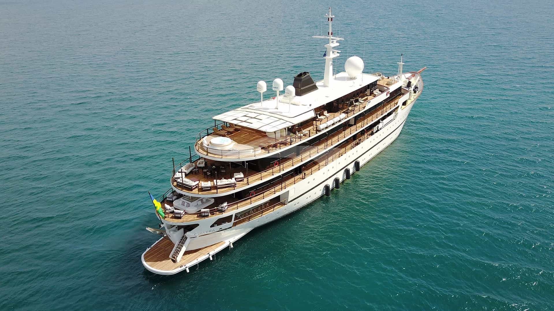
Commanding the gateway where the Atlantic Ocean collides with the Mediterranean Sea, Tangier presents one of the most hydrographically dynamic and culturally rich cruising grounds in Europe and North Africa. For a captain, executing a seamless charter itinerary here demands a precise understanding of the Strait of Gibraltar’s fierce tidal streams, localized wind funnels, and contrasting coastal topologies. For charter guests, a Tangier Yacht Charter yacht charter delivers an extraordinary synthesis of contemporary superyacht infrastructure, dramatic African headlands, and access to pristine, uncrowded anchorages along the Moroccan Riviera.
Navigating these waters requires more than standard Mediterranean pilotage skills. The coastline between Cap Spartel and the Alboran Sea is governed by high-relief coastal topography, complex current dynamics, and distinctive meteorological phenomena. This guide provides the factual, pilotage-grade insight necessary to plan and execute a high-level private or commercial yacht charter out of Tangier.
The Geography of the Tangier Coastline and Marine Zones
The cruising area surrounding Tangier is divided into three distinct marine zones: the Atlantic approach west of Cap Spartel, the narrow throat of the Strait of Gibraltar, and the sheltered Mediterranean coast extending southeast towards Tetouan and the Rif Wilderness.
Cap Spartel marks the north-westernmost tip of mainland Africa. The coast dropping south toward Asilah is characterized by long, exposed Atlantic beach arcs backed by low dunes and sandy shelves. Here, the ocean swell arrives unimpeded from the North Atlantic, creating a high-energy marine environment suited to blue-water passages and coastal day-anchoring only in settled summer conditions.
As you double Cap Spartel and head east, you enter the Strait proper. The coastline forms the broad sweep of the Bay of Tangier, bounded to the east by Cap Malabata. This four-mile-wide bay provides natural protection from Atlantic swells and houses the region’s premier superyacht hub, Tanja Marina Bay.
East of Cap Malabata, the Moroccan shoreline becomes increasingly dramatic. High limestone cliffs drop steeply into the sea beneath the shadows of Jebel Musa (851 metres), the northernmost peak of the Rif mountain range and the southern Pillar of Hercules. Beyond the Spanish enclave of Ceuta and the prominent headland of Cabo Negro, the coast transforms into the Tamuda Bay littoral—a 30-nautical-mile stretch of fine sand beaches, luxury resort developments, and deep-water anchorages running down to Port Smir and M'diq.
Wind Regimes, Currents, and Monthly Sea States
Understanding the meteorological engine of the Strait is crucial for comfortable itinerary planning. The regional wind patterns are almost binary, dominated by two prevailing winds funnelled between the mountain ranges of Andalucia and the Moroccan Rif: the Levante and the Poniente.
### The Levante (Easterly) The Levante originates over the Mediterranean and intensifies as it funnels through the narrow gap between Gibraltar and Morocco. It blows from the east or east-northeast, often reaching Force 6 to 8 in the centre of the Strait even when light breezes prevail in the open Alboran Sea. The Levante brings short, steep, uncomfortable seas inside the Strait and often creates a distinct cloud cap over Jebel Musa known locally as "the tablecloth." On the Atlantic side of Cap Spartel, however, the Levante acts as an off-shore breeze, flattening the coastal water and creating calm anchoring conditions in Ensenada de Jeremias.
### The Poniente (Westerly) The Poniente blows from the west or west-southwest, bringing cool Atlantic air, clear visibility, and longer Atlantic swells. While it creates smooth sailing on the Mediterranean side of Cap Malabata and down the Tamuda Bay coast, it generates heavy breaking seas against the exposed headlands of Cap Spartel and Point Cires when running against an opposing tide.
### Tidal Streams and the Surface Current A permanent surface current flows eastwards from the Atlantic into the Mediterranean at a speed of 1.5 to 3 knots, driven by the higher evaporation rate of the Mediterranean basin. Beneath this surface inflow, a deeper, saltier counter-current flows westwards back into the Atlantic.
Along the Moroccan coast, close to the shore, tidal streams create localized counter-currents that ebb and flow every six hours. A knowledgeable skipper will use these coastal back-eddies—which can reach 2 to 3 knots off Point Cires during spring tides—to gain speed when travelling west against the main Atlantic inflow.
Sea State and Conditions by Month
- May and June: A transitional period. The Levante is moderate, averaging Force 3 to 5. Sea temperatures hover around 18°C to 20°C. Atlantic swells ease, making passages around Cap Spartel predictable. Excellent months for combined Atlantic-Mediterranean itineraries.
- July and August: Peak summer conditions. Air temperatures frequently exceed 30°C, though sea breezes keep the coast temperate. The Levante can blow hard for three to five days at a time, generating localized gales in the narrowest part of the Strait. Surface waters in Tamuda Bay reach 24°C, offering optimal conditions for water sports and at-anchor dining.
- September and October: Widely considered by professional captains to be the prime charter window. The Levante relaxes into gentle afternoon breezes, sea conditions are consistently flat along the eastern coast, and water temperatures remain warm (22°C). Commercial vessel traffic through the Strait decreases slightly compared to the peak summer months.
- November to April: The winter season brings strong Atlantic depressions, heavy westerly gales, and high sea states. Cap Spartel becomes fully exposed to heavy oceanic breakers. Charter operations are generally paused during this period, with yachts utilizing Tanja Marina Bay as a secure winter lay-up facility.
+-----------------------------------------------------------------------------------+
|                            STRAIT OF GIBRALTAR FLOW                               |
|                                                                                   |
|    [ ATLANTIC OCEAN ] ---> Strong Surface Inflow (1.5 - 3.0 kts) ---> [ MED SEA ] |
|                                                                                   |
|    Moroccan Coastal Zone: Localized Tidal Counter-Currents (Up to 3 kts)          |
|    Target Inshore Eddies when Heading West; Stay Offshore when Heading East.       |
+-----------------------------------------------------------------------------------+
Primary Ports and Marina Infrastructure
Modern Moroccan investments have transformed Tangier and its surrounding coastline into an exceptional destination for superyacht support and crewed operations.
### Tanja Marina Bay (Tangier) Located directly within the historic Bay of Tangier, this state-of-the-art facility is Morocco's flagship superyacht marina. It offers over 1,400 berths capable of accommodating vessels up to 130 metres in length with draughts up to 11 metres. The marina is exceptionally well-protected by a massive outer breakwater that dampens all Atlantic surge. Facilities include high-capacity bunkering (duty-free fuel is available for commercial vessels under specific conditions), 24-hour security, ISPS compliance, shore power up to 600A, and immediate access to the historic Kasbah and Medina.
### Marina Smir (Port Smir) Situated 36 nautical miles east of Tangier on the Mediterranean side, Marina Smir is an upscale, private resort marina offering 450 berths for yachts up to 60 metres (maximum draught 2.5 to 3.0 metres inside the main fairway). It acts as the gateway to the Tamuda Bay luxury strip. The marina provides excellent shelter from all winds except strong easterly gales, which can send a swell into the entrance channel. On-site clearance facilities make it an ideal port of entry when returning from Spanish waters or Ceuta.
### Port de M'diq Located eight nautical miles south of Marina Smir, M'diq is a hybrid fishing and pleasure port. While the inner harbor is dominated by the local fishing fleet, the marina section accommodates motor yachts up to 30 metres. It offers a authentic Moroccan maritime experience, famed for its dockside seafood markets where local catches of red mullet, sea bass, and bluefin tuna are prepared fresh off the boats.
### Marina Hércules (Ceuta) Located within the Spanish autonomous city of Ceuta, 28 nautical miles east of Tangier, Marina Hércules offers 500 berths for yachts up to 35 metres. It provides a strategic, European-administered stopover inside the African continent, ideal for duty-free fuel, European provisioning, and seamless entry into the Schengen zone.
Natural Anchorages and Shelter Profiles
While the marinas offer complete shore-side services, the real beauty of a Tangier Yacht Charter yacht charter lies in the diverse natural anchorages dotting the coastline.
### Ensenada de Jeremias (Atlantic Coast) Position*: 35°46'.5N, 005°55'.2W (Just south of Cap Spartel) Seabed*: Fine sand; excellent holding in 6 to 10 metres. Shelter*: Complete protection from Easterly (Levante) winds and South-Easterly breezes. Fully exposed to North-West, West, and South-West Atlantic swells. Characteristics*: A dramatic, five-mile sandy sweep backed by pine forests and high cliffs. In a strong Levante, the water close under the cliff is mirror-flat, despite wind gusts of 25 knots coming off the land. Ideal for daytime water sports, tender drop-offs to beach clubs, and sunset dining.
### Baie de Achaqar Position*: 35°45'.8N, 005°56'.0W Seabed*: Sand with intermittent rock shelves; careful depth-sounder monitoring is required. Shelter*: Sheltered from North-East through to South-East. Exposed to Atlantic swells. Characteristics*: Located directly over the famous Caves of Hercules. Guests can take the tender ashore to explore the caverns. Anchor in 7 metres of water clear of the submerged rock shelves extending from the southern point.
### Belyounech Cove (Foot of Jebel Musa) Position*: 35°54'.5N, 005°23'.8W Seabed*: Coarse sand and gravel; exceptional holding in 8 to 12 metres. Shelter*: Outstanding shelter from South-West, South, and South-East winds. Vulnerable to strong easterly winds which create a heavy swell against the steep mountain drop-offs. Characteristics*: A spectacular, deep-water cove dominated by the sheer 800-metre wall of Jebel Musa. The water clarity here is the finest on the North African coast, making it the premier location for snorkeling and scuba diving on the charter itinerary.
### Restinga Anchorage (Tamuda Bay) Position*: 35°47'.2N, 005°19'.5W Seabed*: Fine sand and mud; superb holding power in 5 to 8 metres. Shelter*: Good protection from West, South-West, and South winds. Open to the East and North-East. Characteristics*: Positioned just north of Marina Smir off the offshore islets of Restinga. The shallow, turquoise waters and sandy bottom offer safe, tranquil anchoring for large motor yachts. Guests can swim to the sandy beaches or take the tender to nearby luxury resort beach clubs.
### Cala Iris (Rif Coastline) Position*: 35°09'.0N, 004°22'.0W (Extended Eastern Cruise) Seabed*: Sand and mud behind the protective islet; holding is excellent in 4 to 7 metres. Shelter*: Sheltered from West, South-West, and North-West. Partially sheltered from North-East by the off-lying island. Characteristics*: Situated 75 nautical miles east of Tangier on the edge of the Al Hoceima National Park. A pristine, horseshoe bay protected by two small islands. It represents the ultimate wild anchorage for guests seeking total isolation amidst dramatic coastal mountains.
+-----------------------------------------------------------------------------------------+
|                                ANCHORAGE SELECTION MATRIX                               |
+-----------------------+-------------------------+---------------------------------------+
| WIND DIRECTION        | RECOMMENDED ANCHORAGE   | SEABED / HOLDING                      |
+-----------------------+-------------------------+---------------------------------------+
| Levante (E / NE)      | Ensenada de Jeremias    | Sand / Excellent (6-10m)              |
| Poniente (W / SW)     | Restinga / Tamuda Bay   | Sand & Mud / Superb (5-8m)            |
| Southerly (S / SW)    | Belyounech Cove         | Coarse Sand / High Density (8-12m)    |
| Calms / Variable      | Baie de Achaqar         | Sand with Rock Shelves / Good (7m)    |
+-----------------------+-------------------------+---------------------------------------+
Essential Navigational Hazards and Tactical Seamanship
Navigating the Strait of Gibraltar demands heightened navigational vigilance. Captains must account for several specific physical and operational hazards.
- Traffic Separation Scheme (TSS): The Strait contains one of the busiest shipping lanes in the world, with over 100,000 commercial vessels passing annually. The TSS is strictly enforced by Tarifa Traffic and Tangier Traffic via radar surveillance. Yachts crossing the TSS must do so at right angles to the direction of traffic flow.
- Point Cires Overfalls: Off Point Cires (Punta Cires), the combination of a shallow shelf dropping off into deep water, paired with a 3-knot spring tide running against a hard Levante wind, creates severe standing waves and overfalls (race). Small craft and tenders should give this headland a berth of at least two nautical miles in adverse conditions.
- Unmarked Fishing Gear: Along the coast between Cap Malabata and Ksar es-Seghir, local fishermen use small wooden craft (floukas) to deploy long lines, drift nets, and lobster pots. These are frequently marked only with empty plastic bottles or black flags without radar reflectors. Keep a vigilant bow watch during coastal transits, particularly at dawn and dusk.
- Submerged Net Systems (Almadraba): Between April and July, traditional tuna trap nets (Almadraba) are set offshore near the Spanish and Moroccan approaches to the Strait. These net arrays can extend up to two nautical miles from the shore and are marked by buoys and guard vessels. Skippers must check local Notices to Mariners before hugging the shoreline.
- Levanter Fog Banks: Hard easterly winds blowing over warm Mediterranean waters can cause sudden, dense fog banks to form near the water surface around Cap Malabata and Cap Spartel, reducing visibility to less than a cable in minutes despite bright sunshine overhead. Thermal radar and FLIR systems should be kept on standby.
Distance and Day-Hop Table
Accurate distance calculation is essential for constructing relaxed, low-stress day-sailing routes for charter clients.
- Tanja Marina Bay to Cap Spartel: 8 NM
- Tanja Marina Bay to Ksar es-Seghir: 14 NM
- Ksar es-Seghir to Belyounech Cove: 13 NM
- Belyounech Cove to Marina Hércules (Ceuta): 7 NM
- Marina Hércules to Marina Smir: 12 NM
- Marina Smir to Port de M'diq: 8 NM
- Port de M'diq to Oued Laou: 18 NM
- Oued Laou to Cala Iris (Al Hoceima): 52 NM
- Tanja Marina Bay to Port Smir (Direct Transit): 36 NM
Practical Master’s Itinerary: A Seven-Day Tangier Charter
The following operational framework outlines how a yacht captain structures a balanced seven-day itinerary, adapting to weather changes while ensuring guests experience both the Atlantic and Mediterranean environments.
### Day 1: Embarkation at Tanja Marina Bay Guests arrive via Tangier Ibn Battouta Airport (a 20-minute private transfer to the marina) and step aboard at Tanja Marina Bay. Settle into the berth, complete safety briefings, and enjoy sunset cocktails on the flybridge overlooking the illuminated Kasbah. Dinner is served on board, featuring fresh local seafood fused with modern Mediterranean cuisine.
### Day 2: Cap Spartel and the Atlantic Shelf (16 NM round trip) Cast off at 09:30 and head west out of the Bay of Tangier. Round Cap Spartel, passing the iconic lighthouse marking the edge of the African continent. Drop anchor in 8 metres of clear water at Ensenada de Jeremias under the lee of the high forest cliffs.
Deploy the yacht's water toys, jet-skis, and seabobs in the flat water. Guests take the tender to Baie de Achaqar to visit the Caves of Hercules. Enjoy a long, relaxed lunch at anchor. Return to Tanja Marina Bay for an evening guided walk through the historic Petit Socco and dinner at an upscale traditional restaurant in the Kasbah.
### Day 3: Crossing the Strait to Belyounech and Ceuta (27 NM) Depart Tangier at 08:30 to catch the east-going coastal flood tide. Run along the dramatic northern slope of Africa, passing the naval base at Ksar es-Seghir. By late morning, anchor beneath the towering cliffs of Jebel Musa in Belyounech Cove. The clear, deep water here is ideal for diving and snorkeling along the submarine wall.
After lunch at anchor, weigh anchor and complete the short 7-nautical-mile transit into Marina Hércules in Ceuta. Guests step ashore to experience the fascinating architectural mix of Spanish and Moorish culture, exploring the 16th-century Royal Walls (Murallas Reales) and their navigable sea moat.
### Day 4: Tamuda Bay and Marina Smir (19 NM) Depart Ceuta, clearing Punta Almina and heading south into the warm waters of the Alboran Sea. Round the striking headland of Cabo Negro, where white luxury villas cling to the pine slopes. Drop anchor in Restinga Roadstead off the small sandy islets.
Spend the afternoon enjoying high-speed water sports or relax on the sun deck. In the late afternoon, make the short 3-nautical-mile run into Marina Smir. The crew arranges private ground transport inland to Tetouan (a 20-minute drive), allowing guests to explore its UNESCO-listed Medina—widely recognized as the most complete and authentic historical city in Morocco.
### Day 5: The Coast of M'diq and Oued Laou (26 NM) Cast off from Marina Smir and steam south past the coastal town of M'diq. Anchor in the turquoise waters off Oued Laou, where the dramatic Rif Mountains drop directly into the Mediterranean. The coastline here is completely undeveloped, offering pristine water clarity and private, peaceful surroundings.
Serve an elaborate lunch featuring local tagines, pastillas, and chilled Andalucian white wines on the aft deck. Spend the afternoon swimming, paddleboarding, or exploring the sea caves along the base of the cliffs by tender. Return to anchor off Cabo Negro for a serene night spent at anchor under the stars.
### Day 6: Tactical Return and Cap Malabata (32 NM) Begin the return transit towards Tangier early to optimize counter-current positioning along the coast. Run close inshore past Point Cires, making efficient progress westwards. Round Cap Malabata by mid-afternoon and anchor off the golden sands of the eastern Bay of Tangier.
The flat, sheltered waters of the bay provide the perfect setting for a final afternoon of water sports with the skyline of Tangier as a backdrop. In the early evening, weigh anchor and secure the vessel in her berth at Tanja Marina Bay. Host a memorable farewell gala dinner prepared by the yacht’s chef.
### Day 7: Disembarkation Enjoy a final relaxed breakfast on the aft deck while watching the morning light illuminate the white buildings of the Kasbah. Guests disembark at 10:00 for their onward private transfers to the airport or high-speed rail connections to Casablanca and Marrakech.
Regulatory, Customs, and Operational Requirements
Cruising Moroccan waters in a private or commercial charter yacht requires adherence to specific maritime procedures.
- Clearance Protocols: Morocco is non-Schengen. Official customs, police, and port health clearance must be executed at the first port of entry (Tanja Marina Bay or Marina Smir). The captain must provide six copies of the crew/guest manifest, vessel registration documents, insurance certificates showing adequate third-party liability cover for North African waters, and passport details. Clearance procedures in modern facilities like Tanja Marina Bay are efficient and professional.
- Tenders and Jet Skis: The operation of personal watercraft (PWC/Jet Skis) is permitted along the Moroccan coast, but strict distance limits apply. PWCs must not be operated within 300 metres of marked swimming zones or inside active harbor fairways. The yacht's crew must enforce life-vest wearing and maintain visual watch whenever water sports are underway.
- Drone Restrictions: Morocco maintains strict security regulations regarding civil drone operation. Drones cannot be imported or flown without prior written authorization from the Moroccan Civil Aviation Authority. Any non-declared drones found on board during customs inspections will be bonded by customs officers until the yacht leaves Moroccan jurisdiction.
- Provisioning Infrastructure: High-grade provisions, fine European wines, imported cheeses, and prime meats can be sourced directly in Tangier through local marine agents or imported via refrigerated transport from Spain through the port of Tanger-Med. Local markets offer exceptional fresh organic produce, Mediterranean citrus fruits, and fresh seafood straight off the artisanal boats.
By mastering the unique wind funneling, tidal counter-currents, and anchorage profiles of the Gibraltar Strait, a captain operating a Tangier Yacht Charter yacht charter can deliver a flawless, world-class cruising experience that seamlessly blends Atlantic scale with Mediterranean elegance.