
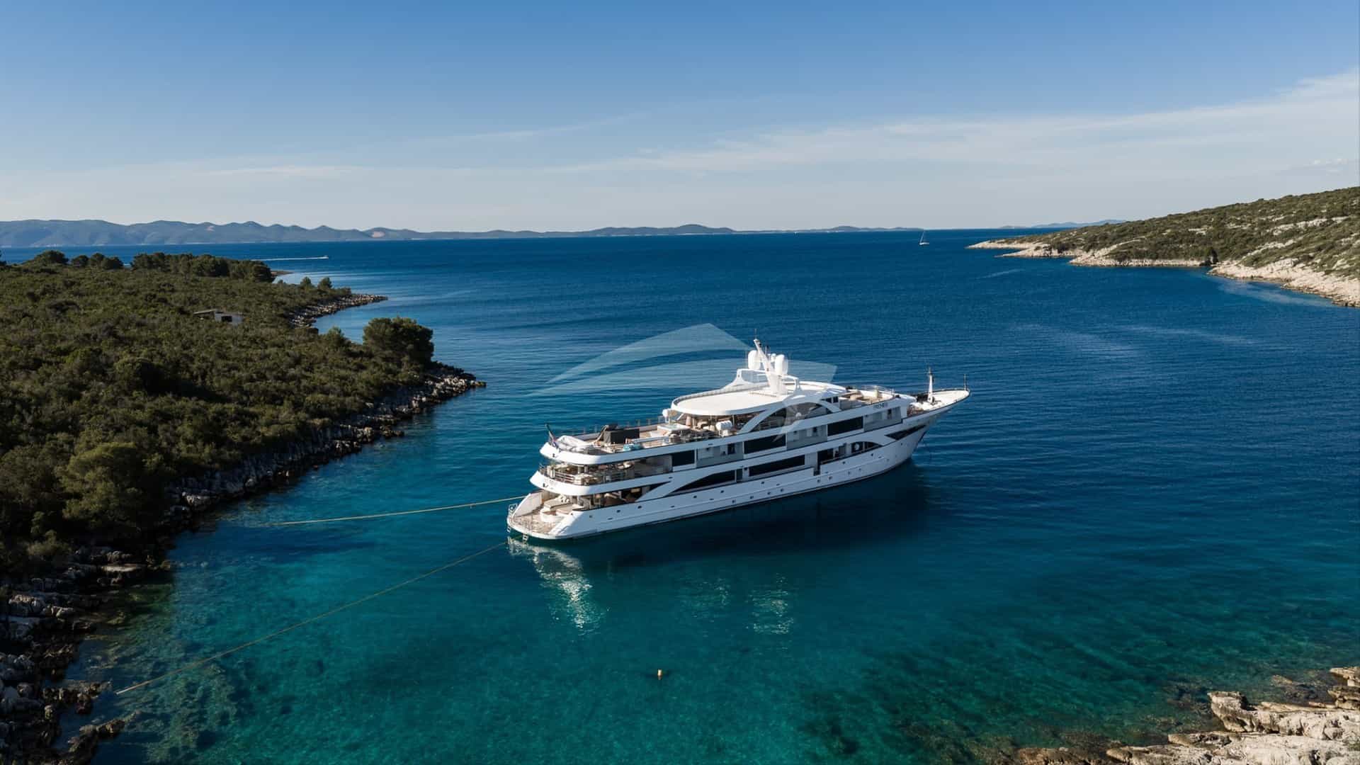
The waters stretching along Spain’s eastern seaboard around Valencia offer an exceptional, nuanced cruising ground that contrasts dramatically with the well-trodden routes of the Balearics. La Marina de València—built originally for the 32nd America’s Cup—provides world-class superyacht berthage, deep-water access, and immediate entry to the Gulf of Valencia. From this modern launchpad, a skipper can head south toward the imposing limestone promontories of Cabo de San Antonio and Cabo de la Nao, or set an offshore course for the volcanic solitude of the Columbretes Islands.
A successful Valencia Yacht Charter yacht charter requires an understanding of distinct coastal microclimates, thermal wind dynamics, strict marine conservation zones, and commercial shipping channels. Unlike enclosed archipelagos, cruising the Valencian coast is an exercise in linear passage planning, where open ocean swells, sea-breeze regimes, and shelter under dramatic headlands dictate the daily rhythm.
The Cruising Grounds: Coastline and Sub-Regions
The cruising area accessible from Valencia divides into three primary nautical zones: the open expanse of the Gulf of Valencia, the jagged limestone coast of North Costa Blanca, and the offshore volcanic archipelago of the Islas Columbretes.
                  [ ISLAS COLUMBRETES ]
                   (Illot de la Foradada)
                             ^
                             |  ~30 NM
                             |
                     [ CASTELLÓN ]
                             ^
                             |  ~30 NM
                             |
  [ LA MARINA DE VALÈNCIA ] - - - - - - - - > [ IBIZA / FORMENTERA ]
             |                                    (~75-85 NM)
             |  ~20 NM
             v
   [ CABO DE CULLERA ]
             |
             |  ~30 NM
             v
[ CABO DE SAN ANTONIO / JÁVEA ]
             |
             |  ~10 NM
             v
     [ CABO DE LA NAO ]
             |
             |  ~7 NM
             v
        [ MORAIRA ]
### The Gulf of Valencia Extending from Sagunto in the north down to the low-lying spit of Cullera, the Gulf of Valencia is characterized by long, low-lying sandy shores backed by the coastal lagoon of the Albufera Natural Park. While the coastline here lacks deep natural inlets, it features commercial ports and modern marinas every 15 to 20 nautical miles. The water shoals gradually, making this section relatively uncomplicated for navigation, though exposed to easterly and north-easterly swells.
### The North Costa Blanca Promontories Beginning south of Cullera and reaching its peak around Dénia, Jávea, and Moraira, the coast transforms into a dramatic landscape of sheer limestone cliffs, hidden caves, and deep-water bays. Cabo de San Antonio rises almost vertically 160 metres out of the sea, followed closely by Cabo de la Nao. This rugged zone provides some of the finest natural anchorages on the Spanish mainland, offering clear waters, submarine caverns, and seabed environments dominated by protected Posidonia oceanica seagrass beds.
### The Columbretes Islands Marine Reserve Positioned roughly 28 nautical miles east-southeast of Castellón de la Plana and 48 nautical miles northeast of Valencia, the Islas Columbretes are an uninhabited archipelago of volcanic origin. The main island, Illa Grossa, forms a submerged crater bay (Puerto Tofiño). Isolated, wind-swept, and strictly protected, this archipelago offers an off-the-grid island experience reserved for yachts with pre-arranged marine park mooring permissions.
Wind, Weather, and Sea State by Month
Cruising conditions in the western Mediterranean off Valencia are shaped by the interactions between the Iberian continental landmass, coastal mountain ranges, and offshore high-pressure systems. Understanding the sea-breeze mechanisms and prevailing seasonal winds is critical for comfortable anchoring and passage-making.
MONTH-BY-MONTH CRUISING CONDITIONS
-----------------------------------------------------------------------------------------
Month     Dominant Winds           Avg Force    Sea State         Cruising Suitability
-----------------------------------------------------------------------------------------
May       NW (Mestral) / NE        3-4 Bft      Slight-Moderate   Good for passage making
June      SE-SW (Garbí thermal)   3-5 Bft      Slight           Excellent summer conditions
July      SE-SW (Garbí thermal)   3-5 Bft      Slight           Peak season; predictable
August    SE-SW / E (Llevant)     3-4 Bft      Slight-Moderate   Hot; afternoon thermal gusts
Sept      E-NE (Llevant)           3-5 Bft      Moderate         Good waters; watch swell
Oct       NE (Gregal) / NW         4-6 Bft      Moderate-Rough   Unstable; shoulder end
-----------------------------------------------------------------------------------------
### May and June Spring marks the stabilization of weather patterns across the Gulf of Valencia. May sees residual north-westerly winds (Mestral) blowing offshore from the Ebro Basin, creating flat sea conditions near the coast but moderate chop further out. By June, the classic summer thermal wind—the Garbí—establishes itself. The Garbí builds predictably from the south-west or south-southwest, starting around midday at 10 to 12 knots, peaking at 16 to 18 knots during mid-afternoon, and dropping off sharply at sunset. Sea states remain slight, making June an ideal month for serene coastal passages and undisturbed overnight anchoring.
### July and August July brings heat, high atmospheric stability, and consistent thermal breezes. The morning typically opens with calm seas or a faint offshore land breeze (Terral), providing mirror-like conditions for early morning runs between Valencia and the southern headlands. By 13:00, the thermal engine kicks in, veering from south-southeast to south-west.
In August, the thermal breeze remains, but the risk of occasional Llevant (easterly) onshore flows increases. The Llevant can generate a persistent, short-period easterly swell that rolls directly into east-facing anchorages like Jávea and Cullera, even when local wind speeds remain low. Sea surface temperatures hover around 26°C to 28°C.
### September and October September offers warm sea temperatures and reduced coastal traffic, but the weather requires closer monitoring. As cold air masses begin to slide over warm Mediterranean waters, the risk of localized convective storms (cold drop or DANA) increases. Winds become more variable, with easterly (Llevant) and north-easterly (Gregal) winds bringing increased swell to the Costa Blanca headlands. Sea states shift rapidly from slight to moderate (Beaufort 4 to 5).
By October, autumn conditions take hold; while clear, crisp days are common, open passages out to the Columbretes require strict weather windows to avoid heavy northeast seas.
Key Natural Anchorages and Shelter Profiles
Choosing the correct anchorage along this coast demands careful evaluation of wind direction, as shelter here is usually provided by high limestone cliffs rather than deep inland coves.
### Illa Grossa / Puerto Tofiño (Islas Columbretes) * Coordinates: 39°53.7'N, 000°41.2'E * Bottom Type: Volcanic sand, rock, and rubble within a designated eco-buoy field. * Shelter Profile: Exceptional 300-degree protection from south-west, west, north, and northeast. Fully exposed to the east and south-east.
This horseshoe-shaped submerged volcanic caldera offers a dramatic overnight stop. Anchoring on your own ground is strictly prohibited to protect the delicate benthos; yachts must secure to designated yellow park moorings. Access is limited by draught and length, and skipper credentials must be filed in advance with the reserve management. The crater walls knock down incoming western seas, but an easterly swell creates a heavy roll inside the bay, necessitating an immediate departure for the mainland.
### Cala Sardinera (Cabo de San Antonio) * Coordinates: 38°46.2'N, 000°12.5'E * Bottom Type: Sand and clay patches between rock ledges. Eco-moorings during peak summer. Shelter Profile: Excellent protection from south-west, south, and south-east winds (Garbí*). Exposed to north and north-east winds.
Situated directly under the southern lee of Cabo de San Antonio, Cala Sardinera is the primary refuge when the summer thermal breeze blows hard from the south-west. The tall cliffs absorb the wind, leaving the bay in flat water. Holding in the sandy pockets is excellent. Skippers should use caution when dropping anchor to avoid Posidonia beds; local environmental patrol boats monitor the area rigorously and will order yachts to re-anchor if gear touches protected seagrass.
### Ensenada de Jávea / Portitxol * Coordinates: 38°45.1'N, 000°13.6'E * Bottom Type: Sand, gravel, and rock. * Shelter Profile: Sheltered from south-west to west winds. Exposed to easterly and southerly swells.
Tucked behind the offshore islet of Isla de Portitxol, this anchorage provides shelter and clear emerald waters ideal for daytime swimming and tender operations. The island breaks the sea, but strong south-easterly weather sends a refraction pattern around both sides of the islet. Anchor in the clear sand patches on the mainland side in depths of 6 to 10 metres.
### El Portet de Moraira * Coordinates: 38°41.2'N, 000°08.3'E * Bottom Type: Fine sand with high holding power. * Shelter Profile: Exceptional protection from north, north-east, east, and north-west winds. Exposed to south and south-west.
Tucked beneath the Cap d'Or promontory, El Portet is widely regarded as one of the prettiest and most protective natural anchorages south of Valencia. The massive headland shuts off any north-easterly swell completely. The gently sloping sandy seabed allows for comfortable riding on a 5:1 scope in 5 to 8 metres of water. If the afternoon Garbí shifts around to the south, a light chop can enter the bay, but the anchorage remains safe.
### Bahia de Cullera (North Anchor) * Coordinates: 39°09.5'N, 000°14.0'E * Bottom Type: Soft sand. * Shelter Profile: Protected from west and north-west winds. Exposed to east, south-east, and north-east.
Positioned 20 nautical miles south of Valencia, Cullera offers an essential intermediate stopping point along an otherwise straight stretch of coast. Anchoring north of the Cabo de Cullera lighthouse provides good holding in 5 metres of water over sand, shielded from the prevailing north-westerly off-shore breezes. It serves well as a lunch stop or a staging point when waiting for daylight before entering the ports of Valencia or Gandía.
Cruising Distances and Day-Hop Logistics
Planning a coastwise itinerary from Valencia relies on balancing long open stretches with concise headland-hopping further south.
-----------------------------------------------------------------------------------
From                        To                          Distance (NM)   Time at 10 kn
-----------------------------------------------------------------------------------
La Marina de València       Cabo de Cullera             20 NM           2.0 hrs
Cabo de Cullera             Dénia Marina                24 NM           2.4 hrs
Dénia                       Cabo de San Antonio         5 NM            0.5 hrs
Cabo de San Antonio         Cala Sardinera (Jávea)      4 NM            0.4 hrs
Cala Sardinera              Cabo de la Nao              6 NM            0.6 hrs
Cabo de la Nao              El Portet de Moraira        7 NM            0.7 hrs
El Portet de Moraira        Peñón de Ifach (Calpe)      6 NM            0.6 hrs
La Marina de València       Islas Columbretes           48 NM           4.8 hrs
Islas Columbretes           Dénia                       54 NM           5.4 hrs
La Marina de València       San Antonio (Ibiza)         76 NM           7.6 hrs
-----------------------------------------------------------------------------------
A displacement yacht cruising at 10 to 12 knots can comfortably complete the run from Valencia to Jávea in under four hours, allowing for a morning departure from the marina and a midday arrival at the anchorages of Cabo de San Antonio. Motor yachts capability of 20+ knots can treat the entire coast from Valencia down to Calpe, including an offshore loop to the Columbretes, as a series of short, flexible runs.
Navigational Hazards and Local Regulations
Navigating the waters off Valencia is straightforward in clear weather, but specific operational hazards and environmental laws demand precise attention from the bridge team.
Key Coastal Hazards Summary:
• Commercial Traffic Lanes: 3 NM exclusion zone around Port of Valencia container terminals.
• Tuna & Aquaculture Farms: Unlit mariculture grids off Burriana, Cullera, and Dénia.
• Shallow Passages: El Freu passage inside Isla de Portitxol (minimum depth 1.8m, rock shoals).
• Posidonia Regulations: Strict anti-anchoring enforcement monitored by marine park rangers.
• Volcanic Reefs: Unmarked rock shelf off Illa Grossa (Columbretes archipelago).
### Commercial Shipping Approaches The Port of Valencia is one of the busiest container hubs in the Mediterranean. High-speed commercial ferries, deep-draught cargo ships, and tugs operate constantly within the Valencia Vessel Traffic Service (VTS) zone. Superyachts exiting La Marina de València must communicate with Valencia Traffic on VHF Channel 11 before entering the main channel. Keep clear of the designated shipping lanes extending five nautical miles seaward from the breakwater, and monitor commercial traffic on AIS carefully when executing coastal crossings at night.
### Fish Farms and Mariculture Grids Extensive offshore mariculture operations are situated along the Valencian coast. Notable sites are located off Burriana, north of Cabo de Cullera, and off the coast of Dénia. These fish farms consist of unlit or faintly lit yellow buoys supporting large circular submerged nets, extending up to two nautical miles offshore. Chart plotters do not always show updated fish farm boundaries. Maintain a sharp visual lookout, especially when running parallel to the coast inside the 50-metre depth contour after dusk.
### Posidonia Oceanica Conservation Laws The Valencian Regional Government strictly enforces regulations protecting Posidonia oceanica (seagrass). Anchoring directly in Posidonia is illegal across all coastal zones of Valencia, Jávea, Dénia, and Moraira. Heavy financial penalties are issued to vessels whose chain or anchor damages the seabed.
- Always identify bare sand patches (arena) before letting go the anchor.
- Use eco-buoy fields where provided (such as those installed around Cabo de San Antonio and Cala Sardinera during summer).
- Keep a lookout for environmental patrol RIBs, which conduct daily chain inspections via underwater drone or snorkelers.
### The El Freu Passage When navigating between the mainland of Jávea and Isla de Portitxol, skippers are tempted to use the narrow channel known as El Freu. This passage is littered with submerged rocks and shallow reefs, with depths dropping to under 1.8 metres in places. Unless operating a shallow-draught tender, all yachts should bypass Isla de Portitxol to seaward, giving the outer rocks a berth of at least two cable lengths.
How a Captain Plans a Seven-Day Itinerary
A master planning a week-long Valencia Yacht Charter yacht charter balances high-end marina stays with wilderness anchorages, structuring the voyage around the prevailing summer thermal winds.
TYPICAL 7-DAY ITINERARY FLOW
[Day 1: Valencia] --> [Day 2: Cullera / Dénia] --> [Day 3: Jávea Bays]
                                                         |
[Day 7: Valencia Return] <-- [Day 5-6: Columbretes] <-- [Day 4: Moraira]
### Day 1: Embarkation at La Marina de València Guests board at La Marina de València. The afternoon is spent completing safety briefings, reviewing the route with the captain, and enjoying the urban luxury of the marina complex. The yacht remains berthed overnight, giving guests time to explore Valencia's historic quarter, sample traditional Paella Valenciana cooked over orange wood in the city center, and experience the modern architecture of the City of Arts and Sciences.
### Day 2: Valencia to Dénia via Cabo de Cullera * Distance: 44 NM * Plan: Cast off early at 08:00 to clear the Valencia commercial fairway before harbor traffic surges. Run south in flat water along the sandy coast of the Albufera. Drop anchor at Cabo de Cullera for a mid-morning swim and breakfast off the boat. Afternoon: As the Garbí* thermal wind develops around midday, set course south-southeast across the Gulf to Dénia. Secure a berth at Marina Dénia. Guests go ashore in the evening to dine at the town's famed Michelin-starred culinary venues beneath the shadow of the Moorish castle.
### Day 3: Exploring the Jávea Promontories * Distance: 12 NM * Plan: A relaxed morning departure round Cabo de San Antonio. The dramatic limestone cliffs drop straight into deep blue water. Anchor in Cala Sardinera for lunch and water sports—seabobbing, paddleboarding, and snorkeling along the underwater caves of Cova Tallada. * Afternoon: Shift the anchorage south round Cabo de la Nao to the turquoise waters of Cala Granadella or Portitxol. As the afternoon wind peaks, the tall headlands provide total protection. Anchor overnight under Cap d'Or in El Portet de Moraira, riding comfortably on sand in 6 metres of water.
### Day 4: Moraira to Peñón de Ifach and Evening Offshore Run * Distance: 25 NM * Plan: Anchor at the base of the massive Peñón de Ifach in Calpe, a towering 332-metre limestone monolith rising directly out of the sea. Send guests ashore via tender to hike the natural park trails or enjoy fresh seafood along the harbor. * Afternoon: Return north towards Dénia or Castellón to position the vessel for the offshore passage to the Columbretes Islands. Check the late-evening weather broadcast to ensure low swell and light easterlies for the archipelago anchorage.
### Day 5: The Offshore Crossing to the Islas Columbretes * Distance: 35–48 NM (depending on departure port) * Plan: Depart at dawn for the open-water run across to the Columbretes Archipelago. Arrive at Illa Grossa by late morning. Pick up an assigned eco-mooring buoy inside Puerto Tofiño crater bay under the supervision of the park rangers. * Afternoon: Arrange a guided shore landing with the resident nature wardens to climb to the lighthouse at the top of the island. The waters here are part of a strictly protected marine reserve holding exceptional marine life; snorkeling and diving inside the crater yield clear visibility often exceeding 30 metres, with large groupers, lobsters, and pelagic fish species visible right under the yacht’s swim platform.
### Day 6: Columbretes to the Mainland Coast * Distance: 48 NM * Plan: Enjoy a quiet morning swim in the volcanic caldera before picking up anchor before midday. Set a course back toward the Valencian coast. The return crossing often offers excellent sailing under a broad reach as the afternoon sea breeze builds from the south-west. * Evening: Drop anchor for a final night under the stars off the beach of Pobla Marina or anchor just outside the outer breakwater of Valencia in stable holding, taking in the illuminated skyline of the city.
### Day 7: Final Cruise and Disembarkation * Distance: 5 NM * Plan: Pick up anchor for a sunrise cruise along the Malvarrosa beach front. Enter La Marina de València at 09:00 for final disembarkation.
Practical Charter Advice for Brokers and Skippers
When securing a vessel for a Valencia-based charter, matching yacht specifications to the regional geography is crucial.
### Vessel Selection & Draught While motor yachts dominate this coast due to their fast cruising speeds between open headlands, large sailing yachts find superb conditions in the Gulf of Valencia during the predictable summer Garbí winds.
Draught is rarely an issue when anchoring off the steep cliffs of Cabo de la Nao or Cabo de San Antonio, where 10-metre depths can be found just 50 metres from the rock faces. However, a shallow draught (under 2.5 metres) is highly advantageous when entering smaller coastal ports like Moraira or negotiating the sandy shoals near the Albufera outlet.
### Stabilization Matters Because many anchorages along the Costa Blanca are headland bays exposed to ocean swells from the easterly quadrant, zero-speed (underway and at-anchor) stabilizers are highly recommended for motor yachts chartering in this region. Stabilizers convert a rolling afternoon anchorage in Jávea into a calm, comfortable environment for lunch and water sports.
### Provisioning Logistics Valencia is one of Spain’s premier agricultural and culinary capitals. Provisions sourced locally through professional marine agents yield world-class ingredients: fresh seafood directly from the central fish auctions (lonjas) of Dénia and Valencia, local rice varieties (Bomba and Senia), and produce from the surrounding Horta. Provisioning before departure from La Marina de València guarantees high quality, as smaller ports down the coast have more limited commercial access for superyacht chefs.
By combining world-class marine infrastructure, rich maritime heritage, dramatic coastal geography, and pristine marine reserves, cruising Valencia aboard a private luxury yacht delivers a unique Mediterranean itinerary—one that mixes urban sophistication with pristine, untamed sea passage-making.