
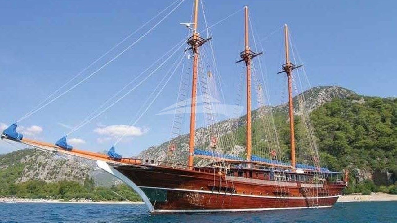
Marina de Vilamoura (37°04.5’N, 008°07.2’W) serves as the primary superyacht terminal and operational springboard for the southern coast of Portugal. Positioned centrally along the Algarve coast, the port provides immediate access to two distinct marine environments: the exposed Atlantic headlands and high sandstone cliffs of the Western Barlavento, and the sheltered, barrier-island lagoon systems of the Eastern Sotavento. While geographically Atlantic, the Algarve benefits from a Mediterranean microclimate during the summer charter season. However, the open-ocean exposure demands rigorous navigation, accurate passage planning, and an understanding of local wind acceleration zones. Executing a successful Vilamoura Yacht Charter yacht charter requires a captain to balance offshore swells with coastal sea breezes, matching target anchorages precisely to daily wind shifts and tidal windows.
The Maritime Geography of the Algarve Coastline
The Algarve coastline spans roughly 90 nautical miles from the mouth of the Guadiana River at the Spanish border in the east to Cabo de São Vicente at the extreme south-western tip of mainland Europe. Vilamoura sits precisely at the transition zone between two contrasting coastal geomorphologies, giving captains options in both directions depending on prevailing swells.
The Central Sandstone Sector (Vilamoura to Carvoeiro)
Directly west of Vilamoura’s twin outer breakwaters, the coast begins as low-lying sandy shorelines before rising into soft golden sandstone cliffs around Olhos de Água and Albufeira. From Ponta da Galé to Cabo Carvoeiro, the cliffline hardens into calcarenite formations carved by oceanic erosion into sea stacks, blowholes, and arches. The seabed along this sector slopes gently, with the 10-metre contour lying roughly 0.3 to 0.5 nautical miles offshore. Cruising here offers iconic visual scenery, but the coast is entirely open to the south and south-west. High cliffs provide excellent protection from northerly offshore winds, creating glassy conditions close under the lee of the rock faces, but any southerly ocean fetch turns these bays into lee shores with uncomfortable ground swell.
The Western Barlavento (Portimão to Cabo de São Vicente)
Beyond the Rio Arade estuary at Portimão, the Barlavento region presents a progressively wilder aspect. The coast between Lagos and Ponta da Piedade features dense clusters of limestone formations and submerged pinnacles. Moving west past Ponta da Piedade toward Enseada da Baleeira and Sagres, the landscape flattens into an arid plateau ending in sheer 80-metre limestone cliffs.
The water depth drops off more rapidly here, with the 20-metre contour coming within a cable of the headlands. This sector acts as a hydrographic funnel where Atlantic ground swells, generated thousands of miles away in the mid-Ocean, hit shallow water and transform into high-energy breakers. Navigating around Cabo de São Vicente brings yachts directly into the open North Atlantic, where the full weight of ocean weather takes effect.
The Eastern Sotavento and Ria Formosa
East of Vilamoura, the geography shifts dramatically past Quarteira. The cliff lines disappear, replaced by the low sandy expanse of the Ria Formosa Natural Park. This marine park consists of a continuous 60-kilometre system of barrier islands (Ilha da Barreta, Ilha da Culatra, Ilha de Armona, Ilha de Tavira) separating an intricate web of tidal channels, mudflats, and salt marshes from the open sea.
Cabo de Santa Maria, located on Ilha da Barreta, forms the southernmost point of mainland Portugal. South of this cape, the continental shelf extends further out to sea, tempering incoming ocean swells. The Sotavento offers flat-water conditions inside the lagoon entrances and vast, uncrowded anchorages along the outer sandbanks, making it the preferred destination during periods of strong westerly winds.
Seasonal Meteorology: Winds, Swell, and Microclimates
Understanding the Algarve’s summer weather patterns requires analyzing the relationship between the Azores High pressure system, the thermal heat low over the Iberian interior, and Atlantic swell patterns.
Spring Transition (April to May)
Spring is a variable transition period. The Azores High fluctuates, allowing Atlantic frontal systems to sweep across the Iberian Peninsula from the west and south-west. Prevailing winds alternate between south-westerlies bringing moist air and swells of 1.5 to 2.5 metres, and moderate northerlies. Sea surface temperatures linger around 15°C to 16°C. While anchorages off Ponta da Piedade and Culatra are quiet, careful monitoring of wave periods is critical, as long-period swells (12 seconds or more) can roll into south-facing bays even under light wind conditions.
The Summer Peak (June to August) and the Nortada
During the height of summer, the weather becomes highly consistent. The dominant wind regime across southern Portugal is the Nortada—a northerly to north-westerly wind driven by the pressure gradient between the offshore high and the continental heat low.
Because the Algarve’s southern coast faces directly south, the Nortada blows offshore over the cliffs along the Barlavento. This creates ideal calm water conditions immediately adjacent to the beaches, despite wind speeds off the cliffs reaching 15 to 22 knots by mid-afternoon. However, as yachts round the corner at Sagres towards Cabo de São Vicente, the Nortada accelerates significantly due to coastal squashing, often blowing 25 to 35 knots with heavy, short-steep seas.
During stable summer weather, local thermal sea breezes (the Marrinha) develop by early afternoon. Near Vilamoura and Lagos, the morning light offshore breeze gives way to a south-westerly or south-easterly wind reaching 10 to 14 knots between 13:00 and 17:00, before dropping off sharply at sunset.
Occasional periods of Leste occur when the wind veers to the east/south-east, blowing warm air directly off the Mediterranean and North Africa across the Gulf of Cádiz. The Leste can blow continuously day and night at 15 to 20 knots, building short, aggressive waves along the Sotavento coast and bringing warm sea temperatures (up to 22°C) along with elevated humidity.
Autumn Season (September to October)
September offers some of the best cruising conditions of the year. The summer heat low over Spain collapses, causing the Nortada to drop in intensity while sea temperatures reach their annual peak at 19°C to 21°C. Winds are generally light and variable in the morning, followed by predictable sea breezes. By late October, the first Atlantic depressions begin to track south, bringing south-westerly winds, rain, and building ground swells that mark the end of the primary charter season.
Essential Anchorages: Shelter, Holding, and Exposure
Finding safe, comfortable anchorages along an ocean coast requires careful matching of wind vector, wave direction, wave period, and bottom topography.
Ilha da Culatra and the Ria Formosa Inlets
- Coordinates: 36°59.2’N, 007°49.5’W (Barra da Armona Outer Anchorage)
- Shelter: Excellent from N, NW, W, and SW inside the lagoon; good outside from N to NE.
- Holding: Excellent in dense mud and fine sand.
- Soundings: 3.0 to 8.0 metres inside main channel; 6.0 to 10.0 metres in the outer roadstead.
The waters behind Ilha da Culatra offer the safest, most comfortable all-weather anchorage in the region. Access to the interior lagoon is gained via the Barra Nova (Barra de Faro-Olhão) or Barra da Armona channels. Superyachts and deep-draft vessels typically anchor in the outer roadstead off the western tip of Culatra in 6 to 8 metres of water over fine sand, protected from north and west winds.
For vessels drawing under 2.5 metres, navigating the marked channel inside past the Culatra village leads to a completely landlocked lagoon anchorage. The tide runs hard through the channels—up to 3.5 knots during spring tides—requiring adequate scope (minimum 5:1 chain-to-depth ratio) and a heavy swing-radius check. Once set, holding in the sticky grey mud inside is superb.
Ponta da Piedade and the Lagos Bight
- Coordinates: 37°04.8’N, 008°40.1’W (Praia de Dona Ana / Camilo)
- Shelter: Excellent from N, NW, and W winds; fully exposed to S and SE swells.
- Holding: Moderate to good in fine sand and broken shell over a flat limestone shelf.
- Soundings: 5.0 to 9.0 metres.
Located south of Lagos, the iconic headland of Ponta da Piedade features dramatic sea stacks and natural arches. Immediately north-east of the point, under the lee of the high cliffs off Praia de Dona Ana and Praia do Camilo, lies an outstanding day-use anchorage during Nortada conditions.
Yachts drop anchor in 6 to 8 metres of clear blue water over sand. While protected from wind and short wind-waves coming off the land, captains must watch for Atlantic swell wrapping around Ponta da Piedade. If a south-westerly swell period exceeds 10 seconds, energy will refract around the headland, causing vessels to roll severely. The broad expanse of Meia Praia, stretching east toward Alvor, provides an alternative anchorage with lower risk of swell refraction.
Enseada da Baleeira (Sagres)
- Coordinates: 37°00.5’N, 008°55.8’W
- Shelter: Excellent from N, NW, and W; moderate from NE; exposed to E, SE, and S.
- Holding: Good in sand with patches of weed and rock.
- Soundings: 6.0 to 12.0 metres.
Situated on the eastern side of the Sagres peninsula, Enseada da Baleeira is the final secure anchorage before rounding Cabo de São Vicente into the open Atlantic. Framed by steep, barren grey cliffs, the bay provides reliable shelter when the Nortada is howling at 30 knots around the cape.
Anchor in 7 to 9 metres clear of the fishing harbour access channel. The seabed is primarily hard sand, though care must be taken to lay the anchor in sand patches rather than over dark rock shelves where the fluke can skid. This anchorage is essential for waiting out heavy westerly weather before attempting an Atlantic passage northward.
Armação de Pêra and Benagil Coastal Shelf
- Coordinates: 37°05.2’N, 008°23.8’W
- Shelter: Good from N and NNE in settled weather; open to all southern sectors.
- Holding: Good in coarse sand.
- Soundings: 5.0 to 10.0 metres.
The cliff-lined shelf running from Praia de Benagil to Armação de Pêra offers access to the Algarve's famous sea caves, including the Benagil Cathedral cave. This area is strictly a fair-weather, daytime anchorage. Captains anchor approximately 2 to 3 cables off the cliff base in 7 to 9 metres of water.
There is zero shelter from any southerly wind or ocean swell. Due to the high cliff face, winds can drop off completely beneath the land, but sudden katabatic gusts can drop off the plateau during late afternoon. Tender operations into the caves must be conducted with extreme caution due to active commercial tourist craft, heavy surge near cave entrances, and falling rock hazards close to the cliff walls.
Key Distances and Passage Planning Matrix
Planning day hops from Marina de Vilamoura requires balancing charterer desires for beach anchorages against transit times across open coastal waters. Below are exact nautical mile distances from Vilamoura Marina entrance (37°04.5’N, 008°07.2’W) to key regional waypoints:
- Vilamoura to Albufeira Marina Outer Breakwater: 6.8 NM
- Vilamoura to Benagil Cave Anchorage: 13.5 NM
- Vilamoura to Portimão Entrance (Rio Arade): 19.2 NM
- Vilamoura to Ponta da Piedade (Lagos): 25.4 NM
- Vilamoura to Enseada da Baleeira (Sagres): 37.8 NM
- Vilamoura to Cabo de São Vicente: 42.1 NM
- Vilamoura to Cabo de Santa Maria (Ria Formosa tip): 16.2 NM
- Vilamoura to Barra da Armona / Culatra Anchorage: 20.5 NM
- Vilamoura to Ilha de Tavira (Barra do Gilão): 31.8 NM
- Vilamoura to Vila Real de Santo António (Guadiana River border): 42.5 NM
For a motor yacht cruising at 15 to 20 knots, the passage from Vilamoura to Ponta da Piedade takes roughly 1.5 hours, allowing comfortable morning transitions before afternoon winds pick up. For a sailing yacht cruising at 7 to 8 knots, a westwards passage into the afternoon Nortada requires early morning departures to clear Ponta da Piedade before the wind accelerates off the cliffs.
Navigational Hazards and Local Pilotage
Cruising off southern Portugal requires strict attention to unique environmental risks, ranging from shifting sandbars to oceanic wildlife encounters.
- Bar Crossings and Tidal Inlets: The entrances to Ria Formosa (Barra Nova and Barra da Armona), Alvor Lagoon, and the Guadiana River are subject to constant sand movement. Chart depths inside these channels change frequently after winter storms. Entering these inlets requires a rising tide, daylight, and recent local knowledge. Crossing these bars during an ebb tide with a strong onshore wind produces high, breaking seas.
- Tuna Nets and Coastal Fishing Gear: The Algarve coast is heavily fished. Unmarked or poorly marked buoy lines, pot lines, and large seasonal tuna nets (almadrabas) are set off the coast between May and September. A major almadraba is traditionally deployed off Tavira and Armação de Pêra, extending up to 2 nautical miles offshore. Night passages within 3 miles of the coast require high vigilance and radar monitoring.
- Cabo de São Vicente Wind and Current Acceleration: The sea area off Cape St. Vincent experiences localized wind acceleration. A 15-knot northerly wind off Portimão will frequently increase to 30+ knots off the Cape, accompanied by a strong south-running coastal current (1.0 to 1.5 knots).
- Ibero-Atlantic Orca Protocol: In recent years, a subpopulation of Iberian killer whales has interacted with sailing yacht rudders in the waters off the Iberian peninsula, including the Strait of Gibraltar, the Algarve, and north along the Atlantic coast. Captains operating sailing yachts or pod-driven motor yachts should check the latest safety guidelines, monitor active sighting apps, and remain prepared to implement standard protocols (stopping the vessel, disengaging the autopilot, dropping sails, and taking refuge in shallow water under 20 metres if targeted).
The Captain’s Log: Executing a Seven-Day Vilamoura Charter
Executing an itinerary on a Vilamoura Yacht Charter yacht charter involves balancing wind patterns with high-end guest expectations. The following master plan illustrates how a captain navigates the Algarve coast over seven days, leveraging afternoon breezes and choosing sheltered night anchorages.
Day 1: Embarkation in Vilamoura and Evening Run to Culatra
Guests embark at Marina de Vilamoura at 12:00. After safety briefings and settling into staterooms, the yacht slips its berths at 14:00, steering east-south-east toward the Sotavento. The passage to Cabo de Santa Maria (16.2 NM) provides a smooth introduction, as the southerly sea breeze is on the starboard quarter.
Rounding the cape, the yacht enters the calm waters off Ilha da Culatra. Anchor in 7 metres of water off the western beach of Culatra. Guests take the tender into the shallow lagoon channels toward the island’s roadless fishing hamlet to sample fresh Amêijoas à Bulhão Pato (clams in garlic and coriander) and razor clams, while the yacht lays in flat water overnight sheltered from the westerly swell.
Day 2: Culatra to Ilha de Tavira and the Spanish Border
Weigh anchor at 08:30 for a morning cruise further east toward Ilha de Tavira (12 NM). The water along this stretch is exceptionally clear, and the long, unbroken sandbar offers an ideal setting for water sports, jet-skiing, and sea-bobbing in warm, calm seas.
By mid-afternoon, as the Leste or south-easterly thermal breeze builds to 12 knots, head east toward the mouth of the Guadiana River (11 NM), which forms the international border between Portugal and Spain. Pass between the long stone breakwaters at Vila Real de Santo António and drop anchor in the river basin off the Spanish town of Ayamonte. The river provides complete protection from all oceanic swell, offering a perfectly quiet night at anchor.
Day 3: Guadiana River to Armação de Pêra Coastal Shelf
An early departure at 07:00 allows a comfortable 36-nautical-mile passage back west across the Gulf of Cádiz toward the central Algarve cliff coast. As the yacht cruises past Vilamoura, the flat sandbanks give way to red clay and gold sandstone cliffs.
By 11:30, drop anchor off Praia de Vale do Olival near Armação de Pêra in 6 metres over sand. The afternoon is spent exploring the nearby coastline by tender, navigating between sea stacks and rock formations.
Chef prepares a traditional Cataplana de Marisco—a rich local seafood stew cooked in a copper clam-shell pot—served on the aft deck while anchored under the cliffs. As night falls and the onshore sea breeze dies away, the yacht remains at anchor in peaceful, mirror-like conditions.
Day 4: Sea Caves of Benagil to the Arade Estuary
At 09:00, weigh anchor and execute a low-speed coastal passage west along the Benagil cliff sector. Launch the tender early to beat the commercial tourist boats into the famous Benagil Cathedral cave, taking advantage of the morning low-surge window.
Re-boarding the yacht, cruise 6 nautical miles west to the mouth of the Rio Arade at Portimão. Pass between the massive stone mole breakwaters and anchor in the sheltered outer basin of Ferragudo, directly opposite the historic fort. Ferragudo offers a charming, traditional Portuguese village setting where guests can go ashore to enjoy charcoal-grilled sardines at waterside taverns.
Day 5: Portimão to Ponta da Piedade and Lagos Bight
Depart Ferragudo at 10:00 for the short 6-nautical-mile run across the Bay of Lagos toward Ponta da Piedade. Navigating slowly through the labyrinth of rock pillars, arches, and hidden coves, the yacht comes to anchor in 8 metres of clear water off Praia do Camilo, sheltered under high limestone headlands.
Guests spend the afternoon paddleboarding through natural tunnels and swimming in turquoise waters. The high cliffs fully block the Nortada, which is blowing at 18 knots over the top of the plateau, keeping the anchorage flat and calm. In the evening, take the tender into the historic harbour of Lagos for dinner ashore in the old walled town.
Day 6: Expedition to Sagres and Cabo de São Vicente
This day is dedicated to exploring the dramatic western edge of the continent. Weigh anchor at 08:30 and steam west across the Barlavento coast past Luz and Salema toward Sagres (13 NM). As the yacht rounds Ponta de Sagres, the landscape becomes stark and dramatic.
Drop anchor in Enseada da Baleeira for lunch and afternoon water sports under the shadow of the fortress cliffs. If ocean conditions permit, weigh anchor at 16:00 for a late afternoon passage around Cabo de São Vicente (4.5 NM west). Standing on the flybridge while passing under the 80-metre cliffs and the historic lighthouse at the edge of the European continent provides an impressive finale to the western cruise. Return to the secure, sheltered lee of Baleeira or Ponta da Piedade for the final night at anchor.
Day 7: Return Passage to Vilamoura Marina
Enjoy a slow breakfast on the aft deck at anchor before commencing the return eastern run back toward Vilamoura (25 NM from Ponta da Piedade). With the morning wind light and the sea surface smooth, line up an offshore route 2 miles off the coast, keeping a lookout for common dolphins that regularly frequent these waters.
Arrive off the Vilamoura breakwaters by 11:30, entering the marina channel to berth at the superyacht quay, perfectly completing a week of ocean navigation and coastal discovery along one of Europe’s most dynamic coastlines.