
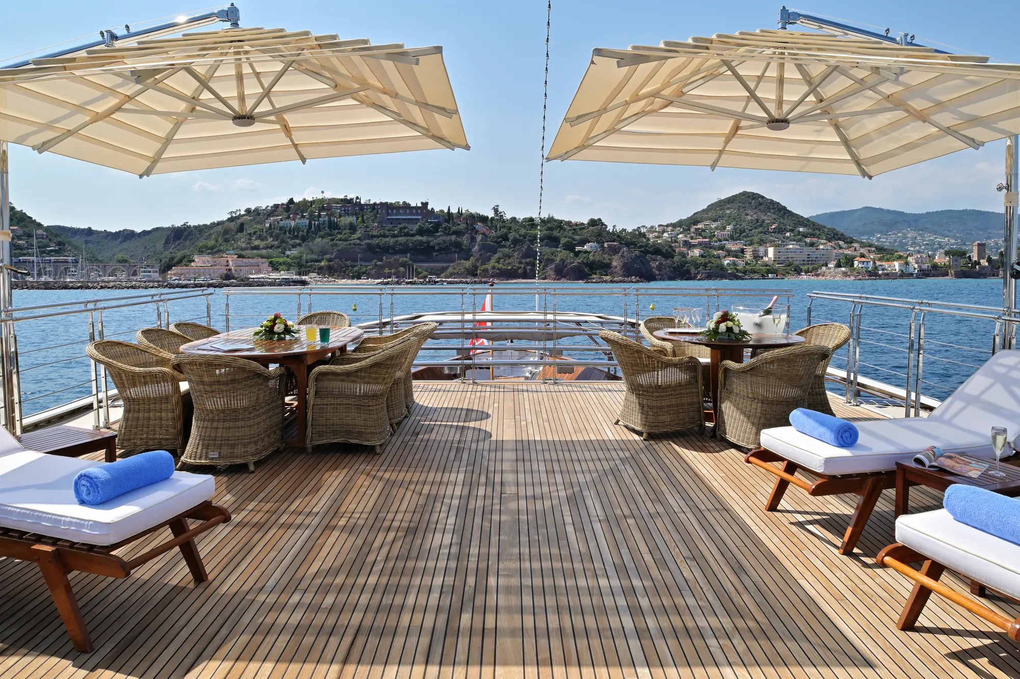
Positioned in the narrow waist of the central Mediterranean, roughly sixty nautical miles south of Sicily, the Maltese archipelago presents an extraordinary cruising ground for private yachts. Comprising three main inhabited islands—Malta, Gozo, and Comino—alongside smaller uninhabited stacks like Filfla and Cominotto, this compact maritime region compresses millennia of naval history, dramatic geology, and varied sea conditions into a cruising footprint of under eighty square miles. The coastline is defined by honey-coloured Globigerina limestone cliffs, deep natural fjord-like inlets known locally as widien, and expansive natural harbours that have sheltered fleets since the Phoenicians.
Navigating these waters requires an understanding of how local winds interact with steep coastal topography. While distances between anchorages are remarkably short, the surrounding sea state can shift rapidly. A yacht can transition from the glass-like tranquility of a landlocked cove to a steep three-metre sea in the space of half a nautical mile when rounding exposed headlands. For a skipper or charter guest, the key to unlocking the archipelago lies in reading the wind, respecting the underwater shelf, and knowing precisely where to drop anchor when the prevailing sea breeze gathers strength in the early afternoon.
The Coastline and Distinct Sea Areas
The archipelago runs along a northwest-to-southeast axis. This geographical orientation creates three distinct cruising zones, each with its own character, soundings, and pilotage considerations.
### Marsamxett and the Grand Harbour On the central eastern coast of Malta lie Marsamxett Harbour and the Grand Harbour, separated by the high-walled peninsula of Valletta. These vast, deep-water natural havens are among the finest in the world. Approaching from seaward, the sight of Fort St Elmo and Fort St Angelo rising directly from the water offers an unmistakable landfall. Depths within the main fairways range from 10 to 30 metres, providing easy access for superyachts of any draught. Marsamxett houses modern marina facilities along Ta' Xbiex and Lazaretto Creek, while the Grand Harbour accommodates large luxury yachts beneath the bastions of Birgu (Vittoriosa). The sea area immediately outside the harbour entrance can generate a short, confused chop when a heavy easterly swell meets the outbound tidal wash and discharge from the inner creeks.
### The Southeastern and Western Cliffs Southward from the Grand Harbour, past the low headland of Delimara, the eastern coast curves into Marsaxlokk Bay—a large, working bay lined with fishing craft and heavy shipping terminals. Beyond Marsaxlokk, rounding the southern tip of the island near Benħisa Point, the topography changes dramatically. The entire southwest coast of Malta, extending up past Dingli Cliffs to Ras ir-Rħebba, is a vertical wall of sheer rock rising over 200 metres above sea level. This coast is ironbound and exposed. Depths drop off sharply to over 50 metres within a cable of the rock face, offering virtually no holding ground or natural shelter. Cruising along this southern shelf is a daytime spectacle undertaken in benign conditions, providing an unvarnished view of limestone arches, deep sea caves, and the solitary, restricted nature reserve island of Filfla lying three nautical miles offshore.
### The Northern Basins and the Comino Channels The northern tier of Malta, together with Comino and Gozo, forms the core of the region's leisure cruising ground. Here, the coastline dissolves into a series of broad bays—St Paul’s Bay, Mistra Bay, and Mellieħa Bay—separated by narrow, low-lying ridges. Between northern Malta and Gozo lie the North and South Comino Channels, flanking the small island of Comino. The water soundings here shallow significantly, with sandy bottoms, patch reefs, and brilliant turquoise shelves ranging from 2 to 12 metres in depth. The sea area in these channels is subject to rapid current acceleration, particularly when thermal winds are forced through the narrow gap between Marfa Point and Comino.
Prevailing Winds, Microclimates, and Seasonal Sea States
To plan a seamless Yacht Charter Malta yacht charter, a captain must constantly monitor the synoptic conditions across the Sicilian Channel. The weather patterns in Malta are driven by large-scale Mediterranean pressure systems, modified significantly by local topography and thermal currents.
### The Principal Wind Vectors The Majjistral (Northwesterly):* The dominant wind of the Maltese islands, blowing for nearly 40 per cent of the year. Originating as the Mistral in the Gulf of Lion, it reaches Malta across the open expanse of the Sicilian Channel. It brings clear skies but builds a heavy, long-period swell along the northwest coast of Malta and Gozo. When the Majjistral exceeds 20 knots, the anchorages along the western coasts become unviable, forcing yachts to seek shelter on the eastern and southern lee of the islands. The Xlokk (Sirocco / Southeasterly):* A warm, moisture-laden wind originating in North Africa. It brings damp haze, reddish Sahara dust, and a slow, rolling southerly swell. The Xlokk makes Marsaxlokk Bay and the south-facing coves untenable, while making the northern bays behind Marfa Ridge exceptional places to ride at anchor. The Grigal (Northeasterly):* Though less frequent in summer, the Grigal is historically the most dangerous wind in the region. It blows over a long fetch from the Ionian Sea, driving heavy seas directly into the Grand Harbour, Marsamxett, Mellieħa Bay, and St Paul's Bay. If a strong Grigal is forecast, yachts must secure berths in deep, well-protected inner marina creeks or seek shelter on the south side of Gozo under high cliffs.
Conditions by Month
MAY & JUNE
Sea Temp: 18°C - 22°C | Winds: Variable, light thermals (8-14 knots)
Swell: Generally low | Crowds: Minimal
Spring offers calm seas and long daylight hours. The dominant weather is settled, with light morning land breezes giving way to predictable afternoon sea breezes of 10 to 15 knots. Water temperatures are refreshing, and anchorages are largely quiet.
JULY & AUGUST
Sea Temp: 25°C - 28°C | Winds: Majjistral prevails (12-20 knots afternoon)
Swell: Moderate on exposed coasts | Crowds: Peak
High summer brings consistent heat and high water temperatures. The Majjistral establishes a regular pattern, building around midday and peaking in the late afternoon before falling away at sunset. Thunderstorms are extremely rare, but afternoon thermals can create strong wind-on-shore conditions in exposed north-facing bays.
SEPTEMBER & OCTOBER
Sea Temp: 24°C - 26°C | Winds: Shifting patterns, occasional squalls
Swell: Moderate, variable | Crowds: Moderate
Late season cruising is highly regarded by experienced local skippers. The sea retains its summer warmth, and the heavy midsummer commercial boat traffic clears. While weather systems remain predominantly gentle, early autumn can bring sudden frontal passages and isolated convective squalls, demanding careful attention to overnight anchorage selection.
Essential Anchorages and Shelter Profiles
The geology of the archipelago offers fine holding in coarse sand and clay, though large areas of protected Posidonia oceanica seagrass must be strictly avoided to protect the seabed and prevent anchors from dragging.
### Comino: Blue Lagoon and Crystal Lagoon The Blue Lagoon, situated between Comino and the islet of Cominotto, is world-renowned for its brilliant, shallow, white-sand basin with depths of 2 to 5 metres. While visually striking, it is exposed to any wind with a northerly or westerly component. The holding in sand is excellent, but heavy day-boat traffic makes late afternoon or overnight stays the ideal window for private yachts.
Just half a nautical mile to the south lies the Crystal Lagoon. Ringed by vertical limestone cliffs reaching 50 metres in height, this deep pocket offers 6 to 15 metres of depth over sand and rock. It provides superb shelter from East, Southeast, and South winds. Because of the sheer rock faces, yachts frequently deploy a bow anchor and take a long shore line to the rocks to prevent swinging in the narrow cove.
### Gozo: Dwejra Bay and Mgarr ix-Xini On the west coast of Gozo, Dwejra Bay is a dramatic, almost completely enclosed circular pool of water guarded by Fungus Rock (Il-Ġeneral) at its mouth. Entrance requires careful navigation through a passage with depths of 8 to 12 metres. Inside, the bay offers complete shelter from All winds except those from the West and Northwest, which send a heavy swell crashing through the entrance gap.
On Gozo's southern shore, Mgarr ix-Xini is a narrow, winding canyon cutting deep into the rock. It resembles a Scandinavian fjord in miniature. Depths decrease gradually from 12 metres at the mouth to 3 metres at the head. It offers absolute protection from Northerly, Westerly, and Northwesterly winds. Due to its narrow beam, yachts must stern-tie to the cliff face. It is unsuitable in South or Southeasterly swells, which drive straight up the channel.
### Malta: Il-Ħofra l-Kbira, Anchor Bay, and Paradise Bay On the southeast coast of Malta, near Delimara, lie two adjacent circular coves: Il-Ħofra l-Kbira and Il-Ħofra ż-Żgħira. Surrounded by curved walls of brilliant white chalk cliffs, these bays offer generous room for multiple large yachts to drop anchor in 5 to 9 metres over fine sand and mud. They provide exceptional shelter during North, Northwest, and West winds, remaining calm even when the Majjistral is blowing hard off the opposite side of the island.
On Malta's northwest coast, Anchor Bay (famous as the film location for Popeye) provides a reliable daytime anchorage when the wind swings South or Southeast. Deep water (8 to 14 metres) over sand and large boulders allows good holding, framed by rugged headlands.
At the northernmost tip of Malta, Paradise Bay sits tucked behind Cirkewwa. It offers fine sand holding in 4 to 8 metres of water and is well sheltered from South, Southeast, and East winds, making it a natural staging point before crossing the South Comino Channel.
Distances, Passage Times, and Navigational Hazards
Cruising Malta does not require long offshore night passages. Instead, it involves precise coastal navigation, short day-hops, and careful attention to localized hazards.
### Key Day-Hop Distances Grand Harbour (Valletta) to Marsaxlokk:* 10.5 nautical miles Grand Harbour to St Paul’s Bay:* 9.5 nautical miles St Paul’s Bay to Comino (Blue Lagoon):* 5.5 nautical miles Grand Harbour to Comino (Direct):* 14.5 nautical miles Comino (Blue Lagoon) to Mgarr Marina (Gozo):* 2.2 nautical miles Circumnavigation of Gozo:* 14.0 nautical miles Full Circumnavigation of Malta Island:* 42.0 nautical miles
### Navigational Hazards and Local Regulations Navigating around the Maltese islands is generally straightforward thanks to steep-to shorelines and clear water, but several specific hazards require constant vigilance:
- Filfla Islet Exclusion Zone: A strict 1-nautical-mile exclusion zone surrounds the nature reserve of Filfla off Malta’s southwest coast. Anchoring, fishing, and passage within this zone are prohibited due to environmental protections and unexploded ordnance dating from historical naval artillery practice.
- Benħisa Reef: Extending southeast from Benħisa Point near Marsaxlokk, this treacherous rocky shelf shallows to under 6 metres well offshore. Vessels rounding the southern tip of Malta must give the cardinal buoy marking Benħisa Reef a wide berth.
- Commercial Fish Farms: Extensive tuna and sea bass fish farm pens are positioned off the coast of Mellieħa, St Paul's Bay, and Marsaxlokk. These floating ring structures extend up to 1.5 nautical miles offshore, are dimly lit at night, and are unlit on radar in heavy seas. Maintain a minimum clearance of 0.5 nautical miles.
- High-Speed Ferry Corridors: Fast passenger catamarans operate at speeds exceeding 35 knots between Valletta, Cirkewwa, and Mgarr (Gozo). They transit through the South Comino Channel with great frequency. Keep a sharp lookout and monitor VHF Channel 12 and 16 when crossing commercial channels.
- Hurd Bank: Located approximately 8 to 12 nautical miles east of Valletta, Hurd Bank is a designated high-seas anchorage for large commercial tankers and cargo ships. Small craft transiting eastward should expect heavy commercial traffic anchored or maneuvering at short notice.
How a Captain Plans a Seven-Day Malta Itinerary
A professional captain planning a week on water in Malta does not fix an unyielding, rigid schedule. Instead, the itinerary is designed as an adaptable loop, executed in harmony with the daily wind forecast. The short distances mean that if the wind swings from Northwest to Southeast midweek, the entire route can be reversed in under two hours of steaming time without sacrificing any planned destinations.
### Days 1–2: Departure from Grand Harbour to Comino The journey typically begins in the historic surroundings of the Grand Harbour or Marsamxett. Slipping lines early in the morning allows for an unforgettable departure beneath the high stone ramparts of Valletta. Steaming north along the eastern coast, the yacht passes Sliema, St Julian's, and the dramatic headland of Pembroke.
By midday, after a brisk 12-nautical-mile run, the yacht arrives in the Comino channels. The captain times the arrival for early afternoon as day-tripper boats begin to disperse. Dropping anchor in the turquoise waters of the Crystal Lagoon, guests spend the afternoon swimming, paddleboarding through limestone sea caves, and exploring the 17th-century St Mary’s Tower ashore. The evening is spent quietly at anchor in the lagoon, backed by vertical cliffs illuminated by the yacht's underwater lights.
### Days 3–4: Exploring Gozo’s Rugged Coastline Weighing anchor at breakfast, a quick two-nautical-mile transit across the South Comino Channel brings the yacht to Gozo. The captain navigates past the harbour of Mgarr and shapes a course along Gozo's southern coast to Mgarr ix-Xini for a morning swim and an ashore lunch of local gbejniet (salted sheep’s milk cheeselets) and freshly caught lampuki (mahi-mahi) at a rustic coastal bay.
In the afternoon, the yacht completes a half-circumnavigation of Gozo, rounding the dramatic cliffs of San Lawrenz to reach Dwejra Bay. Passing through the narrow entrance, the vessel drops anchor in the calm inner basin. Guests can take the tender through the narrow rock tunnel that connects the inland sea (Il-Qawra) to the open Mediterranean. As evening approaches, the yacht rests securely in Dwejra, isolated from coastal light pollution under starry skies.
### Days 5–6: Red Sands and Northern Malta Heading eastward around Gozo's northern shore, the yacht anchors off Ramla Bay—famous for its deep red sand and the ancient legends of Calypso's Cave overlooking the beach. After a morning spent enjoying water sports in the clear, shallow water, the captain sets a course south across the channel back to Malta’s northern coast.
Entering Mellieħa Bay or Paradise Bay depending on the prevailing breeze, the yacht secures a comfortable anchorage for the night. On Day 6, the vessel cruises down the sheltered eastern bays, dropping anchor at Mistra Bay or St Paul’s Islands, where history records Saint Paul’s shipwreck in 60 AD. Here, guests enjoy lunch paired with cold local Vermentino or Syrah while taking in the views of the stone monument crowning the islet.
### Day 7: The Southern Cliffs and Grand Harbour Return On the final full day, if conditions are gentle, the captain executes a spectacular run down the southwest cliff face of Malta. Steaming past the sheer precipices of Dingli and the natural stone archway of the Blue Grotto, guests view a side of the island accessible only from the deck of a yacht.
Rounding the southern tip near Delimara Point, the yacht makes a final lunchtime stop in the sheltered chalk basin of Il-Ħofra l-Kbira. Guests enjoy a late afternoon swim before the vessel makes its final 10-nautical-mile passage back into Marsamxett or the Grand Harbour. Entering the bastions as the sun sets over Valletta provides an iconic conclusion to an exceptional week of Mediterranean navigation.