
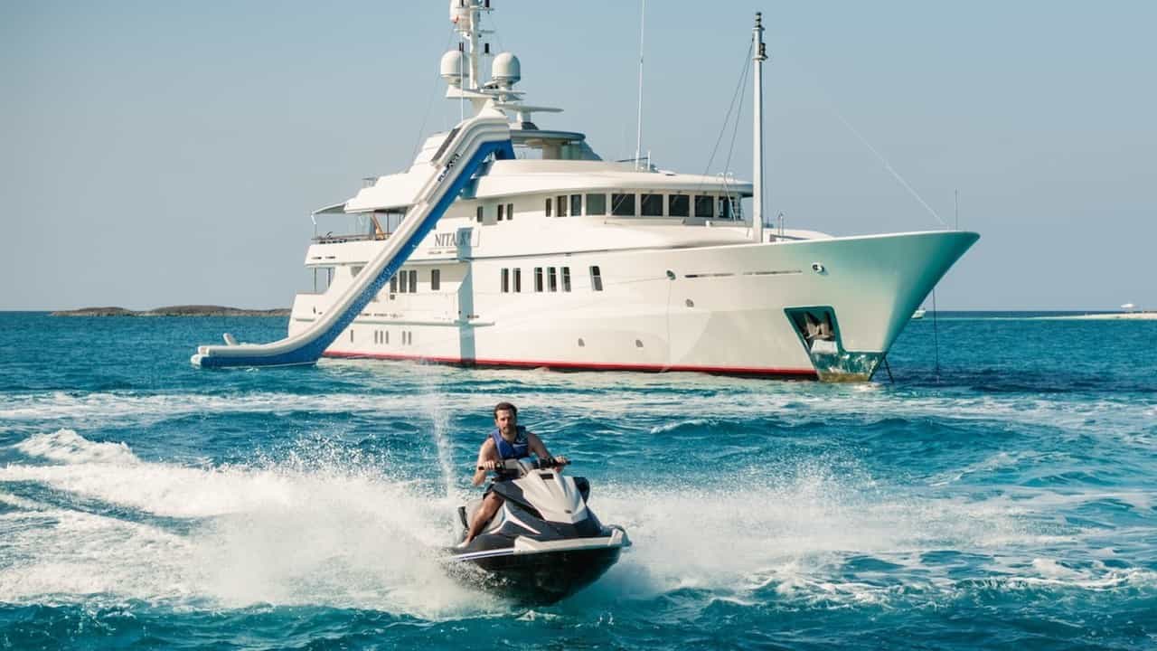
Positioned precisely where the flat, alluvial coastline of the Golfo de Valencia terminates against the dramatic limestone massifs of the Marina Alta, Denia serves as continental Spain’s primary springboard to the Balearic Islands. For skippered and bareboat itineraries alike, a Denia Yacht Charter yacht charter provides a rare combination of immediate deep-water access, robust maritime infrastructure, and exceptional coastal variety. With the 753-metre crag of Mount Montgó rising behind the harbour, the port provides shelter to over 700 berths capable of accommodating vessels up to 50 metres LOA, making it a critical hub for high-end Mediterranean cruising.
Beyond its logistical convenience, Denia sits at the epicenter of a distinct cruising region defined by bold headlands, turquoise coves cut into sheer cliffs, and a rich culinary culture rooted in its status as a UNESCO Creative City of Gastronomy. Understanding how to navigate this coast requires an appreciation of its unique local meteorology, environmental protections, and sea states. Whether conducting a coastal exploration along the cliffs of Cabo de la Nao or embarking on a 45-nautical-mile passage across the Ibiza Channel, a well-planned voyage from Denia yields some of the finest cruising on the Iberian peninsula.
The Nautical Landscape: Coastline, Capes, and Channels
The maritime geography around Denia is defined by two prominent limestone promontories: Cabo de San Antonio (Cap de Sant Antoni) and Cabo de la Nao (Cap de La Nau). North of Cabo de San Antonio, the coast consists of long, sandy beaches running toward Valencia, offering open roads but minimal natural protection from easterly swells. South of the cape, the character of the coastline changes radically. The terrain morphs into towering, karst-limestone cliffs, perforated by sea caves, narrow coves, and deep-water anchorages that extend south past Jávea, Moraira, and Calpe.
                  [ GOLFO DE VALENCIA ]
                            │
                       (  DENIA  )
                            │
               [ Cabo de San Antonio ]
                            │
                     ( Ensenada de )
                     (    Jávea    )
                            │
                 [ Cabo de la Nao ] ────> [ CANAL DE IBIZA ] ────> [ IBIZA / FORMENTERA ]
                            │
                     (  Moraira  )
                            │
                   [ Peñón de Ifach ]
                            │
                      (  Altea  )
The waters immediately off Denia transition rapidly from shallow coastal shelf to deep water. The continental shelf drops off sharply east of Cabo de la Nao, where depths exceed 100 metres within two nautical miles of the shore. This underwater topography directly influences local sea states. The body of water separating Denia from the Balearic archipelago is the Canal de Ibiza (Ibiza Channel). Spanning roughly 45 nautical miles to Es Vedrà and 55 nautical miles to Formentera, this passage acts as a major funnel for wind and wave energy moving between the Balearic Sea to the north and the Algerian Basin to the south.
For a captain, this geography dictates two distinct modes of operation: tight coastal navigation hugging the limestone lees of the Marina Alta, or blue-water passage making across an open channel where wind acceleration and wave amplification require precise weather routing.
Weather Patterns, Winds, and Sea States Month by Month
Navigating the waters surrounding Denia requires a nuanced understanding of the regional wind systems, which shift dramatically between seasons and are heavily influenced by the high topography of the mainland coast.
       [ TRAMONTANA / MISTRAL ]
              (NW / N)
                 │
                 ▼
 [ GARBÍ / LLEBEIG ] ◄─── (DENIA) ───► [ LEVANTE ]
     (SW Thermal)                        (E / NE Swell)
                 ▲
                 │
            [ LEBECHE ]
               (SW)
### Spring (April to May) Spring is a transitional season characterized by dynamic, fast-moving atmospheric fronts. Prevailing winds alternate between the Lebeche (a dry, southwest wind originating over North Africa) and short-lived Levante (easterly) gales. Air temperatures range from 18°C to 22°C, while sea surface temperatures hover around 16°C to 18°C. Swells can be irregular, particularly after a Levante event, which pushes a heavy, short-period easterly wave train into the coves of Jávea and Denia. Cruising in spring demands flexibility, as anchorages exposed to the east become untenable quickly.
### Summer (June to September) The primary cruising season delivers highly predictable weather patterns dominated by atmospheric stability and localized thermal sea breezes. Ambient air temperatures average 28°C to 32°C, with water temperatures peaking at 26°C to 27°C in August.
During mid-summer, the dominant thermal wind is the Garbí (also known locally as the Llebeig), a south-westerly to south-southwesterly breeze. The typical daily cycle unfolds as follows: 08:00 – 11:00:* Calm seas with light offshore catabatic breezes from the Montgó or southern mountain ranges. 12:00 – 14:00:* The Garbí builds steadily as the mainland heats up, reaching 12 to 18 knots by mid-afternoon. 15:00 – 17:00:* Peak wind strength, generating a moderate chop in open waters, though coastal waters under the lee of high cliffs remain flat. 18:00 onwards:* The breeze decays rapidly, returning to glass-like conditions by sunset.
The primary hazard in late August and September is the sudden development of a DANA (Depresión Aislada en Niveles Altos), or cold drop. These upper-level low-pressure systems can trigger severe convective thunderstorms, rapid wind reversals, and heavy localized downpours within a matter of hours.
### Autumn (October to November) As the heat of the interior landmass dissipates, thermal breezes weaken, and synoptic-scale weather systems regain dominance. The risk of sustained Levante (easterly) winds increases significantly. A strong Levante blowing across the long fetch of the Mediterranean can build seas of 2.5 to 4 metres against Cabo de San Antonio and Cabo de la Nao. Water temperatures remain surprisingly mild in October (21°C–23°C), but captains must monitor forecasts carefully for easterly depressions that close out coastal anchorages.
Primary Natural Anchorages and Shelter Profiles
The coast south of Denia features some of the eastern Iberian peninsula’s most dramatic anchorages. However, because these coves are carved into a east-facing coast, selecting the correct anchorage based on prevailing wind and swell direction is vital for safety and comfort on board.
### Cala Sardinera Situated immediately south of Cabo de San Antonio, Cala Sardinera is a classic day anchorage bounded by white limestone cliffs. Shelter:* Excellent protection from South, South-West, and West winds. Completely exposed to North, North-East, and East winds and swells. Seabed & Depth:* Sand and gravel mixed with areas of rock. Anchoring in depths between 6 and 10 metres yields good holding. Cruising Notes:* Because it sits directly under the lee of Cabo de San Antonio, it offers flat water during afternoon Garbí thermal winds. It is an ideal first stop when exiting Denia harbour bound south.
### Ensenada de Jávea (El Arenal & Cala Blanca) The broad sweep of Jávea Bay offers multiple anchoring zones depending on the draft of the yacht and the wind profile. Shelter:* Good protection from West, South-West, and South winds. The northern end near the commercial port offers partial shelter from North-West breezes. Exposed to Easterly sectors. Seabed & Depth:* Predominantly fine sand with exceptional holding power in 5 to 8 metres. Cruising Notes:* The central sand ring off El Arenal beach provides ample space for multiple large yachts to swing without risk of fouling. It is a reliable overnight anchorage during calm summer weather.
### Cala Portitxol (Cala de la Barraca) Flanked by the rugged Illa del Portitxol, this iconic cove features crystal-clear water set against steep pine-forested hills. Shelter:* Excellent protection from West and North-West winds. The island provides a natural breakwater against moderate southerly swells. Exposed to North-East and East swells. Seabed & Depth: Sand, stones, and scattered patches of Posidonia oceanica*. Depths range from 7 to 12 metres in the outer anchorage. Cruising Notes:* Do not attempt to navigate the narrow channel between Illa del Portitxol and the mainland; it is shallow, obstructed by rock ledges, and restricted to small tenders.
       [ MAINLAND CLIFFS ]
              │
  ( Anc. )    │   ( Shallow Rocks - No Passage )
  ( Zone ) ◄──┼─────────────────────────┐
              │                         │
              │                 [ Illa del Portitxol ]
              │                         │
              └─────────────────────────┘
                           ▲
                           │
                     [ Open Sea ]
### Cala Granadella A narrow, horseshoe-shaped fjord carved into the cliffs south of Cabo de la Nao. Shelter:* Superb shelter from North-West, North, and West winds. Exposed directly to South-East and East swells. Seabed & Depth:* Coarse sand and gravel in 6 to 10 metres. Cruising Notes:* Space inside the cove is limited. Large yachts should anchor outside the cove mouth in 12 to 15 metres and launch tenders to explore the inner cave structures, including the Cova del Llop Marí.
### El Portet de Moraira Located just north of the Port of Moraira, beneath the watchtower of Cap d'Or, El Portet is widely considered one of the most comfortable overnight anchorages on the Costa Blanca. Shelter:* Outstanding shelter from North, North-East, and East winds. Exposed to South and South-West breezes. Seabed & Depth:* Clear sand with depths of 5 to 8 metres. Holding is exceptionally reliable. Cruising Notes:* When the afternoon Garbí creates a chop in open water, El Portet remains tranquil under the lee of Cap d'Or. It is a favored anchorage for dinner on board or tendering ashore to Moraira's seafront restaurants.
Navigational Hazards, Traffic, and Environmental Regulations
Cruising off Denia demands rigorous attention to both physical hazards and increasingly strict marine conservation laws.
### Environmental Protections and Posidonia Regulations The marine waters surrounding Cabo de San Antonio and Cabo de la Nao contain protected meadows of Posidonia oceanica (seagrass), an eco-system essential to marine biodiversity and water clarity. Cap de Sant Antoni Marine Reserve: Stretching from Denia south to the Gulf of Jávea, this reserve strictly regulates fishing and anchoring. In primary zones, dropping an anchor on Posidonia is strictly prohibited and carries severe fines administered by the Servicio de Vigilancia Marina*. Mooring Buoys: To protect the seabed, designated eco-mooring buoy fields have been installed in high-density areas such as Cala Sardinera and Cabo de San Antonio. Captains should use these buoys where available or carefully verify that the anchor is dropped in designated sandy patches (clars*) clearly visible through the clear water.
### Local Hydrographic Hazards Cabo de la Nao Wind Acceleration:* As wind flows around the massive headland of Cabo de la Nao, it experiences a funneling effect. It is common to experience 12 knots of breeze north of the cape, which rapidly accelerates to 20+ knots as you round the point. The Portitxol Passage:* As noted, the gap between Illa del Portitxol and the coast is unnavigable for yachts. Depths fall below 1.5 metres over jagged reefs. Vessels must round the outer eastern edge of the island, giving its eastern headland a berth of at least 1 cable to clear submerged rocks. Low-Lying Trap at Punta del Castelló:* The reef extending off Punta del Castelló (near Jávea) sits just beneath the surface. Keep at least 0.3 nautical miles offshore when rounding this point.
### Commercial and Ferry Traffic Denia is a primary mainland terminal for fast ferries running to Ibiza (San Antonio and Ibiza Town) and Palma de Mallorca. Fast ferries depart from the inner harbour, transiting the main fairway channel at speeds up to 20 knots once past the outer breakwater. Fairway Caution:* Yachts entering or leaving Port de Dénia must monitor VHF Channel 11 or 16 and stay clear of the commercial fairway. The narrow channel between the north and south breakwaters leaves little room for maneuver when a 100-metre ferry is transiting.
Day-Hop Distances and Regional Routing
Denia's geographic location allows captains to structure itineraries that combine short coastal hops with longer open-water passages. Below are the key nautical distances from Denia Marina (Port de Dénia):
- Denia Harbour to Cabo de San Antonio: 3.5 NM
- Denia Harbour to Jávea (El Arenal): 8.5 NM
- Denia Harbour to Cabo de la Nao: 13.5 NM
- Cabo de la Nao to Cala Granadella: 2.5 NM
- Cabo de la Nao to El Portet de Moraira: 7.0 NM
- El Portet de Moraira to Peñón de Ifach (Calpe): 6.5 NM
- Peñón de Ifach to Altea Marina: 6.0 NM
- Denia Harbour to Es Vedrà (Ibiza): 44.0 NM
- Denia Harbour to La Savina (Formentera): 54.0 NM
- Denia Harbour to Marina Real Valencia: 46.0 NM (North)
- Denia Harbour to Alicante Marina: 52.0 NM (South)
[ VALENCIA ] ◄── 46 NM ─── ( DENIA ) ─── 44 NM ──► [ ES VEDRÀ / IBIZA ]
                            │
                          13.5 NM
                            │
                            ▼
                    [ Cabo de la Nao ]
                            │
                          13.5 NM
                            │
                            ▼
                    [ CALPE / ALTEA ] ─── 52 NM ──► [ ALICANTE ]
Captain’s Perspective: Executing a Masterful Seven-Day Itinerary
When orchestrating a luxury yacht charter out of Denia, a captain must balance guest preferences for swimming, dining, and sight-seeing with prevailing weather systems. Below is how a master captain plans a seamless seven-day summer itinerary, incorporating flexibility for both coastal and island conditions.
### Day 1: Embarkation in Denia and Warm-up Cruise to Cala Sardinera Guests board at Port de Dénia in the early afternoon. After safety briefings and settling into staterooms, the yacht slips its berths and runs 3.5 nautical miles south past the towering face of Mount Montgó.
The captain drops anchor in Cala Sardinera in 7 metres of water over clear sand. Guests enjoy an afternoon of water sports, swimming in the calm water sheltered from the afternoon Garbí breeze. As the sun sets behind the limestone cliffs, the yacht serves sunset cocktails on deck before slipping into the quiet waters of Jávea for a night at anchor or berthed in the marina.
### Day 2: The Caves of Cabo de la Nao and El Portet de Moraira Weighing anchor early, the yacht cruises south along the jaw-dropping coastline toward Cabo de la Nao. The tender is launched to explore the sea caves along the cliff face, including the spectacular Cova del Llop Marí.
By midday, the yacht rounds Cabo de la Nao, feeling the characteristic acceleration of wind, and runs 7 nautical miles southwest to El Portet de Moraira. Anchor is dropped in 6 metres of turquoise water. The chef prepares a lunch featuring locally sourced Denia red prawns (Gamba Roja de Dénia) paired with chilled Marina Alta white wine. The afternoon is spent paddleboarding around Cap d'Or before an evening meal on board under the stars.
[ DAY 1: Denia ] ──► [ Cala Sardinera ] ──► [ Jávea ]
                                                │
[ DAY 3: Calpe ] ◄── [ El Portet ] ◄────────────┘
       │
       ▼
[ DAY 4: Formentera / Espalmador ] ──► [ DAY 5: Ibiza West Coast ]
                                                │
[ DAY 7: Return to Denia ] ◄── [ DAY 6: Moraira/Jávea ] ◄─┘
### Day 3: The Icon of the Costa Blanca – Peñón de Ifach to Altea Leaving Moraira, the yacht executes a short 6.5-nautical-mile passage south to Calpe, dominated by the colossal 332-metre rock formation, the Peñón de Ifach. The captain anchors in the lee of the limestone monolith, where guests enjoy clear waters for snorkeling.
In the afternoon, the yacht cruises another 6 nautical miles into the sweeping Bay of Altea. The vessel secures a berth in the marina, allowing guests to go ashore and explore the whitewashed, cobbled streets of Altea’s historic hilltop town center, dining at high-end gastronomy venues offering traditional Arroz a Banda.
### Day 4: Crossing the Canal de Ibiza to Espalmador and Formentera With a stable weather window confirmed, the captain plans an early morning departure across the Ibiza Channel. Leaving the coast at 07:00, the yacht cruises at a comfortable 16–18 knots, completing the 54-nautical-mile passage to the uninhabited island of Espalmador, just north of Formentera, in roughly three hours.
The yacht anchors in the crystal-clear, shallow turquoise waters of S'Espalmador. Guests experience the contrasting landscape of the Balearic Islands, spending the afternoon on the white sand beaches before moving the short distance south to anchor off Formentera’s famed Playa de Ses Illetes.
### Day 5: West Coast of Ibiza – Es Vedrà and Cala d'Hort Leaving Formentera, the yacht turns northwest to cross the 12-nautical-mile stretch to the dramatic, mystical rock monolith of Es Vedrà, rising 413 metres straight out of the sea off Ibiza’s southwest coast.
The captain positions the yacht in the lee of Es Vedrà for photos and swimming, before moving into nearby Cala d'Hort or Cala Vadella for lunch. The afternoon is spent cruising up the rugged, pine-clad west coast of Ibiza, anchoring for the night off Cala Comte to capture one of the Mediterranean's most spectacular sunsets.
### Day 6: The Return Passage – Portitxol and Jávea At first light, the yacht begins its western passage back across the Ibiza Channel, making the 44-nautical-mile run back toward the mainland coast of Spain. The target is the dramatic anchorage of Cala Portitxol, tucked behind Illa del Portitxol.
Guests spend the late morning swimming in the shadow of the island and exploring the shoreline's traditional fisherman cottages (barracas). In the evening, the yacht moves to a secure anchorage in the Ensenada de Jávea or takes a berth in the Port of Jávea, enjoying a final celebratory dinner ashore featuring authentic Valencian culinary specialties.
### Day 7: Coastal Cruising and Disembarkation in Denia On the final morning, the yacht weighs anchor for a leisurely 8-nautical-mile return leg to Denia. The captain traces the base of the Cabo de San Antonio Marine Reserve, giving guests a final view of the dramatic sea cliffs.
The vessel enters Port de Dénia by mid-morning. Guests disembark with seamless private transfers arranged to Alicante or Valencia airports, completing an unforgettable voyage that showcased both the mainland's finest coastline and the open waters of the Balearic Channel.