
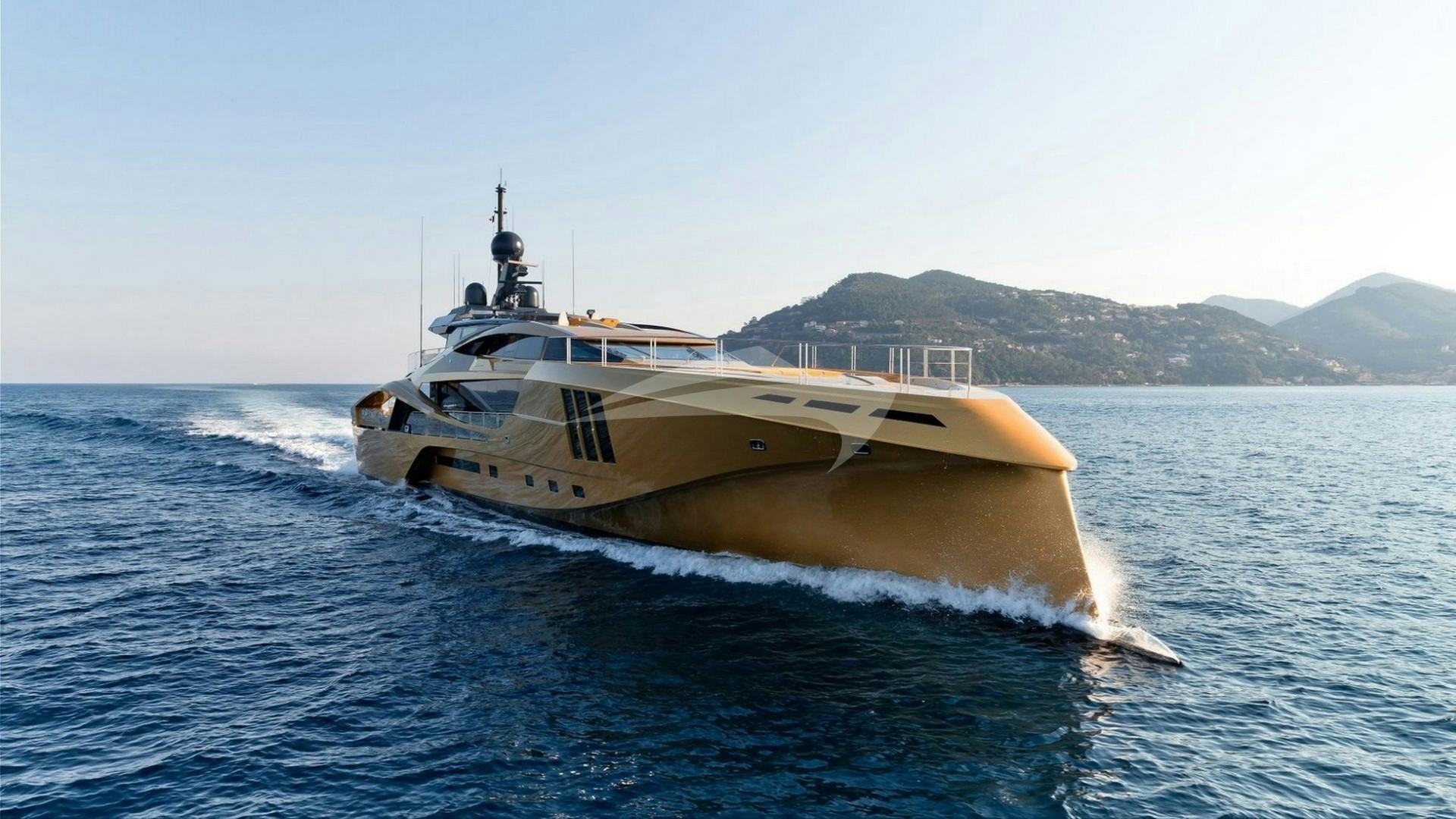
Occupying a commanding central position in the Split archipelago, Hvar is the geographic and social gravitational centre of Croatian yachting. Stretching 37 nautical miles from west to east, yet rarely exceeding 2.5 nautical miles in width, this narrow ridge of Cretaceous limestone acts as a natural breakwater between the Hvar Channel to the north and the Vis and Korčula Channels to the south. Executing a successful Luxury Yacht Charter Hvar yacht charter requires far more than booking a berth on the main town quay; it demands a thorough understanding of the complex local wind regimes, the precise holding characteristics of its limestone coves, and the strategic positioning required to navigate between the high-energy social hubs and the tranquil, sheltered anchorages of the surrounding waters.
Whether arriving under power from Split or under sail through the Splitska Vrata strait, captains approaching Hvar encounter a coastline of contrasts. The northern shore is deeply indented, carved into deep fjords and pine-covered coves that afford superb shelter from southern weather. The southern coast drops precipitously into deep water, offering dramatic sheer cliffs, terraced vineyards, and wild, exposed anchorages suitable only in settled summer conditions. Off the western tip lies the Pakleni archipelago, a labyrinth of fifteen islets and rocks that creates one of the most versatile cruising grounds in the entire Mediterranean.
                  BRAČ ISLAND
   ~~~~~~~~~~~~~~~~~ Hvar Channel ~~~~~~~~~~~~~~~~~
   (N)
    Cape Kabal        Stari Grad Bay      Vrboska    Jelsa
     /                 \____/               |         |
    Pelegrin Pt.          |                 |         |
     \               HVAR ISLAND (North Coast)--------+
      \
  [Pakleni Archipelago]---Hvar Town Port
    - Sv. Klement          |
    - Vinogradišće         |   HVAR ISLAND (South Coast)
    - ACI Palmižana        +--- Sv. Nedjelja --- Dubovica --- Šćedro Is.
   ~~~~~~~~~~~~~~~~~ Vis Channel ~~~~~~~~~~~~~~~~~~
   (S)
The Seaways and Coastal Topography of Hvar
Understanding the surrounding water bodies is essential for smooth passage planning around Hvar. The island separates two distinct marine environments, each governed by different microclimates and swell patterns.
The Hvar Channel (Hvarski Kanal) runs along the northern coast, bounded by the southern shore of Brač Island. This channel varies in width from three to six nautical miles. It acts as a wind funnel during northern weather events, generating short, steep seas when strong winds collide with outgoing currents. The northern coast features two major marine indentations: Stari Grad Bay, a five-nautical-mile deep fjord piercing the island's interior, and the narrower serpentine inlets of Vrboska and Jelsa further east.
The south coast faces the open waters of the Vis Channel (Viški Kanal) to the southwest and the Korčula Channel (Korčulanski Kanal) to the southeast. Here, depths drop off rapidly to over 80 metres within a cable of the shore. High cliffs shelter these waters from northerly winds, but leave them entirely open to southern swells. The western terminus of the island ends at Cape Pelegrin (Rtić Pelegrin), a low-lying, wooded headland that marks the transition into the Pakleni Channel (Paklinski Kanal) and the approach to Hvar Town.
The Pakleni Archipelago—often mistranslated as the "Hell's Islands," though the name derives from pakina, the pine resin historically harvested here to coat ship hulls—stretches six nautical miles southwest into the Adriatic. Comprising islands such as Sveti Klement, Marinkovac, Jerolim, and Vodnjak Veli, this archipelago forms a dense network of channels, coves, and shallow passages. It provides a natural barrier against heavy seas, creating an array of micro-anchorages that accommodate vessels ranging from 15-metre sailing catamarans to 80-metre superyachts.
Wind Systems, Sea States, and Seasonal Weather Patterns
Cruising conditions in the waters around Hvar from May through October are dominated by three principal wind systems. Recognizing the onset of these winds allows a yacht's captain to shift position before sea conditions deteriorate.
### The Maestral (Summer Thermal) The Maestral is the dominant summer wind, driven by daytime temperature differentials between the landmass and the open sea. Typically setting in by 10:00 or 11:00 from the northwest, it steadily builds to 15–22 knots by mid-afternoon before dying away completely by sunset. The Maestral creates ideal, predictable sailing conditions across the Hvar and Vis Channels. Outside the shelter of Cape Pelegrin, it generates a moderate, comfortable chop of 0.5 to 1.2 metres. Cruising vessels should schedule long passages across open channels during the morning lull or leverage the afternoon Maestral for swift, exhilarating sail legs.
### The Bura (Northeasterly Katabatic) The Bura is a cold, dry wind that cascades down from the coastal Dinaric Alps, specifically breaking through the mountain passes behind Makarska and Split. While less frequent in mid-summer (July and August), an offshore summer Bura can strike with little warning, blowing across the Hvar Channel at speeds exceeding 35–40 knots in violent gusts. The skies remain clear and atmospheric visibility is exceptional, but the wind creates a white-water sea state with short, sharp waves. When a Bura is forecast, all anchorages along Hvar's northern coast become untenable. Vessels must seek shelter in the southern bays of Sveti Klement, Stari Grad’s deep inner harbour, or behind the high southern ridges of Šćedro Island.
### The Jugo (Sirocco / Southeasterly) The Jugo is a warm, humid wind blowing from the south-southeast across the Mediterranean basin. Unlike the sudden onset of the Bura, the Jugo builds slowly over two to three days, bringing cloud cover, rising atmospheric pressure drop, and a heavy, persistent southern swell. A fully developed Jugo brings winds of 20–30 knots and generates large waves that roll directly into the south-facing bays of Hvar and the Pakleni Islands, including Vinogradišće. When the Jugo blows, south-facing anchorages must be abandoned immediately in favour of northern havens like ACI Marina Palmižana or the protected coves inside Stari Grad Bay.
Seasonal Cruising Conditions by Month
- May and June: Uncrowded sea lanes, moderate thermal winds, sea temperatures rising from 18°C to 22°C. Settled atmospheric conditions with occasional late-spring fronts. Anchorages and town quays are easy to secure without long-term planning.
- July and August: High summer conditions. Sea temperatures peak at 25–27°C. Reliable afternoon Maestral (12–20 knots). Rare, short-lived afternoon thermal squalls (Neverin) can strike from the west, bringing localized 40-knot gusts for 30–45 minutes. Town quays and buoy fields reach maximum capacity by 14:00 daily.
- September and October: Warm waters (21–24°C), declining ambient air temperatures, shifting wind patterns with a higher frequency of light southeasterly and northeasterly breezes. Exceptional cruising for experienced sailors seeking quiet anchorages and unhurried shore excursions.
Essential Anchorages and Port Infrastructure
### Hvar Town Port Hvar Town harbour is the social heart of the region, dominated by the 16th-century Spanish Fortress (Fortica) standing above the marble Riva. The port provides stern-to mooring for approximately 15 to 20 luxury yachts on the main quay, with water and three-phase electricity connections. Docking here puts guests directly on the promenade.
The port is completely exposed to the south and southwest. A westerly or southwesterly wind (Libeccio/Garbin) sends a dangerous, rolling surge directly onto the Riva, making berths unviable and forcing vessels to drop lines and proceed to open sea or Palmižana. Stern-to berths must be reserved well in advance through local port agents or direct pilot communications. Anchoring in the central basin of Hvar Town harbour is strictly prohibited to maintain clear fairways for ferry traffic and tenders.
       [ACI MARINA PALMIŽANA]
       (Protected from S/SE)
                 |
        ===================  Sveti Klement Island
                 |
      [UVALA VINOGRADIŠĆE]
      (Protected from N/NW/NE)
### Vinogradišće Bay (Uvala Vinogradišće - Sv. Klement) Located on the southern coast of Sveti Klement island directly opposite Hvar Town, Vinogradišće is the premier natural anchorage for luxury yachts visiting the area. This deeply cut bay features a seabed of fine sand and mud, offering superb holding in depths between 6 and 14 metres.
- Protection: Excellent shelter from northern, north-western, and north-easterly winds (Maestral and Bura).
- Exposure: Completely vulnerable to southeasterly and southerly winds (Jugo), which force a heavy, dangerous swell into the bay.
- Mooring: A commercial buoy field operates throughout the summer season. Yachts anchoring in the outer bay must deploy long shore lines to the granite rocks or pine trunks along the eastern or western shores to prevent swinging in close proximity to other yachts.
- Tender Route to Hvar: Guests can step ashore for beachfront dining or take a 10-minute water taxi round Cape Pelegrin directly into Hvar Town harbour.
### ACI Marina Palmižana Located on the northern coast of Sveti Klement, directly across the narrow spine of the island from Vinogradišće, ACI Marina Palmižana offers 180 berths equipped with water and electricity for vessels up to 40 metres in length (larger yachts can lay along the outer breakwater by prior arrangement).
- Protection: Exceptional shelter against southern, south-easterly, and south-westerly winds.
- Exposure: Strong north-easterly Bura winds create a heavy chop in the entrance channel and send surge onto the northern pontoons.
- Infrastructure: High-standard facilities, pine-forested grounds, access to botanical gardens, and direct footpaths connecting across the island to Vinogradišće's southern beach restaurants.
### Taršće and Škorpion Bays (Sv. Klement) For charterers seeking absolute privacy away from beach clubs, Taršće Bay—located two nautical miles west of Vinogradišće on the south side of Sveti Klement—is an exemplary anchorage. The cove cuts deep into the island's southern hills, offering clear turquoise water over a white sand seabed with depths ranging from 8 to 15 metres.
- Protection: Secure in all northerly and easterly breezes.
- Seamanship: Drop anchor in 10 metres in the middle of the inlet and take two floating shore lines to the rock faces on the western arm to hold the vessel's bow into the afternoon thermal wind.
### Stari Grad Bay (Starogradski Zaljev) Stari Grad Bay on the north coast is a deep, four-nautical-mile fjord that terminates at the ancient town of Stari Grad, a UNESCO World Heritage site founded by the Greeks in 384 BC.
- Town Quay: The newly upgraded harbour quay provides stern-to mooring with lazy lines, power, and water for vessels up to 50 metres, completely sheltered from all winds except extreme westerly gales.
- Northern Coves (Tiha, Gračišće, Maslinica): Deeply indented coves along the northern shore of the fjord offer organized buoy fields and calm anchorages surrounded by dense pine forests. Tiha Bay comprises five distinct sub-coves, providing complete protection from the Bura and Maestral.
                   [Tiha Bay]
                 /            \
   Stari Grad   <              > [Outer Fjord Entrance]
     Harbour     \            /
                   [Gračišće]
### Šćedro Island (Uvala Lovišće and Mostir) Located off the southern coast of Hvar, separated by the 1.5-nautical-mile-wide Šćedro Channel, this uninhabited island is a peaceful, undisturbed haven.
- Uvala Lovišće: A deeply cut northern bay with four distinct branches. The holding is excellent in clay and mud at depths of 6 to 10 metres. The bay offers reliable shelter from the Maestral and open southern weather, though it can suffer from katabatic gusts during a severe Bura.
- Uvala Mostir: Located on the northeast coast, featuring the stone ruins of a 15th-century Dominican monastery and a small buoy field protected from westerly winds.
Navigational Hazards and Local Piloting
Navigating the waters surrounding Hvar and the Pakleni Archipelago requires close attention to detail, as shallow reefs, narrow passages, and high-density marine traffic present real challenges.
- Plić Mlin Reef (Vodnjak Veli): Located 0.4 nautical miles west-northwest of Vodnjak Veli island at the western tip of the Pakleni group. This hazardous shallow reef drops to less than 1.8 metres of water and is marked by an isolated danger mark (Fl(2) W 6s). Yachts entering the Pakleni Channel from the west must give this reef a wide berth of at least half a nautical mile.
- Ždrilca Passage: The narrow channel passing between Marinkovac and Planikovac islands. While extremely scenic, the navigable depth drops to 2.2 metres in the central fairway, and currents can reach up to 2.5 knots during spring tides or period wind shifts. Motor yachts with drafts exceeding 1.8 metres and large sailing yachts should avoid this passage entirely and use the deeper fairway around Jerolim Island.
- Pokonji Dol Light: Situated on the islet of Pokonji Dol, marking the eastern entrance to the Hvar Town roadstead. The light (Fl G 3s 9m 4M) must be left well to starboard when approaching Hvar Town from the east. The passage between Pokonji Dol and the Hvar coast is deep and clear, but watch for high-speed local water taxi traffic operating between 18:00 and 02:00.
- Plić Baba: A submerged rock hazard located off the northern point of Marinkovac Island in the Ždrilca approach, marked by a cardinal mark. Keep strictly within the buoyed fairway when approaching from the north.
- Shore Line Mooring Protocol: When anchoring in narrow Dalmatian coves such as Taršće, Tiha, or Lučišće, standard protocol requires swinging room to be limited by taking two stern lines ashore. Use high-visibility floating orange line (minimum 50 metres per side) secured around granite rock horns or lower tree trunks using a round turn and two half-hitches. Never tie to soft sandstone or young pine trees.
Day-Hop Passage Distances
Planning an efficient itinerary around Hvar involves balancing short, relaxing morning hops with clear afternoon sailing legs. Below are exact passage distances between key points of interest:
- Hvar Town Quay to Vinogradišće Bay (Sveti Klement): 2.4 NM
- Hvar Town Quay to ACI Marina Palmižana: 2.8 NM
- Hvar Town Quay to Stari Grad Harbour (via Cape Pelegrin): 15.2 NM
- Hvar Town Quay to Bol (Brač Island / Zlatni Rat): 14.8 NM
- Hvar Town Quay to Vis Town Harbour (Vis Island): 18.5 NM
- Hvar Town Quay to Komiža Harbour (Vis Island): 26.2 NM
- Hvar Town Quay to Lučice Bay (Brač Island): 11.2 NM
- Stari Grad Harbour to Vrboska Inlet: 12.5 NM
- Hvar Town Quay to Šćedro Island (Uvala Lovišće): 13.6 NM
- Hvar Town Quay to Korčula Town Pier (Korčula Island): 32.1 NM
- Split Airport Base (Trogir/Marina Kaštela) to Hvar Town: 24.5 NM
How a Captain Plans a 7-Day Hvar-Centric Itinerary
A realistic, high-end 7-day charter itinerary centered on Hvar balances vibrant shore experiences, quiet swim stops in secluded bays, and manageable sea legs. The following outline demonstrates how a captain adapts to the regional wind systems across a typical mid-summer week starting and finishing in Split or Trogir.
Split/Trogir (Day 1) ──> Brač/Lučice (Day 1) ──> Bol/Pakleni (Day 2) ──> Hvar Town (Day 3)
                                                                             │
Split Base Return (Day 7) <── Šolta/Maslinica (Day 6) <── Vis Island (Days 4-5) ┘
### Day 1: Embarkation at Split/Trogir to South Brač (Lučice Bay) Morning:* Embark guests at 14:00. Clear port formalities and conduct the safety briefing. Afternoon:* Cast off for an initial 14-nautical-mile passage across the Split Channel and through the Splitska Vrata pass. Drop anchor in Lučice Bay on the south coast of Brač. Evening:* Secure stern lines to the pine trees in the western arm of Lučice. Enjoy fine dining aboard or at a waterfront konoba serving fresh peka. Excellent protection from northerly winds.
### Day 2: Brač to Hvar South Coast and the Pakleni Archipelago Morning:* Early morning sail (9 NM) to the famous Zlatni Rat spit near Bol for an uncrowded morning swim before tourist boats arrive. Midday:* Cruise south across the Vis Channel (8 NM) to Hvar's south coast. Anchor below the dramatic cliffside vineyards of Sveta Nedjelja for lunch and a sampling of local Plavac Mali wines. Afternoon:* Round Cape Pelegrin into the Pakleni Archipelago. Take up a pre-booked mooring buoy in Vinogradišće Bay or a berth at ACI Marina Palmižana. Evening:* Tender transfers for guests to Vinogradišće's beachfront lounge venues, followed by late-night drinks overlooking the bay.
### Day 3: Pakleni Exploration and Hvar Town Immersion Morning:* Weigh anchor and shift position two nautical miles west to the pristine waters of Taršće Bay. Deploy water toys, paddleboards, and seabobs in 8 metres of translucent water over white sand. Afternoon:* At 15:00, bring the vessel into Hvar Town harbour to secure a reserved berth on the main Riva promenade. Guests spend the afternoon exploring the Venetian alleyways, climbing to the Fortica Fortress for views over the Pakleni Islands, and shopping in local boutiques. Evening: Dine ashore at one of Hvar Town's high-end seafood establishments, enjoying local dentex (zubatac*) cooked in a salt crust, followed by entry to the town's exclusive night venues.
### Day 4: Hvar to Vis Island and the Blue Cave (Biševo) Morning: Depart Hvar Town early (07:30) for a 22-nautical-mile open-water passage southwest to Biševo Island. Arrive early to view the natural light displays inside the Blue Cave (Modra Špilja*) before peak congestion. Midday:* Cruise to the south coast of Vis Island, anchoring briefly in the amphitheatrical cove of Stiniva Bay or Budikovac Lagoon for a swim stop. Afternoon/Evening:* Proceed to Komiža or Vis Town quay (10 NM), securing the yacht stern-to. Guests take a land tour of the island’s secret military tunnels and former submarine pens.
### Day 5: Vis Island to Šćedro Island and Stari Grad Morning:* Set sail from Vis back toward Hvar's southern coast (18 NM). Anchor in Uvala Lovišće on Šćedro Island for an undisturbed lunch, swimming, and tender excursions along the wild coastline. Afternoon:* Catch the building afternoon Maestral wind to round the eastern headlands or double back around Cape Pelegrin to enter the deep inlet of Stari Grad Bay (16 NM). Secure a berth on the quiet Stari Grad town quay. Evening: Guests walk through the stone alleyways of the 2,400-year-old town, dining in private courtyard gardens serving traditional Dalmatian gregada* fish stew.
### Day 6: Stari Grad North Coast Coves to Šolta Island Morning:* Unmoor and spend the morning exploring the secluded north-coast coves of Stari Grad Bay, such as Uvala Tiha or Cable Bay. Enjoy an extended water sports session. Afternoon:* Set a north-westerly course (16 NM) across the Hvar Channel toward the island of Šolta. Enter the picturesque harbour of Maslinica, berth at the heritage hotel marina, or anchor in the lee of the surrounding islets. Evening:* Sunset cocktails on deck overlooking the western islets of Šolta, followed by a formal dinner at the restored 17th-century Marchi Castle estate.
### Day 7: Šolta to Split/Trogir Disembarkation Morning:* Enjoy a final relaxed swim in Šolta's Šešula Bay. Cast off at 09:30 for a gentle 10-nautical-mile run back across the Split Channel to the home marina base. Disembarkation:* Complete fuel bunkering, clear formalities, and disembark guests by 12:00 for outbound transfers to Split Airport.
Gastronomy and Shore Experience for the Yachting Guest
A luxury charter along Hvar’s coast offers rich culinary experiences rooted in centuries of island tradition. The island's geography—steep sunny hillsides dropping straight into clean, mineral-rich waters—yields world-class produce, wine, and seafood that taste best when sampled directly from the coast.
Signature Culinary Specialties
- Hvarska Gregada: The benchmark dish of Hvar's maritime heritage. Unlike standard tomato-based fish soups, Gregada is a delicate stew cooked with white fish (scorpionfish, sea bass, or dentex), sliced potatoes, onions, garlic, top-quality local olive oil, and white wine, simmered slowly in a wide flat pan over an open fire.
- Peka: Octopus, veal, or lamb slow-roasted under a heavy bell-shaped iron dome (čripnja) covered in hot embers. The meat cooks in its own juices alongside potatoes and wild herbs for over two hours. Requires advance ordering through your yacht's concierge or captain.
- Adriatic Crustaceans: Native langoustines (škampi) sourced from deep water channels, served raw with a drizzle of lemon and mono-cultivar olive oil, or lightly pan-fried na buzara with white wine, garlic, and breadcrumbs.
       [SOUTH-FACING VINEYARDS]
       (Sveta Nedjelja & Ivan Dolac)
                 │
                 ├──> Plavac Mali (Bold Reds)
                 │
       [STARI GRAD UNESCO PLAIN]
                 │
                 └──> Bogdanuša & Prč (Crisp Whites)
### Viniculture and Shore Tastings Hvar boasts one of the oldest wine-making traditions in the Mediterranean, dating back to ancient Greek settlers. The island’s unique microclimates produce two distinct wine styles that every charter guest should sample:
- Plavac Mali: Grown on the near-vertical, sun-baked southern slopes between Sveta Nedjelja and Ivan Dolac. The vines absorb direct sunlight as well as light reflected off the sea. Plavac Mali is an offspring of Zinfandel, delivering full-bodied, ruby-red wines packed with dark fruit, figs, sea salt, and dry Mediterranean herbs. Vessels can anchor off Sveta Nedjelja to access waterfront tasting rooms where barrels age below sea level.
- Bogdanuša and Prč: Native white grape varieties cultivated primarily on the flat, stone-walled Stari Grad Plain. Bogdanuša (meaning "God's gift") yields a pale, crisp, highly refreshing white wine with stone-fruit notes and bright acidity—the ideal pairing for seafood lunches served on deck.
By combining detailed navigational preparation, a respect for regional weather dynamics, and an appreciation for the island's unique shoreside character, a Luxury Yacht Charter Hvar yacht charter provides a seamless, world-class cruising experience across one of the Mediterranean's finest archipelagos.