
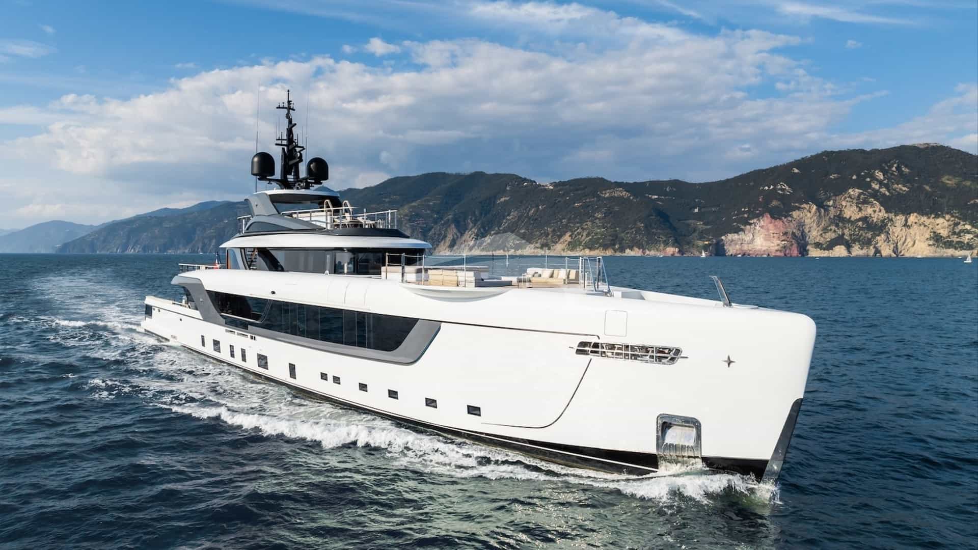
Where the North Atlantic squeezes through the Pillars of Hercules into the Alboran Sea, the coastline of Northern Morocco presents one of the most hydrographically dynamic cruising environments in the western hemisphere. This maritime crossroads—the gateway between Western Europe, North Africa, and the broader Mediterranean basin—combines deep ocean currents, dramatic mountain topographies, and centuries of maritime history. For superyacht owners and charterers seeking an alternative to the worn tracks of the Western Mediterranean, this region offers an authentic maritime frontier anchored by modern infrastructure.
Executing a successful itinerary here requires an understanding of complex wind funnels, tidal streams, and regional customs protocols. Unlike the landlocked basins of the French Riviera or the sheltered archipelagos of Greece, northern Morocco sits at a meteorological valve. Selecting a Morocco Atlantic Gate Yacht Charter yacht charter itinerary allows captains to exploit two completely different marine weather regimes within a single afternoon's passage, shifting from Atlantic ocean swells off Cap Spartel to the protected, warm waters of the Mediterranean's Tamuda Bay.
The Hydrography and Coastal Dynamics of the Strait Gateway
The charter ground spanning Cap Spartel on the Atlantic coast to Marina Smir on the Mediterranean side is defined by the physical geometry of the Strait of Gibraltar. At its narrowest point, between Point Cires in Morocco and Point Marroquí in Spain, the Strait measures just 7.7 nautical miles across. This geographical pinch-point acts as a natural pressure valve for both air masses and oceanic currents.
The Atlantic Ocean maintains a constant surface influx into the Mediterranean Sea to replace water lost to evaporation. This primary surface current sets steadily eastward along the Moroccan shore at speeds ranging from 1.5 to 3 knots. However, this eastward flow is heavily modified by semi-diurnal tides. During the flood tide, the current accelerates significantly, while the ebb tide generates complex counter-currents and inshore eddies close to the Moroccan headlands, particularly inside Tangier Bay and around Cap Malabata.
The sea bed drops precipitously off the northern Moroccan coast. Within two nautical miles of the shore off Ksar es-Seghir, depths reach over 500 metres. This submarine topography prevents shallow-water wave shoaling offshore, but where deep ocean trenches meet the abrupt rise of coastal shelves—such as off Cap Spartel—steep, short seas can build rapidly when wind direction opposes the prevailing current.
Prevailing Wind Regimes and Seasonal Conditions
Maritime weather in northern Morocco is dominated by two primary wind patterns: the Levanter and the Ponente, supplemented periodically by the Saharan Chergui. Understanding these seasonal and local wind phenomena is critical for planning comfortable coastal passages and anchorage selection.
### The Levanter (Easterly) The Levanter is an easterly wind that originates in the Central Mediterranean and funnels through the gap between the Rif mountains of Morocco and the Baetic System of Southern Spain. As it compresses through the Strait, it accelerates. A mild 12-knot breeze off Cabo de Gata can intensify to 30 knots or more by the time it reaches Tangier Bay.
The Levanter is most prevalent from June through August. It creates a short, steep chop in the Strait and causes a persistent low-level cloud banner over Jebel Musa (the northernmost peak of the Rif range). While the Levanter makes Atlantic-bound transits uncomfortable, it leaves the Mediterranean-facing coast south of Ceuta—including Marina Smir and Tamuda Bay—in a smooth, calm lee.
### The Ponente (Westerly) The Ponente brings cool air masses and long-period ocean swells from the open Atlantic into the gateway. Prevalent during spring, autumn, and winter, it occasionally asserts itself during summer months between Levanter cycles. Moderate Ponente conditions (12–18 knots) deliver exceptional clarity, warm land breezes along the Atlantic shore, and smooth sailing condition inside the Strait. However, heavy Ponente gales generate substantial swells that break heavily along the Atlantic coast off Asilah and make Cap Spartel untenable for close-quarters coastal cruising.
### The Chergui (Southeasterly) The Chergui is a hot, dry continental wind blowing directly off the Sahara Desert. Most common in late spring and mid-summer, it can raise coastal air temperatures past 35°C within hours. While it generally brings flat sea conditions along the Moroccan coastline, it carries fine Saharan dust that drastically reduces visibility and requires crew to wash down teak decks and paintwork frequently.
### Month-by-Month Cruising Conditions April – May*: Transitional period. Variable winds alternating between moderate Ponente and early Levanter cycles. Air temperatures average 20–24°C; sea surface temperatures hover around 17°C. Ideal for combined Mediterranean-Atlantic coastal passages, provided weather windows across the Strait are monitored for spring low-pressure systems. June – August*: Peak summer season. Dominant Levanter winds in the Strait, with exceptionally reliable afternoon sea breezes along the Mediterranean coast. Air temperatures reach 28–32°C, while Mediterranean sea temperatures rise to a comfortable 23–25°C. High sunshine hours and virtually zero rainfall make this the premier window for luxury charter operations. September – October*: The optimum window for experienced mariners. The Levanter softens, giving way to light, variable breezes and stable Atlantic high-pressure systems. Sea temperatures remain warm (22–24°C), and water clarity along the Rif coast reaches its annual peak. November – March*: Winter conditions. Strong Atlantic depressions bring heavy westerly swells and rain squalls. Commercial yacht operations generally pause, with yachts utilizing secure berthing hubs like Tanja Marina Bay for winter maintenance or cross-Atlantic layovers.
Ports, Berthing Facilities, and Superyacht Infrastructure
The northern coast of Morocco has undergone a major transformation in marine infrastructure over the past decade, shifting from utilitarian fishing harbours to modern, fully equipped superyacht destinations.
Tanja Marina Bay sits directly at the foot of Tangier’s historic Kasbah. Built into the footprint of the city's old commercial port, it is Africa's first urban marina structured specifically to international luxury standards. The facility includes dedicated quays engineered for large private vessels, featuring 40 recorded superyacht berths capable of handling yachts up to 50 metres LOA, alongside options for larger vessels along the outer commercial walls. High-capacity three-phase power, high-flow bunkering stations, greywater discharge facilities, and 24-hour physical security are fully integrated.
Further east along the Mediterranean coast lies Marina Smir, situated at the heart of the Tamuda Bay resort corridor. Protected by two substantial concrete breakwaters, Marina Smir offers a classic Mediterranean port feel. While draft limitations inside the main basin restrict entry for vessels drawing over 2.5 metres, the port's outer berths accommodate medium-sized luxury yachts. Its proximity to luxury beach clubs, golf courses, and five-star wellness resorts makes it an ideal stop for guest excursions.
For vessels exploring the Atlantic flank, the harbour at Asilah provides emergency shelter and tender drop-off options, though its shallow entrance channel requires careful tide-height calculations and local pilotage advice for draft-conscious vessels.
Natural Anchorages, Coastal Shelter, and Seabed Holding
While modern berths provide shore-side luxury, the true reward of a North African charter lies in its secluded roadsteads and bays. Navigating these waters requires choosing anchorages that match the prevailing wind system.
### Tangier Bay (Baie de Tanger) Tangier Bay is a expansive horseshoe curve bounded by Cap Malabata to the east and the city quay to the west. It provides excellent holding in stiff mud and fine sand in depths between 8 and 14 metres. Shelter*: Complete protection from South, South-West, and West winds. Exclusion*: Exposed to North and North-East winds. A heavy Levanter creates a persistent, uncomfortable roll inside the bay, making the outer roadstead unviable for overnight stays.
### Dalia Bay (Ensenada de Dalia) Located just east of Cap Malabata, short of the commercial infrastructure of Tangier-Med, lies Dalia Bay. Characterised by a sandy beach and green coastal hills, this bay offers clear, turquoise water over a seabed of packed white sand with excellent holding in 6 to 10 metres. Shelter*: Superb protection against South, South-West, and Westerly (Ponente) winds. Exclusion*: Open to the East and North-East.
### Asilah Outer Roadstead Located 1.5 nautical miles off the whitewashed ramparts of Asilah on the Atlantic side, this open roadstead features a sandy bottom in 10 to 12 metres of water. Shelter*: Suitable only as a day-use fair-weather anchorage during light land breezes or settled summer high-pressure systems. Exclusion*: Completely exposed to Atlantic swells from the West and North-West.
### Cala Iris and the Rif Coast Bays Situated roughly 85 nautical miles east of the Strait along the Mediterranean coast within the Al Hoceima region, Cala Iris is a pristine natural bay sheltered by offshore islets (Isla de Tierra and Isla de Mar). The seabed consists of coarse sand and rock, offering secure holding in 8 to 12 metres. Shelter*: Excellent shelter from South, South-West, and West winds, with partial shelter from North-Westerly swells provided by the islands. Exclusion*: Exposed to heavy Easterly blows.
Key Anchorage Summary
- Tangier Bay: Mud/Sand seabed (8–14m depth); ideal shelter during SW–W breezes; exposed to NE Levanter swell.
- Dalia Bay: Fine Sand seabed (6–10m depth); ideal shelter during W–NW Ponente; exposed to Easterly winds.
- Cala Iris: Sand/Rock seabed (8–12m depth); ideal shelter during S–W conditions; exposed to strong Easterlies.
Navigational Hazards and Captains' Considerations
Navigating the waters surrounding the Morocco Atlantic Gate requires rigorous bridge watchkeeping and dynamic passage planning. The Strait of Gibraltar is one of the densest shipping corridors in the world, with over 100,000 commercial vessel transits recorded annually.
The primary hazard is the Traffic Separation Scheme (TSS) enforced across the central Strait. Superyacht captains crossing between Europe and Africa must adhere strictly to Rule 10 of the International Regulations for Preventing Collisions at Sea (COLREGs), crossing the traffic lanes at an angle as close to 90 degrees to the general direction of traffic flow as possible. High-speed passenger ferries operate continuously between Tangier-Med, Algeciras, Tarifa, and Ceuta, travelling at speeds up to 38 knots. Bridge teams must maintain active radar tracking and continuous VHF monitoring on Channels 13 and 16.
Another localized hazard unique to this coastline is the presence of Almadraba seasonal tuna trap nets. Deployed between late March and July, these massive networks of floating lines, heavy cables, and underwater netting extend up to 3.5 nautical miles off key headlands, particularly around Cap Spartel, Cap Malabata, and Barbate on the Spanish coast. The outer perimeter of an Almadraba is marked by small buoyage that can be difficult to pick up on surface radar in rough seas. Captains must cross-reference official Admiralty Hydrographic Notices to Mariners and maintain a generous off-shore distance when rounding these headlands.
Tidal races and standing overfalls present a physical challenge for smaller tenders and shallow-draft chase boats. Off Cap Spartel, the convergence of the ebbing Strait current and incoming Atlantic ocean swells creates a churned sea area known locally as El Cabozo. Similarly, off Point Cires, spring ebb tides running against a strong Easterly wind generate steep standing waves up to three metres high.
Day-Hop Distances and Transit Vectors
Cruising itineraries in this region benefit from short, high-impact day hops that allow charter guests to experience distinct cultures and topographies without long ocean passages.
- Tanja Marina Bay (Tangier) to Cap Spartel: 10 nautical miles (approx. 45 minutes at 14 knots)
- Tanja Marina Bay to Asilah: 28 nautical miles (approx. 2 hours at 14 knots)
- Tanja Marina Bay to Dalia Bay: 16 nautical miles (approx. 1 hour 10 minutes at 14 knots)
- Dalia Bay to Marina Smir: 22 nautical miles (approx. 1 hour 30 minutes at 14 knots)
- Marina Smir to Ceuta: 9 nautical miles (approx. 40 minutes at 14 knots)
- Tanja Marina Bay to Gibraltar: 32 nautical miles (approx. 2 hours 15 minutes at 14 knots)
- Tanja Marina Bay to Puerto Banús: 58 nautical miles (approx. 4 hours at 14 knots)
A Master Captain’s Seven-Day Itinerary Architecture
Executing a charter through the Morocco Atlantic Gate requires built-in flexibility to switch between Atlantic and Mediterranean waters depending on the wind state. The following seven-day master plan demonstrates how a captain balances open-water transits with protected anchorages.
### Day 1: Embarkation in Tangier Guests join the yacht at Tanja Marina Bay. Following safety briefings and welcome drinks on the sun deck, the afternoon is spent exploring the Grand Socco, the historic Kasbah, and the restored American Legation in Tangier's old medina. The yacht remains comfortably berthed in the marina overnight, offering guests an introduction to Moroccan fine dining featuring locally sourced seafood tagines and saffron-infused pastries prepared by the onboard chef.
### Day 2: Tangier to Asilah (Atlantic Passage) Under morning light, the yacht drops lines and heads west out of Tangier Bay, rounding the dramatic lighthouse at Cap Spartel—the northwesternmost tip of mainland Africa. The passage down the Atlantic coast covers 28 nautical miles, taking the yacht past rolling sand dunes and expansive beaches. The yacht drops anchor in the roadstead off Asilah. Guests tender ashore to walk through the fortified Portuguese ramparts, renowned for their vibrant mural art and quiet whitewashed lanes. Rejoining the vessel for dinner, the yacht anchors overnight off the beach, enjoying the long Atlantic sunset.
### Day 3: Asilah to Dalia Bay via Cap Spartel The vessel weighs anchor early to capitalise on calm morning sea states along the Atlantic coast. Rounding Cap Spartel back into the Strait of Gibraltar, the bridge team coordinates with Tangier VTS as the yacht routes past the high limestone cliffs of the Moroccan coastline. By mid-afternoon, the yacht glides into the sheltered turquoise horseshoe of Dalia Bay. The crew deploys the water toys—jet skis, paddleboards, and sea bobs—in the calm, crystal-clear water under the lee of the headland. Anchor is set for a peaceful overnight stay in 8 metres of clear sand.
### Day 4: Transit through the Strait to Marina Smir Leaving Dalia Bay, the passage continues eastward past the commercial hub of Tangier-Med and the steep precipices of Jebel Musa. The yacht crosses the invisible boundary between the Atlantic Ocean and the Mediterranean Sea as it rounds the peninsula of Ceuta. Heading south along the golden sands of Tamuda Bay, the yacht arrives at Marina Smir by early afternoon. Guests can spend the evening accessing world-class spa facilities and private beach clubs along the coast.
### Day 5: Tamuda Bay & Tetouan Hinterland The yacht moves out of the marina to set anchor off the golden sands of Tamuda Bay for a day centered on watersports and onshore cultural immersion. A private driver transfers guests 20 minutes inland to Tetouan, a UNESCO World Heritage site famed for its distinct Andalusian-Moorish architecture, artisan leather tanneries, and quiet silversmith quarters. Guests return to the yacht for a sunset tasting menu on the aft deck while anchored in the Mediterranean lee.
### Day 6: Cross-Strait Extension to Gibraltar or Puerto Banús Leaving the North African coast behind, the yacht executes a cross-Strait passage across the Alboran Sea towards the Iberian Peninsula. Depending on guest preferences, the route points either toward the UK territory of Gibraltar (32 nautical miles) for tax-free shopping and a visit to the upper rock nature reserve, or directly northeast to Puerto Banús (58 nautical miles). Arriving in Puerto Banús by late afternoon, the yacht berths alongside the main quay, placing guests in the heart of Marbella's high-end dining and night-life district.
### Day 7: Disembarkation in Puerto Banús or Tangier Return Following a final breakfast on deck, guests disembark in Puerto Banús for seamless transfers to Málaga Airport, or complete a fast morning transit back across the Strait to Tanja Marina Bay for disembarkation in Tangier.
Practical Logistics, Formalities, and APA Planning
Operating a luxury yacht charter in Moroccan territorial waters requires professional navigation of customs and immigration procedures. Morocco is not part of the Schengen Zone, meaning formal entry and exit clearances must be conducted whenever crossing from European ports like Gibraltar, Algeciras, or Puerto Banús.
Clearing into Morocco at Tanja Marina Bay or Marina Smir is streamlined for crewed yachts. The captain must submit a preliminary crew and guest manifest, registration documents, proof of international insurance, and passport details to the local Gendarmerie Royale Maritime and Douane (Customs) officials upon arrival. Customs officers typically board the vessel to inspect ship certificates and complete passport stamping.
Provisioning in Northern Morocco offers exceptional local produce, though advanced planning is required for specialized European luxury items. The region excels in fresh Atlantic turbot, red mullet, local sea bass, wild prawns, citrus fruits, and organic produce sourced from the fertile valleys around Tetouan and Larache. Fine wines, specific champagne vintages, and specialized dietary items should be fully provisioned in Spain or Gibraltar prior to crossing the Strait, as local import tariffs on European alcohol can be substantial.
When calculating the Advance Provisioning Allowance (APA) for a charter in this region, captains should account for marine fuel price variations. Duty-free marine diesel is readily available at Tanja Marina Bay, often priced competitively against Southern European mainland rates. Port berthing fees across Morocco remain considerably lower than those found in the French Riviera or Balearic Islands, leaving a larger portion of the APA available for custom onshore excursions, local guides, and bespoke dining experiences.
Cross-strait chartering between Morocco, Gibraltar, and mainland Spain provides an unbeatable combination of contrast, culture, and high-performance cruising. Speak to our brokers for crewed availability, custom berth holds, and an accurate APA estimate tailored to your preferred dates and yacht profile.