
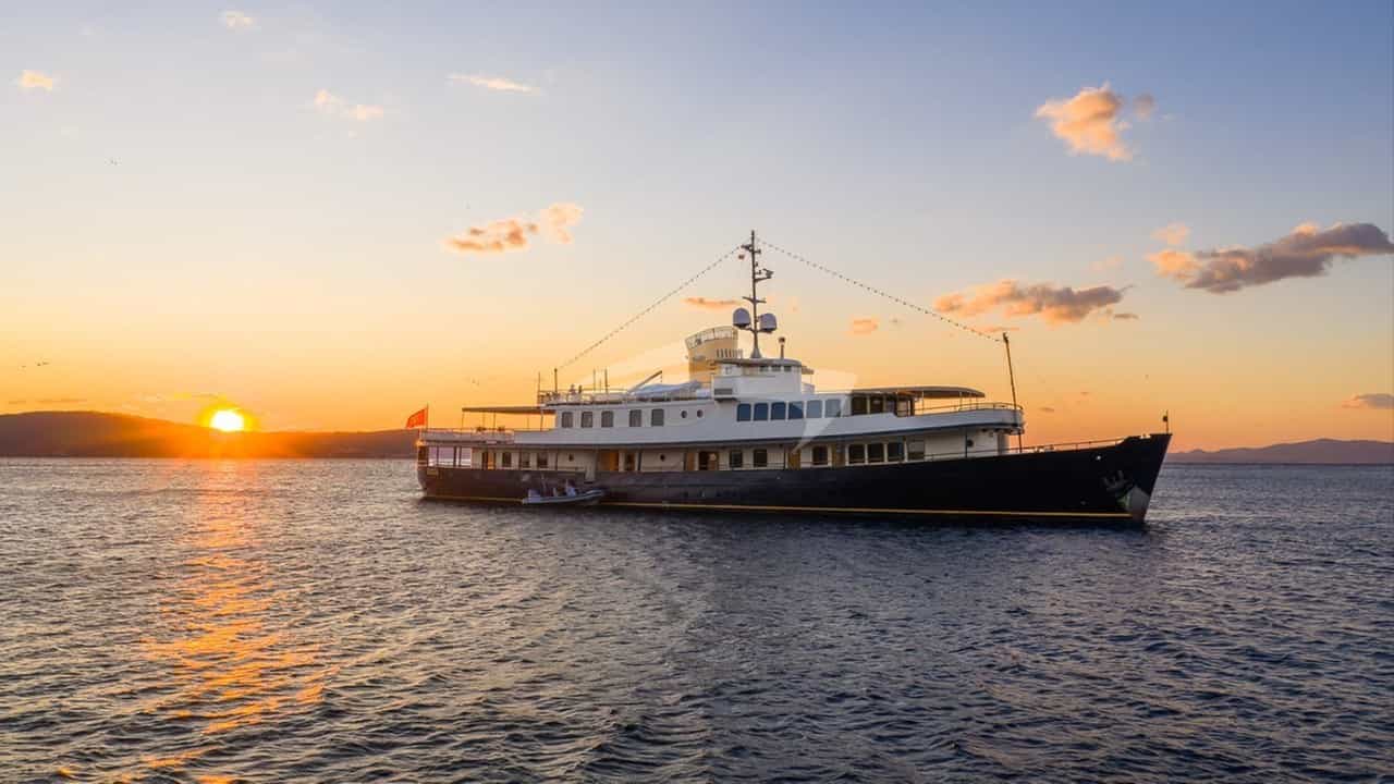
The island of Rab presents one of the most striking geographical dichotomies in the Adriatic Sea. Viewed from the eastern approaches across the Velebit Channel, Rab appears as a stark, sun-bleached wall of bare limestone, scoured of vegetation by centuries of katabatic winds. Yet, as a yacht rounds the northern or southern headlands onto the lee side facing the Kvarnerić, the landscape shifts abruptly into dense Mediterranean holm-oak forests, deeply indented coves, and fertile alluvial valleys.
For a skipper navigating these waters, Rab serves as the strategic fulcrum of the Northern Adriatic. Situated between Krk to the north, Pag to the south, and Cres and Lošinj to the west, it offers an exceptional cruising ground for luxury motor yachts and performance sailing vessels. Planning a successful voyage here requires a keen understanding of local wind systems, bathymetry, and anchorage mechanics, ensuring guests experience both the rugged seclusion of the outer coves and the refined charm of Rab Town’s medieval quay.
The Nautical Geography of Rab and the Kvarner Gulf
Rab spans roughly 22 square kilometres, stretching from the windward, barren ridge of Kamenjak in the northeast to the protected, forest-draped Kalifront Peninsula in the southwest. The island is bordered by distinct sea areas, each demanding specific operational awareness from the bridge.
To the east lies the Velebitski Kanal (Velebit Channel), a narrow, deep passage separating Rab from the Croatian mainland. Depths here plunge rapidly past 70 metres, but the key operational factor is the proximity to the Velebit mountain range, which towers over 1,500 metres above sea level. This channel acts as a natural funnel for down-draft winds and requires vigilance even during high summer.
To the west and southwest, the waters open into the Kvarnerić, a broad sound connecting Rab to the Cres-Lošinj archipelago. Sea depths in the Kvarnerić average between 60 and 90 metres, dropping to shallow sandy shelves near Rab’s shorelines. The seabed composition varies significantly: heavy clay and marl dominate the deeper channels, offering excellent holding, while the outer coves of the Kalifront Peninsula feature fine sand interspersed with dense patches of protected Posidonia oceanica seagrass.
Along the island’s southern flank runs the Barbatski Kanal, a narrow fairway sheltered by the elongated, uninhabited island of Dolin. This passage provides a well-protected transit lane leading directly to Rab Harbour, with soundings generally ranging from 10 to 18 metres.
       [ K V A R N E R I Ć ]
          /            \
   (Cres / Lošinj)      \
                         [ Kalifront Peninsula ] ---> (Gožinka / Kristofor)
                                   |
                               [ RAB TOWN ]
                                   |
                         [ Barbatski Kanal ] <---> [ Dolin Island ]
                                   |
                         [ VELEBIT CHANNEL ]
                                   |
                         (Mainland / Velebit Mts)
Seasonal Microclimates, Winds, and Sea States
Successful passage planning around Rab relies on reading the distinct seasonal weather patterns of the Kvarner region. While the summer months generally offer settled, sunny conditions, local thermal currents and mountain proximity create dynamic microclimates.
The Summer Wind Regime (June to August)
During the peak charter season, the prevailing daytime wind is the Maestral (NW). This thermal breeze typically builds around 10:00 AM, reaches peak force between 14:00 and 16:00 (frequently 12 to 18 knots), and dies away cleanly before sunset. The Maestral creates ideal conditions for afternoon sails between Rab and Lošinj, generating a light, predictable chop in the Kvarnerić that rarely exceeds 1.0 metre significant wave height.
Late afternoons can occasionally bring the Neverin (or Nevera), a short-lived thermal squall originating from the west or northwest across the Istrian peninsula. These systems arrive with little warning, accompanied by a rapid drop in barometric pressure, sudden wind shifts, and localized gusts exceeding 35 knots. A captain resting in an open bay must monitor radar cell developments closely when humidity rises late in the day.
Autumn and Spring Transitions (May, September, October)
The shoulder months see a higher frequency of the Jugo (SE), a moist, warm wind driven by low-pressure systems in the Central Mediterranean. The Jugo builds gradually over 24 to 48 hours, driving long, rolling swells up the Adriatic. Inside the Barbatski Kanal and the southern coves of Rab, the Jugo can create uncomfortable swell conditions and high tides, though the northern bays of Kamporska and Supetarska Draga remain well protected from these seas.
Navigating the Bora (Bura)
The Bora (NE) is the defining wind of the Northern Adriatic, produced when cold high-pressure air over the Croatian interior cascades down the steep slopes of the Velebit mountains.
- Summer Bora: Occurs as a katabatic event, often lasting 12 to 24 hours. It brings cool, dry air, cloudless skies, and exceptional visibility.
- The Velebit Gap Effect: The wind accelerates through mountain passes, particularly near Senj, sending violent gusts (refuli) bursting across the Velebit Channel directly toward the eastern face of Rab.
- Signatures and Indicators: A persistent cap of white roll-clouds (kapa) forming along the crest of the Velebit range is a definitive physical sign that a Bora is imminent, even if the sea surface remains flat calm.
- Impact on Sea State: While the windward side of Rab experiences violent spray and short, steep waves, the lee side (Kalifront) stays flat, though severe downbursts still roll over the island crest into the anchorages.
Key Anchorages and Natural Harbours
Rab offers a diverse array of natural stopovers, ranging from heavily wooded, deep-water coves on the southwestern coast to broad sandy bays along the northern Lopar Peninsula.
Kalifront Peninsula (Southwest Coast)
The Kalifront Peninsula is Rab’s premier daylight anchorage zone, protected as a forest reserve and virtually devoid of shore development.
#### Uvala Gožinka Positioned on the south-southwest shore of Kalifront, Gožinka consists of several smaller inlets lined with stone bathhouses and pine trees. The seabed is a mix of sand and rock, providing good holding in 5 to 10 metres. Shelter:* Excellent protection from NW, N, and NE winds. Exposure:* Fully exposed to the S and SE (Jugo). Operations:* Ideal for lunch stops and swimming. Guests can tender ashore to small, family-run seafood taverns situated on the water's edge.
#### Uvala Kristofor and Uvala Planka Located further northwest along the Kalifront coast, these twin coves offer translucent waters over sandy bottoms surrounded by dense pine forests. Shelter:* Strong shelter from E, NE (Bora), and N winds due to the high tree line and surrounding hills. Exposure:* Open to SW and W winds. Operations:* Deep water extends close to the shore. Yachts frequently drop anchor in 8 to 12 metres and take a stern line ashore to a heavy rock or pine trunk to prevent swinging in narrow coves.
Lopar Peninsula and Northern Bays
The northern end of Rab contrasts sharply with the south, characterized by extensive sandy plateaus and shallow, sweeping bays.
#### Sahara Bay (Uvala Sahara) Located on the northeastern side of the Lopar Peninsula, Sahara Bay is an unblemished, crescent-shaped sandy cove surrounded by low vegetation and red clay cliffs. Shelter:* Protected from S, SW, and W winds. Exposure:* High exposure to the N and NE. Unusable during a Bora. Operations:* The bay shoals very gradually. Vessels with drafts over 2.0 metres should anchor well out in 5 to 7 metres on a seabed of hard-packed fine sand. Holding is excellent, but considerable chain length is required to offset the shallow slope.
#### Supetarska Draga and Kamporska Draga These two deep fjord-like inlets cut far into the northwestern coast. Shelter:* Highly protected natural harbours offering shelter from almost all directions, except severe W/NW gales. Operations:* kamporska Draga features thick mud and silt on the seabed, providing supreme holding power in 6 to 10 metres. Supetarska Draga houses a full-service marina and sheltered anchoring zones, making it an ideal refuge when settled weather breaks.
+-------------------+----------------------------------+-----------------------------+
| Anchorage         | Primary Protection               | Exposure / Vulnerability    |
+-------------------+----------------------------------+-----------------------------+
| Uvala Gožinka     | N, NE, NW                        | S, SE (Jugo)                |
| Uvala Kristofor   | N, NE (Bora), E                  | W, SW                       |
| Sahara Bay        | S, SW, W                         | N, NE (Bora)                |
| Kamporska Draga   | N, E, S, SE                      | Heavy NW                    |
| Rab Town Harbour  | N, E, SE, NW (with breakwater)   | Strong SW (Libeccio) surge  |
+-------------------+----------------------------------+-----------------------------+
Rab Town Harbour and Barbatski Kanal
Rab Town stands on a narrow, elevated rocky peninsula separating the open waters from the inner harbour basin. The historic skyline, dominated by four Romanesque bell towers, provides an extraordinary backdrop for evening mooring.
The town quay (Obala) offers deep-water berthing alongside for large motor yachts, equipped with modern power and water pedestals. During peak summer months, yachts berth stern-to using laid moorings (moringuzi). The harbour is well protected from the Bora by the elevated ridge behind the town, though a heavy SW wind (Libeccio) can drive a persistent swell into the outer basin. Adjacent to the main town quay, ACI Marina Rab provides additional secure berths for craft up to 25 metres.
In the Barbatski Kanal, the narrow channel between Rab and Dolin Island, vessels can anchor in 8 to 12 metres on a mud bottom. This anchorage is exceptionally secure against westerly and northerly weather, serving as a primary overflow area when town berths are full.
Navigational Hazards and Passage Planning
Navigating the waters surrounding Rab requires careful attention to soundings, local currents, and specific geographic points.
### The Sorinj Reef and Lopar Approaches When rounding the northern tip of Rab at Cape Sorinj, yachts must give the headland a wide berth. Shallow rocky ledges extend outward, marked by the Sorinj lighthouse (Fl 3s 10m 6M). Further east off Lopar, numerous unlit islets, such as Maman, Šailovac, and Srednjak, sit in shallow water with shifting sandbanks. Vessels drawing more than 2.5 metres should maintain a track outside the 15-metre bathymetric line when navigating between Lopar and the islet of Sveti Grgur.
### Barbatski Kanal Currents and Traffic The passage through Barbatski Kanal is narrow and subject to strong tidal currents running up to 2.5 knots during spring tides. The direction of the current reverses with the tide, creating choppy water when conflicting with local winds.
Additionally, high-speed car ferries operate continuously between Stinica on the mainland and Mišnjak at the southern tip of Rab. These vessels claim right-of-way in the narrow channel; captains must monitor VHF Channel 16 and leave plenty of room when crossing the ferry track off Cape Mišnjak.
Passage Distances from Rab Town
- Rab Town to Mali Lošinj (Lošinj): 22 Nautical Miles
- Rab Town to Punta Križa (Cres): 14 Nautical Miles
- Rab Town to Zavratnica Fjord (Mainland): 7 Nautical Miles
- Rab Town to Novalja (Pag): 13 Nautical Miles
- Rab Town to Punat (Krk): 23 Nautical Miles
- Rab Town to Silba Island: 24 Nautical Miles
How a Captain Plans a 7-Day Rab Itinerary
A captain managing a Rab Yacht Charter itinerary crafts a balanced route that pairs open-water sailing across the Kvarnerić with calm afternoon swim stops and culture-focused evening berths. The following itinerary showcases a classic week-long route beginning and ending in the Rab region.
       [ KRK / PUNAT ]
              |
         (Day 4/5)
              |
[ CRES / LOŠINJ ] <---> [ RAB ISLAND ] <---> [ MAINLAND / ZAVRATNICA ]
       (Day 2/3)         (Day 1 & 6/7)
                             |
                        [ PAG ISLAND ]
### Day 1: Boarding and the Southwestern Coves Embarkation takes place in the afternoon, either directly at Rab Town Quay or via transfer from a nearby hub such as Krk or Pula. Once safety briefings are complete, the yacht slips its lines and completes a short 4-nautical-mile run around the headland to Uvala Gožinka on the Kalifront Peninsula.
The yacht drops anchor in 7 metres of water over sand. Guests enjoy their first afternoon of swimming and paddleboarding in clear, sheltered waters, followed by an evening meal on deck while anchored under the pines.
### Day 2: Crossing the Kvarnerić to Cres and Lošinj After an early morning dip, the yacht weighs anchor and sets a course west-southwest across the Kvarnerić toward the southern tip of Cres (14 NM). The route crosses deep waters where pods of bottlenose dolphins are frequently sighted.
By midday, the yacht drops anchor in Uvala Plieski or near the islet of Ilovik, taking advantage of white sand bottoms and crystal turquoise water. In the late afternoon, as the Maestral wind moderates, the captain moves the vessel into Mali Lošinj harbour or anchors off the peaceful shore of Sveta Marija on Ilovik for a quiet night at anchor.
### Day 3: The Western Outer Islands (Silba and Olib) The yacht heads south toward the outer islands of the Zadarian archipelago, steering for Silba (15 NM). Silba is a traffic-free island surrounded by clear waters.
The yacht anchors in Uvala Dobre Vode on the southern tip for lunch and water sports. In the afternoon, the vessel completes a smooth 10-nautical-mile leg back north toward the southern tip of Pag, mooring stern-to at the town quay of Novalja or anchoring off the long, sandy spit of Tovernele at Lun, famous for its ancient olive groves.
### Day 4: Northern Rab and the Lopar Sandstone Bays Departing Pag, the captain steers north along the lee of Rab's eastern shore, pointing toward the remote Lopar Peninsula (12 NM). Passing the stark, light grey cliffs of Sveti Grgur, the yacht enters Sahara Bay.
The captain drops a primary anchor with 40 metres of chain in fine sand. Guests spend the afternoon swimming off the yacht’s swim platform, tender-skiing, or exploring the secluded beaches. As evening approaches, the yacht executes a brief 4-nautical-mile passage into Supetarska Draga, securing a berth at the marina or dropping anchor in Kamporska Draga for complete night protection.
### Day 5: The Mainland Fjord of Zavratnica Leaving the northern coves, the yacht rounds the dramatic headland of Sorinj and tracks southeast down the Velebit Channel (16 NM). The contrast here is stunning: sheer mountain walls dive directly into the deep sea.
The target for midday is Zavratnica Fjord, a narrow, steep-sided inlet carved deep into the mainland coast. The captain carefully navigates the narrow entrance, securing the stern to the rock walls while the bow anchor holds the vessel in deep water. Guests can swim directly over the sunken WWII wreck resting in just 3 metres of water at the end of the bay.
                                  /|
                         _________||________
                        |                   |
                        |   ZAVRATNICA      |
                        |     FJORD         |
                        | (Steep Canyon)    |
                        |                   |
 ~~~~~~~~~~~~~~~~~~~~~~~|                   |~~~~~~~~~~~~~~~~~~~~~~~
    VELEBIT CHANNEL     |                   |    MAINLAND COAST
 ~~~~~~~~~~~~~~~~~~~~~~~|      =====        |~~~~~~~~~~~~~~~~~~~~~~~
                        |   [Sunken Wreck]  |
                        |                   |
In the late afternoon, the yacht crosses back over the channel (7 NM) to enter the Barbatski Kanal, securing a prime position alongside the historic town quay of Rab Town.
### Day 6: Historic Rab and the Kalifront Circuit Guests spend the morning exploring the paved Roman streets, bell towers, and stone palaces of Rab Town on foot. Meanwhile, the crew prepares the vessel for a final day on the water.
At noon, the yacht slips its moorings for a leisurely cruise around the Kalifront Peninsula, stopping at Uvala Kristofor for a long, relaxed lunch. The afternoon is spent anchored off Suha Punta, enjoying water sports, before returning to Rab Town Quay for a final evening ashore.
### Day 7: Disembarkation After breakfast on deck overlooking the bell towers, guests disembark at 09:00 for their onwards transfers.
### Contingency Protocols for Weather If coastal weather stations issue a Bora warning during the charter, the captain immediately alters the plan:
- Action: Evacuate all open anchorages on the eastern and northern coasts (Lopar, Sahara Bay, Velebit Channel).
- Safe Refuge: Move the vessel to the sheltered lee of the Kalifront Peninsula, or secure a box berth inside ACI Marina Supetarska Draga or ACI Marina Rab.
- Alternative Route: Shift the itinerary west toward the protected inner channels of Cres and Lošinj, avoiding the open Velebit Channel entirely.
Culminating the Kvarner Experience: Gastronomy and Ashore
A cruising itinerary around Rab is incomplete without engaging with the island's unique terrestrial culture and culinary traditions. Rab's historic center has been a fortified settlement since the Roman Empire, when Emperor Augustus declared it a municipality (Felix Arba).
A walking tour of the old town takes guests along three parallel stone streets—Gornja, Srednja, and Donja Ulica (Upper, Middle, and Lower Streets)—connecting ancient squares, Venetian-style palaces, and four Romanesque bell towers. The tower of St. Mary's Cathedral, standing over 26 metres high, can be climbed via an interior staircase, offering sweeping views over the red-tiled roofs, the harbour basin, and the blue waters of the Kvarnerić.
Ashoreside dining on Rab highlights the high quality of regional ingredients, driven by rich marine life and mineral-rich pastures:
- Kvarnerski Škamp (Kvarner Scampi): Renowned among Mediterranean chefs, these Dublin Bay prawns are caught in deep-water traps in the cold waters of the Kvarner Gulf. Their sweet, delicate meat is best enjoyed grilled over wood fires or cooked na buzaru (sautéed with olive oil, garlic, white wine, and breadcrumbs).
- Rabska Torta (Rab Cake): The island's signature dessert, dating back to 1177 when it was served to Pope Alexander III. The spiral-shaped pastry features a rich filling of ground almonds, lemon zest, sugar, and Maraschino cherry liqueur, wrapped in a delicate egg-dough crust.
- *Pag Lamb (Paška Janjetina): Raised on the neighboring island of Pag, where fierce Bora winds dust the vegetation with sea salt, this tender lamb is slow-roasted under an iron bell (peka*) over live coals alongside native potatoes and Mediterranean herbs.
- Regional Wine Pairing: Meals are traditionally paired with crisp, dry white wines from the region, such as Žlahtina from the nearby island of Krk, or light, aromatic Istrian Malvazija.
Combining these shore experiences with precise seamanship allows charterers to fully appreciate Rab's dynamic contrast—where dramatic windward mountains give way to sheltered, oak-shaded coves and centuries of rich maritime history.