
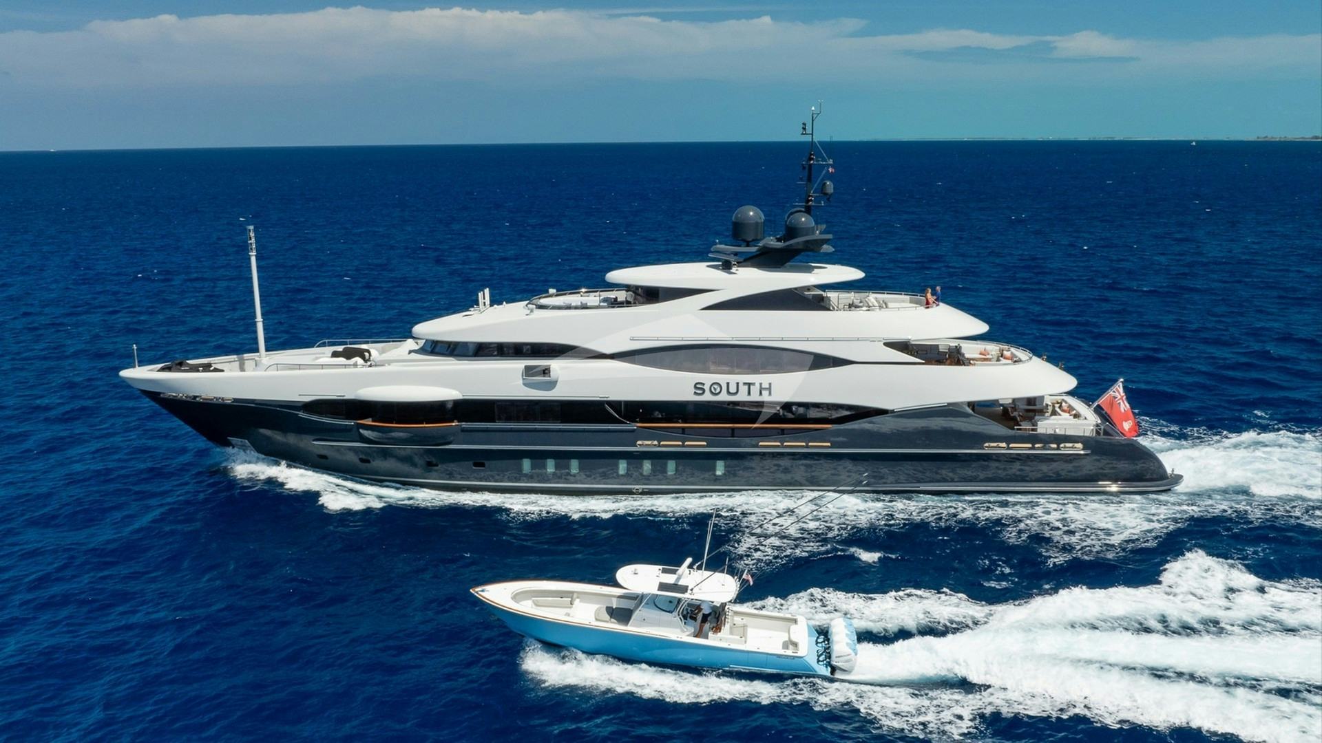
Where the eastern edge of the Pyrenees collapses into the Mediterranean Sea, the Catalan coast forms one of the most dynamic and meteorologically demanding cruising grounds in Western Europe. Anchored at the northern vertex of the Golf de Roses, the municipality of Roses serves as the strategic epicenter for embarking on a Roses Yacht Charter yacht charter. To the immediate north lies the Cap de Creus Natural Park, a wind-sculpted granite and schist peninsula cut with deep ria-like coves. To the south stretches the sweeping arc of the bay, bounded by the limestone cliffs of the Montgrí Massif and the marine reserve of the Medes Islands. Executing a successful charter in these waters requires an uncompromising understanding of local weather dynamics, seabed bathymetry, and regional maritime regulations.
Unlike the predictable, sheltered waters of the Balearic Islands or the French Riviera, the coast surrounding Roses demands active navigation and respect for regional wind phenomena. Captains operating here must balancing raw scenic beauty with tactical anchorage selection. When properly planned, a week afloat in Alt Empordà provides an unparalleled blend of wild naturally sheltered calas, historic coastal villages, world-class gastronomy, and exhilarating blue-water sailing.
The Sea Area and Regional Coastline Geography
The charter area defined by a Roses departure encompasses three distinct geomorphological zones: the Golf de Roses, the Cap de Creus peninsula, and the rocky shoreline of the Baix Empordà stretching south toward Begur. Understanding the hydrographic character of each zone is fundamental to planning day passages and overnight stops.
The Golf de Roses itself is a vast, open bay spanning approximately 12 nautical miles from the headland of Cap Norfeu in the north to the port of L'Estartit in the south. The inner curve of the bay features low-lying alluvial plains formed by the mouths of the Muga and Fluvià rivers. Here, the seabed shelves gently, with depths remaining under 15 metres for up to a mile offshore. While this area offers sandy holding, it provides zero protection from easterly swells or southern thermal winds, making it predominantly a day-sailing passage zone rather than an overnight anchorage area.
Directly north of Roses, the topography changes abruptly. Cap de Creus projects nearly 10 nautical miles east into the Balearic Sea, creating a stark, high-relief coastline characterized by dark slate, pegmatite veins, and shear cliffs dropping into deep water. Here, soundings drop quickly to 40–60 metres within cable-lengths of the shore. The peninsula acts as a natural weather divide; conditions on the southern lee of the cape can differ dramatically from those on the northern exposure toward El Port de la Selva and the French border.
South of the Golf de Roses, the Montgrí Massif terminates in vertical limestone walls that rise up to 100 metres out of the sea. This stretch, punctuated by sea caves and isolated rock stacks, leads directly into the protected enclave of the Illes Medes—an archipelago famous for its marine biodiversity—before giving way to the high-pitted calas of Begur.
Meteorological Realities: Winds, Swell, and Monthly Conditions
The prevailing meteorological feature of the northern Costa Brava is the Tramuntana—a dry, cold, highly localized wind generated by high-pressure systems over France forcing air through the Pyrenean gaps and down the Rhône and Ebro valleys. The Tramuntana accelerates as it hits the open waters of the Gulf of Lion, striking Cap de Creus from the north-northwest.
The Mechanics of the Local Winds
Cruising out of Roses requires constant monitoring of three primary wind systems:
- The Tramuntana (NNW–NW): This wind can rise with very little cloud warning, although a sudden rise in atmospheric pressure and crystal-clear air visibility usually signal its onset. It frequently reaches Force 7 to 9 (30–45 knots) and can persist for three to seven consecutive days in winter and spring. In summer, it tends to blow in shorter, sharper bursts lasting 24 to 36 hours. The katabatic effects off the Cap de Creus hills create violent gusts down the eastern calas.
- The Garbí (SW–SSW): The classic summer thermal sea breeze. It begins building around mid-morning as the Empordà plain heats up, reaching its peak of 15–20 knots by mid-afternoon before dying away rapidly at sunset. The Garbí produces a short, steep chop across the Golf de Roses, making south-facing anchorages uncomfortably rollie by late afternoon.
- The Llevant (E–ESE): The most hazardous wind for vessels along this coast. A Llevant brings moist air, rain, poor visibility, and heavy, long-period seas direct from the open Mediterranean. When a Llevant is forecast, all natural anchorages on the eastern side of Cap de Creus become untenable, requiring immediate retreat into the deep shelter of Port de Roses, Marina Empuriabrava, or a run south to protected harbours.
Monthly Cruising Conditions
May and June offer ideal conditions for active sailors. The Tramuntana pulses are less frequent than in early spring, and daytime sea temperatures begin rising past 19°C. Anchorages are largely empty, though evening air can remain crisp. The thermal Garbí is reliable, providing excellent afternoon sailing conditions across the bay.
July and August represent the peak charter season. The air temperature averages 28–30°C, and sea temperatures reach 24–25°C. The Garbí dominates the daily weather cycle, providing predictable 12-to-18-knot afternoon breezes. While summer Tramuntana events do occur, they are generally shorter and less intense. Coastal anchorages fill rapidly, making early morning arrivals or advance buoy bookings necessary for primary locations like Cadaqués and Port Lligat.
September and October bring changing conditions. September is considered by experienced skippers to be the finest month on the Costa Brava: the sea remains warm (22–23°C), summer crowds recede, and thermal winds are gentle. However, October marks the return of lower pressure systems, bringing a higher frequency of strong Tramuntana gales and early easterly Llevant swells.
Key Natural Anchorages and Shelter Analysis
Selecting an anchorage along the Cap de Creus peninsula requires matching the vessel’s draft and swing radius to the precise wind vector and swell direction. Below are the primary natural anchorages accessible during a charter originating in Roses.
                  [ CAP DE CREUS PENINSULA ]

     El Port de la Selva
         │
         ├── Cala Prona (Protected NW-SW / Open NE-E)
         │
     Cap de Creus Light
         │
         ├── Cala Guillola (Protected W-S / Open E-NE)
         ├── Port Lligat (Protected ALL except strong E)
         ├── Cadaqués (Buoy Field / Open SE)
         ├── Cala Jóncols (Protected NW-NE / Open SE)
         ├── Cala Montjoi (Protected NW-N / Open S-SW)
         └── Cala Pelosa (Protected N-NW / Open S-SE)
         │
    Port de Roses (Base)
### Cala Montjoi Coordinates:* 42°15.1'N, 003°13.5'E Target Protection:* Excellent protection against North, North-West, and North-East winds. Vulnerable to South and South-West swell. Depth and Seabed:* 6 to 12 metres over coarse sand and mud. Good holding once the anchor digs past the upper gravel layer. Operational Notes:* Famous historically as the home of El Bulli, this deep horseshoe bay offers substantial capacity. The northern shore provides the best protection during a Tramuntana, though catabatic wind pulses descend from the surrounding hills. A small beach channel allows tender access to the shore.
### Cala Jóncols Coordinates:* 42°15.9'N, 003°15.2'E Target Protection:* Highly sheltered from West, North-West, and North winds. Exposed to South-East and East swells. Depth and Seabed:* Drops steeply from the shore. Anchor in 8 to 15 metres on a seabed of dark sand and small stones. Operational Notes:* Located just west of Cap Norfeu, Jóncols is surrounded by sheer rock faces covered in olive trees and pine. Because of the steep incline of the seabed, vessels must deploy sufficient chain (a minimum 5:1 scope ratio is recommended) and verify anchor set carefully. It is an exceptional day anchorage for swimming and diving, with clear underwater visibility.
### Cala Pelosa Coordinates:* 42°15.3'N, 003°14.3'E Target Protection:* Superior shelter from North, North-West, and West winds, shielded from the east by the projection of Cap Norfeu. Depth and Seabed:* 5 to 9 metres over sand, mud, and localized Posidonia seagrass beds (strict anchoring restrictions apply over Posidonia). Operational Notes:* Pelosa is one of the safest overnight spots along the southern face of the cape during moderate northerly weather. Local beach chiringuitos offer tender pick-up services for traditional Catalan rice and seafood dishes during the peak summer months.
### Port Lligat Coordinates:* 42°17.6'N, 003°17.2'E Target Protection: Exceptional protection from virtually all vectors due to the barrier formed by the island of Illa de Port Lligat*. Open only to extreme easterly gales. Depth and Seabed:* 2 to 5 metres over mud and fine sand. Operational Notes:* This shallow, enclosed natural harbour was the long-time home of Salvador Dalí. Due to the shallow depths and fragile seabed ecosystems, anchoring is heavily restricted. Modern charter vessels utilize the organized seasonal mooring buoy field. Reservations are essential for deep-draft yachts, which must moor in the outer channel.
### Cala Guillola and Cala Jugadora Coordinates:* 42°17.1'N, 003°18.6'E (Jugadora) / 42°17.9'N, 003°17.8'E (Guillola) Target Protection:* Guillola offers refuge from South, South-West, and West winds. Jugadora, situated right under the Cap de Creus lighthouse, offers protection from West and North-West breezes. Depth and Seabed:* 5 to 10 metres on rock, gravel, and patchy sand. Operational Notes:* These are wild, dramatically sculpted coves situated on the eastern tip of Spain. The water is strikingly clear, framed by dark schist slate formations. They are day-use anchorages; staying overnight is only advised in settled, windless conditions, as any sudden shift to the east creates dangerous lee-shore conditions against vertical cliffs.
Essential Navigational Hazards and Local Regulations
Navigating the waters surrounding Roses requires careful attention to specific natural hazards, high-traffic corridors, and environmental protection zones.
Physical Hazards Around Cap de Creus
The easternmost point of Cap de Creus presents several offshore dangers that require wide berths:
- Massa d'Ous (Encalladora Rock): Located off the north-eastern tip of Cap de Creus, this jagged islet and its associated submerged reefs extend the hazard area significantly offshore. Vessels transiting around the cape should pass at least 0.5 nautical miles to the east of the light marker on Encalladora to avoid breaking seas and shallow pinnacles.
- Cap Norfeu Reefs: The headland of Cap Norfeu features underwater rock spurs, notably El Sardo, extending off its southern tip. Keep a margin of 200 metres off the visible rock face when entering or exiting Cala Jóncols.
- Golf de Roses River Mouths: The estuaries of the Muga (near Empuriabrava) and the Fluvià shift constantly after winter floods. Depths can drop below 2 metres up to 300 metres off the coastline. Deep-draft yachts must give the western beach zone a wide margin.
       [ REVENUE AND NAVIGATION HAZARD MAP: CAP DE CREUS ]

                      N
                      │
   [El Port de la Selva]
                      │
   ┌──────────────────┴──────────────────┐
   │  HIGH TRAMUNTANA ACCELERATION ZONE  │
   └──────────────────┬──────────────────┘
                      │
               Cap de Creus Light
                      │
                      ├──► [Massa d'Ous / Encalladora Reef] (Pass > 0.5 NM East)
                      │
               Port Lligat / Cadaqués
                      │
   ┌──────────────────┴──────────────────┐
   │    POSIDONIA CONSERVATION ZONES     │
   │   (Strict Prohibition on Anchoring) │
   └──────────────────┬──────────────────┘
                      │
               Cap Norfeu Reefs ──► [El Sardo Pinnacle] (Pass > 200m Off)
                      │
   [Port de Roses] ───┴─── [Golf de Roses Siltation Zones - Keep Offshore]
Environmental Regulations and Marine Reserves
Catalonia enforces strict environmental protection laws designed to preserve native marine flora and fauna:
- Posidonia Oceanica Protection: Posidonia (Mediterranean seagrass) is strictly protected under Spanish national law. Dropping anchor or dragging chain through Posidonia beds is prohibited and monitored by eco-patrol vessels operating throughout Cap de Creus and the Costa Brava. Captains must drop anchor strictly in sandy patches, identified by light-blue water coloration, or utilize designated mooring buoys.
- Illes Medes Marine Reserve: Located at the southern boundary of the Golf de Roses, the Medes archipelago is a fully protected marine sanctuary. Anchoring anywhere within the reserve boundary is forbidden. Visiting vessels must reserve a marine park buoy in advance via the official Catalan regional environment portal. Diving and snorkeling here offer exceptional views of large groupers, barracudas, and red coral, but strict rules apply to vessel speeds (maximum 3 knots) and tender operations.
Tactical Masterclass: Executing a One-Week Charter Itinerary
A captain embarking on a seven-day route from Port de Roses must balance coastal exploration with flexible contingency planning to adapt to wind shifts. Below is an ideal tactical sequence for a week-long cruising itinerary under standard summer conditions (prevailing afternoon Garbí with stable synoptic charts).
Day 1: Embarkation at Port de Roses to Cala Montjoi (Distance: 5 NM)
After completing safety briefings and vessel orientation at Port de Roses—a modern facility offering deep-water berths, high-speed fuel, and full provisioning services—cast off late afternoon. Clear the commercial harbour and steam east along the coast past Punta de la Almadrava. Ease into Cala Montjoi to set anchor in 8 metres of coarse sand. Use the evening to trim the rig, test onboard systems, and enjoy a quiet first night framed by the dark hills of the natural park.
Day 2: Cala Montjoi to Cadaqués and Port Lligat (Distance: 8 NM)
Weigh anchor early to round Cap Norfeu before the afternoon thermal breeze accelerates. Pass southward of the El Sardo rock, then turn north-north-east toward the whitewashed village of Cadaqués. Drop anchor temporarily in the outer bay or pick up a pre-booked municipal mooring buoy.
Cadaqués, once an isolated fishing village accessible primarily by sea, is famous for its distinct Catalan modernist architecture and historic artistic community. Go ashore by tender to walk the narrow slate-paved streets and sample local specialties such as suquet de peix (a traditional Catalan fisherman’s rockfish stew) paired with cold, mineral-rich white wines from the nearby DO Empordà wine region.
In the late afternoon, make the short 2-nautical-mile hop around Cap de Ses Creus into the sheltered lagoon of Port Lligat. Pick up your reserved mooring buoy for a secure, flat-water night adjacent to Salvador Dalí’s preserved residence.
Day 3: Port Lligat around Cap de Creus to El Port de la Selva (Distance: 12 NM)
This passage represents the iconic offshore highlight of a Roses Yacht Charter yacht charter. Depart Port Lligat heading north-east. Give the islet of Encalladora a wide berth of at least half a mile to clear the Massa d'Ous reefs. As you clear the cape, the impact of the northern swell becomes apparent.
Track west along the northern face of Cap de Creus, entering Cala Prona or Cala Culip for a midday swim stop. These northern coves feature extraordinary erosion landscapes, where wind and salt have carved the dark rock into surreal shapes.
By mid-afternoon, resume a westerly course into the deep natural bay of El Port de la Selva. The harbour provides excellent protection behind its primary breakwater, along with a full-service marina. The town offers exceptional dining centered around fresh local catches, including the famed prawns of the region and locally caught sea bass.
Day 4: El Port de la Selva to L'Estartit and the Medes Islands (Distance: 18 NM)
Set an early morning course heading back east to round Cap de Creus once more before the daily thermal wind picks up. Once around the headland, set sails for a long, continuous beam reach south across the entire mouth of the Golf de Roses toward the Montgrí Massif.
This 14-nautical-mile run across the bay offers superb sailing conditions in the summer Garbí. Target the red-roofed coastal town of L'Estartit, making fast to a reserved marine reserve mooring buoy at the Illes Medes by mid-afternoon. Spend the late afternoon snorkeling or scuba diving among the pristine limestone caves and submerged drop-offs, which host some of the dense fish populations in the Western Mediterranean.
Day 5: Medes Islands south to Aiguablava (Distance: 8 NM)
Cast off from the Medes buoys and track south along the towering limestone cliffs of the Montgrí coast. Pass the dramatic sea arch of Foradada, large enough to navigate through in a tender during calm conditions. Continue south past the Gulf of Pals to round Cap de Begur.
Enter the deep, pine-fringed cove of Aiguablava. Anchoring in the central sandy channel in 6 to 9 metres of turquoise water provides a spectacular backdrop. The high cliffs protect the cove from southerly winds, though early morning light reveals one of the most stunning anchorages along the entire Spanish mainland.
                  [ SEVEN-DAY CRUISE ITINERARY ROUTE ]

                      El Port de la Selva (Day 3)
                                ▲
                                │ 12 NM
                                ▼
                       Cap de Creus Light
                                ▲
                                │ 8 NM
                                ▼
  Port de Roses (Start/Finish) ──► Port Lligat / Cadaqués (Day 2)
        ▲                               │
        │ 3 NM (Return)                 │
        │                               │
  Cala Almadrava / Pelosa (Day 6)       │ 18 NM
        ▲                               │
        │ 18 NM                         ▼
        └────────────────────── Illes Medes / L'Estartit (Day 4)
                                        │
                                        │ 8 NM
                                        ▼
                               Aiguablava (Day 5)
Day 6: Aiguablava to Cala Pelosa / Almadrava (Distance: 18 NM)
Begin the northbound leg back toward the Golf de Roses. Under normal summer patterns, the morning breeze will be light from the off-shore interior, providing a smooth motor-cruise past Begur and Sa Riera. As you clear Cap de Begur and re-enter the Golf de Roses, the afternoon Garbí will establish itself from the south-west.
Hoist working sails for a fast downwind run back across the bay, targeting the sheltered coves tucked under the lee of Cap Norfeu. Drop anchor in Cala Pelosa or the adjacent beach of Cala Almadrava in 5 metres of water over light sand. Enjoy a final evening anchored under the stars, fully sheltered from any unexpected overnight northerly breezes.
Day 7: Cala Almadrava to Port de Roses (Distance: 3 NM)
Take a final morning swim in the clear waters of Almadrava before weighing anchor for the short, 20-minute run back into Port de Roses. Refuel at the primary berth fuel dock before handing over the vessel to the charter company manager, completing a comprehensive and technically rewarding week navigating one of the Mediterranean's most varied coastlines.
Captain's Summary for Charterers
A successful cruise out of Roses depends on respecting the local geography and remaining adaptable to changing weather conditions. A skipper who monitors synoptic forecasts, respects the power of the Tramuntana, and understands the shelter profile of each cove will unlock a spectacular maritime experience. From the high-energy sailing across the Golf de Roses to the calm waters of the Cap de Creus calas, this stretch of the Catalan coast stands out as a true premier cruising destination.