
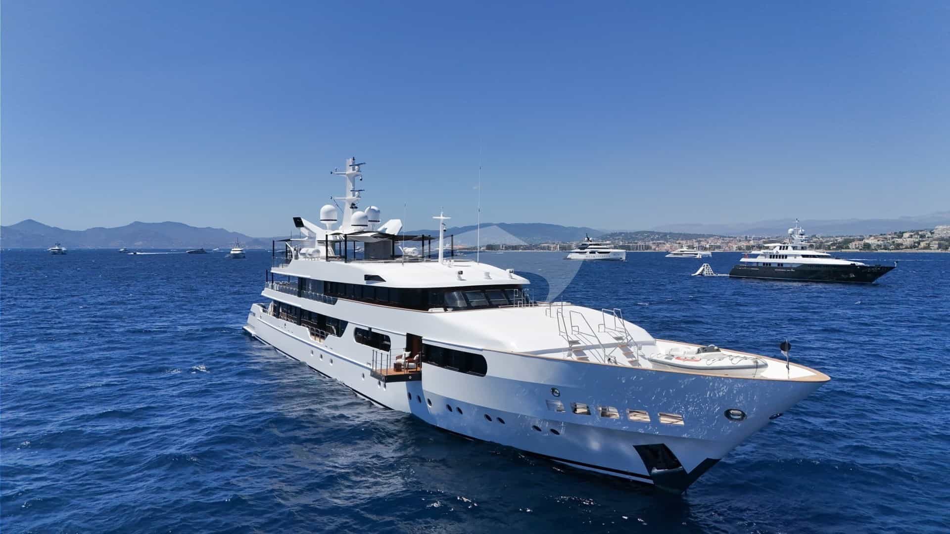
Hvar is the central anchor of the Dalmatian archipelago, a 37-nautical-mile spine of limestone Karst running east-to-west across the central Adriatic. For high-end charter guests and experienced skippers alike, navigating these waters requires a clear understanding of regional microclimates, passage dynamics, and underwater topography. The island's geography creates a series of protected channels, deep fjord-like bays, and exposed offshore coves that offer some of the finest cruising grounds in Europe.
Selecting a modern double-hulled vessel transforms how one experiences this coastline. A Yacht Charter Hvar Catamaran yacht charter provides distinct spatial and operational advantages in these specific waters: a shallow draught—typically between 1.2 and 1.5 metres—allows access to tight, turquoise lagoons within the Pakleni archipelago that remain off-limits to deep-keeled monohulls, while a wide beam offers exceptional stability during afternoon channel thermal transitions.
The Microclimates and Wind Systems of Central Dalmatia
Cruising around Hvar requires precise awareness of three main winds: the Maestral, the Bura, and the Jugo. Each dictates daily passage planning, anchorage selection, and sea states across the Hvarski, Viški, and Korčulanski channels.
The Maestral is the predictable thermal breeze of high summer. Arriving reliably between 10:00 and 11:00 from the north-west, it builds through the early afternoon to a peak of 15 to 22 knots before gently dying away near sunset. In the funnelled channel between Hvar and the southern coast of Brač, the Maestral generates a short, lively chop that remains manageable for cruising catamarans. This wind provides ideal mid-day sailing conditions, allowing captains to complete their main daily passages under sail while relying on flat anchorages by late afternoon.
The Bura is a cold, dry katabatic wind that spills off the mainland Dinaric Alps and the Biokovo mountain range. While more frequent in winter, summer Bura events occur suddenly when high pressure settles over central Europe. The wind accelerates down mountain valleys, blowing from the north-east across the Hvar Channel. It creates fierce, localized gusts (refuli) that can jump from 10 to 35 knots within minutes, particularly down the gap near Vrbanj onto Jelsa and Starigrad Bay, as well as through the Splitska Vrata. When a Bura warning is issued, catamarans must abandon exposed north-facing coves and take shelter in deep, south-facing inlets or well-protected mooring fields using long stern shore lines.
The Jugo is a warm, humid south-easterly wind driven by low-pressure systems moving across the Mediterranean. Unlike the sudden Bura, the Jugo builds gradually over 24 to 48 hours, creating long, rolling sea swells that travel up the open Adriatic. It makes south-facing anchorages—such as Uvala Dubovica or Sveta Nedjelja—untenable due to heavy shore surge. When the Jugo blows, local skippers head for the deep, north-facing inlets of Starigrad Bay or the sheltered berths of ACI Marina Palmižana.
Seasonal Sea States and Monthly Weather Breakdown
- May and June: Early season brings light, variable breezes with average air temperatures between 22°C and 26°C. Sea temperatures hover around 20°C to 22°C. The Maestral is gentle (10–15 knots), and anchorage density is low. Occasional spring low-pressure fronts can bring brief period Jugo conditions.
- July and August: High summer delivers reliable weather, with air temperatures often exceeding 30°C and sea temperatures reaching 25°C to 27°C. The Maestral blows consistently at 15–20 knots. Summer thermals can occasionally trigger a Nevera—a short, violent convective storm from the west or north-west lasting 30 to 60 minutes with sudden wind spikes up to 40 knots.
- September and October: Late season brings cooler air (21°C–25°C) while the sea retains summer warmth (22°C–24°C). The Maestral softens, and the frequency of south-easterly Jugo winds increases. Anchorages clear out significantly, offering calm cruising for those who monitor autumn weather fronts closely.
Anchorage Deep Dive: Shelter, Seabed, and Pilotage
The waters surrounding Hvar and its satellite islands offer a mix of natural coves, structured buoy fields, and formal marinas. Understanding seabed composition and wind protection profiles is essential for safe overnight anchoring.
The Pakleni Otoci Archipelago
Lying directly off the south-western tip of Hvar, the Pakleni Otoci (Hell's Islands, derived from paklina, the pine resin historically harvested here for ship caulking) form a chain of 20 islets. This island network creates a natural maze of channels and coves, serving as the primary playground for luxury yachts chartering in the region.
Uvala Vinogradišće (Sveti Klement): Located on the southern side of Sveti Klement, Vinogradišće is one of the most popular anchorages in Central Dalmatia. The bay features a sand seabed with patches of Posidonia sea-grass, offering excellent holding in 5 to 10 metres of water. It is managed with a commercial mooring buoy field during the peak season. Vinogradišće is exceptionally well-sheltered from the Bura and the afternoon Maestral, as the land spine of Sveti Klement blocks northern winds. However, it is completely open to the south and south-east; a strong Jugo sends a heavy, dangerous swell directly into the cove, requiring immediate evacuation to the northern side of the island.
Uvala Taršće (Sveti Klement): Situated west of Vinogradišće, Taršće is a deep, fjord-like cut into the southern coast of Sveti Klement. It offers superior holding ground in thick clay and sand at depths of 7 to 12 metres. This bay is far less crowded than Vinogradišće and provides near-total protection from northern and north-western winds. Captains typically drop anchor in the middle of the inlet and take two stern lines ashore to the pine trees, holding the catamaran stable against overnight wind shifts.
Uvala Ždrilca and Stipanska: The channel between Marinkovac and Sveti Klement offers iconic turquoise waters over a shallow, white-sand floor. Depths range between 2 and 5 metres, making it a prime day-stop location for shallow-draught catamarans. The passage requires careful visual pilotage to avoid the shallow shelf extending from Jerolim. Due to strong tidal currents reaching up to 2 knots through the narrow gut, this spot is recommended for day anchoring rather than overnight stays.
ACI Marina Palmižana: Tucked into a cove on the northern coast of Sveti Klement, this 211-berth marina provides a secure haven when southern winds make outer coves uncomfortable. It is fully protected from the Jugo, though strong northerlies can cause a light chop inside the basin. The approach requires keeping clear of the Baba rock reef, marked by a black and red isolated danger beacon, sitting 0.3 nautical miles north-east of the marina entrance.
North Coast and Starigrad Bay
The northern coast of Hvar is defined by the deep indentation of Starigrad Bay (Starogradski Zaljev), which cuts nearly 5 nautical miles inland, offering several well-sheltered natural harbors.
Luka Tiha: Located on the northern arm of Starigrad Bay, Luka Tiha is a large, multi-lobed bay comprised of five distinct coves: Stari Tih, Zavala, Hobonj, Luka, and Golubovac. The holding is exceptional, consisting of mud and sand beneath 6 to 12 metres of water, with seasonal mooring buoys available in the larger coves. Luka Tiha provides total shelter from almost all wind directions, including the Bura, as the surrounding hills break the wind's momentum. Only a direct, powerful north-westerly generates swell inside the outer mouth.
Kabal Peninsula Coves: The long, finger-like Kabal Peninsula forms the north-western extremity of Hvar. Inlets like Uvala Tiha and Uvala Smrska feature steep limestone walls dropping into clear, deep water. Boats can anchor in 8 to 14 metres, using long shore lines secured to rock bollards. These coves offer complete isolation and excellent protection against summer Maestral conditions.
South Coast and Offshore Islands
Šćedro Island (Uvala Lovišće & Uvala Mostir): Positioned 2.5 nautical miles off Hvar's southern coast, the island of Šćedro acts as a natural breakwater. Its northern coast features two deep bays: Lovišće and Mostir. Lovišće divides into four small fingers, providing shallow anchorage in 4 to 8 metres over sand and weed. The holding is secure, and seasonal buoy fields are maintained by local family-run konobas (traditional taverns). The island offers excellent protection from the Maestral and moderate protection from the Jugo, though severe Bura winds spouting off Hvar's central mountain ridge can send strong gusts over the island's low crest.
Sveta Nedjelja: Located along Hvar's southern cliff face, Sveta Nedjelja features dramatic underwater drop-offs and vineyard-covered slopes. It is exposed to open sea weather and functions exclusively as a fair-weather day stop. Yachts can anchor temporarily in 10 to 15 metres over rock and sand to visit local cliffside wineries, provided a crew member remains on watch to monitor any sudden swell changes.
Navigational Hazards and Local Pilotage Rules
Navigating the waters surrounding Hvar requires strict attention to specific geographical bottlenecks, shallow reefs, and environmental protection rules.
Major Bottlenecks and Reef Systems
- Splitska Vrata (Split Gates): The narrow passage between the eastern tip of Šolta and the western tip of Brač is the primary shipping lane for vessels moving between Split and Hvar. Traffic density here is high, with fast ferries, commercial coasters, and hundreds of sailing yachts converging on a passage barely 1 nautical mile wide. Wind speeds inside the gap regularly increase by 5 to 8 knots due to local terrain compression. Sailing yachts must keep clear of commercial traffic, maintain engine readiness, and stick to the right side of the channel.
- Pličina Pokonji: Extending east from Pokonji Dol islet (marked by a prominent lighthouse off Hvar Town), this submerged reef shelf features depths rising rapidly from 30 metres to less than 3 metres. Yachts approaching Hvar Town from the east must give Pokonji Dol a berth of at least 0.4 nautical miles to avoid the shallow rocky heads.
- Hvar Town Port (Luka Hvar): The harbor of Hvar Town is one of the most congested ports in the Adriatic. It is open to the south-west, making it extremely hazardous during a Garbin (south-westerly gale), which drives large waves directly onto the town quay (Riva). Due to narrow turning basins, heavy traffic, and limited space, large catamarans rarely berth on the quay. Instead, standard professional practice is to secure a buoy or anchor in the Pakleni Otoci and utilize high-speed tender transfers across the Pakleni Channel to reach the town.
NAVIGATIONAL HAZARDS SUMMARY:
- Splitska Vrata: High commercial traffic, local wind funneling up to +8 knots.
- Pličina Pokonji: Shallow reef shelf east of Pokonji Dol; maintain 0.4 nm clearance.
- Baba Rock: Unlit rock hazard north-east of ACI Palmižana, marked by danger beacon.
- Ždrilca Strait: Shallow depth (<2m in spots), 2-knot tidal current.
Posidonia Conservation Regulations
The Croatian Ministry of Environmental Protection strictly enforces sea-grass conservation across the Dalmatian islands. Posidonia oceanica beds serve as essential nursery grounds for Adriatic marine life. Anchoring directly in dark Posidonia beds is prohibited in designated marine parks and local bay sanctuaries. Skippers must anchor in light-colored sand patches or use authorized mooring buoys. Dropping anchor in sea-grass risks heavy fines from local maritime police and can cause severe damage to the anchor gear if wind shifts break the anchor free from the tough roots.
Cruising Distances and Passage Times
Distances across Central Dalmatia allow for easy island-hopping. A luxury catamaran cruising at a comfortable 8 to 10 knots under engine or sail can move between key stops in short 1 to 3-hour legs.
- Split/Trogir Base to Splitska Vrata: 12 nautical miles (1.5 hours)
- Splitska Vrata to Starigrad Bay (Luka Tiha): 12 nautical miles (1.5 hours)
- Starigrad Bay to Cape Pelegrin: 9 nautical miles (1 hour)
- Cape Pelegrin to Hvar Town / Pakleni Otoci: 5 nautical miles (30 minutes)
- Pakleni Otoci to Vis Town (Vis Island): 18 nautical miles (2 hours)
- Pakleni Otoci to Biševo (Blue Cave): 26 nautical miles (2.5 to 3 hours)
- Pakleni Otoci to Šćedro Island (Lovišće): 16 nautical miles (1.5 to 2 hours)
- Šćedro Island to Korčula Town: 18 nautical miles (2 hours)
- Hvar Town to Bol / Zlatni Rat (Brač): 14 nautical miles (1.5 hours)
A Captain’s Seven-Day Passage Strategy
Executing an ideal week-long charter around Hvar requires a balance between scheduled destinations and tactical adjustments based on daily wind updates. Below is how a professional skipper plans a typical 7-day itinerary starting from Split or Trogir.
7-DAY ROUTE AT A GLANCE:
Day 1: Base (Trogir/Split) to Starigrad Bay (18-22 nm)
Day 2: Starigrad Bay to Pakleni Archipelago / Hvar Town (14 nm)
Day 3: Pakleni Archipelago to Vis Island / Komiža (22 nm)
Day 4: Vis Island to Šćedro Island (20 nm)
Day 5: Šćedro Island to South Hvar / Uvala Taršće (16 nm)
Day 6: Uvala Taršće to Brač / Šolta (Maslinica) (20 nm)
Day 7: Šolta to Base (15 nm)
### Day 1: Embarkation to Starigrad Bay After afternoon check-in and safety briefings, the yacht departs the mainland base, heading south-east toward the Splitska Vrata channel. Once through the gap, the skipper sets a course along the northern coast of Hvar, taking advantage of the fading afternoon Maestral. The destination is Luka Tiha within Starigrad Bay. The catamaran picks up a mooring buoy in Zavala Cove. Guests spend their first evening swimming in calm waters, followed by an onboard dinner anchored under pine-covered hills.
### Day 2: Stari Grad Exploration to the Pakleni Archipelago In the morning, the tender runs guests into the ancient port of Stari Grad, founded by the Greeks in 384 BC, to explore its cobblestone streets and the UNESCO-protected Stari Grad Plain. By 11:00, as the thermal Maestral begins to build, the skipper hoists the sails and routes around the wooded headland of Cape Pelegrin.
The catamaran sails downwind into the Pakleni Otoci, dropping anchor in the turquoise waters of Uvala Ždrilca for lunch, paddleboarding, and swimming. By late afternoon, the yacht moves to a pre-booked mooring buoy in Uvala Vinogradišće. In the evening, a speed-tender drops guests directly onto the Hvar Town quay for dining, shopping, and nightlife before returning to the calm anchorage of Sveti Klement.
### Day 3: Crossing the Viški Kanal to Vis and Biševo Leaving the Pakleni Otoci early, the yacht heads south-west across the open Viški Kanal, covering 18 nautical miles to Vis Island. If sea conditions are calm, the captain pushes directly to the tiny island of Biševo, located 5 nautical miles off Vis’s south-western tip, arriving by 09:30 to enter the famous Blue Cave (Modra Špilja) before mid-day light changes and tour boat traffic increases.
After visiting the cave, the yacht anchors in the sandy cove of Porat on Biševo for lunch. In the afternoon, the skipper sails back to Vis, either mooring on the historic quay of Komiža or dropping anchor in the deep bay of Kut on the eastern side of the island. Guests dine ashore, sampling local specialties like Vugava white wine and Komiška pogača (a traditional baked bread filled with salted sardines, cooked onions, and tomatoes).
### Day 4: Southern Vis Coves to Šćedro Island The morning begins with a scenic cruise along the dramatic southern coast of Vis. The shallow draught of the catamaran allows the captain to nose into Stiniva Cove—a high-walled amphitheatre accessed through a narrow sea cleft—for an early swim before larger tour vessels arrive.
By mid-day, the yacht sets sails across the Korčulanski Kanal, running east toward Šćedro Island. The target is Uvala Lovišće, where the boat picks up a buoy maintained by a family-run konoba. Guests go ashore for a dinner of fresh octopus or veal prepared under the peka—a traditional iron bell covered in hot coals—which must be ordered hours in advance.
### Day 5: The Cliffs of South Hvar to Uvala Taršće Departing Šćedro, the catamaran runs west along the southern coast of Hvar, below the high peaks of Sveta Nedjelja. The yacht anchors off the red cliff formations (Crvene Stijene), where natural red limestone walls plunge straight into deep blue waters. The crew launches water toys and paddleboards while the chef prepares lunch on board.
In the afternoon, the yacht crosses back into the western Pakleni archipelago, seeking isolation away from the main town. The skipper enters Uvala Taršće, dropping anchor in 8 metres of water and securing two long stern lines to shore. Guests enjoy a quiet wilderness night surrounded by sea pine trees, completely sheltered from northern winds.
### Day 6: Tactical Sail to Brač and Šolta With the Maestral filling in by mid-morning, the yacht sets a northern course back across the Hvar Channel to the island of Brač. The skipper adjusts the course to visit Zlatni Rat (the Golden Horn) near Bol, a gravel beach that shifts its shape based on prevailing currents. The catamaran anchors off the beach's western edge for a mid-day swim.
By 14:00, the yacht takes advantage of the afternoon breeze for a long, comfortable beam-reach sail west toward Šolta Island. The yacht enters the harbor of Maslinica on Šolta’s western tip, mooring at the luxury marina basin directly beneath a restored 300-year-old Marchi castle. Guests spend their final evening enjoying fine Mediterranean cuisine overlooking the outer islet chain.
### Day 7: Final Swim and Return to Base On the final morning, the catamaran makes a short 3-nautical-mile hop to the Krknjaši lagoon (often called the Blue Lagoon) on the eastern side of Drvenik Veli. The catamaran’s shallow 1.3-metre draught allows the skipper to navigate deep into the narrow sandy shelf between the islets of Krknjaš Veli and Krknjaš Mali, anchoring in 2.5 metres of clear turquoise water.
After a final lunch and swim stop, the yacht completes the remaining 10 nautical miles back across the Split Channel to the charter base in Trogir or Split, refueling at the marina dock before taking a final night's berth.
Regional Gastronomy and Provisioning Strategy
A successful charter itinerary around Hvar integrates local culinary practices with efficient provisioning. Hvar’s food traditions are rooted in fresh seafood, wild herbs, and ancient winemaking methods.
REGIONAL CULINARY HIGHLIGHTS:
- Hvarska Gregada: Traditional fishermen's stew with white fish, potatoes, garlic, and olive oil.
- Peka: Slow-roasted octopus or lamb cooked under a heavy iron bell buried in coals.
- Plavac Mali: High-tannin red wine cultivated on the steep south-facing slopes of Sveta Nedjelja.
- Bogdanuša: Fresh, dry white wine unique to the Stari Grad Plain.
### Onboard Provisioning Tactics While main ports like Hvar Town and Stari Grad have modern supermarkets, stocking up at the mainland base in Trogir or Split before departure is recommended for specialized dietary items, imported wines, and high-end spirits.
For fresh seafood and produce during the charter, captains rely on local connections: Stari Grad Market:* Best location on Hvar for morning fresh fish purchases, local figs, honey, and goat cheese. Palmižana:* Limited provisions available; small basic markets carry essentials, but prices are high due to island transport costs. Šćedro and Pakleni Konobas:* Family-run taverns in remote coves reserve private buoy moorings for dining guests. Reserving a table early through your skipper ensures access to both a buoy and daily fresh catches, such as dentex, sea bream, and spiny lobster.
By matching the vessel's technical capabilities with a deep understanding of local wind systems and coastline features, a crewed luxury catamaran provides the ultimate platform for exploring Hvar and its surrounding islands in safety and comfort.