
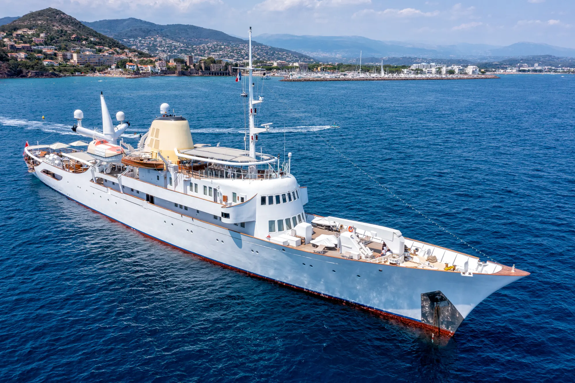
The granitic inner islands of the Seychelles archipelago present one of the most rewarding navigation grounds in the Indian Ocean. Rising from the shallow Seychelles Bank—a submerged micro-continent sitting between 40 and 60 metres below the surface—these 41 granitic islands offer a distinct cruising experience compared to the low-lying coral atolls of the Pacific or Caribbean. Here, dramatic polished granite boulders, dense tropical forest, and deep, clear soundings form a stunning backdrop for exploratory private yacht voyages.
Executing a seamless Yacht Charter Seychelles yacht charter requires a firm grasp of the region’s distinct meteorology, local hydrography, and environmental regulations. Unlike standard Mediterranean seasonal cruising, the Seychelles is a year-round destination where the itinerary is dictated almost entirely by two opposing wind regimes: the North-West Monsoon and the South-East Monsoon. Understanding how these wind systems alter sea conditions, anchorage viability, and passage times is essential for captains and charter guests alike.
The Inner Granitic Shelf: Geographical Overview
The charter grounds divide naturally into two major zones: the Inner Granitic Islands and the distant, outer coralline groups such as the Amirantes and Aldabra. For the vast majority of luxury motor yachts, performance catamarans, and classic sailing yachts, the Inner Islands represent the primary cruising theatre. This core area encompasses Mahé, Praslin, La Digue, Silhouette, and a cluster of satellite islets including Curieuse, Félicité, Grande Soeur, Petite Soeur, Cousin, Cousine, and Frégate.
Mahé is the political and logistical heart of the nation. It hosts the country's main international airport and the sole full-service superyacht facility, Eden Island Marina. Positioned on the central east coast of Mahé, Eden Island provides deep-water berths, high-flow bunkering, fresh water, shore power, and direct access to high-end victualling suppliers. Most charters commence and conclude here.
To the north-east, across the 23-nautical-mile expanse of the Sainte Anne Channel and the open plateau, lies the Praslin group. Praslin, the second-largest island, acts as the secondary hub. Surrounding it are shallow channels, sandy cays, and steep granite outcrops that create a compact, highly varied cruising ground where daily hops rarely exceed five to ten nautical miles.
Monsoons, Sea States, and Seasonal Meteorology
Navigating the Seychelles requires working with, rather than against, the monsoon trade winds. The climate is equatorial, with air temperatures hovering between 26°C and 31°C year-round, but the wind and sea states shift dramatically between two distinct seasons, punctuated by two calm inter-monsoon periods.
The North-West Monsoon (November to March)
Known locally as the Vent du Nord-Ouest, this season brings gentle to moderate breezes, typically ranging from 8 to 15 knots from the north-west. The sea state during these months is generally slight, with low swell heights, making it the preferred season for guests seeking calm, comfortable passages and exceptional underwater visibility for scuba diving and snorkeling.
December and January bring higher humidity and localized tropical rain squalls, which can briefly drop visibility to under a mile. During the North-West Monsoon, all anchorages exposed to the north and west become untenable due to incoming swell. Cruising itineraries must pivot to the south and east coasts of the islands to secure flat water and comfortable holding.
The South-East Monsoon (May to October)
From May through October, the Vent du Sud-Est establishes itself as a persistent, dry, and cooler wind blowing steadily from the south-east. Wind speeds average 15 to 22 knots, frequently gusting over 25 knots across open water stretches. The sea state rises accordingly, generating moderate to rough seas with persistent oceanic swells between 1.5 and 2.5 metres across open passages like the crossing from Mahé to Praslin.
This is the premier season for sailing purists who relish fast, reliable beam reaches. However, motor yachts require careful passage planning to avoid head seas. During this period, all anchorages facing south and east experience heavy surf and surge. The tactical focus shifts entirely to the north and west coastlines, where high granite peaks cast substantial wind and swell shadows.
The Inter-Monsoon Transitions (April and October)
The transitional months of April and October represent the meteorological sweet spots of the Indian Ocean. As the trade winds die back and invert, calm conditions prevail across the entire archipelago. Mirror-flat seas, light air, clear skies, and water clarity exceeding 30 metres make these months ideal for extended open-water passages, offshore fishing, and exploring remote anchorages on both sides of the islands.
Tactical Anchorages and Shelter Options
Securing a comfortable night at anchor in the Seychelles relies entirely on matching your location to the prevailing trade wind. The seabed throughout the Inner Islands consists predominantly of fine white sand, coarse coral rubble, and pockets of dense turtle grass. Anchoring on live coral reefs is strictly prohibited across all marine parks.
Mahé Anchorages
- Eden Island Marina (East Coast): Complete protection from all winds and sea states. The default location for embarkation, provisioning, and heavy-weather refuge.
- Port Launay (North-West Coast): A landlocked marine national park offering superb protection during the South-East Monsoon. The seabed is fine sand in depths of 5 to 8 metres, providing excellent holding. High granite ridges block south-easterly gusts, creating flat water. Exposed and dangerous during the North-West Monsoon.
- Beau Vallon Bay (North-West Coast): A expansive, sandy-bottomed bay offering straightforward anchoring in 6 to 10 metres. Excellent shelter from May to October, but entirely open to the north-west trades, which throw heavy surf onto the shore.
- Anse Royale (South-East Coast): Protected by an outer fringing reef, this anchorage offers shelter during the North-West Monsoon. Deep-draught vessels must anchor outside the reef in 10 to 12 metres over sand, as depths inside the lagoon drop quickly to under 2 metres.
Praslin Anchorages
- Anse Lazio (North-West Coast): Widely regarded as one of the finest anchorages in the region. Features a broad sandy floor with excellent holding in 5 to 9 metres. It provides pristine protection during the South-East Monsoon, shielded from the prevailing winds by the high mass of Mount Plaisir. During the North-West Monsoon, heavy swells roll directly into the bay, turning it into a lee shore.
- Baie Sainte Anne (East Coast): A deep, highly protected natural indentation that serves as Praslin’s primary harbour. It offers safe, year-round holding in 4 to 7 metres of sticky mud and sand. It provides complete shelter from north-westerly and south-westerly weather, though draft within the inner channel requires careful monitoring near the ferry terminal.
- Anse Volbert / Côte d'Or (North-East Coast): Protected from south-easterly winds by the offshore islets of Chauve Souris and Saint Pierre. Anchoring in 4 to 6 metres over sand offers good access to shore dining, though light swell can wrap around the points during trade shifts.
Satellite Island Anchorages
- Baie Laraie, Curieuse Island (South Coast): Situated inside the Curieuse Marine National Park, this bay is exceptionally sheltered during the North-West Monsoon. Anchoring is managed via designated park mooring buoys or drop zones in 6 to 8 metres over sand and grass. It provides direct access to the giant tortoise sanctuary.
- Anse José, Curieuse Island (South-West Coast): Excellent daytime and overnight protection during the South-East Monsoon, featuring a clear sandy seabed in 5 to 7 metres directly off Doctor’s House beach.
- La Passe Harbour & Roadstead, La Digue (West Coast): La Digue lacks deep, fully enclosed bays. Small yachts can enter the narrow artificial harbour at La Passe, but spaces are limited and tidal currents sweep across the entrance. Superyachts and larger catamarans anchor outside in the roadstead in 8 to 12 metres over sand, utilizing tender transfers to the breakwater.
Navigational Hazards and Local Seamanship
Navigating the Seychelles is predominantly visual. While hydrographic charting across the Inner Islands is generally reliable, captains must supplement electronic charts with active forward-looking sonar and a vigilant visual watch from the flybridge.
The primary physical hazards are pâtés de corail—isolated coral heads or bommies that rise steeply from seabed depths of 10 metres to within a metre of the surface. These bommies often sit outside marked channels and are difficult to detect on radar or standard bathymetric contour lines. High overhead sunlight between 10:00 and 14:00 is essential when entering shallow bays or approaching island fringes.
Granite outcrops present another distinct risk. Many islets are surrounded by smooth, steep-to granite shelf rock that extends underwater far beyond the visible shoreline. Hazardous, unlit features in the open passages between Mahé and Praslin include:
- Mamelles Island: A low, unlit granite hump sitting roughly halfway between Mahé and Praslin. Gives off a poor radar return in heavy sea states.
- Trompeuse Rocks: A dangerous, low-lying cluster of granite heads located south-west of Praslin, frequently broken over by swell.
- Ennerdale Rock: The underwater remains of an oil tanker that struck an uncharted granite pinnacle off Mahé in 1970. Resting in 30 metres of water, it requires wide clearance for deep-draught vessels.
Tidal streams are another critical factor. The Seychelles experiences a semi-diurnal tide with a spring range of up to 1.8 metres. While open-ocean currents generally set with the monsoon (north-westerly during the SE trades, south-easterly during the NW trades at 1 to 2 knots), localized tidal streams accelerate significantly through narrow cuts. The channel between La Digue and Praslin, as well as the passage between Curieuse and Praslin, can see currents exceeding 3.5 knots during spring tides, generating steep, uncomfortable chop when the tide runs counter to the wind.
Cruising within designated Marine National Parks—including Ste Anne, Port Launay, Baie Ternay, Curieuse, and Île Coco—is subject to strict park authorities. Anchoring on coral reefs is an offence carrying heavy fines. Marine park rangers actively patrol these zones to collect daily entry and mooring fees, and yachts must use designated park buoys where available.
Passage Distances and Route Planning
The short distances between the Inner Islands allow for flexible itineraries with minimal blue-water passage time. A captain can easily tailor a route to avoid long ocean runs during rough weather while still visiting three or four distinct islands in a single day.
| Passage Leg | Distance (Nautical Miles) | Typical Time at 10 Knots |
|---|---|---|
| Eden Island (Mahé) to Ste Anne Marine Park | 3.5 nm | 20 mins |
| Eden Island (Mahé) to Silhouette Island | 18.0 nm | 1 hr 50 mins |
| Eden Island (Mahé) to Baie Sainte Anne (Praslin) | 26.0 nm | 2 hrs 35 mins |
| Anse Lazio (Praslin) to Baie Laraie (Curieuse) | 2.5 nm | 15 mins |
| Baie Sainte Anne (Praslin) to La Passe (La Digue) | 4.2 nm | 25 mins |
| La Digue to Île Coco | 4.0 nm | 25 mins |
| Praslin to Frégate Island | 27.0 nm | 2 hrs 40 mins |
| Mahé (North Point) to Bird Island (Shelf Edge) | 54.0 nm | 5 hrs 25 mins |
Master Itinerary Construction: The Captain's Perspective
When structuring a seven-day luxury itinerary, a seasoned charter captain builds the framework around the prevailing monsoon season. The goal is to cross the open water stretch between Mahé and Praslin early in the charter, leaving plenty of time for calm, short hops within the sheltered lee of the Praslin group before making the return passage.
#### Day 1: Embarkation and Warm-up Cruise Guests board at Eden Island Marina on Mahé. After safety briefings and customs clearances, the yacht completes a short 3.5-nautical-mile run to the Ste Anne Marine National Park. Here, the vessel drops anchor in 6 metres of sand off Île Moyenne. Guests spend the afternoon swimming and paddleboarding in tranquil, reef-sheltered waters before an overnight anchor under the lee of Mahé’s eastern mountains.
#### Day 2: The Open-Water Crossing to Praslin With an early morning departure to catch light winds, the yacht undertakes the 26-nautical-mile passage north-east across the Seychelles Bank to Praslin. In the South-East Monsoon, this involves a beam-sea passage requiring stabilized cruising. By midday, the vessel rounds the northern headland of Praslin to drop anchor in the calm, turquoise waters of Anse Lazio for lunch, beach access, and an afternoon of water sports.
#### Day 3: Curieuse Island and Marine Reserves A brief 2.5-nautical-mile hop across the sheltered Curieuse Passage brings the yacht to Baie Laraie on Curieuse Island. Guests go ashore to tour the giant tortoise breeding station and trek through the mangrove boardwalks to Anse José. In the afternoon, the yacht repositions 1.5 nautical miles east to the granite islet of Saint Pierre, anchoring off its steep drop-offs for exceptional snorkeling alongside sea turtles and spotted eagle rays. Overnight anchorage is made in the deep shelter of Baie Sainte Anne or Anse Volbert.
#### Day 4: The Outer Islets (Félicité, Grande Soeur, Île Coco) The yacht heads east toward the small cluster of islands surrounding La Digue. First stop is Île Coco Marine Park, a tiny rock outcrop surrounded by a rich coral garden, ideal for an early morning dive. The vessel then shifts to Grande Soeur for a beach barbecue on its uninhabited, palm-lined shores. As the afternoon wind picks up, the yacht completes a short 4-nautical-mile run to anchor in the deep lee of Félicité Island.
#### Day 5: La Digue Exploration A morning passage of 4.5 nautical miles brings the yacht to the roadstead off La Passe, La Digue. Guests go ashore via tender to explore the island, where traditional oxcarts and bicycles remain the primary modes of transport. Highlights include the vanilla plantations of L'Union Estate and the legendary granite formations of Anse Source d'Argent. In the evening, the yacht anchors off the western coast of La Digue or returns to Praslin’s Baie Sainte Anne for absolute quiet and smooth holding.
#### Day 6: Westward Return to Silhouette Island Leaving the Praslin group, the yacht embarks on a 30-nautical-mile passage west toward Silhouette Island, a dramatic granitic peak covered in virgin rainforest. The island rises steeply from the ocean floor, offering deep soundings close to shore. The yacht anchors off the western beach of Anse Mondon or the sheltered reef shelf at La Passe (Silhouette), providing guests with an isolated, wilderness experience far removed from the main islands.
#### Day 7: Mahé’s Wild Coast and Return The final morning involves an 18-nautical-mile run south-east back to Mahé. The captain routes the vessel along Mahé's dramatic north-west coast, dropping anchor in the clear waters of Port Launay Marine Park for a final afternoon of diving, kayaking, and relaxation. In the late afternoon, the yacht completes the final 12-nautical-mile coastal transit around North Point back to Eden Island Marina for a final evening meal aboard and disembarkation the following morning.
Logistical Realities: Victualling, Fuel, and Formalities
Executing a high-spec charter in the Seychelles requires realistic planning around supply chains. While Eden Island Marina offers access to imported European delicacies, fine wines, and fresh local seafood, provisioning on the outer islands is limited. Praslin has basic supermarket facilities and local fish markets, but specialized luxury items must be secured on Mahé prior to departure.
Fuel management requires equal discipline. While fuel bunkering is available at Eden Island Marina and the commercial jetty at Baie Sainte Anne on Praslin, high-flow marine diesel delivery for large yachts should be arranged in advance through a local port agent.
Strict environmental laws protect the pristine ecosystem of the Seychelles:
- Customs & Biosecurity: The introduction of non-native plant or animal matter is strictly regulated. Clearances for yachts arriving from international waters must be executed at Port Victoria on Mahé.
- Single-Use Plastics: The Seychelles government enforces a national ban on single-use plastic bags and straws; luxury charters are expected to minimize plastic waste generation aboard.
- Waste Discharge: The Inner Islands are a zero-discharge zone for untreated greywater and blackwater. Yacht captains must utilize holding tanks and operational treatment plants while navigating within 3 nautical miles of any island or marine reserve.
By understanding these tactical parameters—respecting the seasonal shift of the monsoons, mastering visual pilotage around granite reefs, and planning passages around protected anchorages—captains can consistently deliver extraordinary, uncompromised Indian Ocean voyages.