
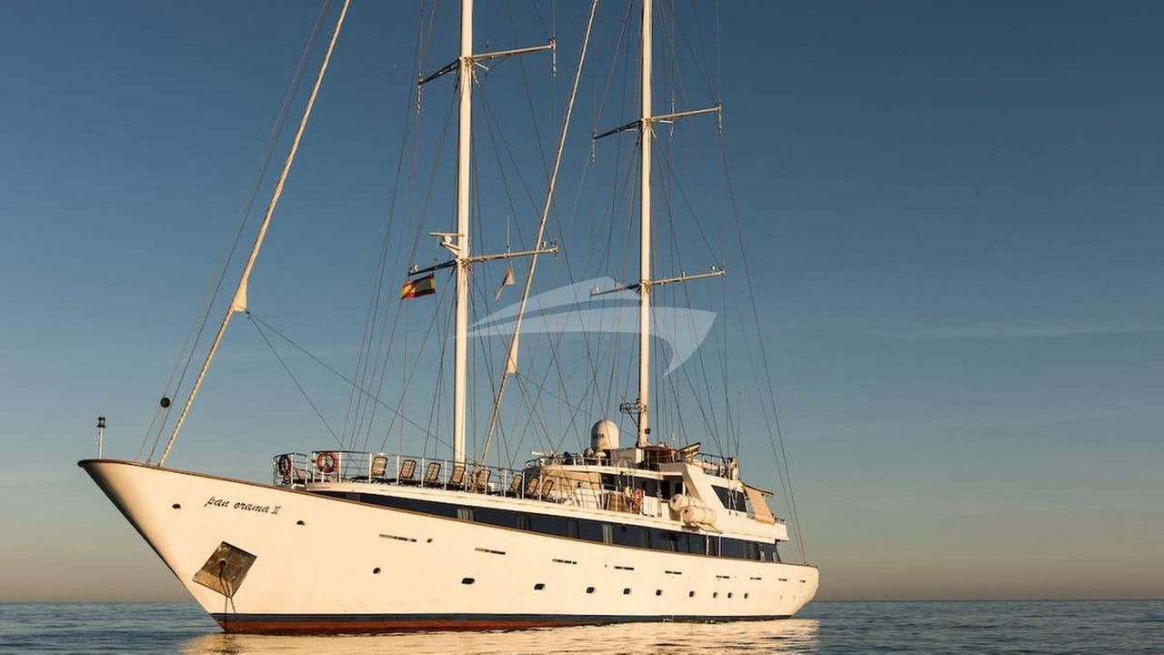
The British Virgin Islands form one of the world’s most hydrographically privileged cruising grounds. Arranged like a protective volcanic arm around the body of water known as the Sir Francis Drake Channel, this archipelago of over fifty islands, cays, and islets offers a rare combination of open-water sailing conditions and sheltered, deep-water anchorages. The islands sit on the Puerto Rico Bank, a shallow submarine plateau where ocean depths drop precipitously to the north into the Atlantic Trench and to the south into the Caribbean Basin. This underwater geology dictates everything about how a vessel behaves here: deep, open channels generate clean, unconfused seas, while the fringing coral reefs and high landmasses mitigate open-ocean swells inside the arch.
For the yacht captain, a British Virgin Islands Yacht Charter yacht charter provides line-of-sight navigation supported by reliable trade winds, negligible tidal ranges, and exceptional visual reference points. Yet beneath this accessible exterior lies a complex marine landscape that requires precise local knowledge. Wind gradients compress between high peaks, groundswells can render north-facing bays unviable overnight, and extensive coral systems demand strict adherence to visual seamanship. Understanding how to read the channels, time the anchorages, and anticipate seasonal weather shifts is the difference between an ordinary holiday and an impeccably executed voyage.
The Geography of the Channel and Outer Cays
The spine of the British Virgin Islands is defined by Tortola, a mountainous island reaching 521 metres at Mount Sage. Tortola acts as a massive windbreak against weather coming off the North Atlantic, creating a calm leeward corridor along its southern coast. Running parallel to Tortola, roughly four to five nautical miles to the south, lies the southern chain of islands: Norman Island, Peter Island, Salt Island, Cooper Island, and Ginger Island.
Between Tortola and this southern chain lies the Sir Francis Drake Channel. Measuring approximately fifteen nautical miles in length and three to five nautical miles in width, the channel functions as an Highway for yachts. Depths through the centre of the channel range consistently between 18 and 28 metres, offering clean, unobstructed sailing over a sandy seabed. Because the southern islands block the prevailing Caribbean ocean swells, the channel remains remarkably flat even when wind speeds reach 22 knots.
At the eastern threshold of the channel sits Virgin Gorda, identifiable from a distance by the dramatic rise of Virgin Gorda Peak (414 metres) and its low-lying southern peninsula composed of giant granite batholiths. To the northwest lies Jost Van Dyke, a rugged, high-relief island that marks the boundary between the inner channel waters and the open Atlantic.
Standing entirely apart from this volcanic cluster is Anegada. Positioned fourteen nautical miles north-northeast of Virgin Gorda’s North Sound, Anegada is a flat coral and limestone atoll whose highest elevation is a mere 8.5 metres above sea level. Surrounding Anegada is Horseshoe Reef, one of the continuous barrier reef systems in the world, stretching over eighteen miles and forming a significant navigational feature in the region.
Prevailing Winds, Tides, and Sea State by Month
Cruising conditions in the British Virgin Islands are dominated by the North Atlantic trade wind system, but the subtle shifts in direction, force, and ocean swell across the calendar year dictate route choices and anchorage selection.
### November to January: The Christmas Winds Late autumn and early winter see the arrival of the famous Christmas Winds. Triggered by high-pressure systems moving off the North American continent, trade winds reinforce to a steady 18 to 25 knots, frequently gusting to 28 knots. The prevailing direction during these months leans north-easterly (050° to 070°).
This period brings long-period northern Atlantic swells (3 to 8 seconds, 1.5 to 2.5 metres) generated by distant winter storms. These swells do not affect the sheltered Sir Francis Drake Channel, but they break heavily onto the north coasts of Tortola, Jost Van Dyke, and Virgin Gorda. Anchorages such as White Bay on Jost Van Dyke or Cane Garden Bay on Tortola can become untenable due to surge. Skippers during these months must prioritise southern-facing, deeply indented cays.
### February to April: Prime Trade Season This is widely considered the quintessential cruising window. Winds settle into a reliable easterly to north-easterly vector at 15 to 20 knots. Ocean swells diminish significantly, leaving the outer passages comfortable and predictable. Air temperatures average 26°C to 28°C with low humidity. The sea state inside the channel is benign, characterized by a light wind chop over deep blue water. All passages, including the ocean leg out to Anegada, can be executed under sail with minimal engine time.
### May to July: Lightening Trades and Southerly Shifts As spring transitions into summer, the trade winds shift toward the east-southeast (090° to 110°) and moderate to 10 to 15 knots. Surface waters calm to a mirror-like surface in the lee of the islands. Northern swells disappear entirely, opening up exposed northern anchorages like Guana Island’s White Bay and the north shore of Jost Van Dyke.
The reduced wind speed makes the passage across the Anegada Passage exceptionally smooth, though high afternoon temperatures mean captains must monitor generator performance and air-conditioning loads during prolonged stays at anchor.
### August to October: The Off-Peak and Tropical Season Late summer and early autumn bring lighter, variable winds intermingled with tropical waves. Wind speeds can drop below 10 knots for days, forcing longer passages under power, interrupted by brief squalls bringing localized wind spikes and heavy rain. Humidity increases, and the risk of tropical storm activity peaks. Many shore-side establishments, private island resorts, and floating restaurants close for maintenance during September and October. Navigating during these months requires flexible scheduling, constant monitoring of barometric trends and satellite weather feeds, and strict attention to insurance navigation limits.
Tides throughout the archipelago are micro-tidal and predominantly diurnal or mixed. The total spring tidal range rarely exceeds 0.3 to 0.4 metres. Current velocity is negligible in open water, but can accelerate to 1.5 to 2.0 knots in narrow bottlenecks such as the passage between Fallen Jerusalem and Virgin Gorda, the mouth of North Sound, and the cut at Soper’s Hole.
Passage Distances and Route Planning
Plotting a course in the British Virgin Islands involves short, high-reward legs. Visual navigation is standard, but precise heading checks and cross-bearings remain mandatory to account for lee leeway caused by strong trade winds blowing across the beam.
Key Leg Distances:
- Road Harbour (Tortola) to The Bight (Norman Island): 6.0 nm
- The Bight (Norman Island) to Manchioneel Bay (Cooper Island): 6.5 nm
- Manchioneel Bay to The Baths (Virgin Gorda): 5.5 nm
- The Baths to North Sound (Virgin Gorda via Round Rock Passage): 8.5 nm
- North Sound (Leverick Bay) to Setting Point (Anegada): 14.2 nm
- Setting Point (Anegada) to Great Harbour (Jost Van Dyke): 26.0 nm
- Great Harbour (Jost Van Dyke) to Soper’s Hole (Tortola): 5.2 nm
- Soper’s Hole to Nanny Cay (Tortola): 6.8 nm
A standard day-hop requires no more than one to two hours of active sailing. This proximity allows captains to schedule morning sails when trade winds are crisp, arriving at lunch stopovers or evening anchorages before the mid-afternoon rush for mooring buoys.
Natural Anchorages and Shelter Analysis
The geometry of each anchorage dictates its suitability based on wind direction and swell conditions. A skilled skipper continuously evaluates holding ground, depth, and swing margins.
### The Bight, Norman Island Coordinates: 18°18.8’ N, 064°37.5’ W Shelter: Exceptional protection from North, East, and South. Completely open to the West. Hydrography: A large, natural, horseshoe-shaped bay with depths ranging from 4 to 12 metres. The seabed is a mix of soft mud and thick seagrass. Holding is excellent once the anchor clears the grass roots into the underlying mud. Operational Notes: Over 100 commercial mooring buoys are installed here. In heavy trade conditions, the high land of Norman Mountain (134 metres) creates katabatic wind squalls that blast down into the bay. Ensure dual-snubber arrangements are used to ease strain on bridle points. The nearby anchorage at Privateer Bay provides an alternative if seeking isolation, though exposed to south-westerly swells.
### Manchioneel Bay, Cooper Island Coordinates: 18°23.1’ N, 064°30.7’ W Shelter: Excellent protection from North-East around to South-East. Unprotected from North and North-West swells. Hydrography: Depths shelf rapidly from 15 metres down to 3 metres near the sandy beach. The bottom consists of white sand patches interlaid with protected seagrass beds. Operational Notes: Anchoring is strictly regulated to prevent damage to seagrass habitats; yachts are required to use the white National Parks Trust or resort mooring buoys. Early arrival (before 13:00) is necessary during peak season. If a northern groundswell enters the bay, vessels will roll uncomfortably, making it prudent to clear out to the lee of Peter Island.
### North Sound, Virgin Gorda Coordinates: 18°30.0’ N, 064°21.5’ W Shelter: Total 360-degree all-weather protection. Hydrography: A vast, deep-water inland ocean spanning over 3,000 acres, enclosed by Virgin Gorda, Mosquito Island, Prickly Pear Island, and the outer barrier of Colquhoun Reef and Necker Island. Depths range consistently from 5 to 12 metres over mud and sand. Operational Notes: Entry is gained via two primary channels: the North Channel (between Mosquito Island and Anguilla Point) and the Colquhoun Channel. Deep-draft yachts (drawing over 2.5 metres) should favour the deep, buoyed North Channel. Inside, anchorages abound: Leverick Bay to the west, Biras Creek to the south, and the waters surrounding Saba Rock and the Bitter End Yacht Club to the east. Holding is superior throughout. North Sound serves as the premier hurricane hole and heavy-weather refuge in the northern Leeward Islands.
### Setting Point, Anegada Coordinates: 18°43.4’ N, 064°23.0’ W Shelter: Good protection from North-East through South-East via the main landmass and Horseshoe Reef. Open to the South-West and West. Hydrography: Approached through a narrow, dredged channel marked by red and green lateral buoys. Depths inside the turning basin and buoy field average 2.2 to 3.0 metres over hard sand and crushed shell. Operational Notes: Vessels drawing more than 2.2 metres must track the tide precisely or anchor outside the main channel mark in 4 metres of water, taking the tender into the dock. The holding ground in hard sand is outstanding, but double-checking anchor setting under power is mandatory due to thin sand layers over limestone shelf in certain sectors.
### Great Harbour and White Bay, Jost Van Dyke Coordinates: 18°26.6’ N, 064°45.0’ W (Great Harbour) Shelter: Great Harbour provides protection from North, East, and South-East. White Bay is protected from the North and East, but vulnerable to South and South-West swell. Hydrography: Great Harbour features depths of 4 to 10 metres over sticky dark mud, offering some of the strongest holding in the territory. White Bay is protected by a outer coral barrier reef; access requires navigating a narrow, shallow cut through the reef directly opposite the mid-beach area. Operational Notes: White Bay should only be entered in clear daylight with the sun high overhead to read reef colours. In any significant southerly wave action, the reef cut becomes hazardous with breaking seas, and captains should divert immediately to Great Harbour or Little Harbour.
Navigational Hazards and Local Knowledge
While visual pilotage is straightforward, several specific geographic points require focused navigational discipline.
### Horseshoe Reef and the Anegada Approach Horseshoe Reef extends off the southern and eastern margins of Anegada for over 18 nautical miles. It is a dense, labyrinthine network of shallow elkhorn and brain coral head formations, many resting mere inches beneath the surface. Navigating inside Horseshoe Reef is prohibited by all charter management companies and marine insurance policies. The approach to Anegada must be conducted from the south-southwest along the clear 20-metre bathymetric contour, tracking directly toward the buoyed entry channel at Setting Point.
### Tow Rock Located in the center of the Sir Francis Drake Channel between Salt Island and Dead Chest (18°21.7’ N, 064°31.5’ W), Tow Rock is a isolated submerged pinnacle rising from surrounding depths of 25 metres to within 4.5 metres of the surface. While deep-draft catamarans pass safely, deep-draft monohulls or vessels operating in heavy seas with deep wave troughs must give this hazard a wide berth.
### The Dogs This group of four small islands (Great Dog, George Dog, West Dog, and Seal Dogs) sits in the open water between Virgin Gorda and Tortola. While deep water surrounds them, Towing Point on Great Dog and the reefs extending off Seal Dog feature shallow ledges extending out up to 150 metres. Currents through the passages between the islands can set a vessel off course by up to 10 degrees during strong spring tides.
### RMS Rhone Marine Park Located off the western point of Salt Island, the wreck of the RMS Rhone (sunk in 1867) sits in depths from 9 to 25 metres. The area is a protected Marine National Park. Anchoring anywhere inside the designated boundary is illegal to prevent anchor chain destruction of marine life and historic artifacts. Moorings here are color-coded: orange for day-use commercial dive boats, and yellow for charter vessels under 18 metres. Overnight stays are prohibited due to exposure to open channel swells.
Execution of a Seven-Day Charter Itinerary
A professional captain plans the week around thermodynamic wind cycles, shore-side logistics, and passenger comfort, avoiding unnecessary beats to windward.
### Day 1: Embarkation to Norman Island Following safety briefings at Nanny Cay or Road Town, Tortola, drop lines at 14:00. Execute a short 6-nautical-mile beam reach across the Sir Francis Drake Channel to Norman Island. Secure a mooring buoy in The Bight. Dispatch the tender to explore the sea caves at Treasure Point, where deep limestone cuts allow direct entry by dinghy. Dinner is taken aboard or at the floating bar anchored in the bay.
### Day 2: Norman Island to Cooper Island via The Indians Cast off at 08:30 to secure a mooring buoy at The Indians—four striking rock pinnacles rising 15 metres out of the water west of Pelican Island. The marine life here thrives in a protected park zone; snorkel the deep wall drop-off on the western side. At 11:30, hoist sails for a 6.5-nautical-mile tack upwind along the southern island chain to Manchioneel Bay, Cooper Island. Pick up a morning buoy early, spend the afternoon paddleboarding over the seagrass beds, and dine ashore at the rum bar and eco-resort.
### Day 3: Cooper Island to Virgin Gorda (The Baths to North Sound) Underway by 07:30 to beat the commercial day-boats to The Baths at the southern tip of Virgin Gorda. Pick up a red day-use buoy off Devil’s Bay. Ship passengers ashore via tender to navigate the labyrinth of massive granite boulders, tidal pools, and hidden white-sand grottos. By 11:30, return to the yacht, clear Colliards Point, and run northeast through Round Rock Passage. Sail 8.5 nautical miles along the windward side of Virgin Gorda, entering North Sound via the North Channel. Moor at Saba Rock or Bitter End Yacht Club.
### Day 4: North Sound to Anegada Clear the North Sound channel markers at 08:30. Set a heading of 030° True for the 14.2-nautical-mile open-water passage across the Anegada Passage. With trade winds on the starboard beam at 18 knots, the yacht maintains 8 to 10 knots over the ground. Track the buoyed channel into Setting Point by late morning. Rent open-top vehicles ashore to explore the northern barrier beaches at Loblolly Bay and Cow Wreck Beach. In the evening, sample locally caught grilled spiny lobster directly on the beach at Setting Point.
### Day 5: Anegada to Jost Van Dyke An early departure at 07:30 allows for the longest downwind run of the voyage: 26 nautical miles from Setting Point to Jost Van Dyke. Set a main and genoa downwind course (heading 245° True) with the trade winds pushing from behind. Pass to the north of Guana Island and Great Tobago before rounding Scrub Island and turning into Great Harbour, Jost Van Dyke. Pick up a mooring or drop anchor in 6 metres of mud. Take the tender around the headland to White Bay for an afternoon cocktail at the beach bars.
### Day 6: Jost Van Dyke to Guana Island & Trellis Bay Cast off at 09:00, sailing east 9 nautical miles along the north coast of Tortola to Monkey Point on the southern tip of Guana Island. Pick up a National Parks Trust day buoy for exceptional snorkeling among large schools of tarpon and yellowtail snapper. At 14:30, make the short 3-nautical-mile passage into Trellis Bay or Scrub Island Resort & Marina to top up freshwater tanks, dock for power, and replenish fresh produce.
### Day 7: Trellis Bay to Nanny Cay / Road Town Execute the final 8-nautical-mile run down the Sir Francis Drake Channel under full sail, taking advantage of the leeward run along Tortola's southern slopes. Pass Road Harbour and return to the base marina at Nanny Cay by 12:00 for smooth disembarkation and logistics clearance.
### Operational Protocols for Skippers To maintain safety and operational standards while cruising the territory, captains follow a set of non-negotiable routines:
- Execute daily engine room and bilge checks prior to main engine startup, verifying raw water strainer clearance, oil levels, and drive belt tension.
- Time departures for popular moorings like The Baths or The Indians before 08:30 to secure NP-trust buoys ahead of the local fleet.
- Monitor weather VHF channel 16/04 twice daily for localized squall warnings, pressure drops, or Atlantic swell notifications.
- Verify fuel and freshwater reserves prior to the Anegada leg, as supply capacity on the outer low-lying atoll is limited and expensive.
- Set a watch for floating fish aggregating devices (FADs) and commercial pot markers when crossing open channels outside main barrier reefs.
### Mooring and Anchorage Governance Strict legal and environmental parameters govern where and how a vessel may be secured within BVI waters:
- Marine National Parks Trust buoys (color-coded red, yellow, and blue) are strictly for daytime recreational use; overnight stays on these specific buoys are illegal.
- White commercial buoys found in bays like The Bight, Manchioneel Bay, and Great Harbour are managed by local concessions and rated for overnight stays up to specified tonnage limits.
- Anchoring in coral reefs or seagrass beds is prohibited across the territory, carrying severe fines enforced by the BVI Conservation and Fisheries Department.
- Vessels must maintain a minimum 200-metre distance from marked swim zones and public beaches when operating under engine power.
By pairing technical competence with an understanding of local weather and hydrography, a captain can navigate the British Virgin Islands with precision. The result is a smooth, flawlessly executed charter through some of the finest sailing waters on Earth.