
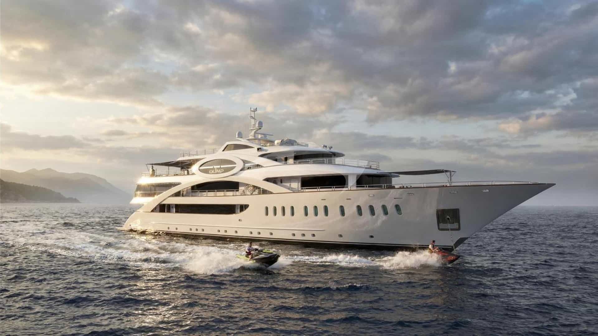
The eastern coastline of the Adriatic Sea presents one of the most complex, rewardingly intricate maritime topographies on earth. Formed by the drowned valleys of the Dinaric Alps, the Croatian archipelago comprises 1,244 islands, islets, and reefs running parallel to the mainland in a northwest-to-southeast orientation. For the skipper and charterer alike, this geographical alignment creates a natural barrier against open sea swells, establishing a network of sheltered channels, soundings, and deep-water passages.
Navigating a Croatia yacht charter successfully requires more than simply setting a course between island capitals. It demands a clear understanding of regional wind dynamics, seabed characteristics, channel bottlenecks, and evolving local maritime regulations. From the limestone shelves of the Kornati Archipelago to the deep, wooded fjords of Mljet, this guide breaks down the technical and tactical essentials of cruising Croatian waters.
Regional Geography of the Croatian Adriatic
The Croatian cruising ground spans roughly 300 nautical miles from the Istrian Peninsula in the north to Cape Oštro at the southern tip of the Kvarner and Dalmatian coasts. Maritime planners generally divide this expansive expanse into five distinct cruising zones, each presenting unique passage dynamics and microclimates.
### Istria and the Kvarner Gulf In the far north, the triangular Istrian peninsula yields to the enclosed waters of the Kvarner Gulf, home to the substantial islands of Cres, Lošinj, Krk, and Rab. This region is defined by deep channels and dramatic topographies where the high peaks of the Velebit Mountain range drop directly into the sea. Navigating here requires constant vigil against catabatic wind gusts off the mainland, though the western shore of Istria offers gentle, shallow approaches and historical Venetian port towns like Rovinj and Pula.
### The Zadar Archipelago and Kornati Moving south, the island density increases dramatically. The Zadar Archipelago forms a labyrinth of long, narrow islands—including Dugi Otok, Ugljan, and Pašman—that shield the mainland coast. West of Dugi Otok lies the Kornati National Park, a stark, treeless seascape of 89 islands and islets formed from weathered Karst limestone. Soundings here are generally deep, often exceeding 40 metres right up to the cliff faces (kruna), but the dense clustering of islets demands precise visual navigation and strict adherence to national park zone restrictions.
### The Šibenik Sector and the Krka Estuary Centered around the historic fortress town of Šibenik, this area acts as the gateway to the Krka River canyon and the inland sea of Prokljan Lake. Accessing Šibenik requires navigating the narrow St. Anthony’s Channel (Kanal Sv. Ante), a controlled deep-water passage where commercial traffic takes precedence. South of Šibenik, the islands of Žirje, Krapanj, and Zlarin provide an offshore buffer before entering the busier waters of Central Dalmatia.
### Central Dalmatia: The Hub of Dalmatian Yachting Stretching from the Split Riviera to the island of Šćedro, Central Dalmatia is the core destination for high-end luxury yacht charters. It contains the prominent islands of Brač, Hvar, Vis, and Šolta. Passages here are characterized by wide inter-island channels—such as the Hvar Channel (Hvarski Kanal) and the Vis Channel (Viški Kanal)—where reliable afternoon sea breezes allow for superb sailing. Vis, the outermost major island, rises from deep water and acts as an offshore weather sentinel for the region.
### Southern Dalmatia and the Elafiti Islands Extending from Korčula to Dubrovnik, Southern Dalmatia is defined by lush vegetation, deep fjords, and historic trade routes. The Pelješac Peninsula dominates the northern sector, creating the narrow, wind-funneled Pelješac Channel opposite Korčula Town. Further south lie the densely forested island of Mljet and the Elafiti Archipelago (Šipan, Lopud, Koločep), offering deep, sand-bottom bays that lead directly to the monumental stone fortification of Dubrovnik.
Wind Systems and Sea States Month by Month
Understanding Adriatic meteorology is fundamental to safe and comfortable passage planning. The weather in Croatia is dictated by the interplay between Mediterranean atmospheric pressure systems and the towering coastal mountain ranges of the Dinaric Alps.
### The Primary Adriatic Winds The Maestral (Mistral):* The quintessential Mediterranean thermal wind. Developing by mid-morning as the mainland heats up, the Maestral blows from the northwest, typically filling in around 10:00 to 11:00, reaching peak velocities of 15 to 22 knots by 14:00 or 15:00, and flattening entirely by sunset. It brings clear skies, predictable sea states, and ideal afternoon sailing conditions. The Bura (Bora):* A cold, dry, catabatic wind that blows from the north-northeast, descending off the coastal mountains. The Bura arrives with little warning, striking in violent bursts and gusts that can easily exceed 40 to 50 knots in localized wind gaps. The air is cleared of humidity, offering extraordinary visibility, but the sea state becomes short, steep, and whipped into white spray. Key Bura hotspots include the Velebit Channel, the Senj Gap, the Vrulja Pass south of Omiš, and the mouth of the Bay of Kotor. The Jugo (Sirocco):* A warm, humid, southeasterly wind generated by low-pressure systems moving across the Central Mediterranean. Unlike the sudden Bura, the Jugo takes 24 to 36 hours to build, bringing heavy cloud cover, rain, and long-period southern swells. It creates rough conditions in south-facing bays and channels, particularly around Vis, southern Korčula, and Lastovo. The Neverin:* Sudden, high-intensity summer squalls that roll in from the west or northwest across the open sea. Typically lasting between 30 and 60 minutes, Neverins bring violent wind shifts, sudden drops in air temperature, heavy torrential rain, and thunder. Captains must monitor barometric changes and radar imagery closely during humid summer afternoons.
### Microclimates and Conditions Across the Season May and June:* Early season cruising features cool sea temperatures (18°C to 21°C) and variable weather patterns. Frontal systems are more frequent, bringing alternating periods of light Jugo and moderate Bura. Overall traffic is minimal, making anchorages accessible, but evening temperatures require heating onboard. July and August: The peak summer period is dominated by the predictable cycle of the afternoon Maestral and calm night-time land breezes (Burin*). Water temperatures average 25°C to 27°C. Ambient temperatures routinely top 32°C. While settled weather is the norm, the risk of sudden late-afternoon Neverin squalls is at its highest during heatwaves. September and October:* September is considered by experienced captains to be the prime cruising month. Sea temperatures remain warm (23°C to 25°C), the heavy summer charter fleet has departed, and the Maestral continues to blow reliably at 12 to 18 knots. By October, the frequency of low-pressure systems increases, bringing stronger Jugo cycles and cooler nights.
Prime Anchorages: Structural Shelter and Holding Characteristics
Securing a luxury yacht in Croatia requires careful selection of natural anchorages tailored to prevailing wind forecasts. The seabed across the region consists largely of fine sand, mud, and patches of thick Posidonia oceanica seagrass growing over a hard limestone substrate.
### Uvala Šešula (Šolta) Located at the western tip of Šolta Island near Maslinica, Šešula is a narrow, fjord-like inlet extending deep into the land. Shelter:* Excellent protection from all winds except strong W and NW swells. Highly secure during Bura and Jugo. Depth & Bottom:* 8 to 15 metres. Seabed is a mixture of mud and sand over rock. Good holding once the anchor digs past the upper grass layers. Mooring Style:* Stern-to lines to the rocks on either the north or south shore are mandatory due to the narrow width of the bay. Local restaurants provide mooring buoys for diners.
### Vinogradišće and Palmižana (Pakleni Islands) Situated on the south side of Sveti Klement in the Pakleni chain off Hvar, Vinogradišće offers access to the island's famous pine forests and botanical gardens. Shelter:* Exceptional shelter from N, NW, and NE winds. Extremely vulnerable to the Jugo (SE), which drives a heavy, dangerous swell directly into the horseshoe bay. Depth & Bottom:* 5 to 12 metres. White sand bottom providing outstanding holding power. Mooring Style:* Heavy-duty concession buoy fields operate here throughout the summer. Anchoring is restricted within the buoy field radius.
### Uvala Lučice (Brač) A large, five-fingered bay located on the southwestern coast of Brač, close to the Splitska Vrata channel. Shelter:* The multiple coves offer tailored protection: the eastern coves shelter against W and NW winds, while the western coves protect against NE Bura conditions. Open to strong S winds. Depth & Bottom:* 8 to 18 metres. Sand and coarse gravel bottom with excellent holding. Mooring Style:* Combination of concession buoys and stern-to mooring to shore bollards.
### Skrivena Luka (Lastovo) Literally translating to "Hidden Harbour," this enclosed marine lagoon sits on the southern coast of the remote island of Lastovo, accessed via a narrow, light-marked entry channel. Shelter:* 360-degree all-round protection. One of the safest natural hurricane holes in the Southern Adriatic, completely immune to open ocean swells. Depth & Bottom:* 6 to 14 metres. Dense clay and mud bottom; holding is exceptional. Mooring Style:* Anchor freely in the middle, drop onto restaurant pontoon berths, or take stern-to lines to the eastern shore.
### Polače (Mljet National Park) A vast, landlocked bay on the northwestern tip of Mljet, shielded by four uninhabited islets (Tajnik, Moračnik, Kobrava, and Ovrata). Shelter:* Comprehensive protection from virtually all wind vectors. Even heavy Bura gusts are dissipated by the high forested hills surrounding the bay. Depth & Bottom:* 10 to 20 metres. Fine mud and silt seabed offering flawless holding. Mooring Style:* Anchoring in designated zones or securing stern-to the quay alongside the Roman ruins, utilizing lazarette lines to the stone quayside.
Navigational Hazards, Key Passages, and Local Regulations
While Croatian waters are deep and generally clear of uncharted hazards, several specific geographic bottlenecks and regulatory framework rules demand the attention of the bridge team.
### Critical Maritime Passages Splitska Vrata (Split Gate):* The narrow, 1.5-cable-wide channel between Cape Ražanj (Brač) and Cape Livka (Šolta). This is the primary traffic arterial for vessels transitioning between Split, Hvar, and Vis. Currents can run up to 2.5 knots during spring tides or after prolonged Jugo winds. Navigating officers must maintain a sharp lookout for commercial hydrofoils, ferries, and sailing yachts tacking across the narrow channel fairway. Mali Ždrelac Passage:* A cut-through passage between the islands of Ugljan and Pašman. It features an overhead bridge with an absolute air draught restriction of 16.5 metres and a dredged channel depth of 4.5 metres. Masted vessels exceeding these dimensions must route around Dugi Otok or pass through Veliki Ždrelac to the south. Pelješac Channel:* The narrow strait separating Korčula Town from the Pelješac Peninsula. The high mountain ridge of Sv. Ilija (961m) creates a powerful wind-funnel effect, accelerating afternoon Maestral winds by an additional 8 to 10 knots over the surrounding sea area. Vessel congestion here is high during peak summer afternoons.
### Regulatory Framework and Environmental Directives To preserve fragile marine ecosystems, Croatia enforces strict anchoring regulations across its territorial waters.
Key Regulatory Rules for Croatian Charter Operations:
• Concession Fields: Anchoring within 150 metres of any official concession buoy field is strictly prohibited by law.
• Posidonia Protection: Anchoring in designated Posidonia seagrass conservation zones is banned; vessels must use designated buoys or seek mud/sand seabeds.
• National Park Entry: Kornati, Mljet, Brijuni, and Lastovo Archipelago require paid entry permits. Purchasing permits online 24 hours in advance reduces fees by up to 50%.
• Shore Lines: When taking lines to shore in wild anchorages, lines must be fixed to rock features using protective webbing straps—never tied around living pine trees.
A Captain’s Operational Logic: Planning a One-Week Route
Executing a successful week-long Croatia yacht charter involves managing distance, guest expectations, wind forecasts, and port logistics. A classic, highly requested itinerary spans the 140-nautical-mile passage between Trogir/Split and Dubrovnik. The following operational breakdown demonstrates how a professional captain sequences this passage to maximize comfort and guest experience.
### Day 1: Trogir / Split to Maslinica, Šolta (12 NM) Following afternoon embarkation and safety briefings at ACI Marina Trogir or Split, the yacht executes a short 12-nautical-mile shake-down run across the Split Channel to Maslinica on Šolta’s western tip.
This short leg allows guests to settle in while the vessel secures a berth at the boutique Martinis Marchi marina or takes a buoy in nearby Uvala Šešula. The anchorage provides immediate, calm water for evening dining.
### Day 2: Šolta to Vis Town or Komiža, Vis (24 NM) The day begins with a morning passage across the open Vis Channel (Viški Kanal). Departing by 09:00 avoids the building afternoon Maestral swell.
The route passes the western edge of Hvar before reaching Vis Island. Vis Town harbour on the northeast side provides deep-water quay berths equipped with lazy lines, well protected from W and S winds. If settled conditions prevail, the captain may elect to round to Komiža on the western coast, positioning the vessel for an early visit to Biševo the following morning.
### Day 3: Vis to Biševo and the Pakleni Islands / Hvar (22 NM) A short 5-nautical-mile run at dawn brings the yacht to Mezuporat Bay on the island of Biševo to visit the famous Blue Cave (Modra Špilja). Visits must be timed early to beat the commercial tour boats arriving from Split.
By 11:00, as the thermal breeze fills in, the yacht sets a course northeast (18 NM) under full sail across the Vis Channel to the Pakleni Islands. The afternoon is spent at anchor in Vinogradišće Bay or secured inside ACI Marina Palmižana, with tender transfers arranged across the narrow sound into Hvar Town.
### Day 4: Pakleni Islands to Korčula Town via Šćedro (32 NM) This longer passage day utilizes the reliable afternoon Maestral. The yacht navigates east along the southern coast of Hvar, dropping anchor at the quiet, pine-fringed islet of Šćedro for a mid-day swim stop and lunch (14 NM).
At 14:30, the yacht weighs anchor and crosses the Pelješac Channel to Korčula Town (18 NM). The entry to ACI Marina Korčula or the eastern anchorage requires careful monitoring of the strong westerly current flowing through the strait. Guests step straight off the stern into the medieval Venetian old town.
### Day 5: Korčula to Mljet National Park, Polače (18 NM) A comfortable morning cruise down the sheltered Mljet Channel brings the vessel to the northwestern end of Mljet Island. The captain routes through the deep, islet-protected western passage into Polače Bay.
The yacht secures stern-to the stone quay or anchors in 12 metres of sticky mud off Tajnik Islet. The afternoon is dedicated to exploring the freshwater lakes (Veliko and Malo Jezero) and the 12th-century Benedictine monastery using the yacht’s tenders or electric bikes.
### Day 6: Mljet to Šipan, Elafiti Archipelago (20 NM) Leaving Mljet, the route tracks southeast along the island’s steep, green ridge line before entering the Elafiti Archipelago. The goal for the day is Šipan, the largest of the island group.
The captain drops anchor in the wide, sheltered sound of Luka Šipan on the western side or Suđurađ on the eastern end. These deep coves feature sand bottoms and fine shore restaurants built into old Aristocratic summer palaces from the Dubrovnik Republic era.
### Day 7: Šipan to Dubrovnik / ACI Marina Miho Pracat (12 NM) The final leg is a dramatic coastal procession. Departing Šipan, the yacht passes Koločep and rounds the dramatic limestone headland of Mount Srđ.
Before proceeding to the final berth at ACI Marina Miho Pracat up the Ombla River estuary, the captain holds the vessel just off the ancient city walls of Dubrovnik (Grad), allowing guests to take in the views of the stone fortifications from the water.
Provisioning, Local Gastronomy, and Logistics
Executing a charter at this level requires seamless logistics. Croatia’s island infrastructure has evolved significantly, yet understanding local specialities and supply routes remains crucial.
### Regional Culinary Anchors Dalmatian cuisine relies heavily on fresh, locally harvested ingredients prepared with simplicity. Captains and chief stews coordinate directly with local fishermen and boutique suppliers in major ports: Peka: A traditional slow-cooked dish of octopus, veal, or lamb roasted beneath a heavy iron bell (čripnja) buried under glowing charcoal embers. Requires advance ordering of at least four hours at island konobas* (taverns). Crni Rižot:* Cuttlefish ink risotto, enriched with local olive oil and white wine, a staple of every traditional Dalmatian port. Shellfish of Mali Ston: Cultivated in the mineral-rich, brackish waters of the Mali Ston Bay near Pelješac, these European flat oysters (Ostrea edulis*) and mussels are delivered fresh to yachts anchoring nearby. Indigenous Wines: Central and Southern Dalmatia boast world-class indigenous grape varieties. Look for crisp Pošip and Grk white wines from Korčula, or the powerful, tannic Plavac Mali* reds cultivated on the precipitous, sun-baked slopes of Dingač and Postup on the Pelješac Peninsula.
### Marinas, Fueling, and Bunkering Logistics The Adriatic Club International (ACI) marina network forms the backbone of Croatia's maritime infrastructure, offering high-standard berths, shore power, and water facilities across 22 locations. However, peak summer pressure on berth availability requires charter brokers and captains to secure advance reservations months ahead, particularly for key hubs like ACI Marina Palmižana, Korčula, and Dubrovnik.
Fuel logistics require strategic planning. Primary marine fuel docks are situated at Split, Milna (Brač), Hvar Town (extremely congested, stern-to drop-in only), Vis Town, Korčula, and Dubrovnik. Wise captains schedule bunkering runs during early morning hours to avoid long queues of charter vessels returning at the end of their weekly hire periods.
By understanding the distinct regional wind patterns, respecting the spatial geometry of the islands, and preparing for local regulatory requirements, navigating a Croatia yacht charter transforms into a masterful exercise in seamanship and luxury travel.