
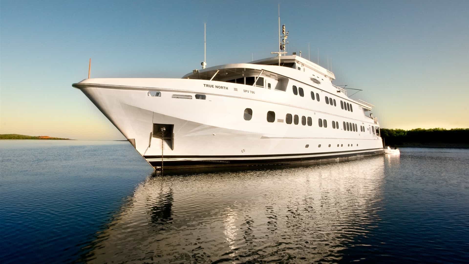
The island of Hvar occupies a strategic position in the central Dalmatian archipelago, situated between the island of Brač to the north, Vis to the southwest, and Korčula to the south. For captains and charter brokers executing a Luxury Yacht Charter Hvar yacht charter, the island presents a compelling contrast: an intense, high-energy social scene concentrated around Hvar Town, balanced by deep, protected bays along the northern coast and the labyrinthine anchorages of the offshore Pakleni Otoci.
However, Hvar is also one of the most operationally demanding cruising grounds in the Adriatic Sea. The combination of limited deep-water quay space, severe summer congestion, specific microclimatic wind patterns, and strict regional maritime regulations requires meticulous advance logistics. Whether managing a 28-metre performance catamaran, a 45-metre sailing yacht, or a 70-metre displacement motor yacht, mastering the berthing options, supply chains, and transfer corridors is essential to seamless execution.
The Operational Reality of Hvar Island
Cruising the waters around Hvar involves understanding three distinct marine environments: the open Hvar Channel (Hvarski Kanal) to the north, the Vis Channel (Viški Kanal) to the south, and the narrow Pakleni Channel (Pakleni Kanal) which separates Hvar Town from the offshore islet chain. The prevailing summer wind is the Maestral, a northwesterly thermal breeze that builds reliably from late morning, peaking around mid-afternoon at 15 to 22 knots before dropping sharply at sunset.
While the Maestral creates exceptional conditions for afternoon sailing, it generates a chop that can penetrate unprotected anchorages facing west or northwest. Conversely, the unstable Bura—a cold, katabatic wind blowing from the northeast off the coastal Dinaric Alps—can strike suddenly, particularly early or late in the summer season. The Bura produces violent gusts that roll through the gaps in the hills above Stari Grad and Jelsa, testing mooring lines and anchor holdings. The third dominant wind is the Jugo, a humid southeasterly that brings a heavy, rolling sea state and elevated water levels across the southern quays.
Navigating these waters during the peak months of July and August requires captains to balance guest itineraries against local weather forecasts and berth availability. Understanding where to berth, where to anchor, and how to stage guest arrivals forms the foundation of a successful charter itinerary in Hvar.
Hvar Town Harbour: Berthing Protocols and Constraints
Hvar Town harbour is the visual and social epicenter of the island, dominated by its Venetian architecture, the 16th-century Spanish Fortress (Fortica), and the sprawling central piazza. Berthing directly on the main waterfront promenade—the Riva—is the ultimate preference for many guests, yet it represents one of the most challenging docking scenarios in Croatia.
### The Port Quays and Depth Profiles The main Town Quay accommodates vessels stern-to or alongside, depending on length and draft. The port authority (Lučka Uprava Hvar) manages the quays, where depths vary significantly. Near the historic Arsenal building and the inner basin, depths drop to under 2.5 metres, making this area suitable only for small tenders and local craft. Moving outward along the central section of the Riva, depths increase from 3.5 to 5.5 metres, permitting medium-sized motor yachts to berth stern-to using ground lines (lazy lines) connected to heavy seabed moorings.
For superyachts exceeding 40 metres in length, the outer section of the main pier head offers the deepest water, with depths reaching 6 to 7 metres. However, space here is severely limited. At most, three to four large yachts can dock simultaneously. Vessels over 50 metres or those drawing more than 5 metres of draft are generally unable to berth at the Riva and must drop anchor in the outer roads.
### Surge, Weather Hazards, and Congestion Berthing on the Hvar Riva carries inherent physical risks during summer. The harbour opens to the southwest and receives zero protection from Jugo-generated swells or sudden summer thunderstorms (neverina). When a strong Jugo develops, waves roll directly into the harbour basin, causing vessels stern-to the quay to range violently. Captains must maintain constant watch, keep engines on standby, and be prepared to drop lines and slip out to open water if the surge threatens to force gangways into the stone masonry.
Furthermore, commercial passenger traffic creates perpetual turbulence. High-speed catamarans operating between Split, Bol, and Dubrovnik enter and leave the harbour throughout the day, generating steep, wake-driven wash that rebounds off the concrete seawalls. Passing traffic demands heavy-duty fender lines, large spherical pneumatic fenders (such as Megafend or AERE systems), and careful adjustment of passerelles.
### Reservations and Administrative Allocation Direct reservations for the Hvar Town Riva cannot be secured months in advance through standard public booking portals. The local harbour master allocates berths on a daily, rolling priority basis. Preference is given to high-value commercial charter vessels and returning mega-yachts coordinated through established Croatian shore agents. Captains seeking a berth on the Riva should communicate their Estimated Time of Arrival (ETA) to their designated port agent 24 to 48 hours in advance, reconfirming early on the morning of arrival. Vessels are typically directed to dock between 14:00 and 16:00, aligning with the mid-afternoon turnaround of local excursion craft.
ACI Marina Palmižana: The Primary Staging Hub
Located 2.4 nautical miles southwest of Hvar Town on the northeastern coast of Sveti Klement—the largest island in the Pakleni Otoci chain—ACI Marina Palmižana serves as the primary operational and berthing alternative to the town quays.
### Layout, Draft, and Vessel Limits Palmižana is an inlet surrounded by pine forests, offering 211 berths equipped with water and electricity hookups. The marina operates seasonally, typically from April through October. Drafts within the marina basin range from 3 metres near the inner pontoons to 8 metres near the outer breakwater entrance.
The physical configuration of the marina inlet imposes clear size limits: * Standard pontoon berths safely accommodate motor and sailing vessels up to 25 to 30 metres in length. * The outer breakwater quay can accept larger vessels up to 40 metres by special arrangement with the marina office. * Yachts exceeding 40 metres or drawing over 4.5 metres cannot safely manoeuvre within the narrow fairways of the marina and must utilize the anchorages on the southern side of Sveti Klement.
### Environmental Exposures and Infrastructure Limits Palmižana provides good protection from the prevailing summer Maestral and southern Jugo winds. However, the marina entrance faces northeast and is directly exposed to the Bura. A strong Bura generates a short, punishing chop across the Pakleni Channel that enters the marina inlet, causing vessels on the outer pontoons to pull heavily on their mooring lines.
Shore logistics at Palmižana require practical adaptation: Freshwater Constraints:* Island water supplies are imported via subsea pipelines or water tankers and are strictly rationed during July and August. Yachts are frequently restricted to filling tanks during specific morning hours, and washdowns may be limited or temporarily prohibited by marina management. Shore Power Infrastructure:* Electrical pedestals provide standard 32-amp and 63-amp single-phase connections, with limited 125-amp three-phase power available on the main breakwater. Large motor yachts running high continuous cooling loads will likely need to operate onboard generators continuously. Tender Logistics to Hvar Town:* Because Palmižana is separated from Hvar Town by the Pakleni Channel, guest transport relies entirely on water transfers. The 10-minute transit across the channel requires a stable, high-speed tender (such as a large RIB or custom chase boat) capable of handling the steep afternoon chop. Local water-taxi services operate 24 hours a day during peak season, providing a safe alternative for guests returning late from town.
Alternative Harbours: Stari Grad, Jelsa, and Vrboska
Captains seeking total protection from heavy weather or guests looking for a quieter, culture-focused shore experience often shift their focus to the north coast of Hvar Island.
### Stari Grad: Deep-Water Security and Mega-Yacht Infrastructure Located at the head of a 5-nautical-mile-deep bay on Hvar's northwest coast, Stari Grad is the oldest town on the island and offers the best natural shelter in the region. The bay is completely protected from all wind quarters except strong westerly gales, which can send a light swell into the outer roadstead.
Stari Grad has recently upgraded its maritime infrastructure to cater directly to larger yachts. The central town quay (Stari Grad Riva) features continuous seabed lazy lines and reliable electrical shore power (up to 125-amp connections). Depths along the southern side of the town harbour range from 4 to 6 metres, allowing vessels up to 60 metres to dock stern-to.
Unlike Hvar Town, Stari Grad allows berths to be reserved in advance through municipal port booking systems or local agents. The town quay connects directly to mainland logistics via the main car ferry terminal situated 1.5 nautical miles west of town, making Stari Grad the ideal operational hub for major provisioning runs, bunkering, and discreet guest embarkations or disembarkations.
### Jelsa and Vrboska Further east along the northern shoreline lie the historic fishing towns of Jelsa and Vrboska: Jelsa:* Situated in a shallow cove, Jelsa offers stern-to berthing along its newly extended waterfront pier. Depths range from 2.5 to 4 metres, making it suitable for sailing yachts, catamarans, and motor yachts up to 30 metres. The harbour is vulnerable to the Northern Bura, which blows straight into the inlet. Vrboska:* Tucked deep inside a winding, fjord-like canal, Vrboska offers exceptional shelter. The ACI Marina Vrboska, positioned on the outer southern shore of the inlet, provides 85 berths with depths up to 5 metres. The inner town harbour is spanned by stone bridges and is suitable only for shallow-draft vessels under 18 metres.
Anchorages and Overnight Staging Zones
When harbour berths are fully occupied or guests prefer the privacy of an isolated cove, Hvar offers several world-class anchorages.
       [ HVAR ISLAND NORTH COAST ]
       ---------------------------
       Stari Grad Bay  ==> Excellent shelter (All winds exc. W). Large quays.
       Luka Tiha       ==> Multi-bay anchorage. Good mud/sand holding.

       [ PAKLENI OTOCI ARCHIPELAGO ]
       -----------------------------
       ACI Palmižana   ==> Marina berths to 30m/40m. Exposed to NE Bura.
       Vinogradišće    ==> South side Sv. Klement. Sandy floor. Exposed to S/SE.
       Taršće Bay      ==> Deep cut cove. Excellent protection from N/NW.

       [ HVAR ISLAND SOUTH COAST ]
       ---------------------------
       Šćedro Island   ==> Lovišće Bay. Sand/weed floor. Superb S-wind refuge.
### The Pakleni Otoci Chain Uvala Vinogradišće:* Located on the southern coast of Sveti Klement directly opposite Palmižana, this deep cove features a sandy bottom with depths between 6 and 18 metres. Holding is good, though the bay fills rapidly with day-cruisers. It is completely open to the south and southeast; if the Jugo builds, yachts must evacuate immediately. Uvala Taršće:* Positioned further west on Sveti Klement, Taršće offers a secluded setting with depths of 10 to 22 metres over a bottom of sand and posidonia seagrass. It provides excellent shelter from the Maestral and Bura, making it a prime overnight anchorage for yachts over 40 metres.
### Northern and Southern Island Anchorages Luka Tiha (Stari Grad Bay):* Located on the northern peninsula of the entrance to Stari Grad, Tiha consists of a series of seven deep, pine-fringed coves. The seabed is predominantly mud and sand, providing excellent holding ground in 5 to 12 metres of water. It is a preferred anchorage for large sailing yachts during heavy weather. Šćedro Island (Uvala Lovišće):* Located 1.5 nautical miles off Hvar’s southern coast, the uninhabited island of Šćedro offers a natural hurricane hole in Lovišće Bay. Its four distinct arms feature sandy seabed bottoms with depths of 6 to 15 metres, providing exceptional protection from all prevailing summer winds, particularly the Jugo.
Capatains anchoring anywhere in the Hvar region must observe strictly enforced environmental laws prohibiting anchor drop in designated Posidonia oceanica seagrass meadows. Posidonia fields are protected under Croatian marine conservation acts, and local maritime police actively inspect anchorages, issuing heavy fines for anchoring outside marked sandy zones or buoy fields.
Fuel, Water, and Technical Bunkering
Fuel and water logistics around Hvar require strategic timing to avoid substantial operational delays.
### Fuel Bunkering Options The primary marine fuel station on Hvar is located on the crib pier at the Western end of the Hvar Town promenade. However, this fuel dock is notoriously restrictive: * Depth alongside is barely 2.8 metres, preventing medium-to-large displacement yachts from approaching. * The approach fairway is narrow and congested with water taxis and tender traffic throughout the day. * Fuel flow rates are slow, making high-volume bunkering impractical.
To bunker efficiently during a Luxury Yacht Charter Hvar yacht charter, captains should plan fuel stops at larger regional hubs: 1. Milna (Brač): Located 13 nautical miles northwest of Hvar Town, Milna features a dedicated marine fuel dock at the harbour entrance with depths of 4.5 metres, higher pumping speeds, and easier access. 2. Split Harbour (Gat Svetog Duje / Severna Luka): For superyachts requiring high volumes of marine diesel (AGO), bunkering directly at the commercial port facilities in Split before crossing the Brač Channel is standard operational practice.
Duty-free fuel (tax-free marine gasoil) is available in Croatia only to commercially registered yachts possessing a valid charter license and cleared out on an international voyage exiting Croatian territorial waters. The nearest international ports of entry with duty-free fuel facilities relative to Hvar are Split and Dubrovnik.
### Water and Technical Utilities Freshwater access varies widely. While Stari Grad and Jelsa offer unlimited mainland-piped municipal water at their public quays, island anchorages and ACI Marina Palmižana operate on local storage tanks. High-capacity onboard watermakers (desalination units) are essential for any yacht spending extended periods in the Pakleni Otoci. Captains must ensure reverse-osmosis filtration systems are equipped with robust pre-filters, as coastal plankton blooms in mid-summer can quickly clog sensitive membranes.
Provisions and High-End Shore Logistics
Provisioning on Hvar requires leveraging a combination of local specialty producers and established commercial yacht suppliers based on the mainland.
### Local Sourcing vs. Import Logistics Hvar possesses an rich agricultural heritage, particularly in the Stari Grad Plain—a UNESCO World Heritage cultural landscape that has been continuously cultivated since the ancient Greeks colonized the island in 384 BC. Chefs can source exceptional hyper-local ingredients directly on the island: Fresh Seafood: The daily fish market (Ribarnica*) in Hvar Town, situated near the Arsenal, offers wild-caught Adriatic sea bass, dentex, John Dory, scampi (Nephrops norvegicus), and red mullet supplied by local longline fishermen. Local Produce and Oils:* Organic figs, wild asparagus, lavender honey, and premium cold-pressed extra-virgin olive oils derived from Oblica and Levantinka olive cultivars are readily available. Wines of Hvar:* The island produces world-class indigenous wines, including Plavac Mali (a robust red grown on the steep southern cliffs of Sveta Nedjelja), Pošip, and the rare Bogdanuša (a crisp white native exclusively to Hvar).
For specialty international ingredients, wagyu beef, caviars, and specific luxury vintage champagne, yachts rely on professional marine provisioning companies operating out of Split. Deliveries are trucked to Split harbour, transported across the channel via the Jadrolinija car ferry to Stari Grad, and delivered directly to the vessel via refrigerated van. Alternatively, urgent provisions can be transferred across the Pakleni Channel using private supply tenders stationed in Split or Trogir.
Formalities, Customs, and Navigation Regulations
Croatia's integration into the European Union and the Schengen border control zone has streamlined maritime entry, yet strict national regulations remain actively enforced by the Ministry of the Sea, Transport and Infrastructure (Ministarstvo mora, prometa i infrastrukture).
### Border Formalities and Entry Ports Yachts entering Croatian territorial waters directly from non-Schengen destinations (such as Montenegro) must proceed immediately to an officially designated Port of Entry to clear customs and immigration. Hvar Town:* Serves as a seasonal Port of Entry from April to October. The customs pier is located at the main quay head. However, space constraints mean large vessels often clear customs at anchor by arrangement with the border police. Year-Round Alternative Ports of Entry:* Split, Korčula, and Dubrovnik.
### Essential Maritime Filings Before cruising Croatian waters, every commercial and private foreign-flagged vessel must hold an approved electronic vignette (light dues and navigation safety fee) and submit a crew and passenger list to the Croatian Maritime Safety Information System (CIMIS). This is managed electronically through a local agent prior to arrival.
Key regulatory operational rules include: Speed Limits:* Vessels are strictly forbidden from planing within 300 metres of the coast. Within narrow channels, ports, and the entire Pakleni Channel, maximum speed is restricted to 5 to 8 knots. Tender Operation:* Personal watercraft (jet skis and Seabobs) must be operated more than 300 metres from the nearest shoreline and outside designated bathing areas and narrow channels. Local maritime police (Kapetanija) actively patrol the Pakleni Channel and issue heavy fines for unauthorized jet-ski operation close to shore.
Airports, Transfers, and Aviation Logistics
Seamless guest handovers depend on choosing the correct arrival corridors and transfer vessels.
       [ SPLIT AIRPORT (SPU) ]
                  |
         (5-min van transfer)
                  v
       [ RESNIK PRIVATE DOCK ]
                  |
     (45-min chase boat / 22 NM)
                  v
       [ HVAR TOWN / PALMIŽANA ]
### Primary Aviation Gateway: Split Airport (SPU) Split Airport (Resnik) is the primary gateway for guests chartering around Hvar. Located on the mainland coast near Trogir, it accommodates commercial airlines and private aviation services. High-Speed Chase Boat Transfer:* The most efficient transfer path avoids city traffic entirely. Guests deplane, complete VIP customs clearance, and take a 2-minute ground transfer to the Resnik private dock located directly adjacent to the runway. From Resnik, a high-speed tender or chase boat (such as a Wajer 55, Anvera, or Axopar 37) transits the 22 nautical miles across the Brač Channel directly to Hvar Town or Palmižana in 40 to 50 minutes. Vehicle and Ferry Transfer:* Alternatively, guests can take a private van from Split Airport to Split harbour (30 to 45 minutes depending on summer traffic), followed by a 60-minute passenger catamaran transfer directly to Hvar Town.
### Secondary Aviation Gateway: Brač Airport (BWK) Located on the neighboring island of Brač near the town of Bol, Brač Airport features a 1,760-metre asphalt runway capable of landing regional turboprops, business jets (up to Gulfstream G650 and Bombardier Global series), and private charters. Transfer Time:* From Brač Airport, guests take a 15-minute road transfer down the serpentine mountain pass to Bol harbour, followed by a 15-minute tender crossing across the Hvar Channel to the northern quays of Hvar or a 25-minute run around the eastern point to Hvar Town. This route minimizes water transit time during adverse weather.
### Crew Rotations and Medical Emergency Support Hvar Town and Stari Grad provide excellent infrastructure for crew movements and operational handovers. Split Airport’s proximity allows seamless crew transfers via regular ferry routes.
For medical emergencies, Hvar Town features a primary health centre (Dom Zdravlja) equipped with emergency medical staff. In critical situations requiring specialized tertiary care, the Croatian Coast Guard and Ministry of Defence operate 24-hour medical evacuation helicopters (MEDEVAC), flying patients directly from the Hvar helipad to the Clinical Hospital Centre Split (KBC Split) in under 15 minutes.
Executing a Luxury Yacht Charter Hvar yacht charter requires balancing high guest expectations with realistic maritime constraints. By matching vessel specifications against draft limits, securing shore support early, and respecting local environmental patterns, captains and charter managers ensure an exceptional experience in one of the Mediterranean's most sought-after cruising regions.