
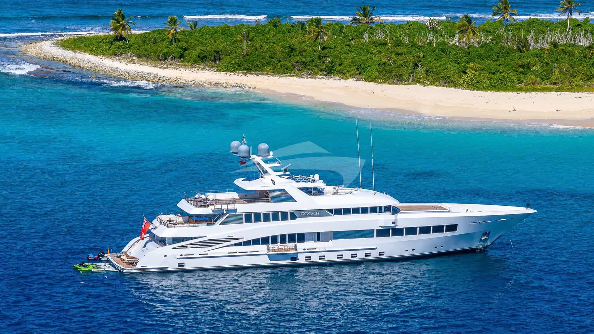
Selecting a Split Yacht Charter yacht charter provides immediate access to the densest concentration of high-value island cruising anywhere in the Mediterranean Sea. Leaving from the central hub of Split—whether departing from ACI Marina Split or the tender step along the city’s West Coast waterfront—plunges a vessel straight into the Central Dalmatian archipelago. Here, the tectonic folds of the Dinaric Alps submerged eons ago to leave a series of long, east-west aligned islands: Šolta, Brač, Hvar, Vis, and Korčula.
The primary strategic mistake made by novice charterers in these waters is forcing a linear, sprint-style passage down to Dubrovnik, covering excess mileage at fifteen knots while bypassing the intricate micro-climates and pristine anchorages of the island cluster right on Split's doorstep. A masterclass week aboard a motor or sailing yacht executing a Split Yacht Charter yacht charter keeps total distance around 120 to 150 nautical miles. This approach prioritises unhurried morning swims in turquoise coves, precise wind-window sailing, and securing choice quay berths or shore tables long before the afternoon fleet arrives.
Regional Geography and Sea Basins
Cruising out of Split requires an understanding of three distinct water bodies: the Split Channel (Splitski kanal), the Hvar Channel (Hvarski kanal), and the open, deep waters of the Vis Archipelago. Each basin possesses its own sea state dynamics, fetch characteristics, and thermal behaviours.
The inner basin, framed by the Split mainland to the north and the northern shores of Šolta and Brač to the south, is generally well-protected from heavy southerly swells. It serves as a forgiving proving ground for the first afternoon of a charter. Depths here range from 60 to 80 metres over a predominantly mud bottom, offering exceptional holding if caught in a squall, though most vessels head directly for island coves rather than dropping anchor in open channel waters.
Beyond the barrier formed by Brač and Šolta lies the Hvar Channel and the Pakleni Islands passage. The water deepens, and sea states become more dynamic. Between the eastern tip of Šolta and the western headland of Brač sits the narrow passage of Splitska Vrata (the Split Gates), a tactical bottleneck for all yacht traffic moving south from the regional capital.
Further seaward, the island of Vis sits isolated in deep water. The open sea basin surrounding Vis drops past 100 metres and lacks land protection to the south and west. Cruising here demands strict attention to offshore weather patterns, as swells generated in the Southern Adriatic wash directly onto Vis's outer coastline without impediment.
Wind Regimes and Sea States by Month
The weather profile of the Central Dalmatian coast is dictated by four dominant Mediterranean winds: the Maestral, the Bura, the Jugo, and the local summer thermal squall known as the Nevera.
Wind Vectors & Characteristics:
Maestral (NW) | Thermal, predictable, 12-22 knots | Peak: 14:00-17:00
Bura (NE)     | Katabatic, violent gusts, dry    | Unpredictable, off high mountains
Jugo (SE)     | Synoptic, warm, humid, heavy swell | Builds over 24-48 hours
Nevera (W/NW) | Convective squall, sudden, short  | Summer late afternoon/night
### May and June Early season cruising presents a mix of mild thermal activity and occasional unsettled synoptic systems. The seabed and sea water temperatures hover between 18°C and 22°C. The dominant wind during stable high-pressure periods is a gentle Maestral—a north-westerly sea breeze driven by land heating—which builds reliably around 11:00, peaks at 12 to 16 knots by 15:00, and dies completely by sunset.
However, late spring can bring multi-day Jugo conditions. The Jugo is a warm, humid south-easterly wind that originates over the North African coast, gathering moisture across the Mediterranean. It generates a long, heavy swell that penetrates the south-facing bays of Hvar, Vis, and Korčula. Seas in open channels can reach 1.5 to 2.5 metres during a sustained Jugo. Anchorages on the northern shores of Šolta, Brač, and Hvar offer total protection during these passages.
### July and August High summer brings stable, high-pressure weather with warm sea temperatures exceeding 25°C. The Maestral is the engine of summer yachting, blowing reliably from the north-west almost every day. It routinely reaches 15 to 22 knots in the channels between Brač and Hvar, offering exceptional conditions for under-sail passages or comfortable, level cruising for displacement yachts.
The primary meteorological hazard during peak summer is the Nevera. These are intense, highly localised convective squalls that form over the Italian mainland or northern Adriatic and roll across the ocean from the west or north-west. They occur most frequently in the late afternoon or early evening following intense heat. A Nevera comes with little warning: a sudden drop in pressure, a darkening western horizon, and a violent temperature drop, followed by winds surging from 5 to 40+ knots within ten minutes. Though short-lived—rarely lasting more than an hour—a Nevera will test an anchorage severely. High holding ground, long scope on the anchor chain, and a secure stern line are non-negotiable.
### September and October Autumn is widely considered by experienced skippers to be the finest season for a Split Yacht Charter yacht charter. Air temperatures cool to a comfortable 24°C, sea temperatures remain warm (22°C to 24°C), and summer crowds dissipate. The Maestral becomes gentler, but the frequency of both Jugo and Bura events increases.
The Bura is a cold, dry katabatic wind that cascades down from the mainland mountain ranges of Mosor and Biokovo. It surges through mountain passes and accelerates off the cliffs, striking the sea with violent, unpredictable gusts (refuli) that turn the water surface into white mist. While a summer Bura rarely lasts more than 24 hours, an autumn Bura can blow fiercely for three days. Cruising along the north coast of Brač or near the mainland shore under Biokovo becomes dangerous during a strong Bura, with gusts exceeding 50 knots shooting out from the land. Vessels must seek shelter in south-facing bays with high northern topography, such as Lučice on Brač or the deep fjord of Stari Grad on Hvar.
Premier Natural Anchorages and Shelter Profiles
A successful charter relies on matching the predicted night-time wind vector with an anchorage that provides correct geographical shelter and dependable bottom holding.
### Šolta: Šešula and Maslinica Located on the western tip of Šolta, Uvala Šešula is a narrow, winding bay cut deep into the land. It provides complete shelter from the Maestral and the summer Bura. Because the bay is narrow and drops to depths of 12 to 18 metres quickly, traditional anchoring with a large swing radius is impractical. Vessels must drop a heavy bow anchor in the middle of the inlet and run twin stern lines ashore to pine trees or dedicated rings (krma na stijenu). The seabed consists of mud and coarse sand mixed with posidonia sea-grass, offering good holding once the anchor penetrates the upper layer.
Immediately north lies Maslinica, featuring a fine boutique marina fronting an 18th-century castle. The marina is protected by a cluster of seven small islets that break incoming sea swells, though an entry during a heavy westerly wind requires care due to shallow shoals around Islet Radula.
### Brač: Lučice Bay and Bobovišća On the south-western coast of Brač, Uvala Lučice branches into three distinct coves. This deep indentation is famous among regional skippers for its protection against the Bura. When the north-easterly wind screams across the Brač Channel, the high interior plateau of the island lifts the wind overhead, leaving the water inside Lučice glassy and flat, despite heavy turbulence further out at sea. The depth varies from 15 metres at the cove mouths to 3 metres at the inner beach heads. The bottom is fine sand over limestone; ensure the anchor is set thoroughly, as thin sand layers over smooth bed rock can cause an anchor to drag under sudden load changes.
On the north-western coast, Bobovišća na Moru provides a deep fjord-like cut that snakes inland, splitting into two arms. It offers safe mooring buoys and quay berths protected from almost all winds except a strong, direct westerly, which can push a rolling swell into the outer bay.
### The Pakleni Archipelago: Vinogradišće and Taršće Stretching south-west from Hvar Town, the Pakleni Islands (Pakleni otoci) form a labyrinth of channels, coves, and pine-clad islets.
- Uvala Vinogradišće (Palmižana): Situated on the southern coast of Sveti Klement, Vinogradišće is the iconic anchorage of the Pakleni chain. It features a wide, horseshoe bay lined with pine trees. It gives solid shelter against the Maestral and Bura. However, it is completely open to the south; a Jugo wind makes Vinogradišće untenable, driving a dangerous, rolling sea directly onto the beach. The seabed is sand with exceptional holding between 6 and 12 metres. Mooring buoys are present during the summer season, managed by local venues.
- Uvala Taršće: Positioned further west on Sveti Klement, Taršće is a quieter, pristine alternative to Vinogradišće. It is deeply recessed with high limestone walls on both sides, providing excellent shelter from north-westerly and easterly winds. Drop anchor in 8 to 10 metres on a sandy bottom, ensuring clear distance from the steep underwater rock ledges along the bay's eastern edge.
### Vis: Stončica and Stiniva Vis represents the outermost island boundary for most 7-day charters starting from Split.
- Uvala Stončica: Located on the north-eastern corner of Vis, Stončica is an exceptional, long bay anchored by an iconic lighthouse on its eastern point. The bay cuts south-west, rendering it impervious to easterly and southerly winds. The inner cove narrows to a sandy seabed in 4 to 7 metres of light green water, providing some of the best holding ground in the Central Adriatic.
- Uvala Stiniva: Located on the dramatic south coast of Vis, Stiniva is a famous geological monument—a collapsed sea cave forming a hidden amphitheatre surrounded by towering limestone cliffs, accessible only via a tiny sea gap no wider than four metres. Stiniva is strictly an early morning or late afternoon swim stop, not an overnight anchorage. The water outside the cliff entrance drops away rapidly to 25 metres, and the southern exposure leaves anchored vessels vulnerable to any sea state generated from the south or west.
### Šćedro and North Hvar: Lovišće and Tiha Uvala Lovišće (Šćedro):* The small island of Šćedro lies off the southern coast of Hvar. Its northern side contains Uvala Lovišće, a deep bay with four distinct fingers. It is an extraordinary anchorage during summer weather, sheltered from all but strong northerly winds. The pine trees grow down to the water's edge, and local taverns maintain private mooring buoys for dining guests. Uvala Tiha (Hvar): Located on the northern side of the Stari Grad peninsula on Hvar, Tiha is a collection of seven small coves offering varied wind protection. It is an ideal refuge when waiting out a south-easterly wind, as the high peninsula block of Hvar suppresses the Jugo* sea.
Critical Navigational Hazards and Passages
Navigating Central Dalmatia requires careful observation of coastal topographies, localized currents, and shallow transit channels.
### Splitska Vrata (The Split Gates) This narrow, one-nautical-mile passage between Cape Ražanj on Šolta and Cape Zaglav on Brač experiences concentrated vessel traffic. During summer afternoons, dozens of yachts, fast ferries, and commercial catamarans funnel through this point simultaneously. The current through Splitska Vrata generally runs north toward the Split Channel at 1 to 1.5 knots, but following a sustained Jugo, out-flowing currents can reach 3 knots. The wind through the gates often funnels and increases by 5 to 8 knots compared to the open channels on either side. Watch for the red navigational light structure on the islet of Mrduja, which sits directly in the middle of the passage.
Key Waypoint Metrics:
Split (ACI) to Splitska Vrata:     9.5 NM
Splitska Vrata to Milna (Brač):     2.5 NM
Splitska Vrata to Palmižana:       16.0 NM
Palmižana to Vis Town:             11.5 NM
Vis Town to Komiža (via Biševo):   21.0 NM
Palmižana to Korčula Town:         32.0 NM
Stari Grad to Split (ACI):         23.0 NM
### The Pakleni Islets Shoals and Passages Cruising through the Pakleni archipelago requires slow speeds and close watch on depth sounders. Mali Ždril: The shallow passage between the islands of Marinkovac and Planikovac has a controlling depth of under 1.5 metres and is littered with submerged rocks. Keelboats and motor yachts drawing over 1.2 metres must never* attempt to transit Mali Ždril. Pokonji Dol Light:* When approaching Hvar Town from the east, vessels must clear the islet of Pokonji Dol. Give the islet a berth of at least 0.3 nautical miles to clear the shallow rocky shelf extending off its south-western point. Izmetka Reef: Situated off the western tip of Sveti Klement, this low-lying reef is marked by an isolated danger mark. Give it a wide berth when rounding Sveti Klement to enter the Vis Channel, especially at night or during heavy Maestral* seas when white water breaks across the reef.
### The Biokovo Katabatic Acceleration Zones When executing a passage between Hvar's eastern tip (Sućuraj) and the mainland, or along the coastal run from Makarska down to Ploče, vessels enter the shadow of the 1,760-metre-high Biokovo mountain range. Even on clear summer days when the rest of the Adriatic is experiencing a gentle 10-knot breeze, cold air pocketed high on the limestone peaks can collapse down the vertical cliff faces, creating sudden katabatic blasts along the coastal strip. Maintain a high engine readiness and do not fly full un-reefed canvas close to the shoreline under Biokovo.
The Professional Captain’s Itinerary Strategy
A seasoned skipper running a Split Yacht Charter yacht charter structures the week around flow, wind dynamics, and timing. The goal is to move efficiently, secure prime spots before peak congestion hours (typically 14:00 to 16:00), and maintain flexibility to adapt to changing weather conditions.
### Strategic Routing Framework The traditional, highly refined 7-day loop avoids dead-end tracks by executing a logical counter-clockwise or clockwise circuit based on the prevailing wind forecast.
       [SPLIT ACI / WEST COAST]
               /       \
              /         \  (23 NM)
     (14 NM) /           \
            v             v
      [ŠOLTA/BRAČ]    [STARI GRAD]
           |               ^
           | (18 NM)       | (12 NM)
           v               |
    [PAKLENI / HVAR] ------+
           |
           | (12 NM)
           v
      [VIS ARCHIPELAGO]
#### Day 1: Split to Western Šolta or Milna, Brač (12 - 15 NM) Boarding typically completes by mid-afternoon. The first leg is a brief, 90-minute run across the Split Channel. This allows the deck crew to check all systems and gives guests an immediate swim in the clear waters of Šešula or Bobovišća. A pre-booked buoy or dinner line at a local konoba (taverna) eliminates the stress of searching for a spot late in the day.
#### Day 2: Šolta/Brač to the Pakleni Islands & Hvar Town (16 - 18 NM) Raise anchor early and cross the Hvar Channel before the midday Maestral builds full sea swells. Anchor for lunch and extended water-sports in Uvala Taršće or Soline on Sveti Klement. In the late afternoon, take the tender across the narrow strip of water into Hvar Town quay to view the Venetian architecture, or remain securely at anchor in Vinogradišće, using a water taxi service to access the town's nightlife and dining options.
#### Day 3: Pakleni Islands to Vis Town (12 NM) A direct west-south-west run across the Vis Channel. Vis was closed to foreign military vessels until 1989, leaving its natural landscape remarkably preserved. Dock along the historic waterfront of Kut (the eastern village of Vis Town) or pick up a mooring buoy in the middle of Luka Bay. Dinner should feature local specialties like Peka (slow-roasted octopus or veal cooked under an iron bell covered in hot coals) or Viška Pogača (a savoury bread filled with salted anchovies, cooked onions, and tomatoes), accompanied by the island’s indigenous white wine, Vugava.
#### Day 4: Vis Offshore Exploration to Komiža & Biševo (22 NM) Cast off at first light to round the southern coastline of Vis. Make a short morning stop off the high cliffs of Stiniva Bay or the emerald waters of Budikovac Island. Continue west to the tiny, exposed island of Biševo to visit the Blue Cave (Modra Špilja).
Tactical Timing: The Blue Cave must be visited between 10:30 and 12:30, when sunlight passes through an underwater opening, bathing the entire limestone cavern in an intense electric-blue light. After the cave visit, head into the deep bay of Komiža on the western coast of Vis for a quay berth or night on a buoy under the dramatic backdrop of Mount Hum.
#### Day 5: Komiža to Šćedro or Stari Grad, Hvar (25 - 28 NM) Track north-east back toward Hvar. If seeking remote quiet, anchor in Uvala Lovišće on Šćedro, where pine forests drop to the water's edge and shore-side konobas serve fish caught that morning. If a historic town environment is preferred, sail to Stari Grad—the oldest town in Croatia, founded by Ionian Greeks in 384 BC. Stari Grad sits at the end of a deep, 5-nautical-mile fjord on Hvar's north coast, offering total protection from all winds, full utility hook-ups on the municipal quay, and fine dining hidden within its ancient stone alleys.
#### Day 6: Stari Grad/Šćedro to Lučice, Brač via Zlatni Rat (18 - 22 NM) Depart Hvar and set a course for the southern coast of Brač. Execute a slow drive-by of Zlatni Rat (the Golden Horn beach near Bol), a unique natural spit of fine white pebbles that shifts its shape depending on the current and prevailing wind. Because Zlatni Rat is highly exposed and densely packed with day-tour boats, avoid anchoring long-term here. Instead, push west to spend the final anchor night in the calm, deep waters of Uvala Lučice or the historic harbour of Milna.
#### Day 7: Brač Coast to Split (12 - 15 NM) Enjoy an extended final morning on the water, swimming off the secluded coves of southern Šolta or northern Brač. Begin the final transit back through Splitska Vrata by mid-afternoon.
Fuel Strategy: The primary fuel stations at ACI Marina Split and Milna experience severe congestion between 15:00 and 19:00 on Friday afternoons as charter fleets return. A smart skipper fuels the vessel early Friday morning at Milna or arranges to fuel during an off-peak window, avoiding hours of idling in line before final berth tie-up on the Split waterfront.
Cruising Realities and Operational Expertise
A flawless luxury charter in Central Dalmatia comes down to managing small operational details:
- *Shore Lines (Krma na Stijenu):* When anchoring in tight Dalmatian coves, always use at least 50 metres of floating polypropylene line payed out from the stern to a secure rock or pine tree on shore. This prevents the vessel from swinging over shallow rock shelves when the wind shifts during night-time land breezes.
- Bathing Water Quality: The interior bays of popular spots like Hvar and Palmižana see heavy boat traffic in July and August. Always check local sea currents before dropping swimming platforms, or cruise a half-mile outside the main mooring fields to find open, crystal-clear water.
- Provisioning Infrastructure: Major provisioning is best completed in Split prior to departure, where high-end supermarkets and the famous Split Green Market (Pazar) offer fresh local produce, olive oils, and prosciutto (Pršut). Islet markets on Šolta, Vis, and Hvar are smaller and stock limited inventory during mid-season spikes.
- Restaurant Reservations: In Central Dalmatia, securing a berth on a konoba pontoon or a table at top waterfront venues often requires booking several days in advance during peak season. A skilled broker and local captain leverage established regional connections to secure these reservations, ensuring seamless integration between sea passages and shore dining.
By approaching the Central Dalmatian coast with rigorous navigational respect and an itinerary aligned with the land’s topography and seasonal wind cycles, a Split Yacht Charter yacht charter delivers an unrivaled luxury yachting experience through the historic waters of the Adriatic.