
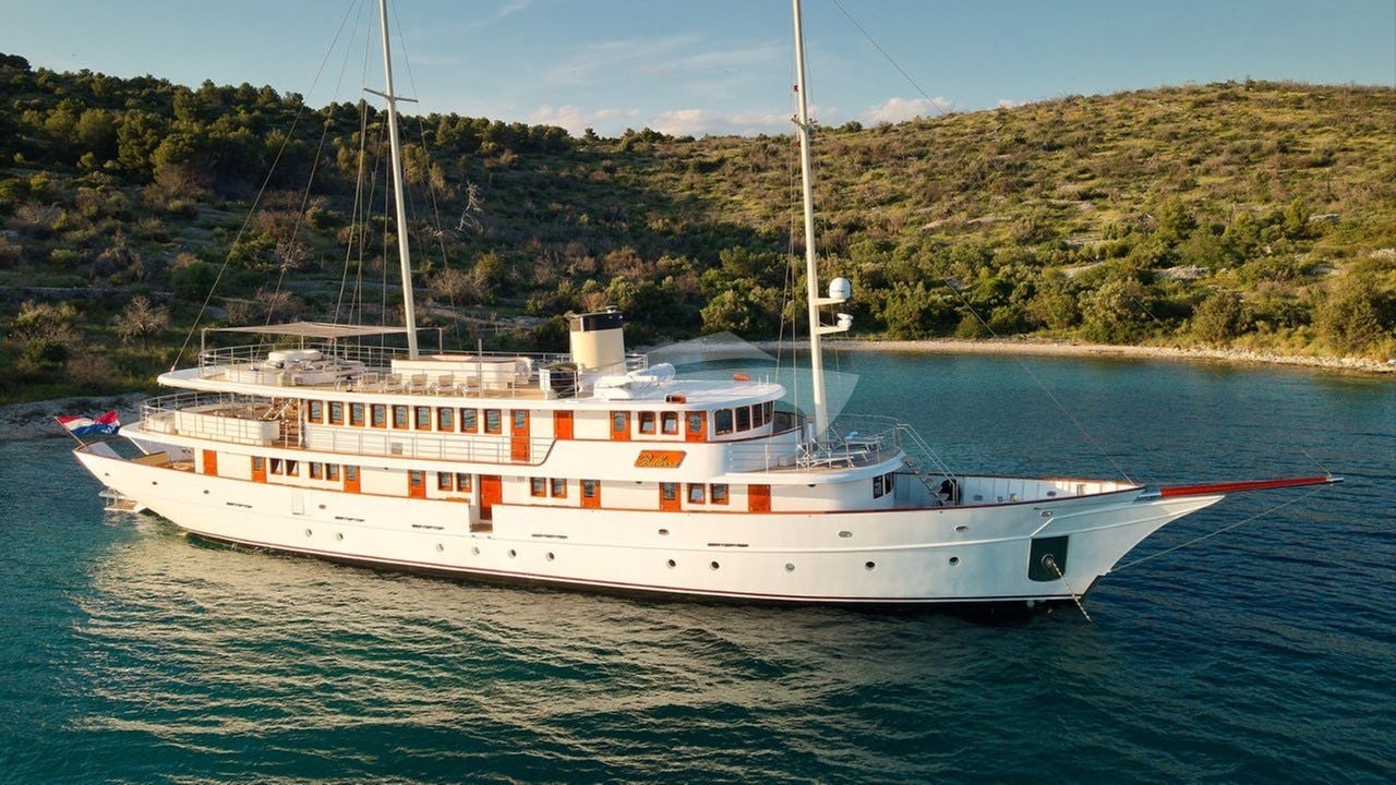
The town of Cavtat sits on the wooden Rat peninsula, 12 nautical miles south-east of Dubrovnik’s Old Town and a mere five-minute drive from Dubrovnik Airport (Čilipi). For discerning charterers evaluating a South Dalmatian itinerary, a Yacht Charter Cavtat yacht charter provides the ultimate balance of swift airport transfers and immediate access to pristine sea lanes. Unlike yachts embarking inside the narrow Ombla River at Komolac, vessels departing Cavtat bypass the congestion of Dubrovnik’s commercial shipping lanes and clear directly into open, deep water.
Cavtat’s maritime layout is defined by two symmetrical bays embraced by dual wooded headlands: the Rat peninsula to the south and Sustjepan to the north. Together, they create Luka Cavtat to the west and Tiha Bay to the east. The waterfront promenade—lined with towering date palms, centuries-old stone palaces, and traditional konobas serving wild-caught sea bass and local Dingač red wine—offers one of the most sophisticated embarkation quays in the eastern Mediterranean. Beyond the harbour walls lie the uninhabited islets of Mrkan, Bobara, and Supetar, forming a natural barrier before the open expanse of the southern Adriatic.
Geography and Sea Areas of South Dalmatia
Cruising from Cavtat opens up three distinct geographical zones: the Immediate South Coast, the Elafiti Archipelago with the Mljet Channel, and the South-Eastern Border Route toward Montenegro.
### The Immediate South Coast and Župa Bay Directly northwest of Cavtat lies Župa Bay (Župa Dubrovačka), a wide coastal indentation flanked by steep limestone hills. This stretch offers open cruising with deep water right up to the 50-metre contour line, though it remains exposed to southerly weather. Rounding the stark cliffs of Mount Srđ brings yachts to Lokrum Island and the iconic medieval stone walls of Dubrovnik. Navigating beneath these fortifications at displacement speed offers an unmatched perspective of the city before pushing northwest into the sheltered island passages.
### The Elafiti Islands and Mljet Sound Stretching northwest from Dubrovnik lies the Elafiti Archipelago, comprising Koločep, Lopud, Šipan, and several uninhabited islets including Jakljan and Olipa. The sea area between the islands and the mainland is the Koločepski Kanal, a protected highway ideal for smooth displacement cruising when open seas carry a heavy swell. Beyond Šipan lies the Mljet Channel (Mljetski Kanal), running between the long, pine-forested island of Mljet and the rugged Pelješac Peninsula. This deep-water channel is a primary passage for vessels heading toward Korčula and Lastovo.
### The South-Eastern Coastal Run Heading south-east from Cavtat, the high, dramatic Konavle cliffs (Konavoske Stijene) fall vertically into 80 metres of ink-blue water. This coastline leads past Molunat—a tranquil bay protected by Islet Mali Školj—to Cape Oštro at the entrance of the Boka Kotorska (Bay of Kotor). This geographical positioning makes Cavtat the primary customs port for luxury yachts clearing out of Croatian territorial waters before entering Montenegro.
Seasonal Weather Patterns: Winds, Sea States, and Microclimates
Understanding the local weather dynamics is essential for comfortable passage planning along the South Dalmatian coast. The summer season from May to October is dominated by distinct wind regimes that dictate daily routing.
### May and June: Thermal Transitions Early season cruising is characterised by mild conditions, shifting atmospheric fronts, and sea surface temperatures ranging between 19°C and 22°C. Morning breezes are typically light and variable from the east or north-east. By mid-afternoon, thermal sea breezes develop, producing moderate sailing conditions without building significant sea states. Atmospheric pressure can be mobile, bringing occasional southerly Jugo conditions that persist for 24 to 48 hours, creating long, rolling swells along exposed headlands.
### July and August: The Maestral Rule Peak summer brings stable high-pressure systems and consistent sea water temperatures of 25°C to 27°C. The dominant wind force is the Maestral, a north-westerly thermal sea breeze generated by the temperature differential between the warm sun-baked landmass and the cooler sea. 10:00 - 11:30:* Sea remains glass-calm; ideal for breakfast at anchor and short passages. 12:00 - 16:30: The Maestral* builds steadily, reaching 14 to 20 knots. A short chop forms in exposed channels such as the Koločepski Kanal and the western end of the Mljet Channel. 18:00 - 19:30:* The thermal gradient collapses, and the wind dies completely, leaving serene conditions for evening mooring.
Captains must remain vigilant for the Neverin—a sudden, violent, localized thermal squall that approaches rapidly from the west or north-west, usually late in the afternoon following intense heat. A Neverin brings gusty winds of 35 to 45 knots, heavy rain, and a sudden drop in temperature, lasting anywhere from 30 to 90 minutes before clearing completely.
### September and October: Autumn Stability and the Bora Autumn is considered by experienced skippers to be the finest time for cruising Cavtat and the surrounding islands. The sea retains its summer warmth (22°C–24°C in September), while summer crowds disperse. The Maestral loses its peak intensity, yielding to lighter, predictable breezes. However, early autumn brings an increased frequency of the Bora (Bura)—a cold, dry, katabatic wind blowing off the Dinaric Alps and descending over coastal peaks like Mount Srđ. The Bora strikes suddenly from the north-north-east in powerful gusts, creating white-capped steep waves with little swell. While Bora conditions bring crystal-clear visibility, anchorages open to the north and north-east become rapidly untenable.
Cruising Anchorages and Shelter Profiles
Choosing the correct anchorage along this coastline depends entirely on the prevailing wind direction and the vessel's draft. South Dalmatia features a mix of deep sandy bays, mud-bottom inlets, and deep-water tavern quays.
### Luka Cavtat and Tiha Bay Luka Cavtat (West Bay): Provides direct access to the main town quay. Yachts berth stern-to using lazy lines connected to heavy ground tackle in 4 to 8 metres of water over mud and sand. It offers excellent shelter from southerly winds (Jugo), but is completely exposed to the west and north-west. When a strong Maestral* blows, heavy surge can enter the bay, requiring yachts to keep off the quay wall. Tiha Bay (East Bay): A broad, well-sheltered crescent northeast of the Rat peninsula. The seabed consists of soft sand and thick mud, offering superior holding in 6 to 12 metres. Tiha is the premier natural anchorage in the immediate Cavtat area during Jugo* or light thermal conditions, though it remains vulnerable to northern winds.
### Uvala Šunj (Lopud Island) Located on the south-eastern tip of Lopud, Uvala Šunj is a famed wide bay featuring a rare horseshoe-shaped sand floor. Shelter:* Excellent protection against north-westerly, northerly, and easterly winds. Holding:* Outstanding in 5 to 8 metres of sand. Vessels must set plenty of chain to prevent dragging when afternoon thermal winds peak. Hazards: Completely open to the south and south-east. If a Jugo* swell sets in, Šunj becomes extremely dangerous, transforming into a lee shore with breaking rolling seas.
### Šipanska Luka (Šipan Island) A deep, fjord-like inlet cutting into the north-western coast of Šipan, Šipanska Luka is one of the safest natural harbours in the Elafiti group. Shelter:* Near-total 360-degree protection, guarded by surrounding hills. It is safe in virtually all conditions, though strong north-westerlies can cause a mild chop in the outer bay. Holding:* Heavy grey clay floor providing exceptional ground holding in 6 to 15 metres. Town quay facilities and tavern buoys are available at the head of the bay.
### Uvala Okuklje (Mljet Island) A horseshoe-shaped natural haven carved into the northern coast of Mljet. Shelter:* Exceptional protection from southerly, westerly, and northerly winds. High limestone ridges knock down the force of offshore breezes. Holding:* Good holding in mud and dense Posidonia weed (look for sandy patches when dropping anchor in 7 to 10 metres). Local family-run taverns provide stone pier berthing with laid moorings and spring lines for dining guests. Hazards: The narrow entrance requires careful central alignment. Rare north-easterly Bora* gusts can shoot over the hills, causing yachts to dance on their moorings.
### Polače and Pomena (Mljet National Park) Located at the western end of Mljet, Polače is an expansive, landlocked sound shielded by four green islets: Tajnik, Kobrava, Ovrata, and Moračnik. Shelter:* One of the most bulletproof hurricane holes in the southern Adriatic. Sheltered from all quadrants. Holding:* Mud and silt in 8 to 18 metres. Anchor holding is bulletproof once the anchor digs past the surface layer.
Key Passage Distances and Day-Hop Logistics
Cruising from Cavtat allows for relaxed, short-range hops or extended offshore passages. Displacement yachts cruising at 10 to 12 knots can comfortably explore the entire region without exhaustive hours under engine power.
Cavtat Quay to Lokrum Island (Dubrovnik Anchorage) : 9.5 nm
Lokrum Island to Koločep (Donje Čelo Bay)           : 5.5 nm
Koločep to Lopud (Uvala Šunj)                     : 3.5 nm
Lopud to Šipanska Luka (Šipan)                    : 6.8 nm
Šipanska Luka to Okuklje (Mljet)                  : 13.5 nm
Okuklje to Polače (Mljet National Park)           : 15.0 nm
Polače to Korčula Town (ACl Marina / East Road)   : 14.2 nm
Cavtat Quay to Porto Montenegro (via Zelenika)    : 29.0 nm
A typical day-hop between Cavtat and the inner Elafiti Islands takes less than an hour at cruising speed, making this region exceptionally family-friendly and well-suited for charterers who prefer frequent swim stops, paddleboarding in turquoise coves, and long, relaxed lunches at anchor.
Navigational Hazards and Local Piloting
While the coastal waters of South Dalmatia are deep, clear, and generally forgiving, several specific hazards require meticulous attention from the bridge team.
### Shoals and Reefs of Mrkan and Bobara When approaching Cavtat from the south-east or south-west, direct lines of sight can be deceptive. The islets of Mrkan, Bobara, and Supetar are encircled by dangerous shallow reefs: Pličak Seka od Mrkana:* A submerged rocky reef lying south-west of Mrkan Island, with depths rising sharply from 40 metres to under 3 metres. It is marked by an isolated danger mark, but requires a wide berth, especially in rough weather when seas break over the rock. Pličak Trava:* Positioned between Bobara and the mainland coast, this shoal is hazardous for deep-draft vessels trying to cut through the inner passage. Captains should stick to the main channel north-west of Islet Supetar when entering Luka Cavtat at night.
### Grebeni Rocks and the Koločep Venturi Effect Positioned off the western tip of Mount Petka (Lapad peninsula), the Grebeni rocks are a narrow ridge of jagged islets protruding into the main shipping lane toward the Elafiti Islands. The outermost rock features the Grebeni lighthouse (Fl(3) W 10s 27m 10M). Deep-draft yachts must clear the outer light by at least 0.5 nautical miles to avoid submerged spurs and erratic tidal eddies.
Further northwest, the narrow channel separating Koločep from the mainland acts as a natural funnel. During peak Maestral hours or a strong Bora, wind speeds inside the Koločepski Kanal can accelerate by 5 to 8 knots over open-sea forecasts due to local geography.
### Port Customs Protocols at Cavtat Cavtat is an official seasonal Port of Entry for the Republic of Croatia, operating from 1 May through 31 October. The designated Q-quay (Customs Quay) is located at the outer end of the main waterfront pier in Luka Cavtat. * Vessels arriving from international waters (e.g., Montenegro or Italy) must proceed directly to the Cavtat Q-quay before anchoring or dropping off passengers. * The quay is marked by yellow paint and designated signs. Yachts must prepare fenders on both sides, as swell from passing vessels can make berthing along the stone wall uncomfortably active. Clearance requires presentation of the vessel's registry, crew list, passenger manifest, radio license, and proof of insurance to the Harbour Master (Lučka Kapetanija*) and Border Police offices situated directly adjacent to the pier.
How a Captain Plans a Seven-Day Cavtat Itinerary
Executing a seamless charter requires balancing guest expectations, weather shifts, fuel efficiency, and berth reservations. Below is how an experienced professional captain structures a week-long cruise starting from Cavtat.
### Day 1: Embarkation, Clearance, and Initial Hop Guests arrive at Dubrovnik Airport and are escorted to Cavtat harbour in five minutes, boarding the yacht at the palm-lined promenade. After a welcome champagne toast and safety briefing, the captain slips the moorings by 15:30. The yacht cruises 9.5 nautical miles northwest, passing under the soaring sea walls of Dubrovnik’s Old Town. As the afternoon Maestral fades, the captain drops anchor in the lee of Lokrum Island or moves into Tiha Bay for an initial evening swim, followed by a formal dinner prepared by the onboard chef using fresh local ingredients.
### Day 2: The Elafiti Islands and Šipan After an early morning breakfast, the vessel navigates through the calm Koločep Channel, dropping anchor in the turquoise waters of Uvala Šunj on Lopud for sea bobbing and paddleboarding. Lunch is served at anchor. By 15:00, as the afternoon wind picks up, the crew hauls the anchor and makes a short, exhilarating 7-nautical-mile passage under sail or power to Šipanska Luka. The captain secures a stern-to berth at a waterfront tavern pier, where guests sample locally produced olive oil and wild caught calamari.
### Day 3: Crossing to Mljet National Park The yacht departs Šipan early, heading west across the Mljet Channel (13.5 nautical miles). The destination is Okuklje or Polače on Mljet Island. The captain aligns the cruise to enter the calm sound of Polače by midday. The tender is deployed to shuttle guests ashore to explore the saltwater lakes (Veliko i Malo Jezero) and the 12th-century Benedictine Monastery on Saint Mary Islet. The yacht remains at anchor in the tranquil, mud-bottom basin of Polače, completely protected from all sea swells.
### Day 4: Korčula Town and the Pelješac Channel Setting off at 08:30, the vessel cruises northwest along the coast of Mljet before crossing toward the historic island of Korčula (14.2 nautical miles). The passage involves navigating the Pelješac Channel—a famous windsurfing corridor where afternoon thermals reliably hit 18 to 22 knots. The captain secures a pre-reserved berth at the ACI Marina Korčula or sets anchor in the roadstead off Badija Islet. Guests spend the evening exploring the fortified, Venetian-style grid town of Korčula, famous as the birthplace of Marco Polo, dining ashore or on the aft deck overlooking the medieval towers.
### Day 5: Pelješac Vineyards and Archipelagic Bays The yacht turns east, following the indented coastline of the Pelješac Peninsula. The captain anchors off Vrnik or Badija Islet for a morning spent swimming in crystal-clear turquoise lagoons. In the afternoon, the vessel cruises along the steep vine-clad slopes of Postup and Dingač. A private wine tasting is arranged ashore, showcasing robust Plavac Mali wines and indigenous Grk whites from nearby Lumbarda. By late afternoon, the yacht drops anchor in Uvala Jakljan, a secluded bay west of Šipan, offering total peacefulness under a canopy of stars.
### Day 6: Dubrovnik Coastline and Cavtat Sunset The yacht begins its return leg toward Cavtat, cruising past the pine slopes of Koločep and setting up for an iconic photo opportunity off Dubrovnik’s Old Town harbour entrance. The captain positions the vessel just off the historic fortress of Saint John while guests enjoy afternoon tea on the flybridge. The final night is spent back in Cavtat—either on the main town quay enjoying the buzzing atmosphere of the waterfront promenades or anchored securely in the peaceful waters of Tiha Bay.
### Day 7: Disembarkation and Seamless Departure Guests enjoy a relaxed final breakfast on the aft deck while watching local fishermen return with their morning catch. Because Cavtat is located right next to the airport, there is no stress over morning sea state conditions or long road transfers. Guests disembark at the Cavtat quay at 09:00, reaching their departure terminal within ten minutes, concluding a flawless South Dalmatian cruising experience.