
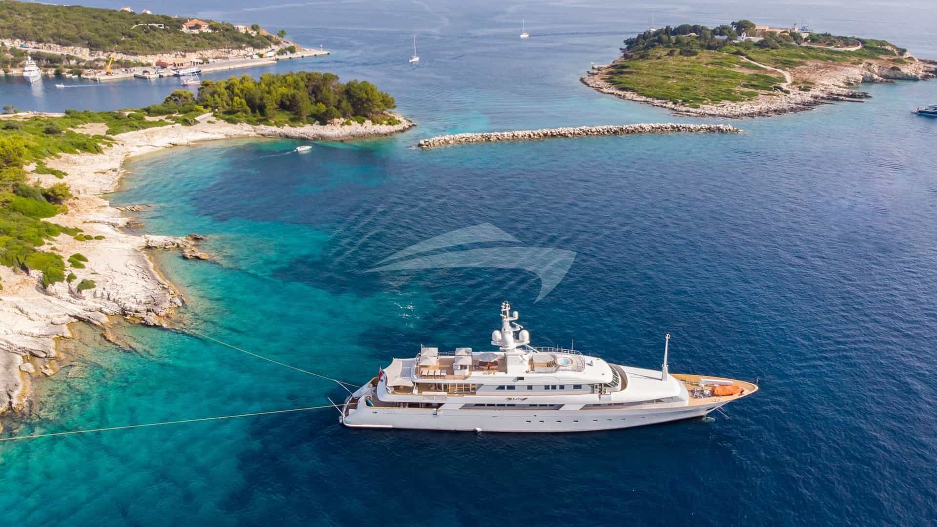
Rising quietly from the translucent shoals south of Ibiza, Formentera offers one of the most distinctive cruising grounds in the Western Mediterranean. Lacking an international airport and restricted in heavy land development, its waters remain the primary vehicle for understanding its geography. For captains and charterers alike, the island presents an interplay of low-lying limestone spits, shifting white-sand bars, steep headlands, and exceptionally clear water. Achieving a seamless itinerary requires precise understanding of local wind dynamics, strict ecological anchor controls, and the shallow passages separating Formentera from its northern neighbours.
Whether executing day trips from Ibiza Town or embarking on an extended voyage aboard a luxury Yacht Charter Formentera yacht charter vessel, understanding the nuances of these waters transforms a standard itinerary into an impeccably executed passage.
The Geographic Anatomy of Formentera's Cruising Ground
Formentera stretches roughly 12 nautical miles from the low-lying northern tip of S’Espalmador to the dramatic 192-metre cliffs of Far de la Mola on its eastern edge. Unlike Ibiza, whose high pine-covered topography creates pronounced wind shadows and localized microclimates, Formentera is largely low and flat. Outside the elevated plateaus of Cap de Barbaria and La Mola, the island offers little vertical protection against prevailing winds.
This low profile means that wind blows cleanly across the island. A southerly breeze will cross the narrow neck of land at Es Caló or Migjorn with minimal disruption, generating chop on the northern beaches while leaving the south side sheltered from waves, even if the breeze remains present.
       [ I B I Z A ]
          |
          | ~11 nm across Es Freus
          v
   [ S'Espalmador ]
          |
   [ Ses Illetes ] ---- (East Coast) ---- [ Es Pujols ]
          |                                    |
     [ La Savina ]                             |
          |                                    v
   [ Cala Saona ]                         [ Es Caló ]
          |                                    |
   (Cap de Barbaria)                           v
          |                             [ Far de la Mola ]
          +------ [ Platja de Migjorn ] -------+
The cruising area splits naturally into five distinct maritime sectors:
- The Northern Spit and S’Espalmador: A delicate, dynamic environment of shallow turquoise channels, strict nature reserve protections, and sandy holding ground.
- The West Coast (La Savina to Cap de Barbaria): Protected from easterly weather, featuring the island's primary marina facilities and high-wall red sandstone coves.
- The South Coast (Platja de Migjorn): An uninterrupted six-nautical-mile sweeping bay bounded by Cap de Barbaria to the west and La Mola to the east, ideal during northern summer breezes.
- The Eastern Cliffs and La Mola: Exposed, deep-water cruising along vertical limestone cliffs, suitable for passage-making and calm-weather coastal exploration.
- The North-East Coast (Es Caló to Es Pujols): A coast punctuated by rocky shelves, turquoise pockets, and ancient fishing slipways, offering excellent anchorage when the wind shifts south or west.
Prevailing Winds, Thermals, and Sea States by Month
Cruising conditions in the Pityusic Archipelago are dictated by a combination of broad Mediterranean pressure systems and highly reliable local thermal activity.
### May and June Early season brings mild, stable weather dominated by lighter thermal breezes, known locally as the Garbí or Embat, which build from the south-west or south-east by early afternoon. Wind speeds average 8 to 14 knots, dropping quickly before sunset. Sea temperatures range from 19°C in May to 23°C in late June. Swell is generally low (under 0.8 metres), though late-season Atlantic fronts moving across mainland Spain can occasionally push a moderate north-westerly swell through Es Freus.
### July and August Midsummer conditions produce stable pressure systems and warm sea temperatures averaging 26°C to 28°C. Wind patterns are overwhelmingly dominated by predictable daytime thermals. The breeze typically sets in from the east-south-east around 11:00, veering south-south-west by mid-afternoon and topping out between 12 and 16 knots. The sea state is calm in the morning, becoming slightly short and choppy by 15:00 in exposed areas like Es Freus or off Cap de Barbaria, before flattening out completely by nightfall.
### September and October The early autumn transition brings warm seas (24°C–25°C) and less congested anchorages, but requires a more vigilant eye on synoptic charts. While early September often provides some of the finest cruising conditions of the year, late September and October mark the onset of convective weather patterns. The Mestral (north-west) and Llevant (east) winds can establish themselves quickly, bringing localized squalls and short, steep seas. Captains must monitor high-altitude cold troughs (DANA events) which can generate intense rainfall and erratic wind shifts within hours.
Navigating Es Freus and Ecological Anchoring Protocols
The passage between the southern tip of Ibiza and S’Espalmador—known as Es Freus—is the essential maritime gateway for yachts accessing Formentera. Extending across three nautical miles, this strait is broken up by several islets and reefs, creating complex tidal currents and demanding focused navigation.
### Managing the Freus Passages There are three main channels through the strait: 1. Freu Gros: The main commercial shipping channel, located closest to Formentera, running between the islet of Illa des Porros and Penjats. Deep, well-marked, and unobstructed, this is the primary route for large motor yachts, deep-draft sailing vessels, and commercial ferries. 2. Freu Mitjà: Passable in calm seas for medium-draft vessels, but requiring careful positioning between dangerous rocky shoals. 3. Freu Petit: Located closest to the Ibiza coast, suited primarily for small craft due to shallow depths and submerged rocky heads.
Currents through Es Freus are primarily wind-driven rather than tidal, but they can reach speeds of 2 to 3.5 knots during sustained easterly or north-westerly winds. When a strong wind opposes a heavy current, a short, sharp sea state develops rapidly within the strait. Captains should maintain sufficient speed for positive steerage and give the shallow shelf extending north from Illa des Porros a wide berth.
[ IBIZA COAST ]
   |
   |-- Freu Petit (Shallow, local small craft only)
   |
[ Illa des Penjats ]
   |
   |-- Freu Gros (Deep water channel, commercial ferries & superyachts)
   |
[ Illa des Porros ]
   |
   |-- Pas de S'Espalmador / Els Freus Shoals (Shallow, shifting sand, max 1.5m)
   |
[ S'ESPALMADOR ]
### Posidonia Oceanica Protection and Buoy Booking Formentera is world-renowned for its hyper-clear water, a direct result of extensive Posidonia oceanica seagrass meadows that filter the sea and oxygenate the coastal marine environment. The Balearic regional government strictly enforces environmental laws to protect these UNESCO-listed meadows.
Free-anchoring on Posidonia is strictly prohibited. Heavy fines are issued by patrolling environmental vessels (Agents Mediambientals) and the Civil Guard. Anchors and chains must fall exclusively on clean sand.
To preserve the fragile seabed while accommodating yachts, designated ecological buoy fields have been established: S'Espalmador (Puerto Espalmador):* Includes a regulated mooring buoy field for vessels up to 35 metres. Reservations must be secured in advance through the official Posidonia Maps / Ports IB portal during peak summer months. Caló de S'Oli / Ses Illetes:* Designated buoy zones and monitored sand-anchoring corridors require captains to inspect their dropped anchor to ensure complete distance from seagrass borders.
Vessels carrying heavy chain and large ground tackle should deploy a crew member on the bow or use a drone/seabob operator to visually verify anchor placement on pure white sand patches before setting the hook.
The Definitive Anchorages: Shelter and Seabed Characteristics
### Ses Illetes (Platja de Ses Illetes) The quintessential Formentera anchorage, running down the narrow western side of the northern peninsula.
- Shelter: Excellent shelter from E, SE, S, and SSE winds. Completely open to W, NW, and N winds.
- Seabed & Holding: Expansive patches of fine white sand interspersed with clear Posidonia zones. Excellent holding in 4 to 8 metres of water.
- Logistics & Life On Board: The anchorage provides immediate access via tender to iconic shorefront lunch venues such as Beso Beach, Juan y Andrea, and Es Molí de Sal. The shallow water allows tenders to run right up to designated beach channels. In late afternoon, as the day-boats return to Ibiza, the anchorage settles into a quiet overnight berth, provided no westerly swell is present.
### S’Espalmador (Isla de Espalmador) An uninhabited private island separated from Formentera by a shallow, narrow channel (El Pas).
- Shelter: Highly sheltered inside the natural bay (Puerto Espalmador) from N, E, and SE winds. Vulnerable to any prevailing SW or W wind, which sends a rolling swell into the lagoon.
- Seabed & Holding: Pure sand with regulated yellow and white mooring buoys. Depths inside the lagoon shoal rapidly from 4 metres down to under 1.5 metres near the shore. Deep-draft motor yachts (over 2.5 metres draft) should remain on the outer edge of the buoy field.
- Cruising Notes: Going ashore allows access to pristine beaches and the island's interior paths. Swimming across El Pas to Formentera is strongly discouraged due to extreme rip currents that pull through the shallow gut between the islands.
### Cala Saona Positioned on the west coast south of La Savina, framed by rich red sandstone cliffs and topped by pine trees.
- Shelter: Superior protection from N, NE, E, and SE breezes. The high cliffs eliminate light easterly thermals completely. Highly vulnerable to W and SW winds and swells.
- Seabed & Holding: Fine sand bottom with exceptional holding in 5 to 9 metres. The transition line between sand and Posidonia is clearly visible from the deck.
- Cruising Notes: Cala Saona offers an ideal overnight anchorage when easterly winds are forecast overnight. The red cliffs reflect the setting sun, making it one of the premier evening locations on the island. The bay's caves and carved cliff sides along the southern flank present excellent tender exploration routes.
### Platja de Migjorn A long, sweeping coastline spanning almost the entire southern side of Formentera.
- Shelter: Exceptional shelter during north-westerly, northerly, and easterly winds. Completely exposed to the south and south-west.
- Seabed & Holding: Sand channels weaving between low rocky shelves and seagrass patches. Holding is variable; captains must visually confirm that the anchor has set into a sandy pocket rather than onto smooth, flat limestone plates. Depths range from 5 to 10 metres, staying roughly 300 metres off the beach.
- Cruising Notes: Migjorn feels distinctly wilder and less congested than Ses Illetes. It accommodates larger superyachts that require deeper draft options and wide turning basins. Key tender drops include beachfront destinations like Es Arenals and the quiet cove of Caló d'es Mort at the far eastern end.
### Es Caló de Sant Agustí and Es Pujols Located on the north-eastern shoreline, facing toward Ibiza.
- Shelter: Protected from S, SW, and W winds. Heavily exposed to N, NE, and E sea states.
- Seabed & Holding: Sand and mixed rock shelves. Depths drop off quickly off Es Caló, providing anchorages in 6 to 12 metres.
- Cruising Notes: Es Caló features a traditional wooden slipway inlet used by local fishermen. It is a favoured calm-water lunch spot during periods of southerly winds, providing clear views up to the soaring heights of La Mola.
Passages, Distances, and Port Logistics
Cruising around Formentera involves short, high-reward hops. However, proper planning around vessel draft, fuel availability, and berth reservations is essential.
### Key Day-Hop Distances Marina Ibiza / Ibiza Town to S’Espalmador:* 11.2 nautical miles S’Espalmador to Ses Illetes:* 2.1 nautical miles Ses Illetes to La Savina Port:* 2.8 nautical miles La Savina to Cala Saona:* 4.5 nautical miles Cala Saona to Cap de Barbaria Lighthouse:* 5.2 nautical miles Cap de Barbaria to Platja de Migjorn (Central):* 6.0 nautical miles Platja de Migjorn to Far de la Mola (Eastern Tip):* 7.5 nautical miles Far de la Mola to Es Caló de Sant Agustí:* 4.2 nautical miles Es Caló to S’Espalmador (via East Coast):* 9.8 nautical miles Complete Circumnavigation of Formentera:* ~34 nautical miles
                   [ IBIZA TOWN ]
                         |
                      11.2 nm
                         v
                  [ S'ESPALMADOR ]
                         |  2.1 nm
                         v
                  [ SES ILLETES ]
                         |  2.8 nm
                         v
                  [ LA SAVINA ]
                         |  4.5 nm
                         v
                  [ CALA SAONA ]
                         |  5.2 nm
                         v
              [ CAP DE BARBARIA ]
                         |  6.0 nm
                         v
              [ PLATJA DE MIGJORN ]
                         |  7.5 nm
                         v
               [ FAR DE LA MOLA ]
### Port Facilities and Marinas La Savina is Formentera's sole commercial and recreational port. It houses two main marina operators: Marina de Formentera and Formentera Mar.
- Berthing Constraints: Space for yachts over 30 metres is strictly limited, particularly during July and August. Transient berths must be requested well in advance.
- Draft Limits: Maximum draft inside the marina basins ranges between 3.0 and 4.5 metres, depending on berth location. Heavy deep-draft sailing yachts should confirm depths with the marina office prior to entry.
- Fueling: The fuel dock at La Savina operates daily, but experiences long queues of day-boats between 17:00 and 19:30. Captains requiring large fuel uplifts should arrange to bunk early in the morning or secure fuel in Ibiza Town or Santa Eulària before crossing the strait.
Tactical Seven-Day Itinerary Planning for Captains
A successful week-long charter itinerary focusing on Formentera balances short, comfortable sea runs with intelligent adaptation to prevailing wind direction. Below is how an experienced captain structures a classic seven-day voyage, starting and ending in Ibiza while keeping Formentera as the core highlight.
### Day 1: Embarkation in Ibiza Town – Crossing to S’Espalmador Distance:* 11 nautical miles Tactics:* Board at Marina Ibiza or Marina Port Ibiza at 12:00. Clear the harbour, run south through Freu Gros, and drop anchor in the sandy turquoise lagoon of S'Espalmador by mid-afternoon. Spend the evening at a reserved buoy, taking in the sunset with views back toward the silhouette of Ibiza’s Dalt Vila.
### Day 2: S’Espalmador to Ses Illetes Distance:* 2.5 nautical miles Tactics:* A morning swim in the clear waters of S'Espalmador before a 15-minute engine run south to Ses Illetes. Drop anchor in 5 metres of water on pure white sand. Arrange tender transfers for beachside dining. The afternoon is spent enjoying water sports on the sheltered lee side of the spit. Stay overnight if easterly winds remain calm, or slide into Marina La Savina for a secure dockside evening.
### Day 3: West Coast Exploration to Cala Saona Distance:* 6.5 nautical miles Tactics:* Depart the anchorage and head south along the cliff-lined west coast. Round Punta de sa Gavina, dropping anchor inside Cala Saona for lunch. The high red cliffs offer excellent shade for paddleboarding along sea caves. Anchor overnight in the center of the bay, positioned to enjoy the red cliff face illuminated by the setting sun.
### Day 4: Cap de Barbaria to Platja de Migjorn Distance:* 11.5 nautical miles Tactics: Weigh anchor early to clear Cap de Barbaria before afternoon thermals build up the sea state around the headland. Cruise past the famous lighthouse and round the southern point into the vast crescent of Platja de Migjorn. Anchor off Es Arenals in 6 metres of turquoise water. Enjoy local seafood onshore—such as classic bullit de peix or frito de langosta*—followed by an overnight stay anchored under light northerly off-land breezes.
### Day 5: Migjorn to La Mola and Es Caló Distance:* 12 nautical miles Tactics:* Cruise east along the dramatic southern face of La Mola, where vertical rock walls drop directly into deep blue waters (30+ metres depth within 100 metres of shore). Round the eastern tip, Far de la Mola, keeping a safe distance from offshore currents. Round into the northern coast and anchor off Es Caló de Sant Agustí for afternoon snorkeling over rocky reefs and sand patches.
### Day 6: Northern Coast to Es Pujols and Tagomago Distance:* 14 nautical miles Tactics:* Work west-northwest along Formentera's northern shore. Stop outside the reefs of Es Pujols for a swim stop in deep turquoise water. By late afternoon, set a course north across Es Freus, heading toward the private island of Tagomago off Ibiza’s north-east coast, securing a well-protected anchorage on its western side for the final evening.
### Day 7: Return to Ibiza Town Distance:* 12 nautical miles Tactics:* Enjoy a final morning anchorage at Tagomago or Talamanca Bay before making the short run into Ibiza Town for final disembarkation and smooth guest departure transitions.
+-------------------------------------------------------------------+
|               TYPICAL 7-DAY CAPTAIN'S ROUTING LOG                 |
+-----+----------------------------------+--------------------------+
| DAY | ROUTE                            | OVERNIGHT ANCHORAGE      |
+-----+----------------------------------+--------------------------+
| 01  | Ibiza Town -> S'Espalmador       | S'Espalmador Buoy Field  |
| 02  | S'Espalmador -> Ses Illetes      | Ses Illetes / La Savina  |
| 03  | Ses Illetes -> Cala Saona        | Cala Saona Red Cliffs    |
| 04  | Cala Saona -> Platja de Migjorn  | Migjorn (Es Arenals)     |
| 05  | Migjorn -> La Mola -> Es Caló    | Es Caló de Sant Agustí   |
| 06  | Es Caló -> Es Pujols -> Tagomago | Tagomago Private Island  |
| 07  | Tagomago -> Ibiza Town           | Disembarkation           |
+-----+----------------------------------+--------------------------+
Essential Onboard Logistics and Preparation
Cruising Formentera on a luxury yacht demands careful attention to water management, tender selection, and ecological compliance.
### Water and Provisioning Unlike Ibiza, Formentera has extremely limited native freshwater resources. Water makers (desalination units) are essential equipment for any yacht spending more than two consecutive days away from a marina berth. High-output water makers allow the vessel to remain self-sufficient at anchor without returning to La Savina for tank fills.
Provisioning should be arranged prior to departure from Ibiza Town. While La Savina has high-quality markets, specialty items, rare vintages, and high-volume guest requests are far more easily sourced from major suppliers based in Ibiza and delivered directly to the yacht before slipping lines.
### Tender Operations and Draft Because much of Formentera’s best water is shallow—often ranging between 1.5 and 3.5 metres—a yacht's tender is a primary tool for guest movement. Deep-draft motor yachts and large catamarans will anchor in 5 to 8 metres, using high-powered RIBs or jet tenders to transport guests through designated swim channels directly onto the sand. Ensure the tender has low-speed maneuvering capability, underwater lighting for night drop-offs, and a shallow draft to safely navigate rocky slipways like Es Caló or shallow beach passes along Illetes.
By mastering these operational variables—respecting the Posidonia meadows, timing the passages through Es Freus, and aligning the yacht's position with daily thermal wind cycles—a charter aboard a luxury vessel in Formentera delivers an unblemished, world-class yachting experience.