
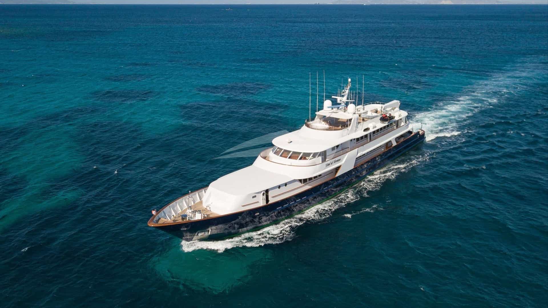
Commanding the central position on Croatia’s coastline, the Zadar archipelago presents a fundamentally different cruising landscape from the southern waters of Split and Dubrovnik. Positioned at 44°07'N, Zadar serves as the threshold to an intricate labyrinth of over 300 islands, islets, and isolated reefs. What distinguishes this region is its extraordinary density of offshore barriers. Unlike the exposed sea lanes further south, Northern Dalmatia is structured in parallel, linear island chains—Ugljan, Pašman, Iž, Rava, and Dugi Otok—running northwest to southeast. These landmasses create a natural matrix of protected channels, deep-water sounds, and landlocked basins that shelter yachts from open Adriatic swells.
When securing a Zadar Yacht Charter yacht charter, captains gain direct access to one of the most sheltered and hydrographically complex cruising grounds in the Mediterranean. Within a single day's run, a vessel can transition from the sheer, limestone cliffs of Telašćica Nature Park to the stark, lunar topography of the Kornati National Park, or the sand-floored lagoons of the outer northern islands like Molat, Silba, and Olib. Successfully navigating these waters demands precision: understanding the local wind phenomena generated by the Velebit mountain range, anticipating narrow passage currents, and knowing precisely which cove yields secure holding when the weather shifts.
The Waters and Geography of Northern Dalmatia
The geography of the Zadar cruising ground is defined by three primary longitudinal channels. Closest to the mainland lies the Zadar Channel (Zadarski kanal), bounded to the west by the high, green ridges of Ugljan and Pašman. This channel provides a calm, highway-like passage running south toward the Murter Sea. West of Ugljan and Pašman lies the Middle Channel (Srednji kanal), a wider body of deep water bounded on its seaward flank by Iž, Rava, and the long spine of Dugi Otok. Further seaward still, the outer islands face the open Adriatic, offering deep drop-offs and crystalline visibility.
South and southwest of Zadar lie the two crown jewels of the region’s marine reserves: Telašćica Nature Park and the Kornati Archipelago. Telašćica is a vast, natural harbour cut deep into the southern tip of Dugi Otok, featuring a dramatic, six-nautical-mile bay ringed by high ridges and guarded by vertical sea cliffs (Stene) on its outer Atlantic-facing side. Immediately adjacent lies the Kornati National Park, a surreal wilderness of 89 uninhabited islands and rocks stripped bare by historic deforestation and grazing, where deep water runs right up to sheer limestone shores.
To the north of Zadar, the character of the coastline shifts again. The northern island group—comprising Molat, Ist, Silba, Olib, and Premuda—is lower in elevation, surrounded by shallow sandy shelves, turquoise sounds, and small fishing settlements. Cruising here feels distinctly remote compared to the busier southern routes, appealing to navigators who prefer tranquil anchorages over bustling marina quays.
Wind Systems, Seasons, and Sea States
Understanding the microclimate of Northern Dalmatia is essential for safe and comfortable navigation. The region is governed by four primary wind systems, each with distinct visual cues and sea state profiles.
### The Maestral The dominant summer wind is the Maestral, a classic sea breeze generated by the thermal differential between the Balkan landmass and the cooler Adriatic Sea. During stable high-pressure conditions from late May through September, the Maestral follows a reliable daily cadence. It begins to build around 10:00 to 11:00 from the WNW, steadily rising to a brisk 12 to 22 knots by mid-afternoon before dropping away completely before sunset. In the broad channels like the Srednji Kanal, the Maestral creates ideal beam-reaching conditions with a moderate, short chop. Cruising under sail is exceptionally consistent under these conditions, with seas remaining flat in the lee of the outer islands.
### The Bura The most formidable meteorological force in the Zadar region is the Bura, a cold, dry katabatic wind that cascades down from the high passes of the Velebit mountain range. The Velebit acts as a massive thermal wall; when cold air accumulates on the interior plateau, it spills over the peaks, accelerating down the steep slopes into the sea.
Even in mid-summer, a Bura can strike with little warning, blowing from the NE or NNE. Early warning signs include a sudden drop in humidity, exceptional atmospheric clarity, and the formation of a cap of white, roll-like clouds over the Velebit summits. The Bura produces violent, localized gusts (maestraluni) that can exceed 40 to 50 knots, tearing the tops off waves and creating blinding white spray (fumarea). The Zadar Channel and the waters surrounding Pag Island are particularly vulnerable to these downbursts. However, because the wind originates from the mainland, the sea state close to the lee shores remains flat, though the force of the wind itself can easily cause anchors to drag in grassy or hard-clay sea beds.
### The Jugo and Neverin The Jugo is a warm, humid SE wind born in the North African desert that absorbs moisture as it moves north across the Mediterranean. Unlike the sudden Bura, the Jugo takes 24 to 36 hours to build, accompanied by falling barometric pressure, overcast skies, and high humidity. In Northern Dalmatia, the Jugo funnels up the channels, generating long, heavy swells that push into S- and SE-facing bays. The Kornati islands offer excellent shelter from the sea state generated by the Jugo, provided yachts select anchorages open only to the north or west.
Summer squalls, known locally as Neverin or Neverina, are short-lived but intense thermal thunderstorms that push rapidly from the W or NW, typically between late afternoon and midnight. They bring rapid wind shifts, heavy downpours, and sudden gusts up to 40 knots. A vigilant captain monitors barometric trends and watches the western horizon for dark, anvil-headed cumulonimbus clouds. A Neverin usually clears within 45 to 60 minutes, leaving behind cool, calm air.
### Month-by-Month Cruising Conditions May and June:* Characterised by moderate breezes, low traffic, and high atmospheric clarity. Sea temperatures range from 18°C in May to 22°C in June. The Maestral is reliable, though late-spring frontal systems can bring brief spells of Bura or Jugo. July and August:* The peak summer season brings air temperatures between 28°C and 34°C and sea temperatures averaging 25°C to 27°C. The thermal Maestral dominates, providing dependable daily sailing. Anchorages and concession buoy fields fill rapidly by mid-afternoon. September and October:* September is widely considered by experienced charter captains to be the prime cruising month. Water temperatures remain warm (23°C–24°C), thermal winds remain stable, and crowds diminish significantly. October sees a higher frequency of low-pressure systems and early autumn Bura events, requiring more tactical anchorage selection.
Key Anchorages and Shelter Characteristics
Selecting the correct anchorage in Northern Dalmatia requires matching the vessel's draft and ground tackle to the seabed geology and wind direction. The seabed varies dramatically from coarse sand and mud in northern bays to hard limestone shelf swept clean by currents, often covered by slippery Posidonia sea-grass (Posidonia oceanica), which demands careful anchor placement.
### Pantera Bay and Čuna Cove (North Dugi Otok) Located at the northwestern tip of Dugi Otok, guarded by the iconic Veli Rat lighthouse, Pantera Bay is a vast, natural lagoon offering remarkable protection. The main bay has a sandy bottom providing excellent holding in 4 to 8 metres of water. For vessels with a draft under 2.0 metres, the inner basin of Čuna, accessed via a narrow, shallow channel, offers complete 360-degree landlocked shelter from all wind directions. A concession buoy field is maintained in Pantera Bay during the summer season.
### Telašćica Nature Park (South Dugi Otok) Telašćica is one of the safest natural harbours in the entire Adriatic, containing several distinct coves within its deeply indented shoreline: Uvala Magrovica:* Located at the northernmost point of the bay, Magrovica provides complete protection from the Bura and Maestral. The holding ground is soft mud and weed; setting the anchor firmly requires laying out a generous scope of chain. Uvala Mir:* Situated on the southwestern side near the saltwater lake Mir, this cove offers concession buoys. It provides reliable shelter from W and NW winds, though it can experience uncomfortable swell if a strong Jugo blows from the SE. Uvala Farfarkulac:* Nestled behind a small islet inside the bay, this cove features steep pine-clad shores and deep water close to land, ideal for taking long stern lines ashore to the rocks.
### Kornati Archipelago Anchorages The Kornati islands feature minimal vegetation, meaning land-based wind shadows are lower, but the physical landmasses effectively knock down wave action. Uvala Levrnaka (Levrnaka Island):* Located on the northern side of Levrnaka, this deep bay (Anica) is well protected from the Maestral and Jugo. Anchor in 10 to 15 metres over sand and weed, or use the restaurant quays equipped with lazy lines. On the island's opposite side lies Lojena, a white-pebble beach with stunning turquoise water; however, Lojena is exposed to the SW and S and should only be used as a daytime swimming stop in calm weather. Uvala Vrulje (Kornat Island): The largest settlement in the national park sits inside a protected sound behind the island of Babić. Holding is good in thick mud. Vrulje offers exceptional protection from all quarters except strong SW winds. Local konobas* (traditional taverns) provide moorings for dining guests. Uvala Lavsa (Lavsa Island):* A nearly circular, enclosed bay with a narrow entrance facing NW. Lavsa offers near-total protection from all winds, though care must be taken when entering due to a shallow shelf on the eastern entrance point. Holding is excellent in mud.
### Zapuntel and Brgulje (Molat and Ist Islands) Zapuntel Sound:* The narrow strait separating Molat and Ist is a classic transit stop when heading north. A well-maintained buoy field covers the passage. The sound provides good protection from E and W winds, but strong NW or SE winds funnel through the gap, creating a wind-tunnel effect and tidal currents reaching 2 knots. Brgulje Bay (Molat Island):* A spacious, circular bay on the south side of Molat, featuring a large buoy field and a small pier at Brgulje village. It gives solid shelter from N, NE, and NW breezes, but remains vulnerable to heavy Jugo conditions.
### Uvala Hiljača (Žut Island) Located on the eastern shore of Žut (just outside the Kornati National Park boundary), Hiljača consists of several deep indentations protected to the east by the small islets of Gustac and Bisaga. It offers superb holding in sand and mud and is exceptionally safe during a Bura, as the high crest of Žut absorbs the main force of the wind.
Navigational Hazards and Passages
Cruising in Northern Dalmatia requires sharp visual navigation and absolute precision when negotiating narrow straits and shallow passages.
Key Navigational Parameters for Northern Dalmatia:
• Mali Ždrelac Bridge Clearance: 16.5 metres (above high water)
• Mali Ždrelac Channel Depth: 4.0 metres
• Mala Proversa Depth: 4.5 metres (Currents up to 4 knots)
• Velebit Channel Gust Factor: Up to 2.5x mean wind speed during Bura
### Mali Ždrelac Passage The Mali Ždrelac channel passes beneath a concrete arch bridge connecting the islands of Ugljan and Pašman. This is a vital shortcut between the Zadar Channel and the Middle Channel. Air Draft Hazard: The bridge clearance is strictly 16.5 metres* above mean high water. Sailing yachts with mast heights exceeding 15.5 metres must NOT attempt this passage. Larger sailing vessels must navigate around the northern tip of Ugljan or through the southern end of the Pašman Channel. Depth and Current: The channel has been dredged to a depth of 4.0 metres* and a width of 56 metres. Currents can run up to 4 knots depending on the tide and wind-driven water build-up, turning the narrow cut into a fast-flowing river. Priority is given to vessels navigating with the current.
### The Proversa Passages Connecting the Middle Channel to the open sea and the Kornati archipelago, the Proversa passages lie between the southern tip of Dugi Otok and Kornat Island, flanking the small island of Katina. Mala Proversa: The northern channel, passing between Dugi Otok and Katina, is the primary passage used by charter yachts. It is clearly marked by lateral red and green beacons. The channel depth is 4.5 metres*, but the navigable width is narrow. Currents can reach 3 to 4 knots; vessels should maintain sufficient speed to retain steerage while respecting other traffic. Vela Proversa:* The southern channel, passing between Katina and Kornat Island, is wider but contains shallow stone shoals along its southern boundary. Navigational markers must be strictly adhered to.
### Velebit Bura Acceleration Zones The coastline directly beneath the Velebit mountains—specifically the Pag Channel, the Maslenica Strait, and the sea area off Starigrad Paklenica—acts as a natural wind amplifier. During a Bura, wind speeds in these zones can be double those recorded in the outer islands. If a strong Bura is forecast, vessels should avoid these mainland-adjacent waters and seek shelter in the deep sound behind Ugljan or inside the Kornati chain.
### Unmarked Reefs and Fish Farms The clear waters of Dalmatia can be deceptive. Notable isolated shoals include the Grebeni reef complex off Zadar town, the Grmeč shoal north of Sestrunj, and various unmarked rock shelves extending off the ends of low-lying islets in the Kornati. Furthermore, fish farms are situated along the eastern coast of Ugljan and Iž; these are lit at night but require a wide berth of at least 200 metres to avoid subsurface lines.
Tactical Itinerary Planning: How a Captain Executes a Week
A professional charter captain plans a week out of Zadar not by following a rigid daily route, but by adapting to the 3-day weather window while optimizing fuel burn, sailing angles, and quiet anchorage arrivals.
### Day-Hop Distance Ledger Zadar / Sukošan to Veli Rat (Dugi Otok):* 26 nautical miles Veli Rat to Zapuntel (Ist / Molat):* 10 nautical miles Zapuntel to Iž Veli (via Sestrunj Channel):* 18 nautical miles Iž Veli to Telašćica (Dugi Otok):* 16 nautical miles Telašćica to Piškera (Kornati):* 12 nautical miles Piškera to Žut (Uvala Hiljača):* 10 nautical miles Žut to Zadar / Sukošan (via Mali Ždrelac or S Pašman):* 18–22 nautical miles
Tactical 7-Day Master Plan
#### Day 1: Embarkation at Sukošan / Zadar to Uvala Lučina (Iž Island) Distance:* 12 Nautical Miles Execution:* Boarding typically concludes by late afternoon. Cast off and clear the marina, setting a course across the Zadar Channel toward the Mali Ždrelac passage (for motor yachts or low-rig sailing vessels) or heading north around Ugljan. Drop anchor or pick up a buoy in Uvala Lučina on Iž. The anchorage offers sand holding in 5 to 8 metres, protected from the W and NW. Dinner on shore features fresh Adriatic squid and locally pressed olive oil.
#### Day 2: Iž to Pantera Bay and Veli Rat (North Dugi Otok) Distance:* 20 Nautical Miles Execution:* Raise anchor at 09:00 to catch the morning calm. Sail northwest through the Sestrunj Channel into the Middle Channel. As the thermal Maestral builds to 15 knots around 11:30, unroll the headsail for a fast beam reach along the northeastern shore of Dugi Otok. Arrive at Pantera Bay by 14:00 to secure a concession buoy before the afternoon arrivals. Take the tender to explore the 41-metre Veli Rat lighthouse and swim along the white pebbles of Sakarun beach.
#### Day 3: Veli Rat to Molat and Ist (Zapuntel Sound) Distance:* 12 Nautical Miles Execution: A shorter day focusing on seamanship and secluded swimming. Depart Pantera Bay and head north across the Prolaz Maknare, taking note of the tidal stream. Drop anchor for lunch in the crystal-clear, shallow turquoise waters off the islet of Škarda or Uvala Slagani on Olib if conditions are settled. By 15:30, pick up a buoy in the Zapuntel Sound between Molat and Ist. Dine at a small local waterfront konoba serving wild-caught dentex cooked under a traditional iron bell (peka*).
#### Day 4: Zapuntel to Telašćica Nature Park (South Dugi Otok) Distance:* 28 Nautical Miles Execution:* The longest passage of the week. Depart early, setting a course south down the unpopulated outer seaward coast of Dugi Otok if the sea state is calm, enjoying the dramatic views of vertical limestone drop-offs. Alternatively, run down the sheltered Middle Channel. Enter Telašćica Nature Park through the Mala Proversa channel, observing the 4-knot current and keeping strict watch for lateral buoys. Pick up a national park buoy in Uvala Magrovica.
#### Day 5: Telašćica through the Kornati Archipelago to Levrnaka Distance:* 12 Nautical Miles Execution:* Spend the morning hiking to the outer cliffs of Telašćica and the warm, high-salinity Lake Mir. At noon, cast off and cross into the Kornati National Park. Sail through the narrow passage between Aba Vela and Kornat Island. Stop at Uvala Lojena on Levrnaka for a afternoon swim over white seabed sand. Shift round to the Anica cove on Levrnaka's northern side for night mooring, securing a space on the stone quay of Konoba Levrnaka.
#### Day 6: Levrnaka to Žut Island (Uvala Hiljača) Distance:* 14 Nautical Miles Execution:* Weave through the heart of the Kornati, passing the dramatic, cliff-ringed islands of Rašip, Piškera, and Mana, where the ruins of a 1950s film set stand on the high ridge. Practice close-quarters navigation through the tight passages of the archipelago. Exit the national park boundary to the northeast and enter Uvala Hiljača on Žut Island. Line-to-shore anchoring is executed here: drop the bow anchor in 10 metres over sand and run two long stern lines to the rocks ashore.
#### Day 7: Žut to Zadar / Sukošan Base Distance:* 18 Nautical Miles Execution:* The final leg crosses the southern sound of the Middle Channel. If the Maestral rises early, enjoy a final reach across to the southern tip of Pašman. Pass through the Pašman Channel, taking time for a swim stop off the heart-shaped islet of Galešnjak. Return to the home marina in the late afternoon to refuel at the fuel dock before docking. Finish the journey with a glass of chilled Pošip wine and Paški sir (aged sheep’s milk cheese from Pag) as the sun sets over the island of Ugljan.